The Best Scenic Drives in Reunion Island
It’s enough to look at a satellite image of Reunion Island to understand there’s something unique to this forgotten destination. Its network of backcountry roads reaches nearly every corner of the island and some are impressive engineering marvels, overcoming extreme natural obstacles to reach their scenic destination. Renting a car and hitting the road is part of the fun and to help you out, here are the best scenic drives in Reunion Island.
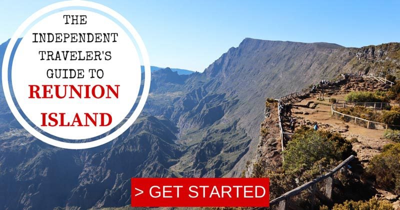
Reunion Island Travel Guide
Planning or thinking about a trip to Reunion Island? Have a look at additional Reunion Island travel guides, including day-by-day itineraries and the best beaches and hikes in Reunion Island. For a quick read, here are the top 10 things to do in Reunion Island.


Quick Tour of Reunion Island
Here’s a quick video tour of Reunion Island!
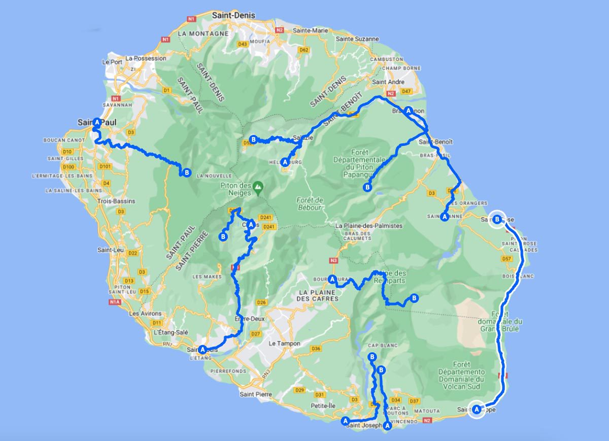
Best Scenic Drives in Reunion Island Map
This map features all the beaches mentioned in this guide to Reunion Island’s best scenic drives. Click on the image to open the map.
Saint Paul to Maido Lookout
As you veer off the Route des Tamarins and begin climbing the mountains on Route du Maido, the gravitational pull of the coast’s “island vibe” gradually dissipates. You now enter a different world known as Les Hauts de St-Paul, a world of simple hamlets that overlook the Indian Ocean but feel as though they are light-years away from the deep blue.
These days, the area is sprinkled with parfumeries, local distilleries that produce extracts mostly from geranium and other regional plants. Many producers still use methods that haven’t changed over the years. As you drive beyond the tree line and near the scenic lookout, it’s now easier to see the ocean. The only visible living things at this altitude are birds in the sky and alpine-like bushes that feed off the moisture in the misty clouds. The Maido is also the starting point for two of Reunion Island’s finest hikes.
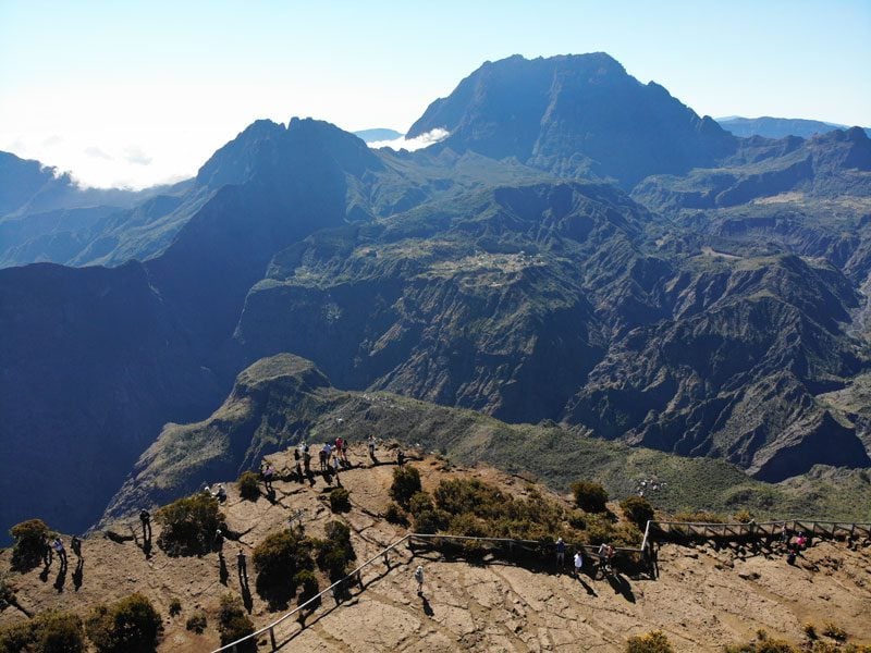
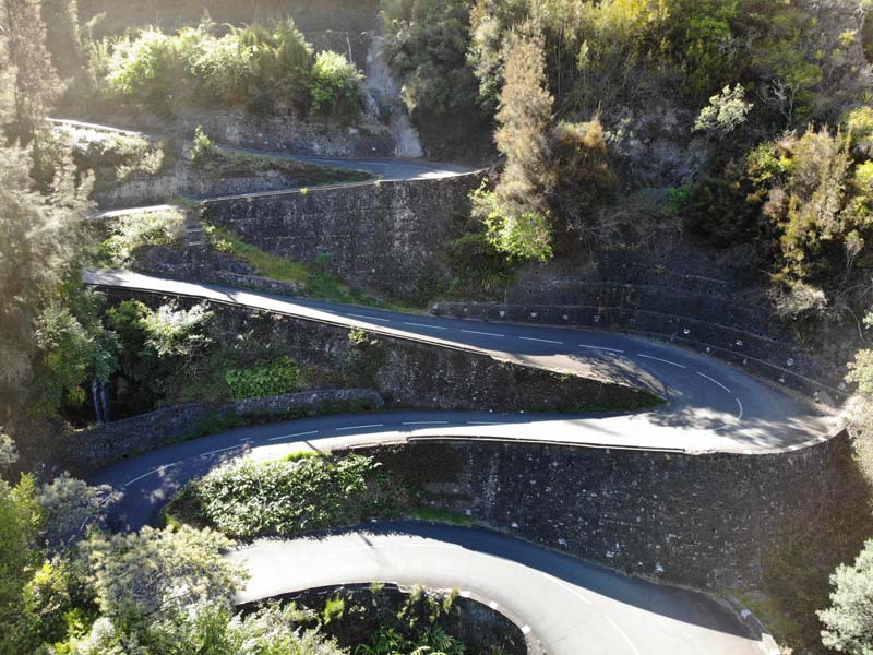
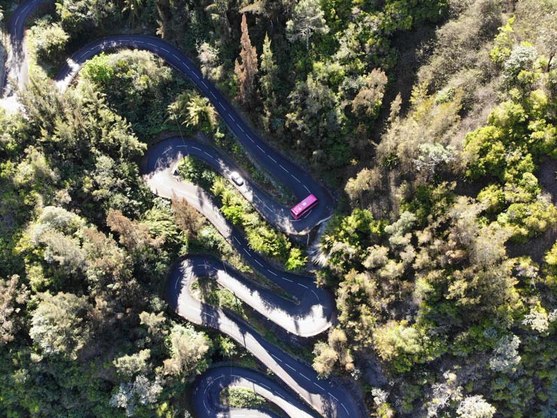
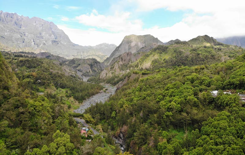
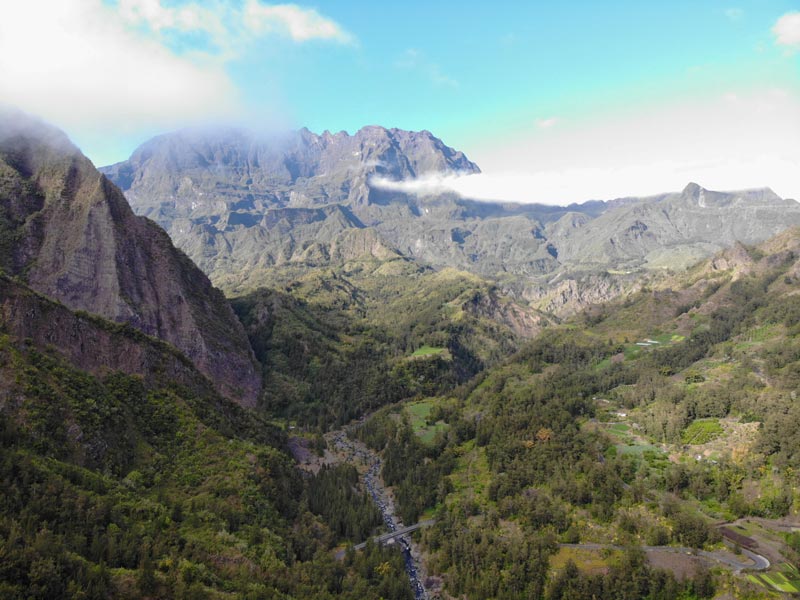
Saint-Louis to Cilaos
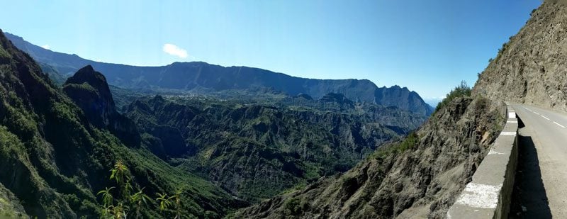
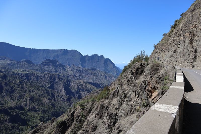
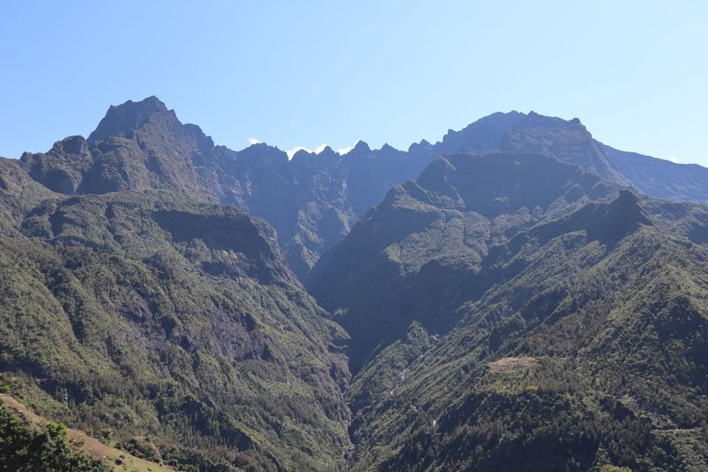
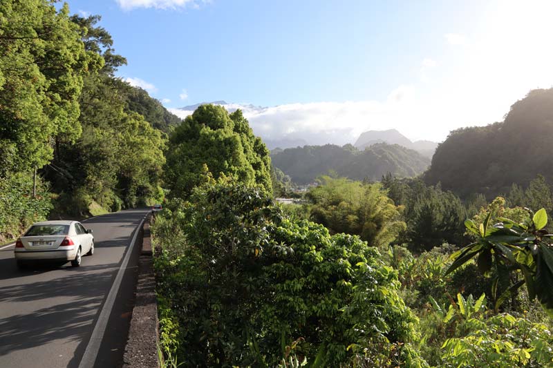
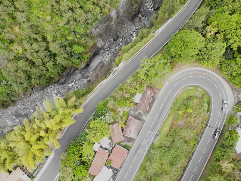
The RN-5 heads into Cirque de Cilaos from Saint-Louis for 35 km of pure thrills and extreme scenery. It is the best scenic drive in Reunion Island, without a doubt, and it will take a lot of courage and patience to negotiate one-lane bridges and tunnels, blind sections, and 400 turns, some of which are almost full circle and uphill. This engineering marvel was built in 1932 without the use of any explosives.
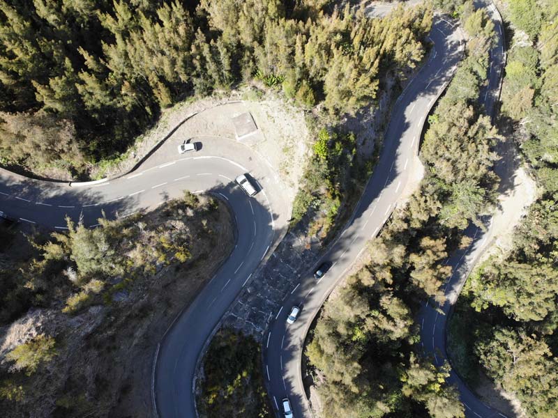
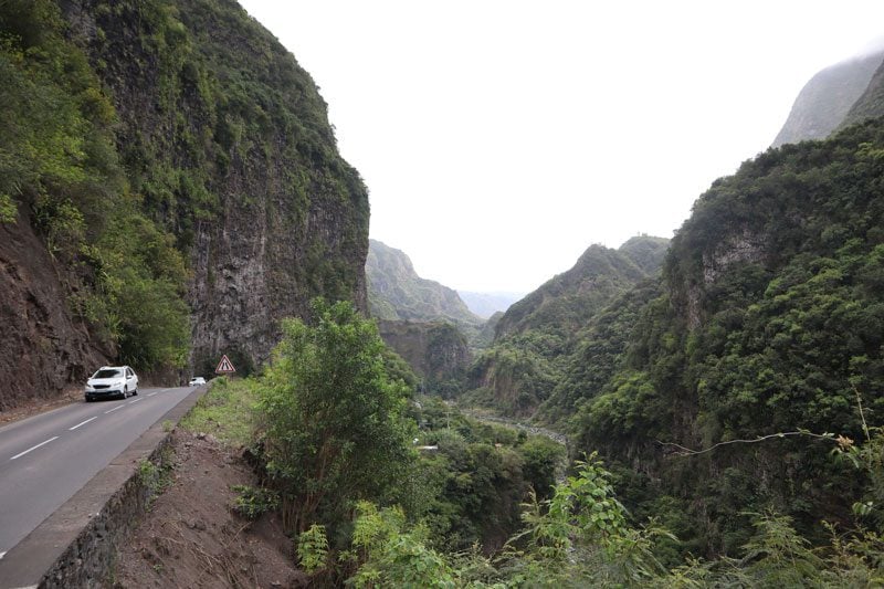
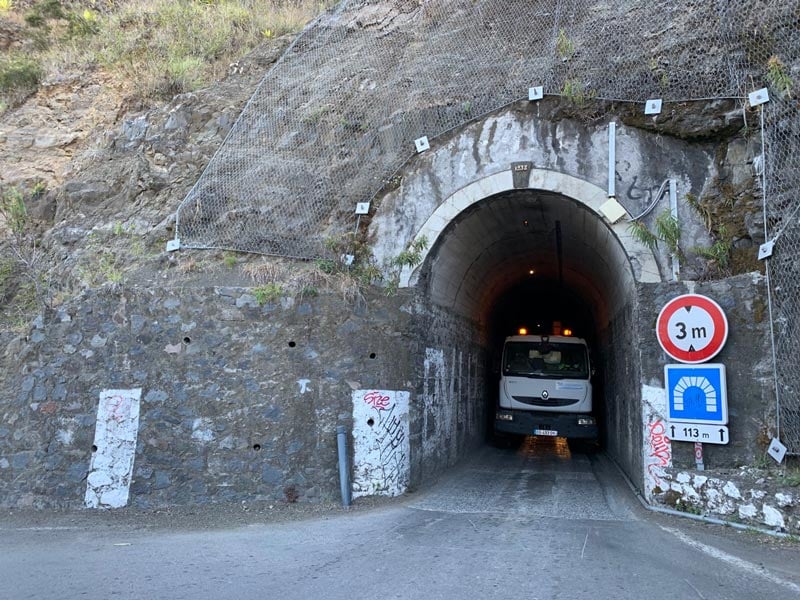
Feeling completely walled in by the high peaks on both sides of the road, it’s hard to imagine that the Indian Ocean is just a few kilometers down the road. As you inch closer to Cilaos, especially beyond the one-laned tunnel, the scenery opens up, and the cirque’s hamlets come into view, looking as if clinging for dear life on the only flat ground found on the high ridges.
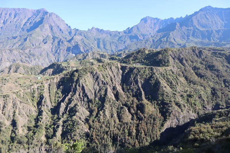
Cilaos to Ilet a Cordes
Perched on a remote ridge, the hamlet of Ilet a Cordes was so inaccessible back in the day that runaway slaves needed to use ropes to climb to it (hence its name, “hamlet of ropes”). The isolated settlement is now linked to Cilaos via the scenic D242 that leaves you breathless for 11 kilometers, some of which had to be cut into the cliff. The drive begins with a mesmerizing series of sharp python-like downhill twists, later easing with a smooth drive with changing views of the cirque, its hamlets and ravines, and plenty of opportunities to stop and absorb the scenery.
As you enter Ilet a Cordes, the feeling of traveling back in time is the first thing that comes to mind. There’s hardly anyone around, apart from a few farmers tending to their fields of lentils without the use of any machinery. It’s so quiet out here, and the acoustics are so great that you can hear the birds singing from every conceivable angle. Leave your car and explore on foot, or keep driving wherever the road takes you.
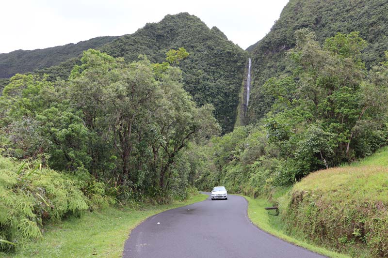
Saint-Andre to Hell-Bourg
The D48 follows the contours of the 37km-long Riviere du Mat into Cirque de Salazie, Reunion’s wettest cirque. There seem to be more waterfalls than people living here, with some trickling straight onto the asphalt after minor periods of rain. Tightly squeezed between shark-fin-shaped emerald peaks, keep a sharp look for hidden waterfalls like Cascade Blanche and Cascade du Voile de la Mariee.
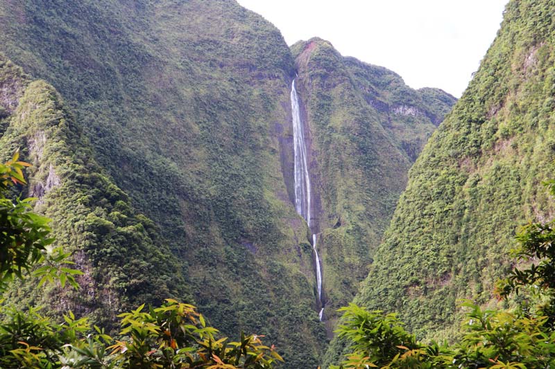
The picturesque village of Hell-Bourg is a fitting end to this scenic road. Nearby thermal springs boosted tourism back in the day, but with the springs long gone, Hell-Bourg now attracts tourists thanks to its scenic location and Creole architecture. Known as La Case, the town’s colorful traditional houses are unique to the area. Ranging from simple homes to former mansions, their distinction comes from the lambrequins (ornamental trim) made of wood or metal with various designs.
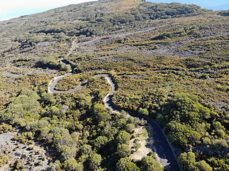
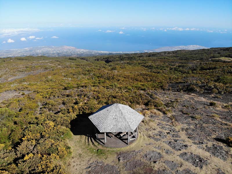
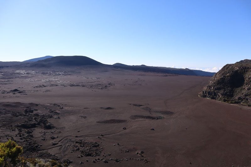
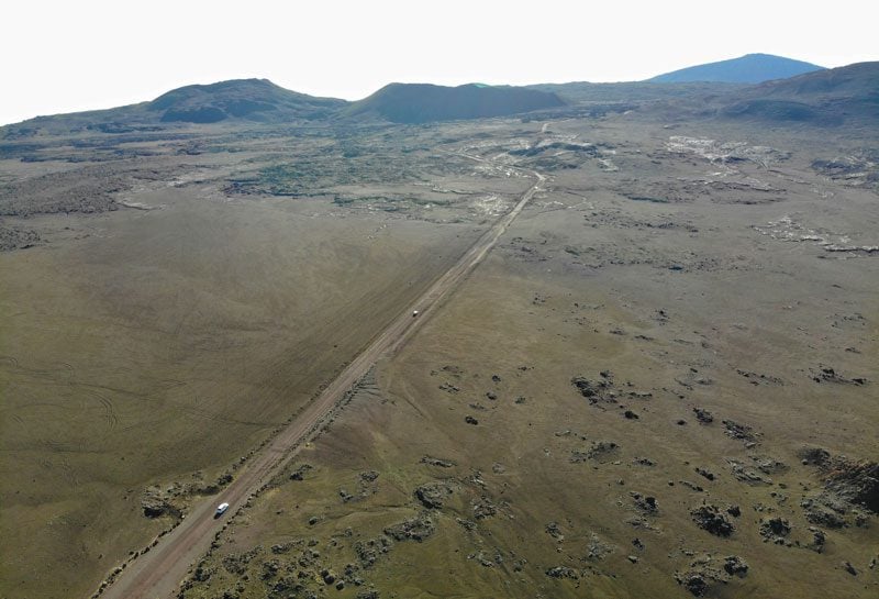
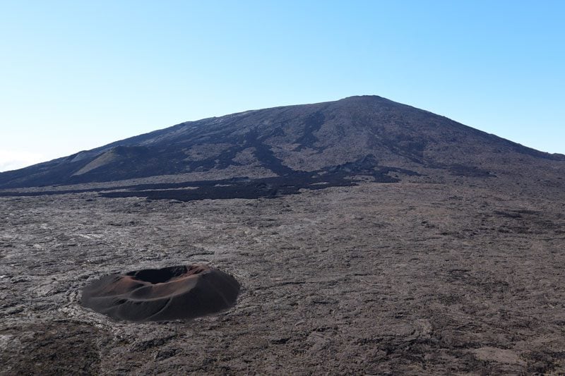
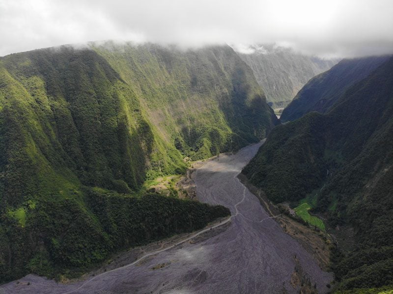
Bourg-Murat to Pas de Bellecombe
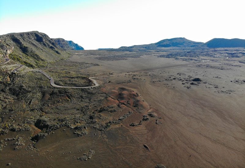
The RF5 is the only road heading to Piton de la Fournaise, Reunion Island’s active volcano. Things start on the green side at the Nez de Boeuf scenic lookout. Stop and admire this deep valley created by 300,000 years of erosion.
Beyond the lookout, the landscape completely changes and becomes what looks like a desolate desert. At Pas de Sables, peer down to the wide plain of volcanic ash, scarred by sporadic craters marking past major eruptions and cinder cones indicating minor activity. From here, the paved road plunges straight to the plain and turns into dirt all the way to Pas de Bellecombe. This scenic lookout marks the end of the line and the starting point for several hikes. You’re now at an altitude of 2,311m and from the viewing area, you can see the Dolomieu Crater in the foreground and the Formica Leo on the caldera floor.
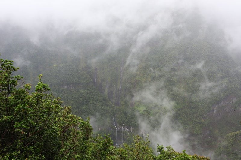
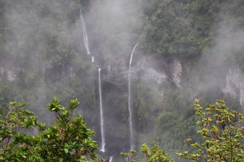
Bras Panon to Takamaka Lookout
The D53 heads inland from the coast to the wettest spot on Reunion Island. The roadside waterfalls offer a hint of what’s ahead, but when you reach the Takamaka Lookout, you’re simply left speechless. The Takamaka Valley drains an enormous amount of rainfall. With 6-7 meters of annual rainfall, it is one of the wettest places on Earth! And with all this rain come waterfalls, falling like tears from the cloud-covered heavens. Be sure to get here early in the day when there’s a greater chance of clear skies.
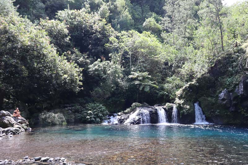
Riviere Langevin
Riviere Langevin is blessed with an abundance of water. A backcountry road heads inland for about 9km and follows the contours of the valley’s river. It’s a pretty drive and very popular with local families over the weekend. Locals come prepared, park the car in a nice spot, and let the kids splash in the river for the day. Drive all the way to Cascade de la Grand Galet to see from up close one of the prettiest waterfalls on the island.
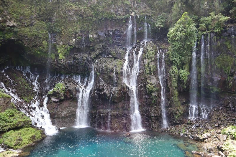
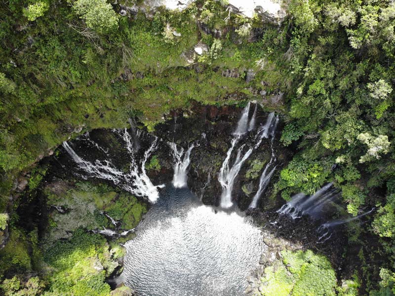
To make the most of the scenic drive, head to Cascade du Trou Noir. This secluded waterfall and swimming hole are what you envision when booking a vacation to a tropical island. Don’t forget your swimming gear; if you really want to appreciate the clearness of the water, bring a mask. This is a great place for a picnic lunch.
Saint-Philippe to Sainte-Rose
In Reunion’s “wild south”, the N2 turns the corner at Saint-Philippe and reaches the southernmost point on the island at Cap Mechant with its famous vertical sea cliffs. Now heading north, the road cuts through Grand Brule, a plain of hardened lava where recent eruptions from Piton de la Fournaise often lead to road closures.

Manapany to Grand Coude
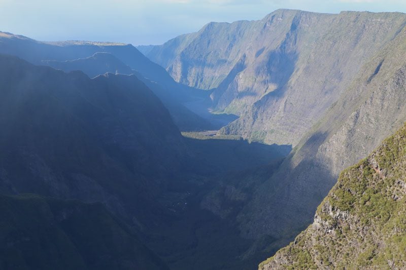
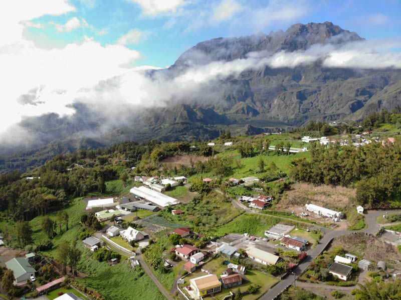
It’s amazing where people manage to settle around Reunion Island, considering just how remote some of its sections are. Grand Coude is one such area, a hamlet resting atop a narrow plateau at a height of 1200m. On either side of the plateau are deep valleys whose origins are the slopes of the high ridge that form the beginning of the volcano and gradually widen until meeting the coastal plain. Stop wherever you feel like to enjoy the surreal views and imagine locals get to see this on a daily basis, but only until late morning when the clouds start to roll in.
Hell-Bourg to Grand Ilet
Back in Cirque de Salazie, head on the D48 from Hell-Bourg and turn to Grand Ilet on the D52 at Cascade du Voile de la Mariee. The hamlet of Grand Ilet is close to the top of the ridgeline that separates Cirque de Salazie from Cirque de Mafate. It really feels like the end of the line around here or at the very least a drive somewhere in the countryside of the Alps. Be sure to spot the Piton d’Anchaing, one of the most unique features in the cirque (1,356m).
What’s Next?
Now that we’ve covered the best scenic drives in Reunion Island, you’re ready to hit the road! Be sure to check out the rest of the Reunion Island travel guide collection, including a day-by-day Reunion Island itinerary, the best beaches and hikes on the island, essential travel tips, and lots more.
Pin These Images To Your Favorite Boards!