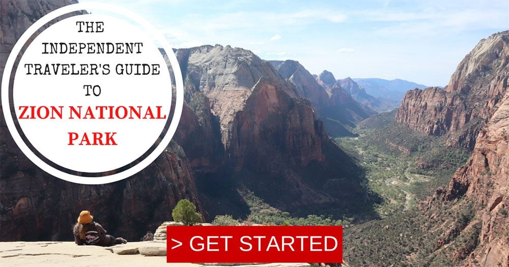
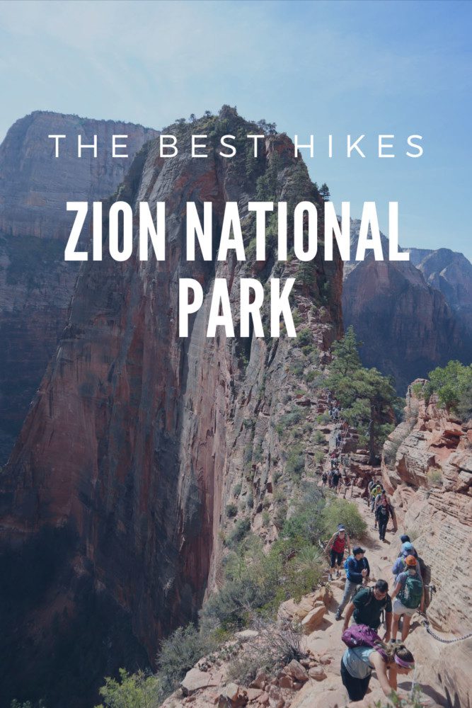
The Best Hikes In Zion National Park
Whether getting wet in the Narrows, feeling high at Angel’s Landing, or going off-the-grid in the Kolob region, don’t forget to pack hiking shoes for your visit to Zion. With trails suitable for any visitor type, leave some time to ditch the shuttle bus and put your legs to work. In this guide, we’ll explore some of the best hikes in Zion National Park.
I visited Zion National Park on a family road trip from Las Vegas many years ago. Still, I did some serious hiking in the park only on a recent visit as part of a five-week road trip in the American Southwest. This list of the best hikes in Zion National Park is based on my experience and extensive research.
Additional Zion Resources
Check out the Zion National Park travel guide collection for additional information, including essential planning tips, sample Zion itineraries, and top things to do. Additional Southern Utah guides are also available to create a memorable road trip in one of America’s prettiest corners.
Here are a few things to keep in mind if planning to hike in Zion National Park. Of course, this is not an exhaustive list.
- Planning to hike to Angel’s Landing? See if a hiking permit is required.
- The best time to hike in Zion National Park is when the temperature is pleasant during spring and fall. The scenery is more interesting during spring as wildflowers are blooming in Zion Canyon, especially during May.
- You can still hike during the summer months. Just be conscious of extreme weather. Moreover, frequent afternoon thunderstorms hit Zion Canyon, so do the “heavy” hiking earlier in the day.
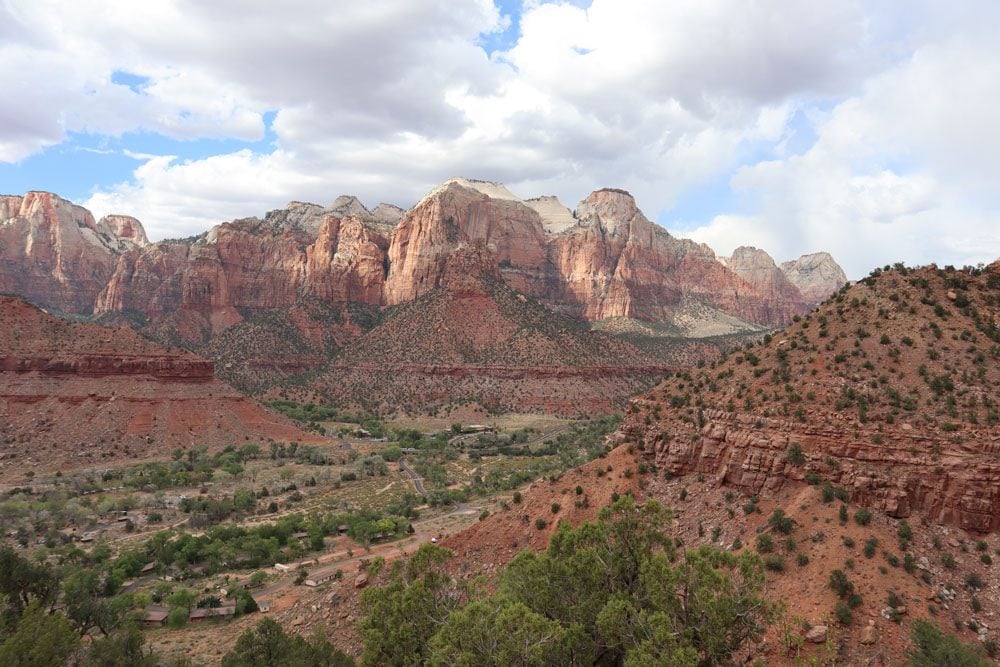
- Zion Canyon is best appreciated from its rims or high-elevation viewpoints. Plan to do at least one hike out of the canyon floor.
- Mornings in Zion Canyon can be cold, even in the summer months, so pack accordingly. Also, it’s best to wait for the sun to rise high in the sky and light up the entire canyon. Therefore, use the early morning hours for climbing to the higher ground or hiking on impressive trails, even in the shade.
- Check trail information on the official Zion National Park website and “sanity check” your hiking plan with park rangers at the visitor. Zion trails might be closed for repairs from bad weather or for ongoing search and rescue missions.
- I heavily relied on All Trails maps when planning my hikes, and I strongly recommend upgrading to the pro version so you can download trail maps to your phone.
- There are some exceptional backcountry trails in the Kolob region (Kolob Terrace Road and Kolob Canyons). If you’re planning to hike in this part of the park, purchase a physical hiking map of the area.
Zion NP Travel Guide Video
Featuring Zion Canyon’s top sites, get to know the national park with this travel guide video.
Packing List
Here are a few items worth mentioning in the context of hiking in Zion. Of course, this is not an exhaustive list. Check out the X Days In Y Packing List for more ideas.
- Get your copy of the Lonely Planet guide to Zion & Bryce Canyon. If your visit to Zion is part of a more extended road trip, the Lonely Planet guide to Southwest USA is a good alternative.
- If you’re planning to do serious hiking, especially multi-day hikes in the backcountry, purchase a physical hiking map.
- Water: bottles or a water pack
- Sun protection: hat, sunscreen, sunglasses
- Clothing: lightweight and sweat-repelling layers
- Dry weather: lip balm and tissues
- Safety: first-aid kit, walking poles (optional), sturdy hiking shoes, thick socks
- Change of clothes for longer hikes that require car travel
- Hygiene: alcogel, small garbage bag
- Energy bars
- USB charger to charge your phone in the car
- Dress in layers
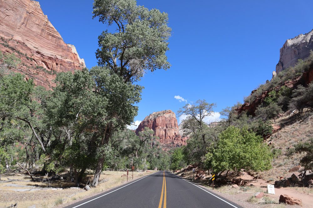
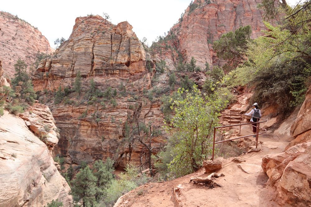
The following list highlights some of the best hikes in the park, but it’s important to note that this is not a complete list. This guide primarily focuses on the top hikes in and around Zion Canyon. For more information about hiking in Zion National Park, visit this official page.
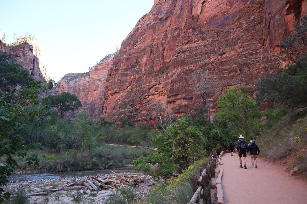
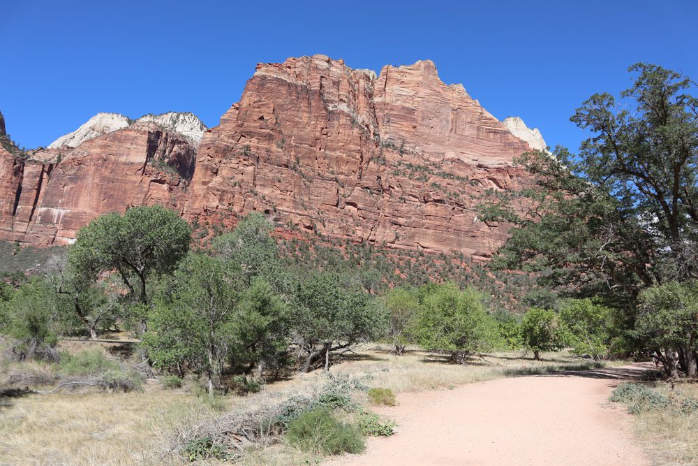
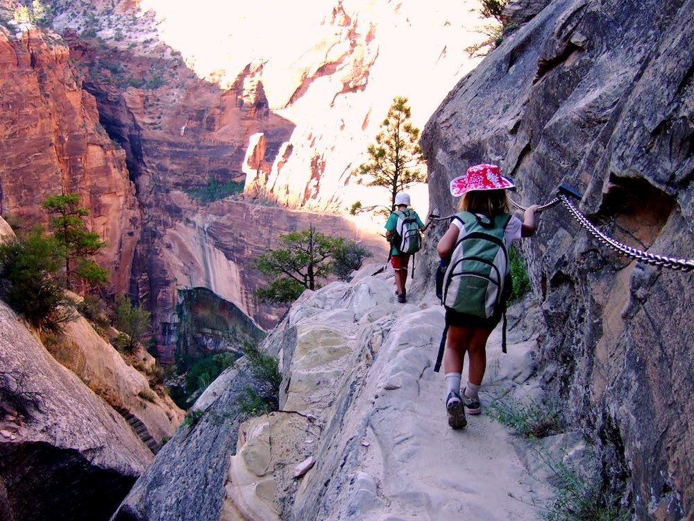
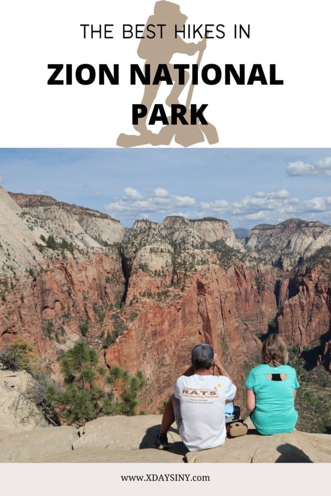
Angel’s Landing Hike
Distance: 4.4 miles, 7.1 km | Difficulty: hard | Trail Map
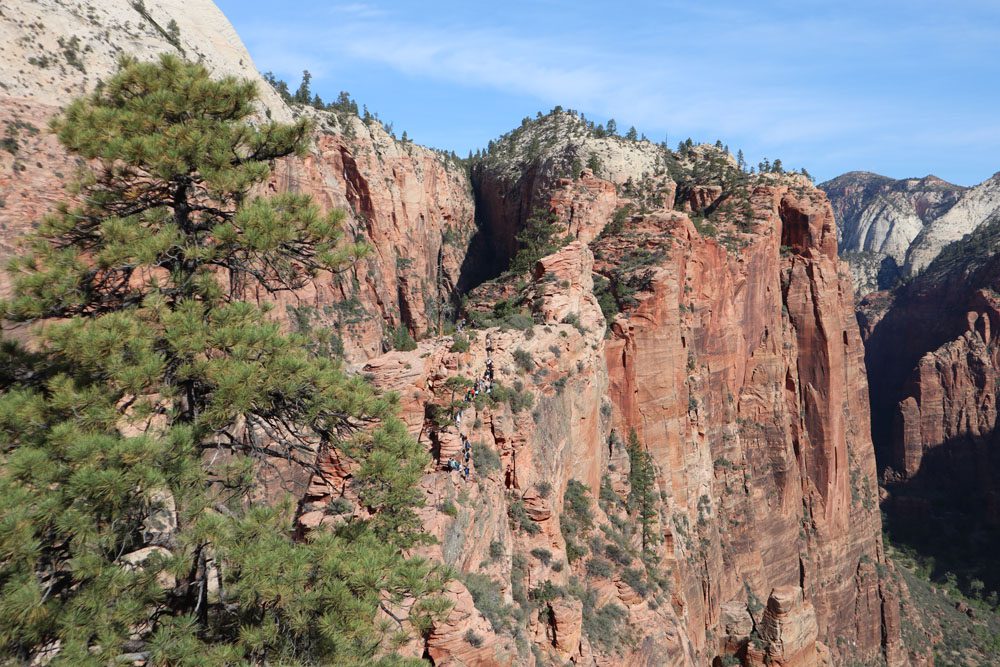
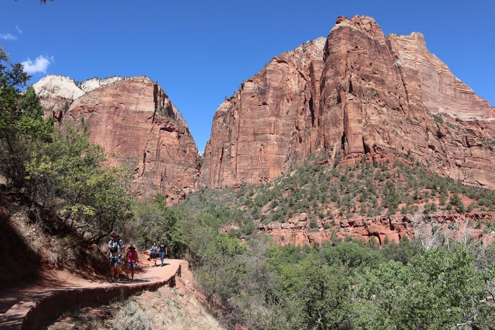
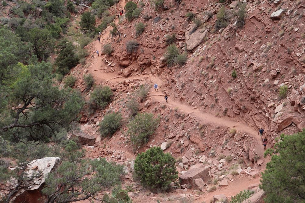
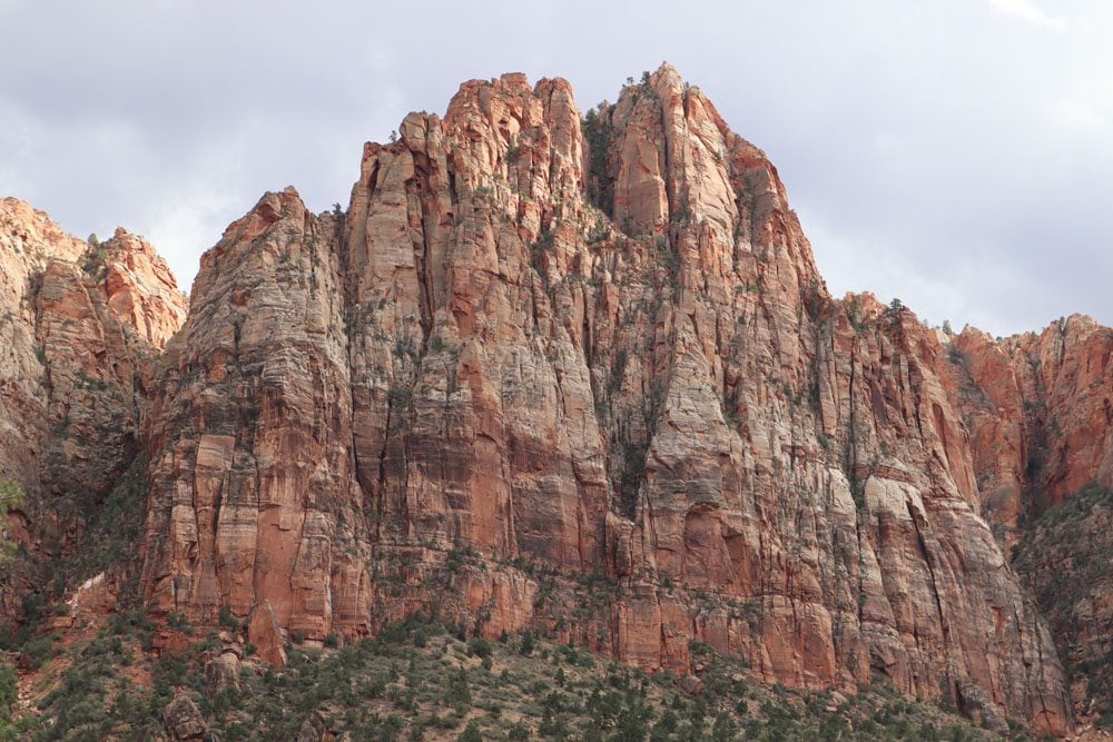
Angel’s Landing is the most popular hike in Zion National Park and the top highlight for most visitors. The goal of this hike is to reach a scenic clifftop that, as one early hiker claimed, could only be reached by angels.
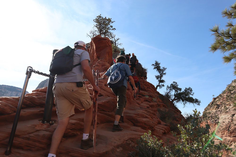
The trail begins across the river from the Grotto shuttle stop on a short sandy section that’s quickly replaced with a paved trail. Your legs start to work as you gradually gain elevation above the canyon floor via a series of punishing switchbacks. There are plenty of opportunities to pause and catch your breath while enjoying the views, but those will be better on the return leg when the sun is high in the sky.
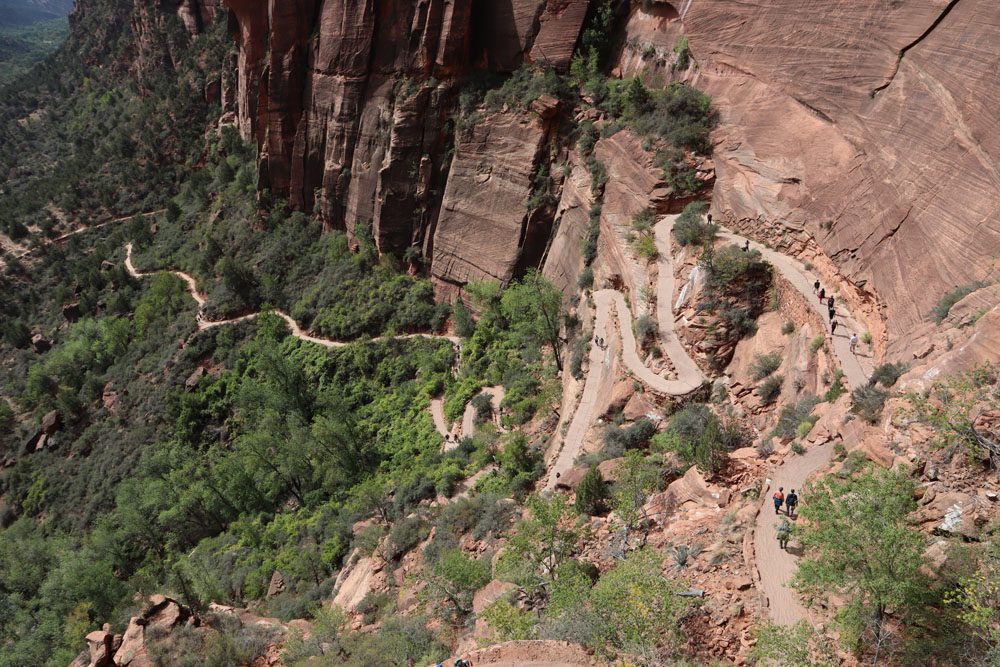
The switchbacks end at a narrow crack in the cliff known as Refrigerator Canyon. This short leg is a small shaded oasis, offering relief from the heat and the climbing. As you exit the canyon, the paved trail again gains elevation, this time via Walter’s Wiggles, an impressively-constructed series of short switchbacks that end at Scout Lookout.
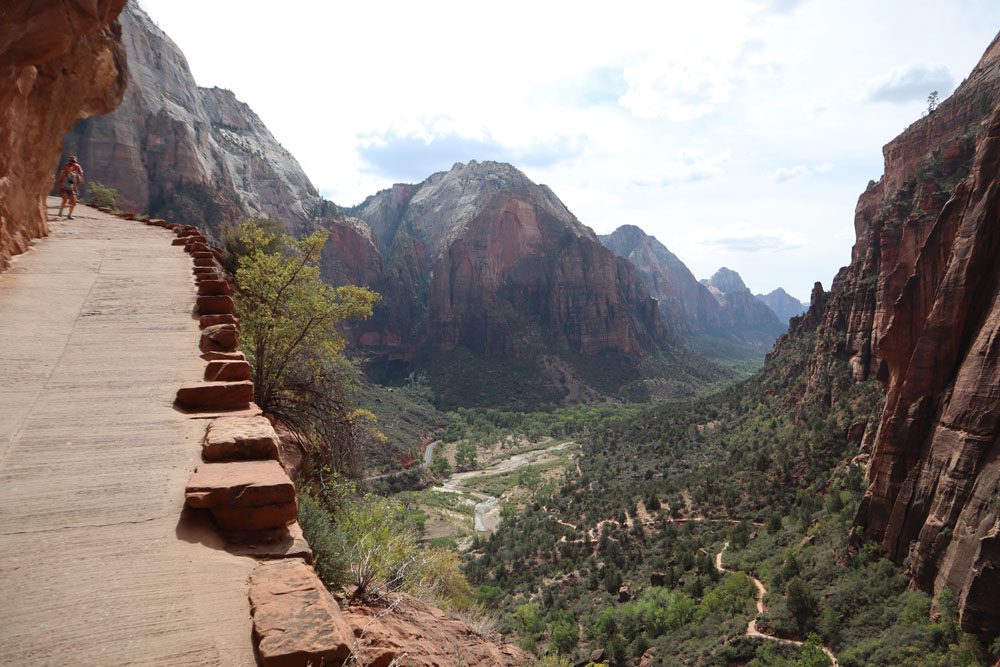
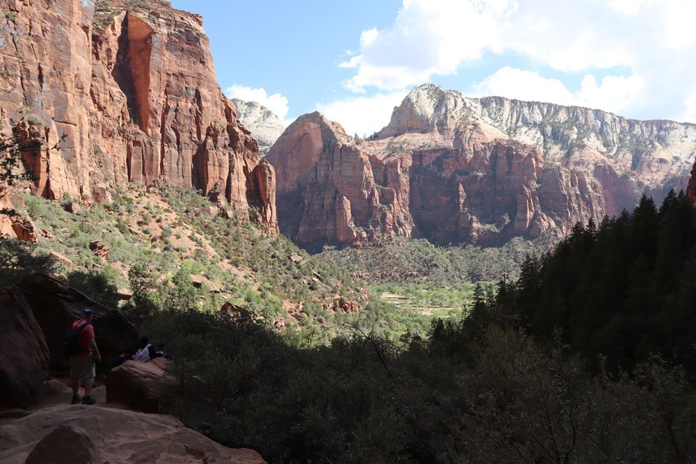
At Scout Lookout, make the call whether to continue to Angel’s Landing or stop here and enjoy the breathtaking views. Hiker’s on the West Rim Trail also pass at this scenic lookout.
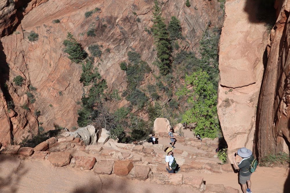
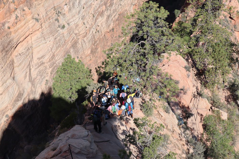
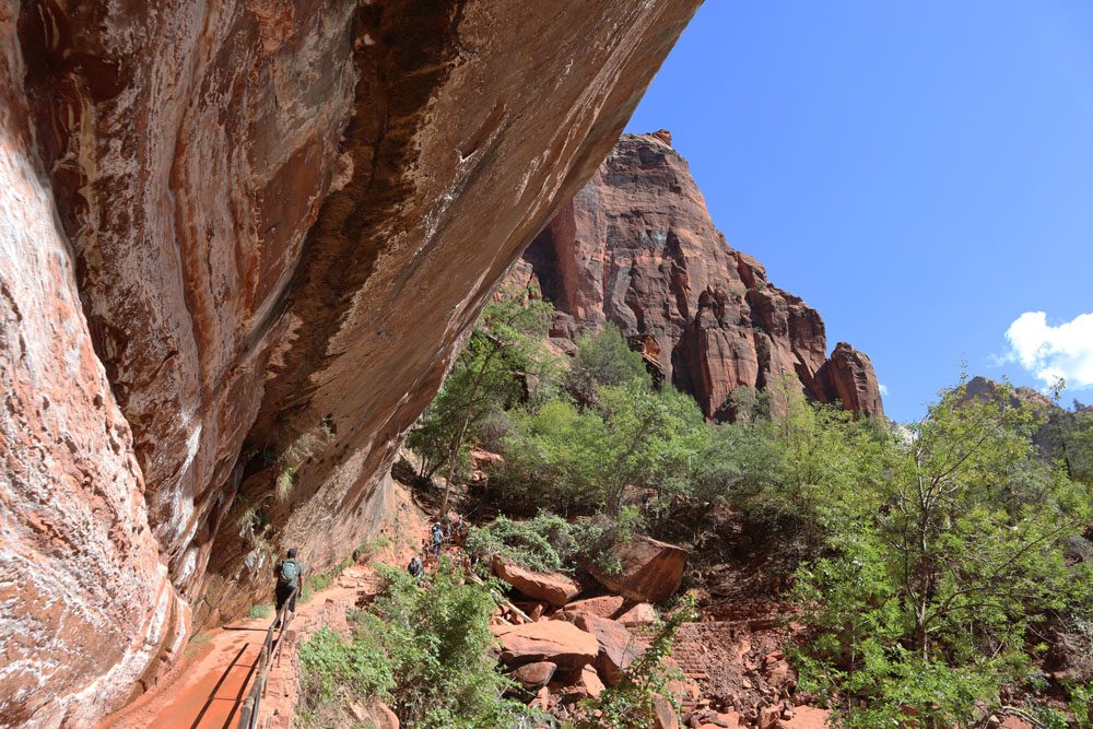
The final leg to Angel’s Landing requires hikers to be brave, fit, patient, and not stressed from heights. With the use of chains, rocky steps, and some fancy footwork, you’ll hike the final leg to Angel’s Landing. Before the permit requirement, this short section took quite a bit of time to complete, and it had less to do with the topography and more with the human bottleneck.
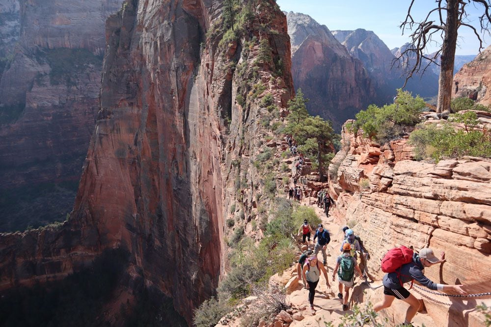
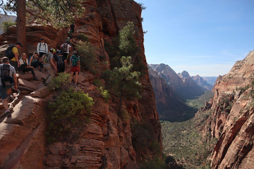
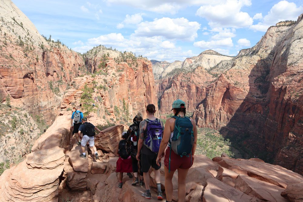
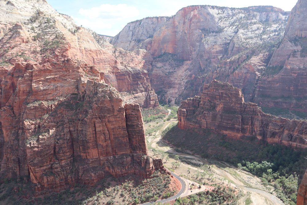
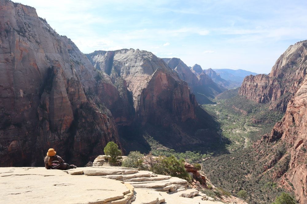
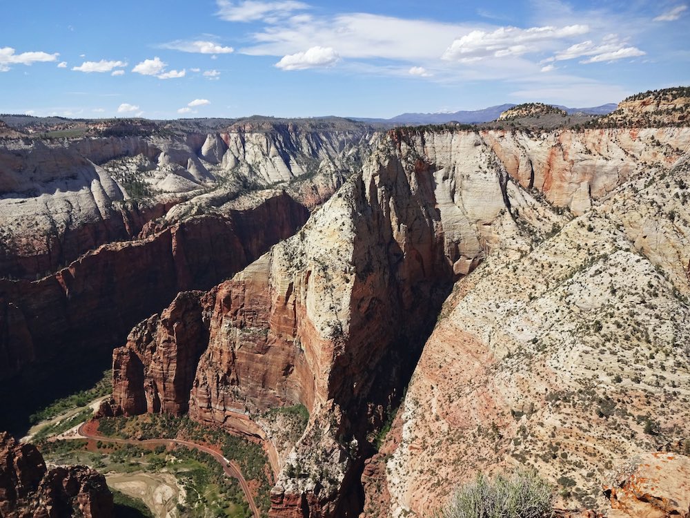
At Angel’s Landing, Zion Canyon is literally beneath your feet, and the passing park shuttles are so small. The unbeatable views from Angel’s Landing are well worth the mental and physical challenge. Of course, you’ll want to stay here and enjoy the scenery with a sandwich in your hand, but be warned that resident chipmunks are anything but shy.
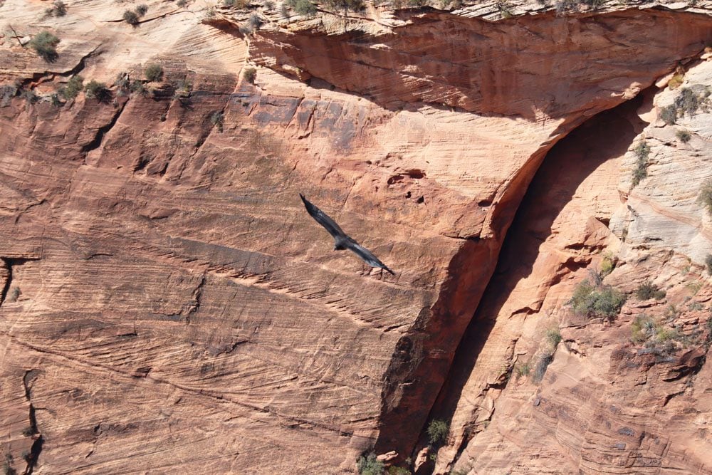
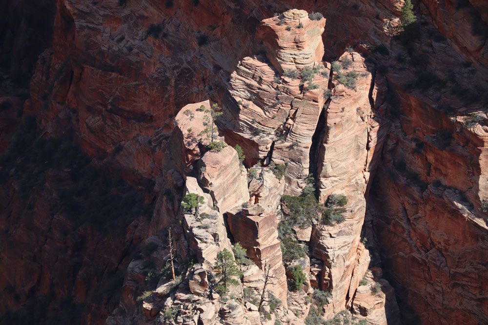
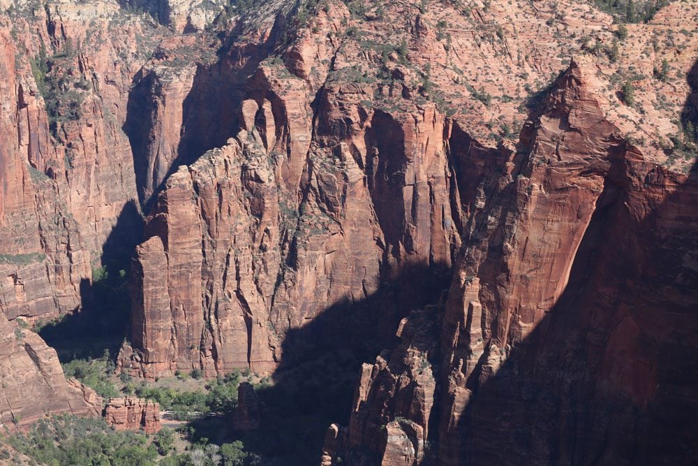
Have a unique close look at Big Bend and the interesting rock formations on the canyon walls and the sharp pinnacles. If conditions are right, you’ll also see condors patrolling the skies.
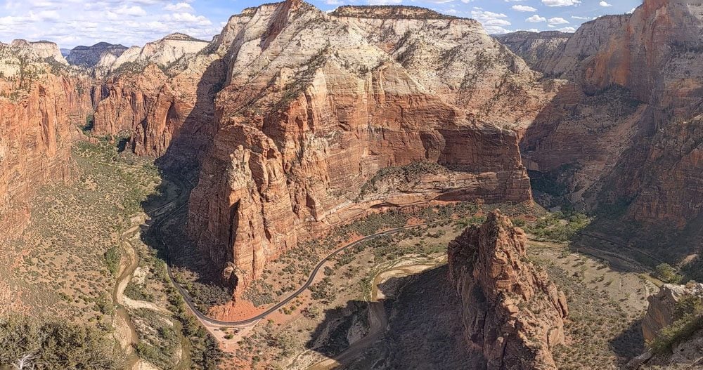
What goes up must come down. So, once you think you’ve had enough, stay for a little longer and take a few more mental pictures of Zion Canyon from Angel’s Landing. Then, fully satisfied, begin to head back down. Once you clear the traffic and reach Scout Lookout, it’s a quick hike to the trailhead. With the sun now high in the sky, every switchback reveals superb views.
- Check the park’s official website to see if a permit is required to hike to Angel’s Landing.
- Allow five hours for a comfortable experience or less if you hike fast without many stops.
- Start early in the morning to avoid serious climbing when it’s hot.
- Poles might come in handy, but they’ll be a nuisance in the final leg, so only bring them if they can easily fold into something small and not obstructive.
- The final leg to Angel’s Landing is very slippery when wet. Respect trail rules and ranger advice.
- Bring more water than you think you’ll need and protect yourself from the sun as many trail sections are exposed to the elements.
- The new permit system should alleviate the heavy congestion on the final leg from Scout Lookout to Angel’s landing, but I assume patience is still required as there is no room for two-way traffic.
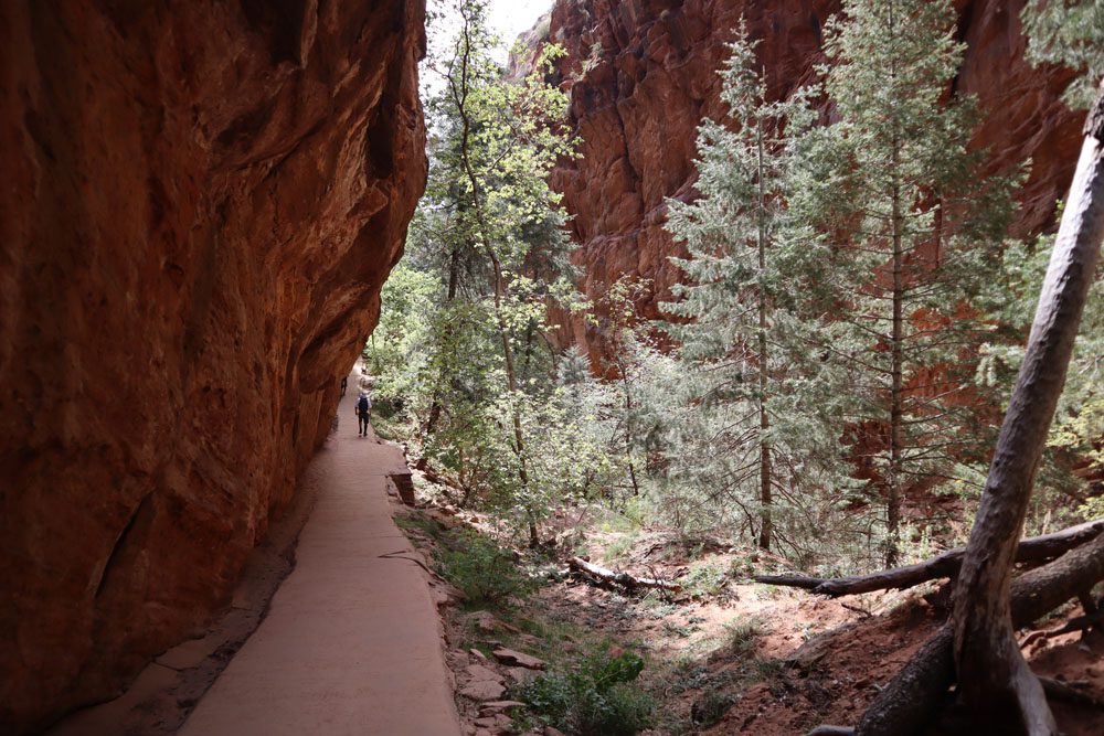
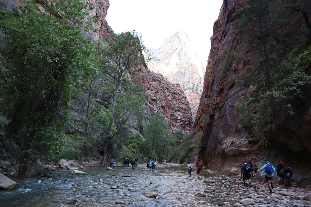
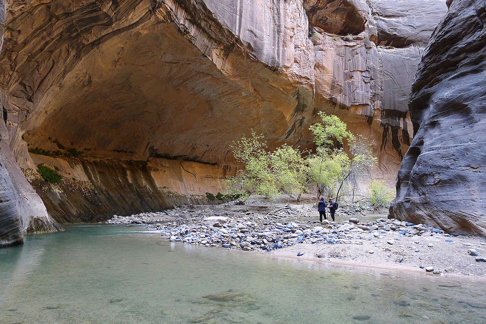
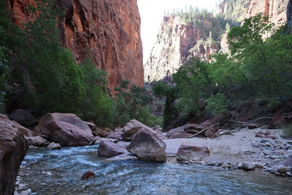
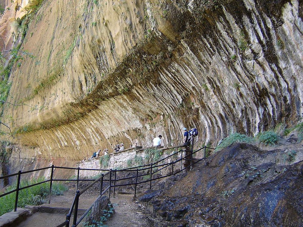
The Narrows Hike
Distance: 9.4 miles, 15.1 km | Difficulty: hard | Trail Map
The Narrows is right on par with Angel’s Landing as far as Zion’s most popular hikes. The Narrows form the narrowest section of Zion Canyon, a claustrophobic slot canyon with 1000-foot walls. Hiking the Narrows is more of an adventure than a hike since many trail sections are inside the Virgin River, where the water level can be waste-high. If you want to experience hiking the Narrows but don’t want to spend a full day on this experience, you can hike for about one hour and turn around. The “bottom-up” trail begins at the end of the Riverside Walk and ends close to a fork in the river at Big Springs.
- Check the park’s official website to see if the trail is safe and if the water level is not too high.
- Rent special gear to hike the Narrows from various outfits just before the visitor center. You’ll need special waterproof boots, a long wooden pole (regular hiking poles won’t do the job), and protective clothing.
- Hiking the Narrows is a good morning activity that doesn’t require the sun to be high in the sky.
- You can also hike the Narrows “top-down” from Chamberlain’s Ranch. This route is downstream, but a hiking permit is required.
Riverside Walk
Distance: 2.2 miles, 3.5 km | Difficulty: easy | Trail Map
The Riverside Walk is a popular Zion Canyon trail, thanks to its scenery and suitability for all visitors. The paved path begins at the last shuttle stop (Temple of Sinawava) and follows the Virgin River upstream.
The Riverside Walk is a great morning option as it’s still enjoyable in the shade, and there’s a good chance of spotting deer grabbing breakfast by the riverbank. In addition, the trail brings hikers close to the sandstone cliffs. You can also ditch the trail and walk along the riverbank in some sections or take a peaceful break to the soothing sounds of the flowing river. The Riverside Walk ends at the starting point for the Narrows hike. Before turning back, check out the mighty Mountain of Mystery.
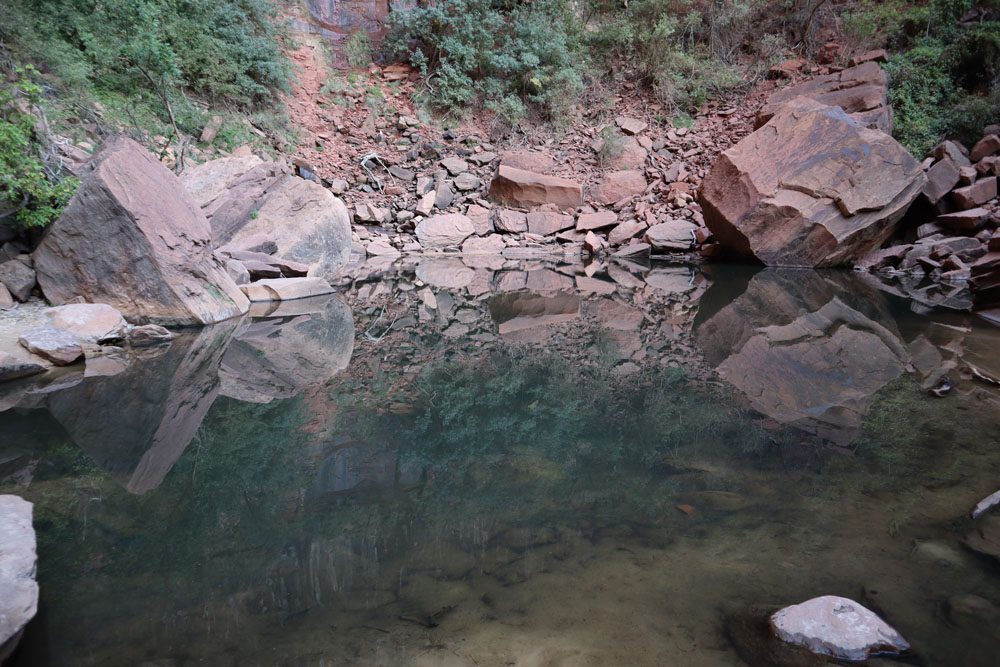
Emerald Pools Trail
Distance: 3 miles, 4.8 km | Difficulty: moderate | Trail Map
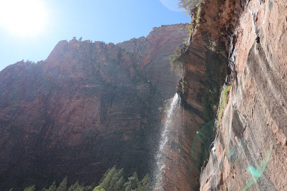
Another popular Zion hike, this trail leads to three separate pools, but it’s the lower and upper pools that are the most impressive. The trail to the Lower Emerald Pool begins at the small bridge next to the Zion Lodge shuttle stop. This section is paved and gently gains elevation while heading inland towards the west rim of Zion Canyon.
The Lower Emerald Pool is fed by a small waterfall that glides over a steep section of the canyon wall. It still flows even in the dry months of the year. The trail takes hikers behind this impressive natural wonder via a slight depression in the canyon wall.
The Middle Emerald Pool isn’t that impressive, but it’s high enough to provide a nice view of Zion Canyon’s east rim. The final leg to the upper pool is a more challenging climb over an uneven surface, so you can hike to either the lower or middle pool and turn around.
The Upper Emerald Pool is a magnificent secluded desert oasis. It’s tranquil here despite the crowds, and even in the summer months, the pool is impressive. Reflecting its surroundings like a perfectly polished mirror, I found myself hypnotized by this phenomenon and couldn’t stop staring at the water’s surface for a few minutes trying to discern what my eyes were seeing.
You can also hike to the Emerald Pools and then Zion Lodge from the Grotto shuttle stop via the Kayenta Trail.
The Grotto Trail
Distance: 1.2 miles, 1.9 km | Difficulty: easy | Trail Map
The Grotto Trail connects the Grotto and the Zion Lodge shuttle stops. This easy hike runs parallel to the main road and offers views of the west rim of Zion Canyon. It only takes about twenty minutes to complete, and it’s a way to spice things up by ditching the shuttle bus.
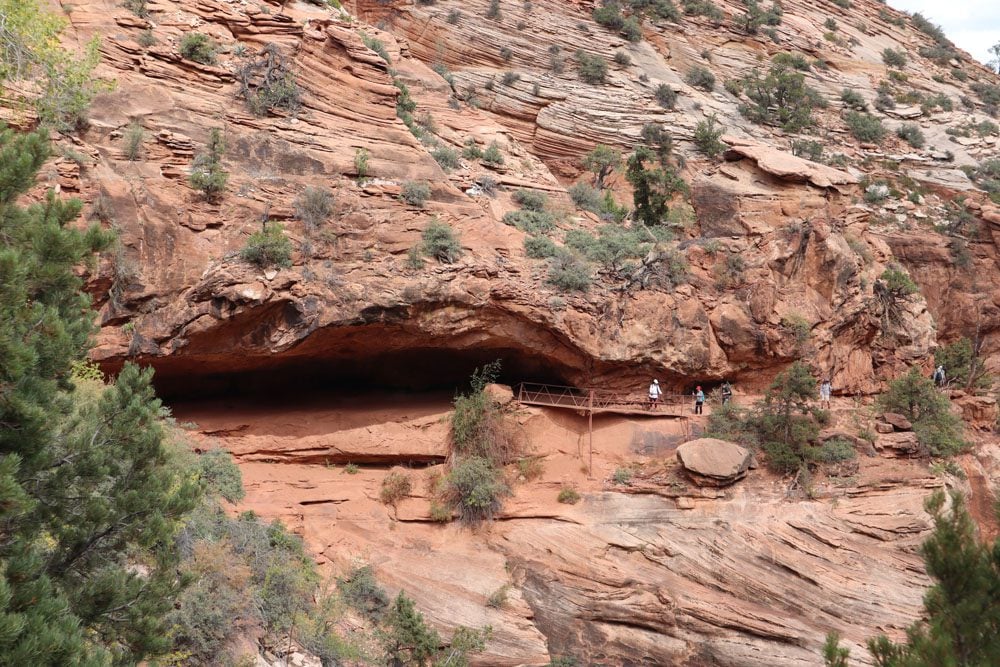
Weeping Rock Trail
Distance: 0.3 miles, 0.5 km | Difficulty: easy | Trail Map
The hike to the Weeping Rock is the shortest trail in the national park. The trail ascends to an interesting cavity in the canyon wall from the Weeping Rock shuttle stop. Constant moisture gives the impression of tears coming out of the sandstone.
The trail and shuttle stop are closed following a major rock slide in 2019. Check the park’s website to see if Weeping Rock has reopened.
Echo Canyon Hike
Distance: 8 miles, 12.9 km | Difficulty: moderate | Trail Map
If you fancy hiking in a slot canyon without the crowds of the Narrows, the Echo Canyon hike can be a good option. Be sure to check trail conditions and be conscious of flooding. The trail begins at the Weeping Rock shuttle station and heads inland through the east rim.
This trail might be closed and will likely reopen together with Weeping Rock.
Hidden Canyon Hike
Distance: 3.1 miles, 5 km | Difficulty: moderate | Trail Map
Also starting from the Weeping Rock shuttle station, the hike in the Hidden Canyon is one of Zion’s most unique experiences. Hikers must overcome any fear of heights, as some sections of this trail leave no room for error. The trail begins with a series of switchbacks followed by a tightrope act on the side of the cliff. Then, enter a secluded world inside the canyon and turn around when it’s no longer possible to hike further inland.
(1) As with the Weeping Rock and Echo Canyon trails, the hike to Hidden Canyon might be closed for repair. (2) You can combine this hike with a detour to Observation Point
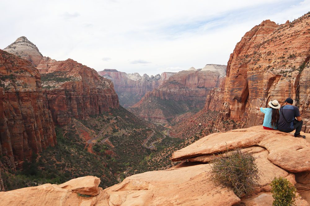
Canyon Overlook Trail
Distance: 1 mile, 1.6 km | Difficulty: moderate | Trail Map
At just one mile (return), the Canyon Overlook Trail offers the best “per capita” views in Zion National Park. Pick up the trail on the left side when exiting the Zion-Mount Carmel Tunnel and weave your way above a narrow creek rich in pine and juniper trees. The eroded sandstone created many interesting highlights to keep your eyes busy, such as arches, caves, and jagged pinnacles. The trail ends 1,000 feet above the Zion Canyon floor at Canyon Overlook, with views of the scenic highway and some of Zion’s iconic peaks, such as the West Temple and the Sentinel.
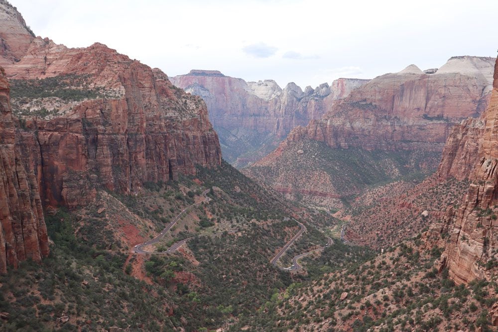
Parking for the Canyon Overlook Trail is tricky. There’s a tiny parking lot right across the road from the trailhead, but there’s little chance of finding free space. So keep driving east, away from Zion Canyon) and park on the side of the road where possible.
Canyon Overlook is one of the best places to watch the sunrise in Zion Canyon.
Watchman Trail
Distance: 3.3 miles, 5.3 km | Difficulty: moderate | Trail Map
Offering similar vistas to Canyon Overlook Trail, albeit less impressive due to the lower elevation, the Watchman Trail begins next to the visitor center. This is a convenient hike to do at the end of the day.
Within a short distance, the trail travels from the relatively lush world of the riverbank to the sparse vegetation of the desert. Watch for the change in plant species, from wildflowers and willows to cactus and pinyon pines. After a series of switchbacks, the trail ends at a small mesa. From this scenic lookout, you can see the Watchman, lower Zion Canyon, and the town of Springdale.
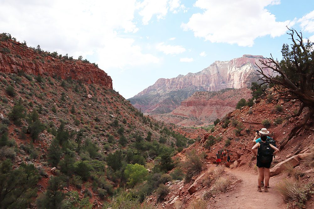
East Rim Trail
Distance: 11.8 miles, 19 km | Difficulty: hard | Trail Map
The East Rim Trail can be hiked in either direction, but since the Weeping Rock trailhead is still likely closed, start from the trailhead off the Zion-Mount Carmel Highway. Most hikers split this challenging hike into two days. This unlocks the opportunity to summit Cable Mountain, hike to Observation Point, and check out Hidden Canyon (see above).
There’s more to the national park beyond Zion Canyon. If you want to get away from the crowds and have the extra time, consider spending an extra two or three days exploring Zion’s Backcountry. The West Rim Trail continues out of Zion Canyon after Scout Lookout on the Angel’s Landing trail and ends at scenic Lava Point. Other worthwhile hikes off Kolob terrace Road include the Wildcat Canyon, the Connector, and Hop Valley trails.
Check out the Timber Creek Overlook, La Verkin Creek, and Taylor Creek trails in the national park’s Kolob Canyons area.
What’s Next?
Now that you know the best hikes in Zion National Park, it’s time to begin mapping the hikes on your wishlist. Check out the Zion National Park travel guide collection for more information about Zion, including essential planning tips and multiple Zion itineraries. If you’re visiting other parks in Utah, more resources are available.
Pin These Images To Your Favorite Boards