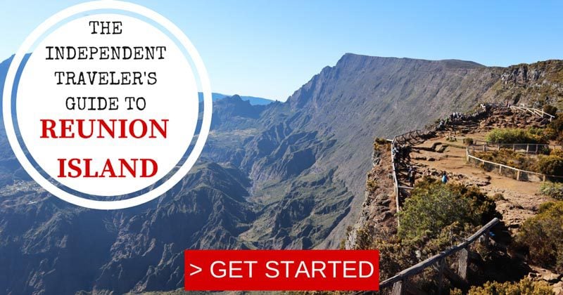
Best Hikes in Reunion Island
Reunion Island is a destination for travelers that are not searching for lazy days at the beach. After all, this is one of the most impressive and diverse islands on earth and the great news is that it’s still under the radar. With more than 1,000km of marked trails, the island is a magnet for outdoor enthusiasts. So gear up and let’s explore the best hikes in Reunion Island.
Reunion Island Travel Guide
Planning or thinking about a trip to Reunion Island? Have a look at additional Reunion Island travel guides, including day-by-day itineraries and the best beaches in Reunion Island. For a quick read, here are the top 10 things to do in Reunion Island.
Quick Tour of Reunion Island
Here’s a quick video tour of Reunion Island!
Here are a few essential hiking tips for Reunion Island.
- Each trail mentioned in this guide of Reunion Island’s best hikes includes a link to “additional info”. I strongly suggest researching the trails you wish to hike.
- These resources also include GPX files of trail maps for each hike that can be downloaded to a personal map. That way, you’ll always know if you took the right turn and also get a sense of how much longer you have to keep going.
- Some mentioned hikes also include links to AllTrails maps. Upgrade your account so you can download the trail map to your phone for offline access.
- Mornings are the clearest so plan to be at the trailheads but no later than 10 am (I recommend starting at 8 am if possible).
- If the hike requires an overnight stay, be sure to book your stay well in advance. Dinners can usually be paid for on the spot.
- Be sure to pack more water and snacks than you might think you need. The weather can be warm and the hikes harder than what you’re used to.
- Leaving your car at the trailheads is OK but for overnight hikes, it is debatable. Inquire with your hosts and use the island’s extensive bus system if in doubt.
- Having the right gear can make the difference (see “what to pack” section in this guide specifically around Reunion Island travel tips).
- Unless the weather forecast calls for all-day sun throughout the island, be prepared for changing weather and changing temperatures. Be sure to extensively read about your hike and pack accordingly. Always be prepared for wet and cold weather in the mountains.
The trails described in this guide to the best hikes in Reunion Island are described in greater detail in this Reunion Island itinerary.
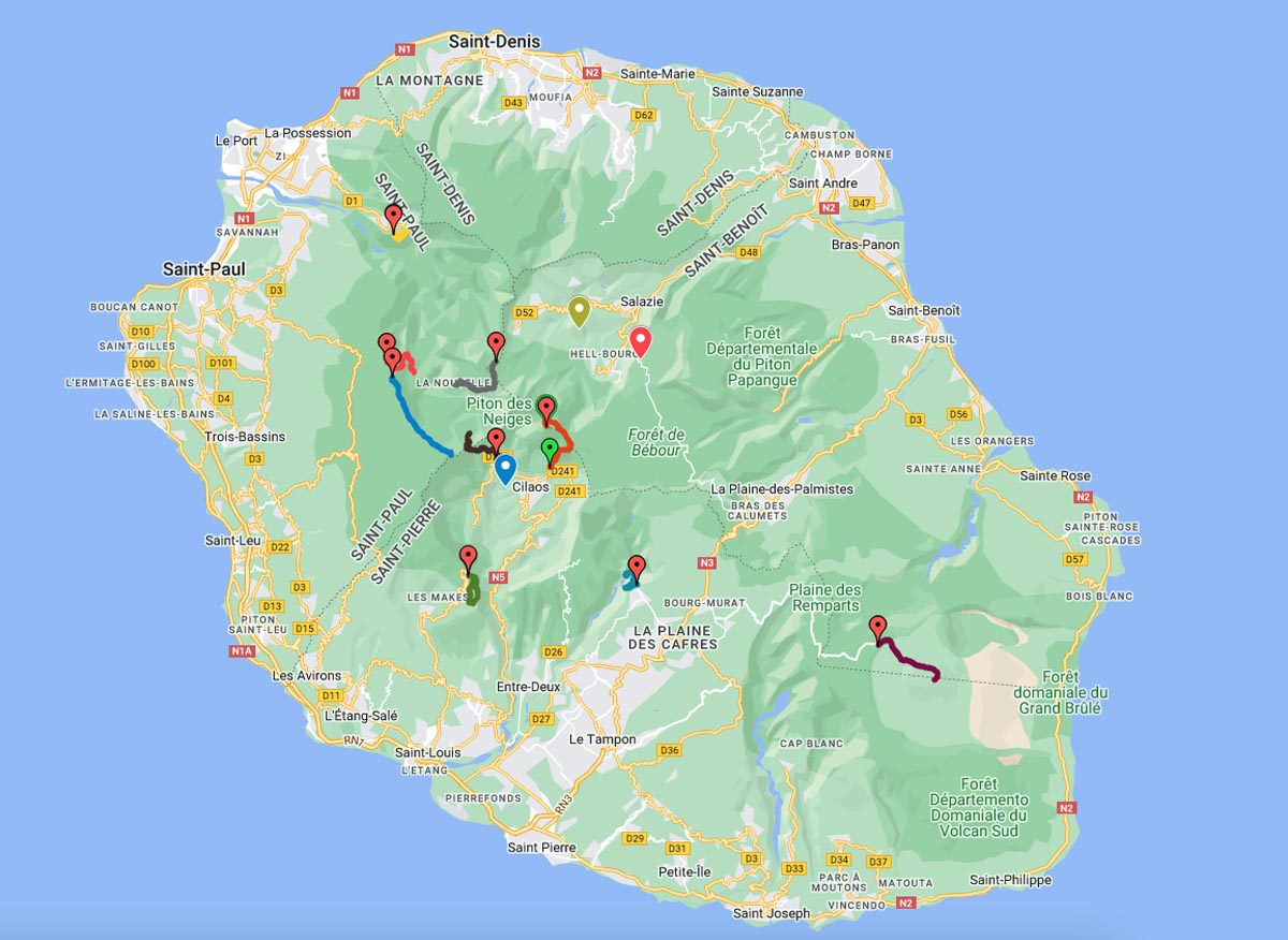
Map of the Best Hikes in Reunion Island
This map features all the trails mentioned in this guide to Reunion Island’s best hikes. Click on the image to open the map.


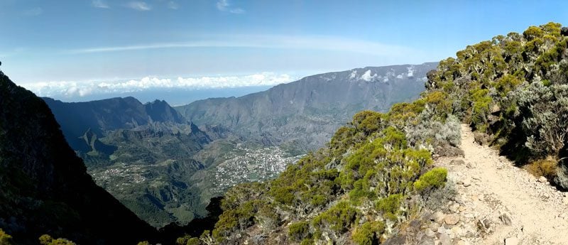
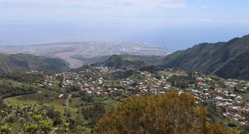
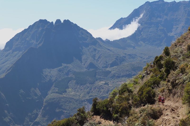
Dos d’Ane to Cap Noir
Distance: 3 km (loop) | Time: 1.5 hrs | Difficulty: medium | More info | Trail Map
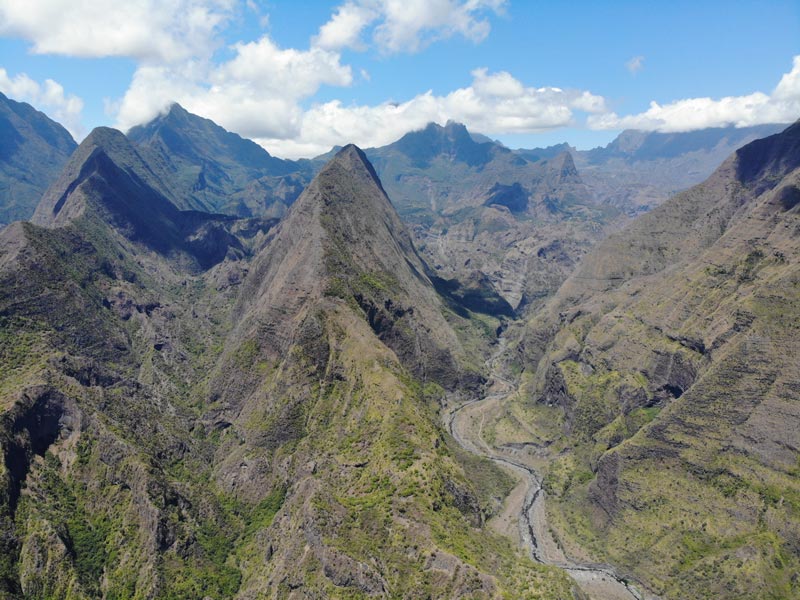
A great option for those staying around Saint-Denis or Saint-Paul, the hike from Dos d’Ane to Cap Noir comes after a scenic drive from the coastline up to the high-altitude trailhead. The highlight of this hike is the Cap Noir lookout, one of the most scenic spots on the island. From here, the Bras des Merles valley cuts through two deep ridges, and its narrow maze leads straight through into Cirque de Mafate, the most inaccessible of Reunion Island’s three cirques. From the lookout, the trail ascends to Roche Verre Bouteille, a peculiar-looking pinnacle. This spot also affords views of the picturesque hamlet of Dos d’Ane and the Indian Ocean.
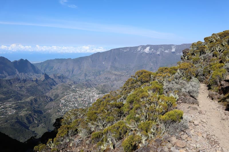
Sentier de Roche Plate
Distance: 10 km (return) | Time: 5.5 hrs | Difficulty: medium | More info
Starting from the iconic scenic lookout of Le Maido (2200m), this hike leads to the hamlet of Roche Plate in Cirque de Mafate, the only cirque on the island that cannot be accessed with a car. It’s a beautiful trail that follows the bending contours of the cirque’s ramparts, finally zig-zagging its way down to Roche-Plate. You can use this trail for a multi-day exploration of the remote cirque or for a day hike in and out of the cirque, leaving the afternoon free for some beach time.
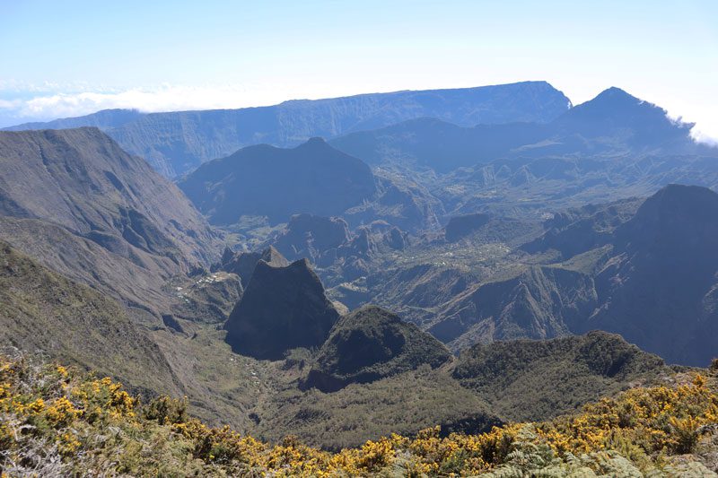
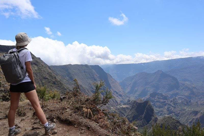
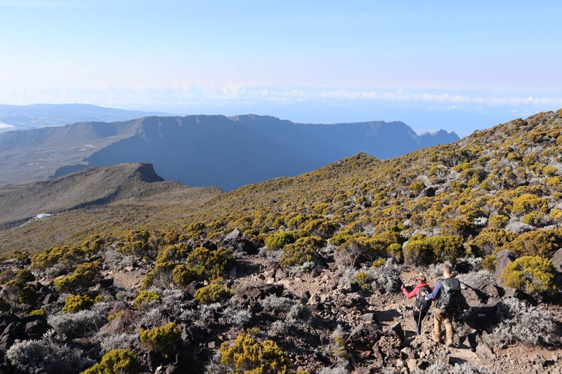
Maido to Grand Benare
Distance: 15.5 km (return) | Time: 7 hrs | Difficulty: challenging | More info | Trail Map
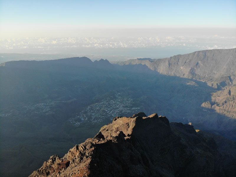
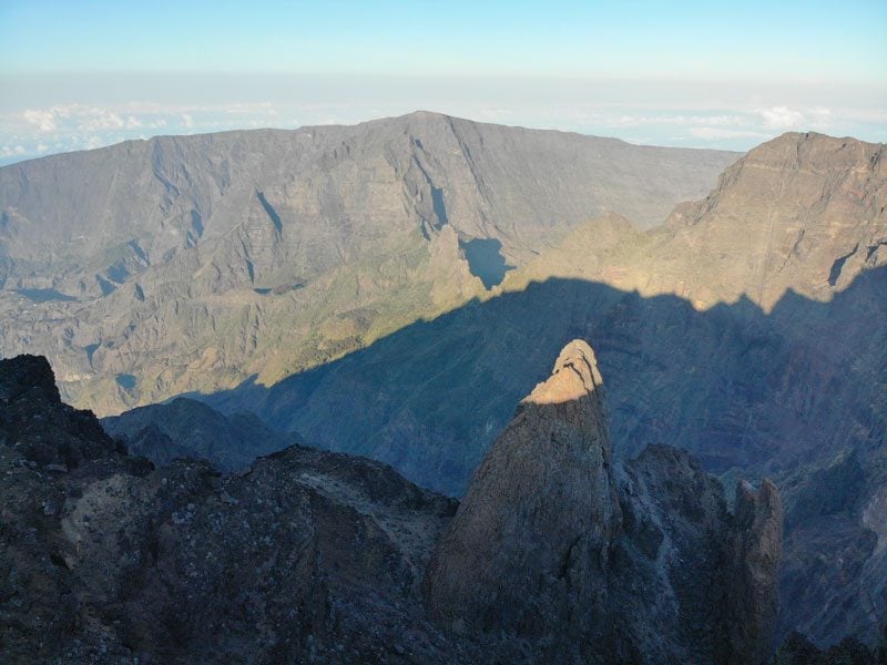
Grand Bénare is the third highest peak on Reunion Island (2896m), towering above both Cirque de Cilaos and Cirque de Mafate. On an island with so many fine scenic lookouts, this is one of the most impressive, but you’ll need to work hard to reach it. The hike begins from Le Maido and heads right on the crest of the cirque before beginning to summit the giant. As you inch closer, better views of Piton des Neiges are afforded, and from the summit, you’ll also enjoy views of Cilaos. This hike should not be taken lightly for the effort required but also for the harsh climate at the top.
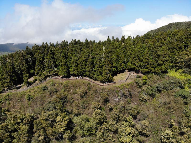
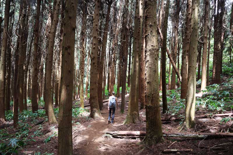
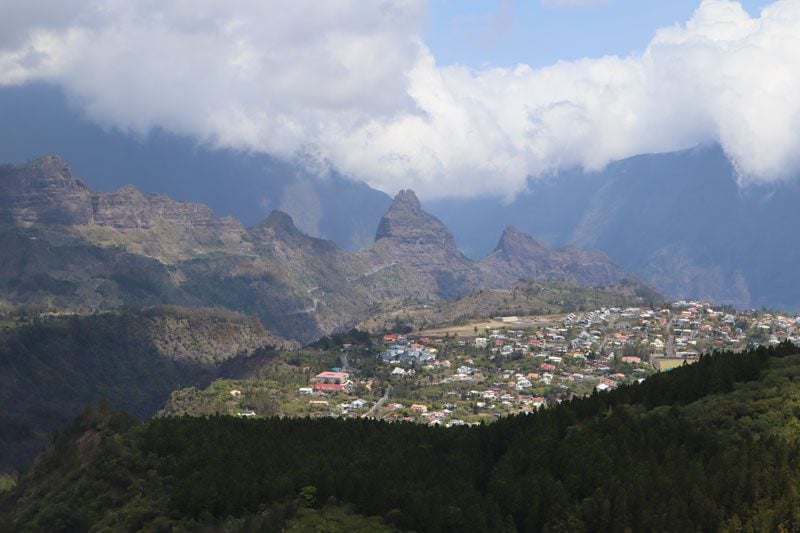
La Fenetre des Makes
Distance: 5.2 km (loop) | Time: 3.5 hrs | Difficulty: medium | More info
This hike combines sensational views together with a lovely walk through a forest of cedar trees and tropical plants. Begin at La Fenetre (“The Window”), a high-altitude scenic lookout over Cirque de Cilaos (1580m), and spot the timeless hamlet of Ilet a Cordes. From the lookout, set out on a looping trail that begins with additional lookouts over the cirque before descending into an enchanting forest of cedars that chills the air. Before climbing back to the starting point, the trail traverses fields covered in lush tropical vegetation, including wild ginger and arume flowers.
Sentier de la Chapelle
Distance: 8 km (return) | Time: ~5 hrs (return) | Difficulty: moderate | More info | Trail Map
One of the best day hikes in Cirque de Cilaos, don’t forget your swimming gear on this hike. From Cilaos, the trail leads to a canyon filled with water and to a famous spot beneath two boulders that collapsed on each other, creating “the chapel”. The trailhead is located at the edge of town.
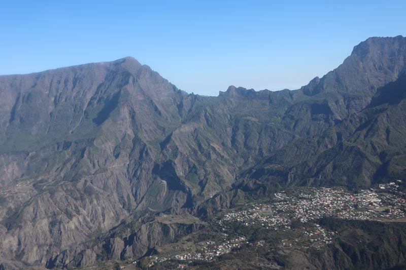
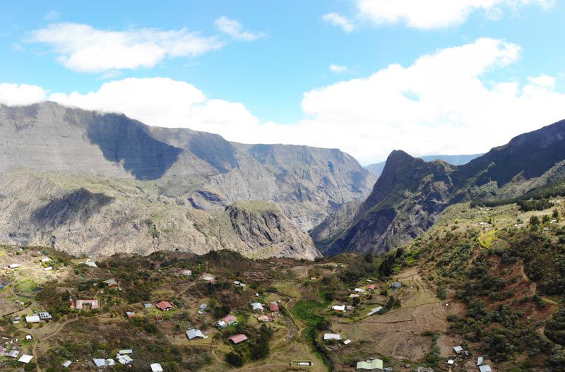
Cilaos to Marla
Distance: 11.5 kms (return) | Time: ~6 hrs (return) | Difficulty: challenging | More info | Trail Map
This challenging hike takes you from one cirque to another, beginning in Cirque de Cilaos and rising to the ridge, separating it from Cirque de Mafate via the Taibit Pass. If you’re looking for a short day hike from Cilaos, you can pause at the pass and enjoy the view before heading back, but for a longer adventure, continue down to the picturesque hamlet of Marla in Cirque de Mafate.

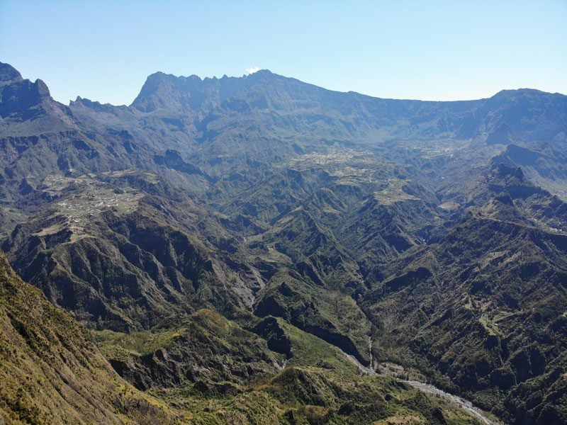
Hike to Piton des Neiges Summit
Distance: 15 km (return) | Time: 7.5 hrs (inc. stops) | Difficulty: very challenging | More info | Trail Map
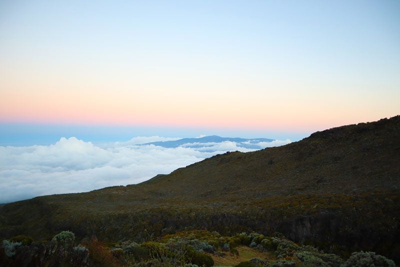
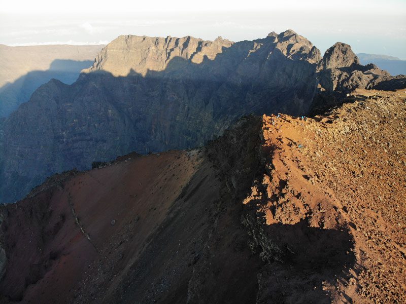
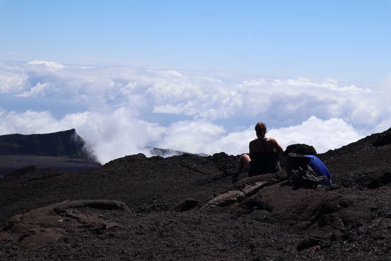
Towering to a height of 3,069m above sea level, Piton des Neiges is the highest peak in Reunion Island. As its name suggests, it is so high that it occasionally sees snowfall. Hiking to its summit is the most rewarding hike on the island, offering unobstructed 360-degree views of a landscape that resembles an outer world. Hikers from around the world visit Reunion for this hike, but you certainly don’t need to be a pro to take on this challenge.
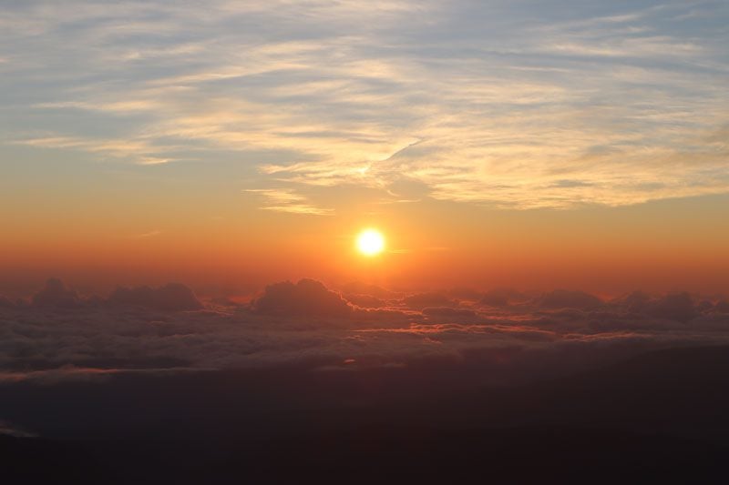
It is strongly advised to split the hike over two days due to the altitude gained, overnighting in Gite de la Caverne Dufour (2,470m). The hike immediately begins with an accent that is continuous pretty much until the summit. The landscape often changes, beginning in a lush forest, then gradually becoming misty as you enter the clouds before summiting in a desert landscape.
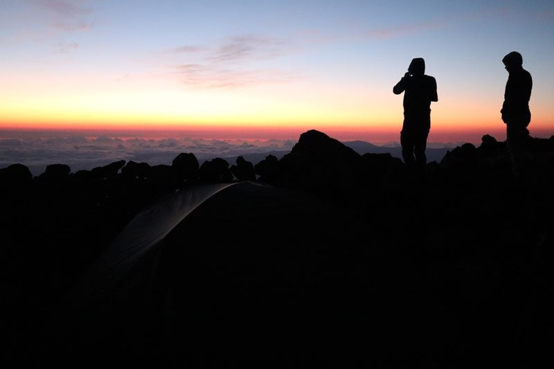
Long before dawn, the hike resumes in pitch dark as you begin the final ascent to the summit from the overnight cabin. Gradually, night turns into day in a spectacular display of colors. At the summit, you patiently wait for the sun to rise as you try to warm up finally. Once it does, the surrounding landscape is fully revealed. You can now point out towns and villages, clearly distinguish the color of the volcanic ash that makes up the ground, and admire the magnificent pinnacles rising to our right.
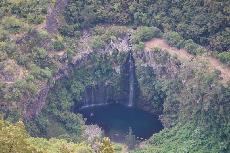
Grand Bassin
Distance: 10 km (return) | Time: 5 hrs | Difficulty: moderate | More info | Trail Map
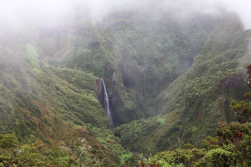
Beginning at the Belvedere de Bois Court scenic lookout, this hike leads to an area known as Mini Mafate. Officially, this is Grand Bassin, a tiny hamlet that sits at the intersection of three rivers. Locals live completely off the grid as this hamlet is only accessible on foot (hence the reference to Cirque de Mafate). The hike’s highlight is Cascade du Voile de la Marlee, a waterfall that splashes into a pool that seems to be completely detached from the outside world.
Hike to Trou de Fer Lookout
Distance: 9 km (return) | Time: 3.5-4hrs | Difficulty: easy | More info | Trail Map
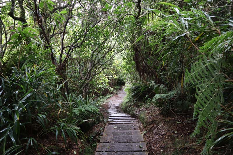
Trou de Fer translates to “Iron Hole” and it’s one of the most striking natural features in Reunion Island. This 300-meter deep chasm funnels a number of rivers, culminating in a 695m waterfall that is the highest in France, including its various territories. For hikers, the best way to see the Trou de Fer is from a viewing area on a trail that begins from the Gîte de Bélouve. A series of bridges and a raised wooden path cut through one of the wettest parts of the island, a primeval forest of moss-covered tamarind trees and ferns. From the viewing area, the Trou de Fer truly resembles a scene from Jurassic Park.
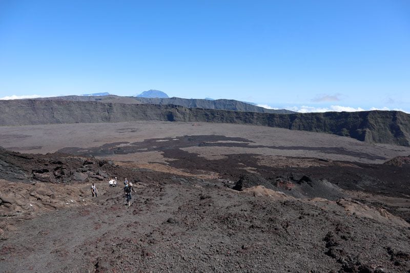
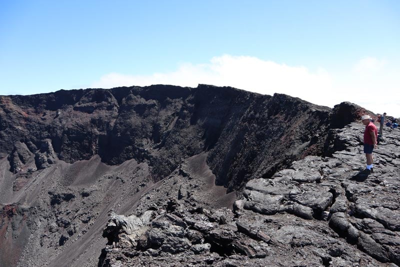
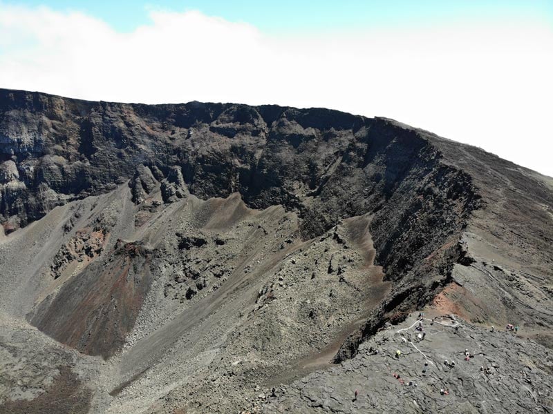
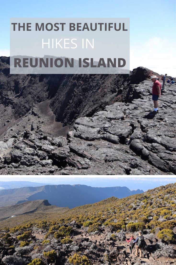
Dolomieu Crater – Piton de la Fournaise
Distance: 12 km (return) | Time: 4.5-4 hrs | Difficulty: challenging | More info | Trail Map
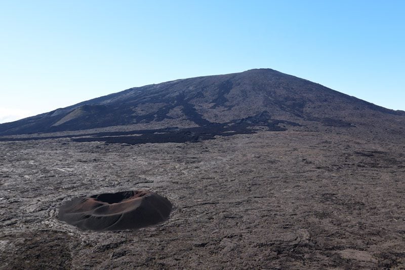
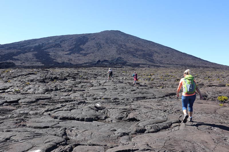
The hike from Pas de Bellecombe to the Dolomieu Crater is one of the most popular hikes in Reunion Island and the closest we humans will ever get to travel to Mars. The hike basically involves a descent from the rim of the outer crater down to the caldera floor, hiking across the dry lava field, and climbing to the rim of the Dolomieu Crater. The trail begins with a series of switchbacks that plunge to the caldera floor. From there, white markings on the lava point the way. The climax is reached at the moment you take the final step that reveals the size and depth of the Dolomieu Crater (2,460m), spanning 400 meters across and 300 meters deep.
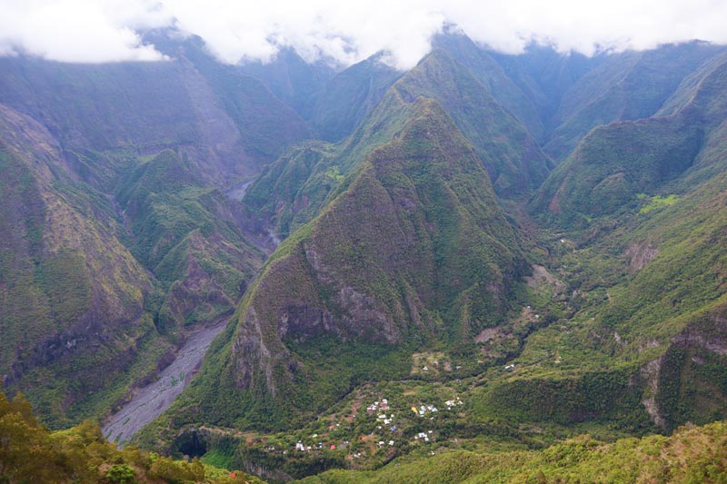
Col de Boeufs to La Nouvelle
Distance: 11 km (return) | Time: 5.5hrs (including stops)| Difficulty: medium | More info | Trail Map
One of the best hikes in Reunion Island, the hike to La Nouvelle offers the hard-to-resist opportunity for a day trip into Cirque de Mafate. The trail begins not far from Col de Boeufs, the pass that separates Cirque de Salazie from Cirque de Mafate at an altitude of 2,011m. It also serves as a parking lot for locals living in La Nouvelle who live in near-complete isolation from the outside world. For basic necessities, they either need to fly out of their village or climb out to get to their car.
Even if the weather is lousy in Cirque de Salazie, things can quickly change, and it could be a very sunny day in Mafate. Halfway down, the trail splits, and you can hike to Marla. Upon reaching La Nouvelle, the fun is really all about exploring this secluded hamlet. Go for a stroll through the village and grab lunch in one of the small cafes. You can spend the night here or climb back out to “the real world” that’s beyond Reunion Island’s most inaccessible cirque.
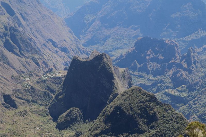
Piton d’Anchaing
Distance: 4 km (return) | Time: 3 hrs | Difficulty: medium | More info
We’ll wrap up this extensive list of the best hikes in Reunion Island with a lovely walk in Cirque de Salazie to the summit of Piton d’Anchaing (1,356m). It’s one of the most unique features in the cirque. The hike first climbs through fields of passion fruit and chouchou, the staple crop of the cirque. You’ll then cross a ravine via a suspension bridge before beginning the climb to the summit, from which panoramic views of the cirque are guaranteed on a clear day.
What’s Next?
Now that we’ve covered the best hikes in Reunion Island, it’s time to stretch those legs and begin making travel plans. Be sure to check out the rest of the Reunion Island travel guide collection, including a day-by-day Reunion Island itinerary, the best beaches on the island, essential travel tips, and lots more.
Pin These Images To Your Favorite Boards!