Canyonlands National Park Travel Guide
Though Utah’s largest national park receives just a fraction of the visitors compared to other members of the “Mighty Five,” Canyonlands rewards the few who make it here, especially those who dare to go off the beaten track. This Canyonlands National Park travel guide deep dives into the ins and out of planning a trip to Southern Utah’s giant.
Having a strong affinity for deserts, I was surprised I only made it to Canyonlands on a recent road trip in the American Southwest. I spent three days extensively exploring three of the national park’s four districts and would have stayed much longer if the weather didn’t turn sour. This Canyonlands National Park travel guide is based on extensive research and my experience.
Why Visit Canyonlands National Park?
If you’re intrigued by the “classic” desert scenery featured in old western films, or wish to explore some of America’s wildest and remotest corners, Canyonlands NP is a perfect choice.
Colorful sandstone needles, natural arches, mesas, buttes, canyons, and fins. These are just some of the stunning geological features waiting to be discovered at Canyonlands.
With just a fraction of visitor numbers compared to other Utah national parks but with far more land than the eye can see, Canyonlands NP is the perfect place to be at one with nature.
Several sections make up this travel guide:
Additional Southern Utah Resources
Check out additional travel guides to Southern Utah and combine your visit to Canyonlands NP with additional members of Utah’s “Mighty Five.”
Background
Located in the heart of the high-desert Colorado Plateau, Canyonlands National Park is the largest of Utah’s five national parks. It covers an immense area spanning 337,597 acres (1,366 km2). That’s more than double the size of Zion National Park, yet Canyonlands gets six times fewer visitors than Zion.
Canyonlands was established as a national park only in 1964. It is so remote and difficult to traverse that few dared to explore this region in centuries past. The park preserves a stunning desert landscape of sandstone canyons, arches, spires, buttes, mesas, and fins. Water and gravity are the natural forces responsible for this artwork, slowly carving the land into what we see today. At the heart of Canyonlands is the confluence of two mighty rivers: the Colorado River and the Green River, appearing as giant serpents meeting for a battle when viewed from the air.
The Four Districts of Canyonlands NP
Canyonlands National Park is so immense that it’s divided into four districts. Three of the four districts have “defined” borders dictated by the Colorado and Green Rivers that flow through the heart of the national park. Though backcountry dirt roads might connect some districts, traveling between them is no easy task.
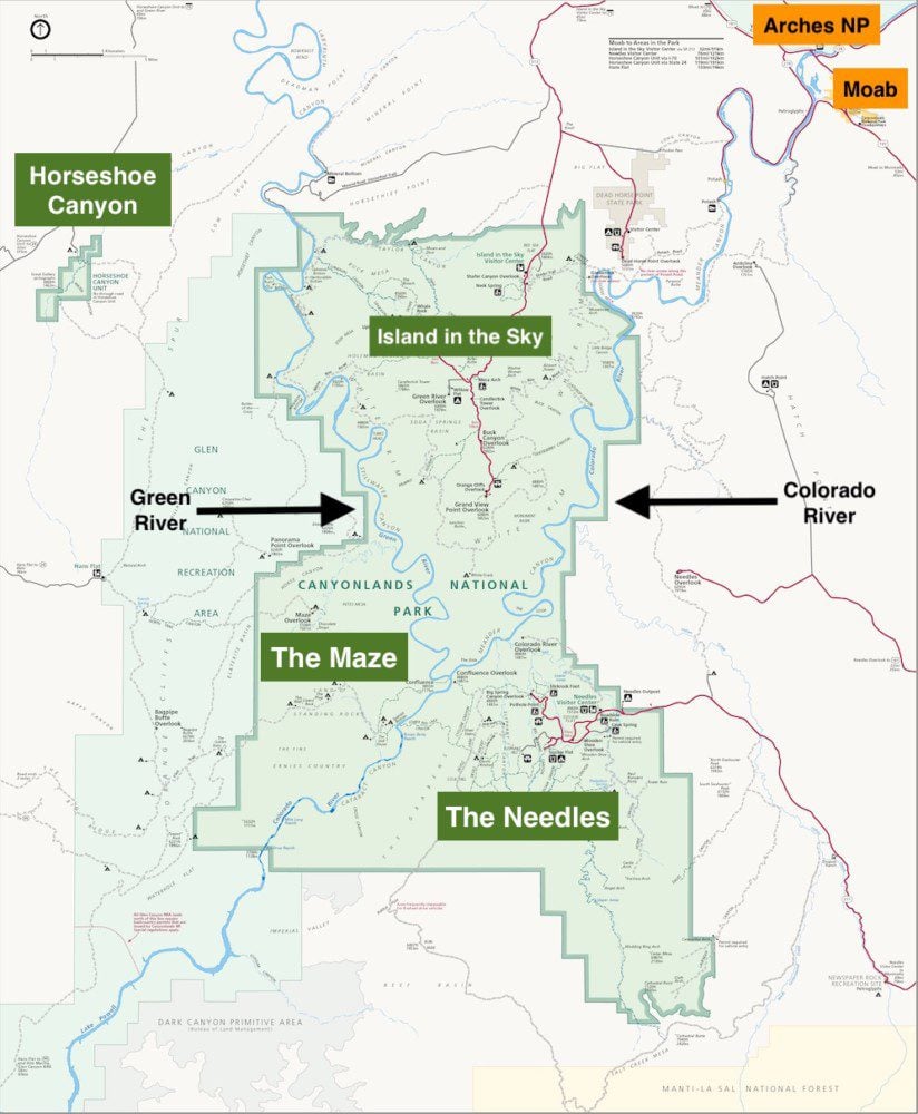
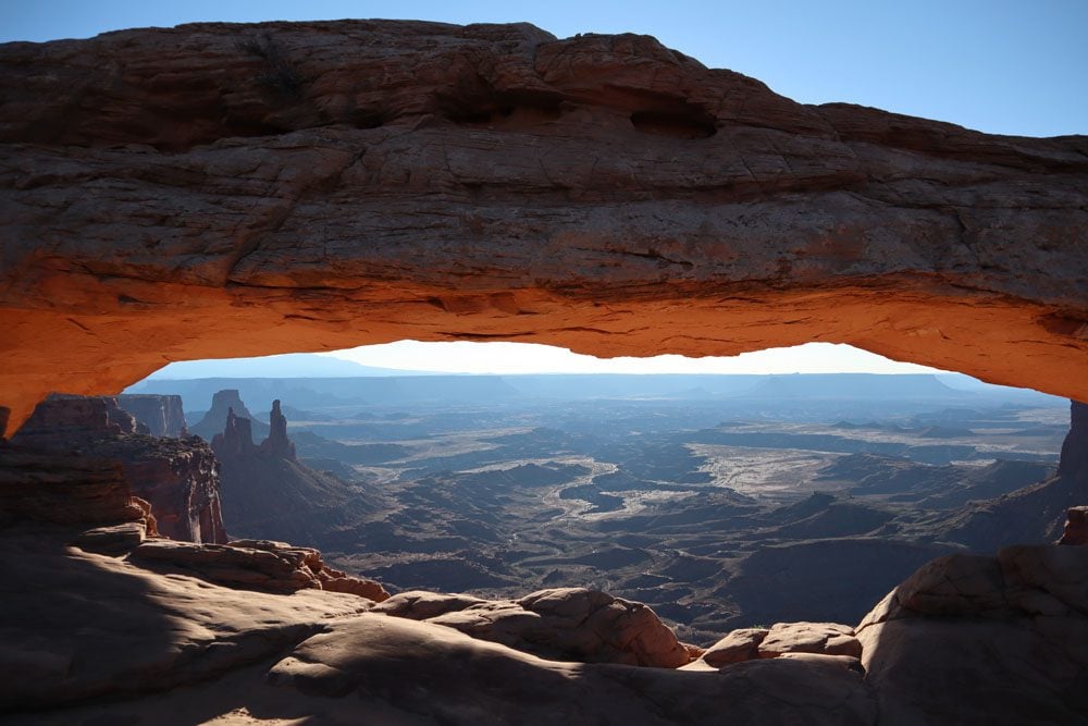
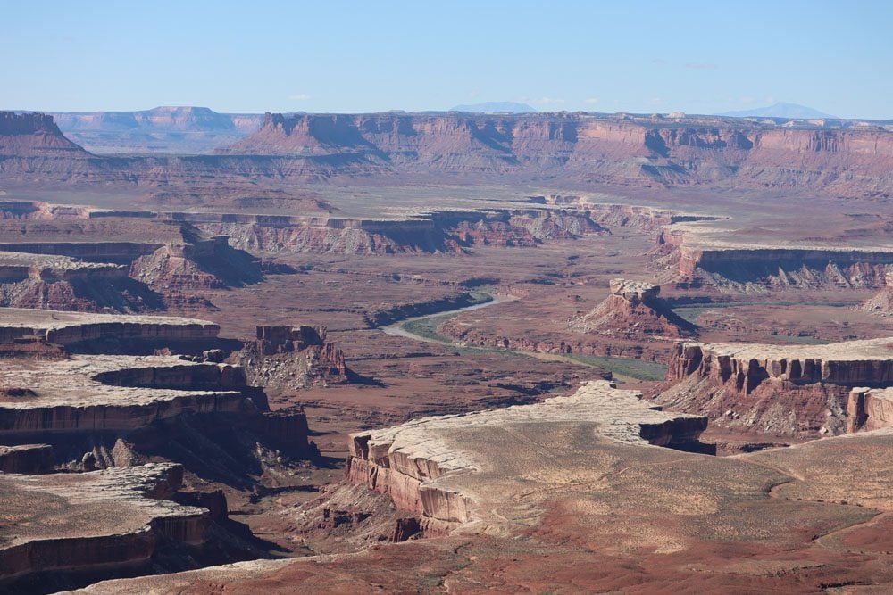
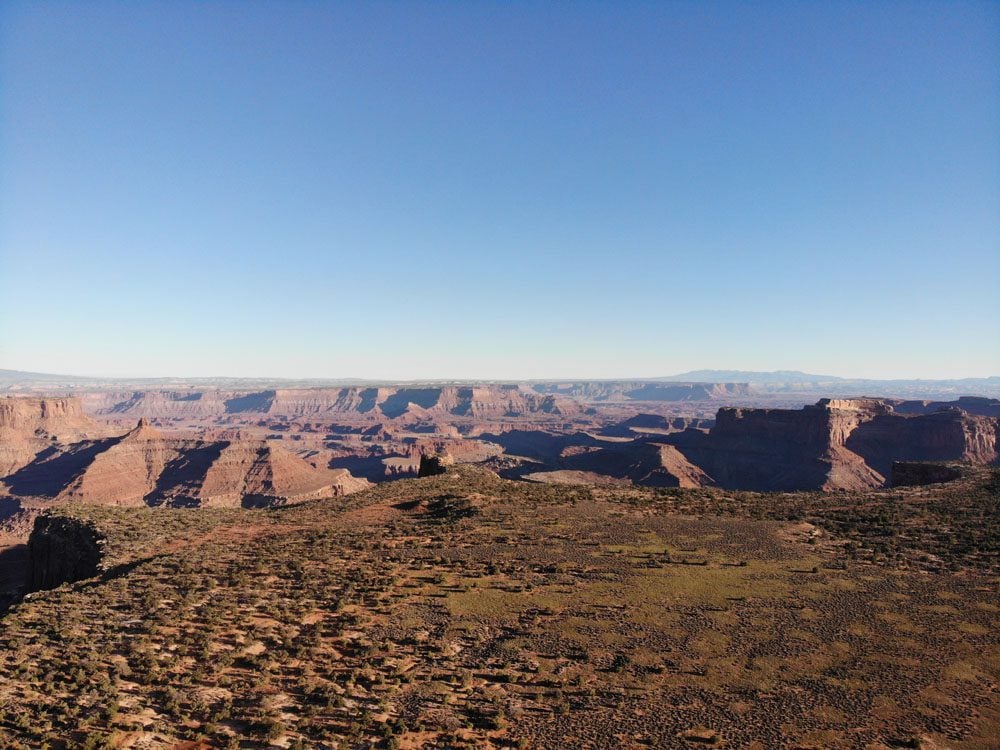
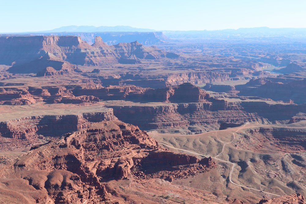
Island in the Sky
Island in the Sky is located in the northern section of Canyonlands NP. It gets its name from its geological position, resting on a sandstone mesa 1,000 feet above the confluence of the two major rivers. Therefore, it’s not so much an “island in the sky” but more a “peninsula in the sky.”
About 80% of visitors to Canyonlands NP head to Island in the Sky. It is the most accessible and visited of Canyonlands’ four districts. Thanks to its 34-mile (return) scenic drive, dotted with spectacular scenic viewpoints and trailheads, Island in the Sky is the easiest district to explore, a perfect choice for a one-day visit.
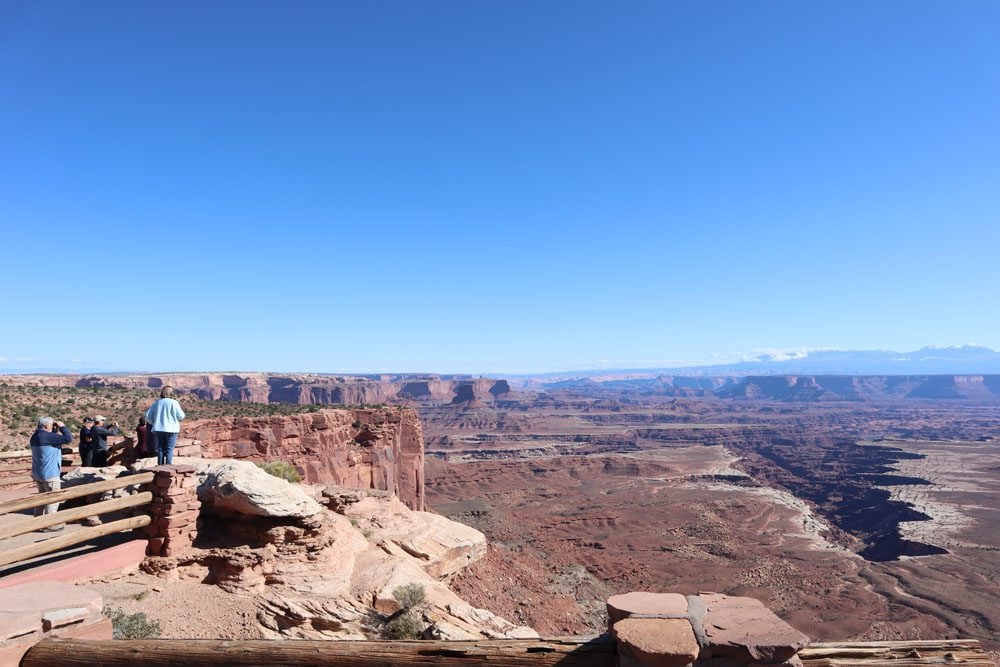
Most of Island in the Sky’s viewpoints overlook the White Rim, an impressive sandstone bench forming the bottom canyon. With a 1,200 feet (370m) elevation difference between the White Rim and Island in the Sky, an additional drop of 1,000 feet to the rivers, and the ability to gaze 100 miles into the heart of the desert, Island in the Sky often leaves visitors breathless. The island’s neighbor, Dead Horse Point State Park, offers additional vistas and hikes. This is where the timeless closing scene from Thelma and Louise was filmed.
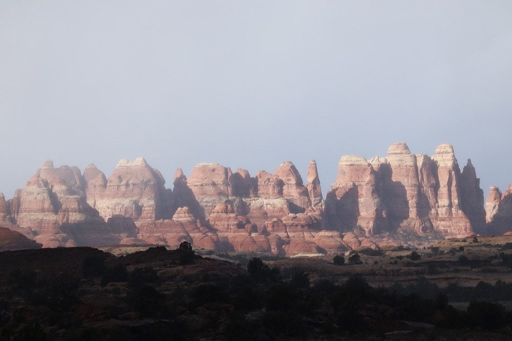
The Needles
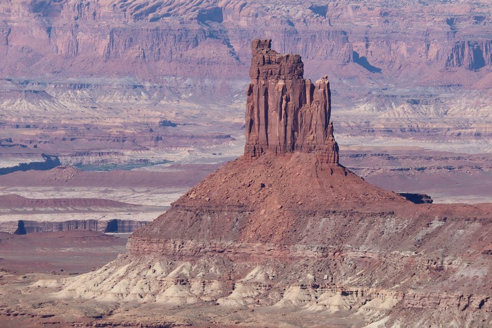
The Needles district is located east of the Colorado River at the southeast corner of the national park. It’s highly revered by serious hikers and 4WD enthusiasts, accounting for 20% of visits to Canyonlands National Park. The district is named after the colorful red and white sandstone spires that dominate the landscape. However, the Needle also boasts several stunning natural rock arches, though they’re found deep in the backcountry in contrast to their often roadside location in Arches National Park.
Though there is a scenic drive in the Needles, a high degree of effort is needed to explore the district fully. Using 4WD roads and an extensive network of trails, visitors to the Needles can experience its stunning natural features from a close distance, unlike in Island in the Sky, where they’re viewed from afar.
The Maze
The Maze is Canyonlands’ wildest and most remote district. It’s located west of the rivers and named after the 30-square mile puzzle of mesas, buttes, towers, and fins, that require skill to navigate through. This is one of the least accessible areas in the Continental U.S. With no paved roads, the Maze is only fitting for visitors with a 4WD vehicle and lots of time on their hands.
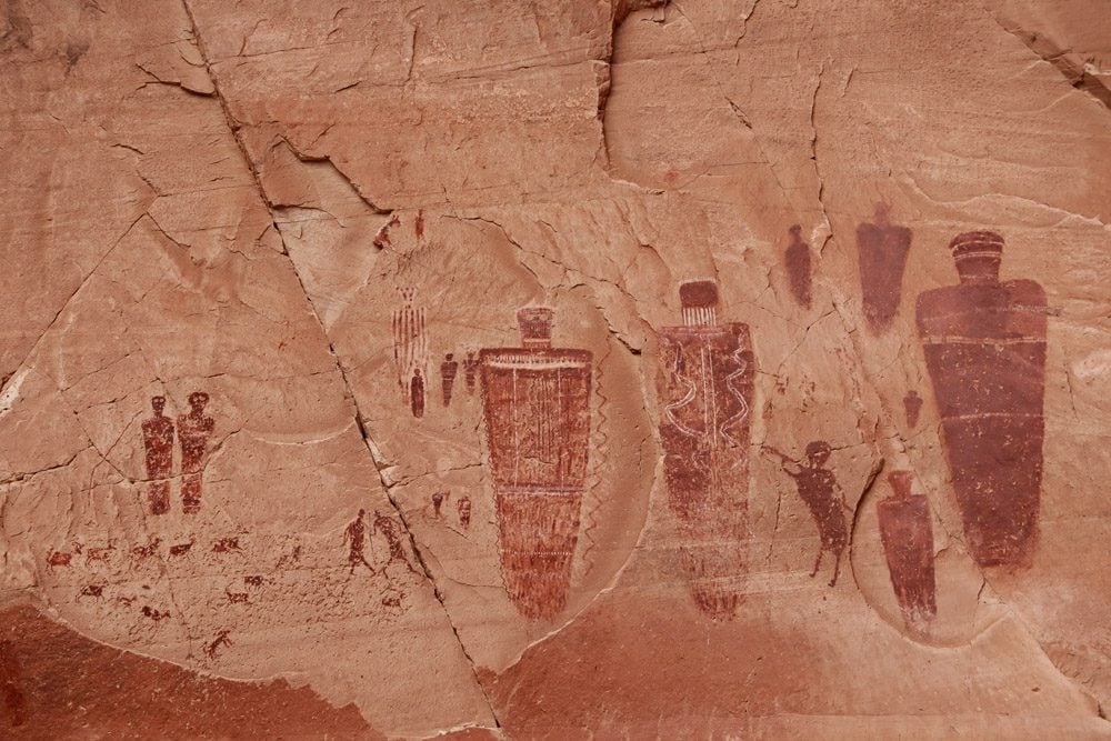
The Maze also includes Horseshoe Canyon, managed as a separate unit by the NPS yet part of Canyonlands National Park. Horseshoe Canyon features some of North America’s most impressive and significant rock art, highlighted by the Great Gallery, where life-sized figures left by mysterious hunter-gatherers predating the Ancestral Puebloans over 2,000 decorate the canyon wall.
The Rivers
The Rivers is not as defined as the previous three districts but is generally referred to as the area where the Colorado and Green Rivers meet. The Confluence is a popular area for wildlife and boating and is usually explored as part of a large group.