Death Valley Travel Guide
Things to See and Do in Death Valley
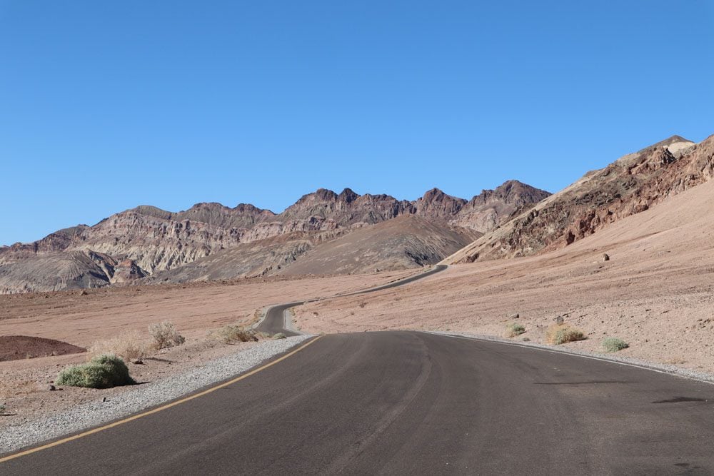
In this section of the Death Valley travel guide, I’ll highlight the park’s main attractions. I recommend following along using this companion map.
To see how to best divide your time in Death Valley, check out these Death Valley itineraries (one day, two days). For specific hiking information, check out this guide which highlights the best hikes in Death Valley. For a quick read, here’s a list of the top 10 things to see and do in Death Valley.
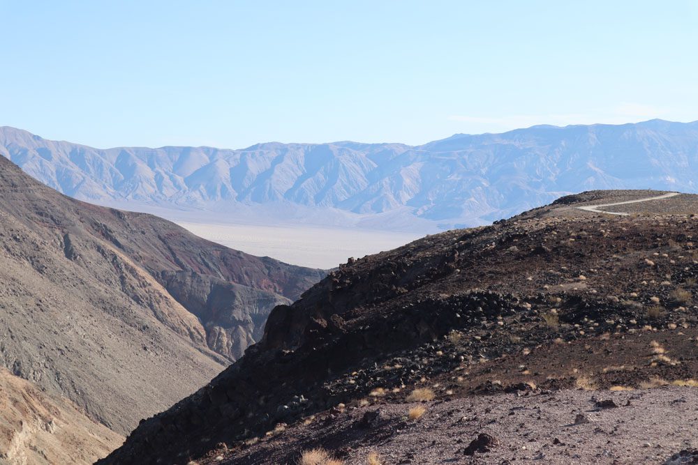
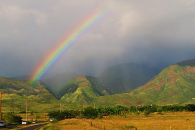
Father Crowley Overlook
Named after a Catholic priest who often stopped here to enjoy the views, this is a quick stop on the way to Death Valley or if exiting the national park heading west. The scenic overlook offers a glimpse of Death Valley itself but the main attraction here is Rainbow Canyon, a colorfully striped canyon created by ancient volcanic activity. Military jets sometimes flew inside the canyon, earning it the nickname Star Wars Canyon. This thrilling excuse to visit Father Crowley Overlook has been halted in recent years following a tragic crash.
Darwin Falls
This little oasis not far from Father Crowley Overlook is reached via an easy hike, though the trailhead may not always be accessible to sedans. At 18 feet (5.5 m), Darwin Falls is impressive due to its desert location and remoteness. There’s a very good chance you’ll have this place all to yourself.
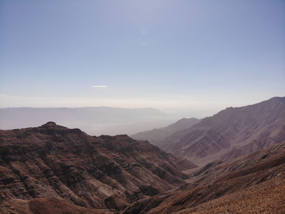
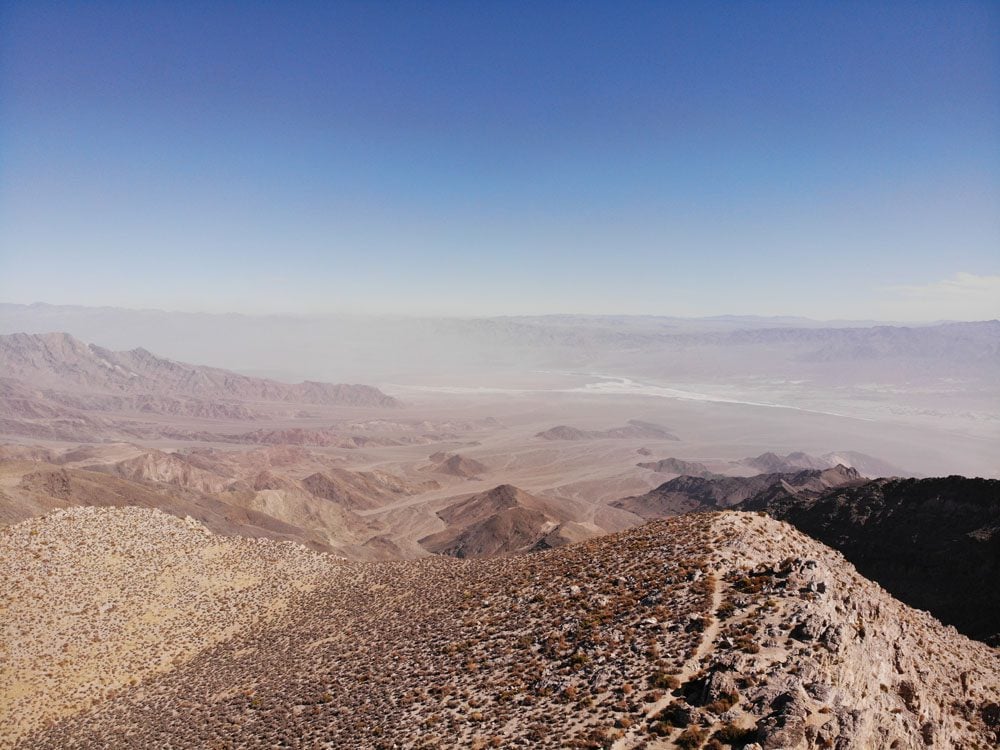
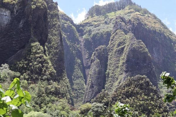
Aguereberry Point
Aguereberry Point rewards the travelers who drive for six miles on a lonely dirt road to reach this scenic spot. At Aguereberry Point, enjoy one of the most expansive vistas on the western side of Death Valley.
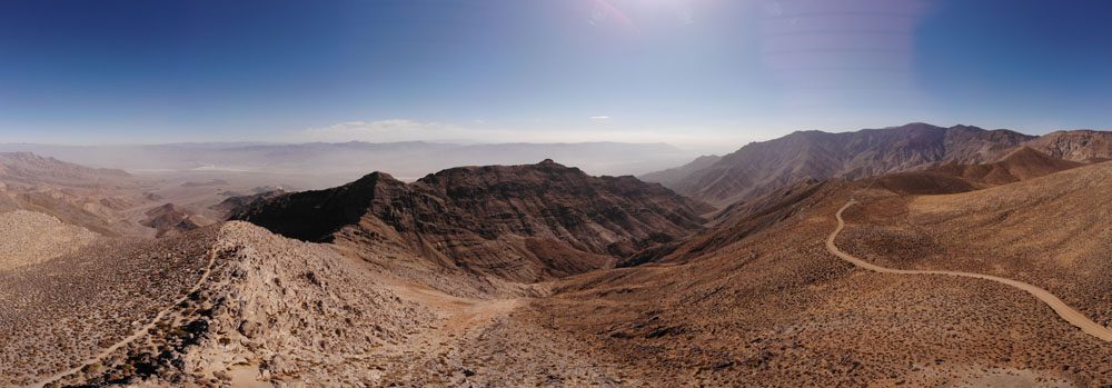
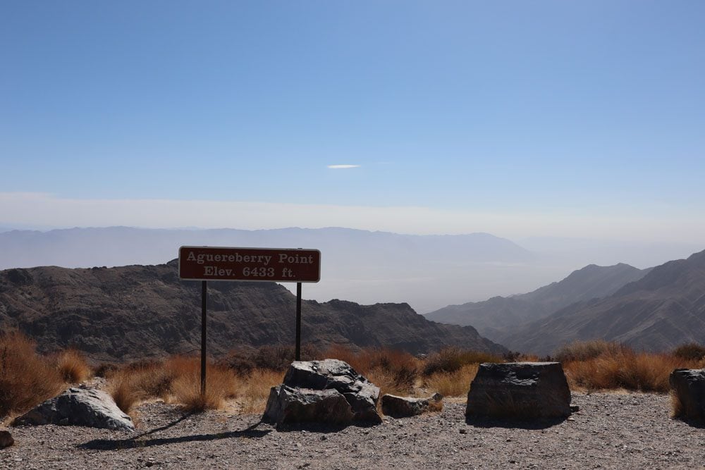
A trail on the north side of the ridge leads to the most spectacular lookout, where Death Valley is 6,000 feet (1,828 m) beneath your feet. It is possible to drive to Aguereberry Point with a sedan. If this spot is too out of the way for you, the view is quite similar from Dante’s View, a more accessible scenic lookout on the opposite side of the valley.
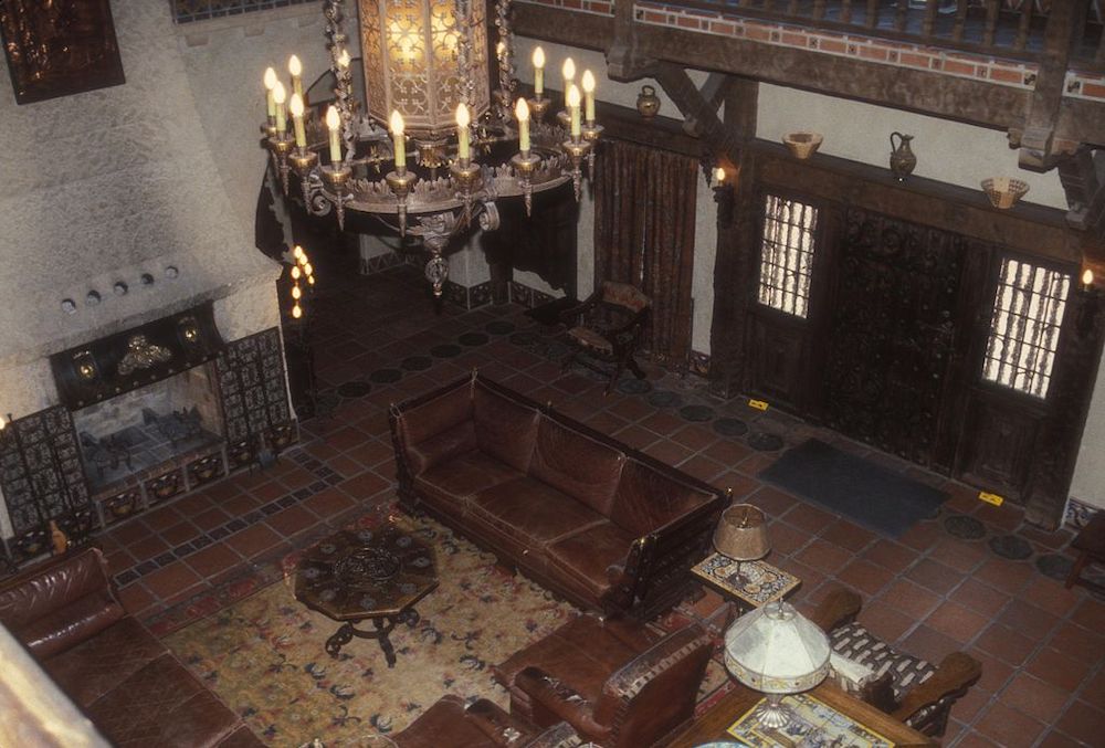
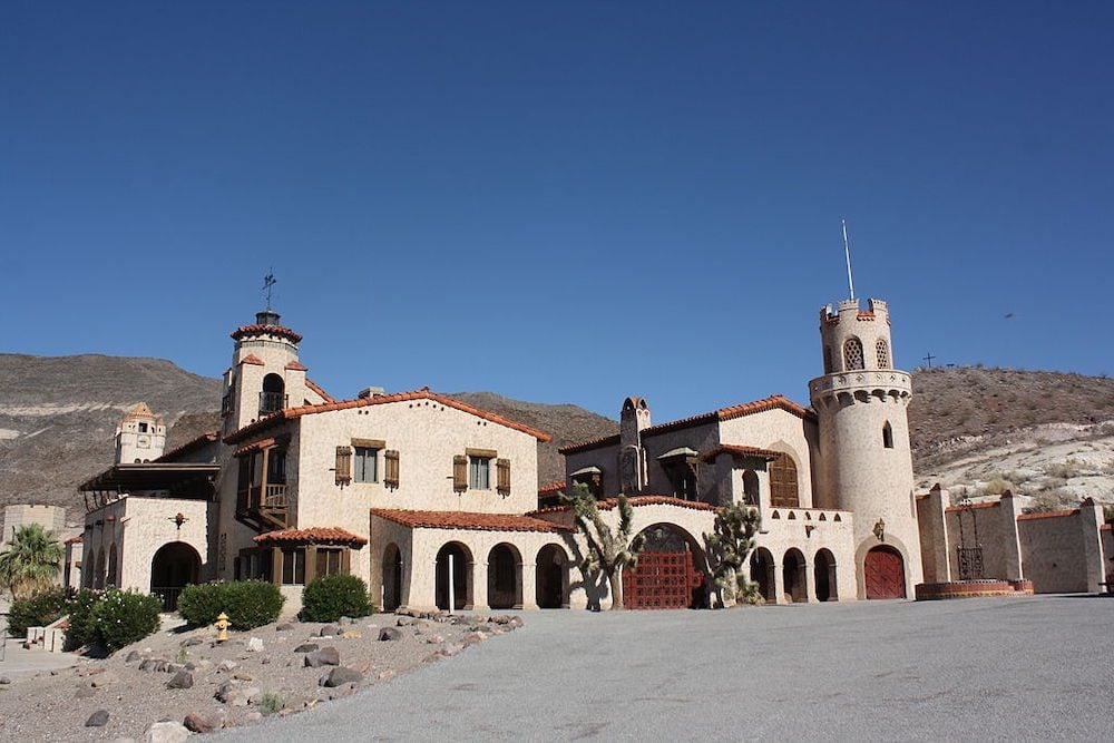
Scotty’s Castle
This Spanish-style mansion is a bizarre resident of Death Valley. The mansion was built during the 1920s by Albert Johnson, a wealthy businessman who spared no expense in its construction. Johnson and his wife spent very little time here and the mansion was eventually claimed by a colorful local prospector and “cowboy” Walter “Death Valley Scotty” Scott, hence the name Scotty’s Castle. The construction of the mansion was never fully completed. These days, the pilgrimage to Scotty’s Castle is sort of a must on any visit to Death Valley. It is out of the way but goes well together with a visit to Ubehebe Crater and the drive to Racetrack Valley.
Scotty’s Castle suffered major flood damage in 2015. At the time of updating this Death Valley itinerary, ranger-led tours of Scotty’s Castle are the only way to visit the site. Check if space is available for your dates.
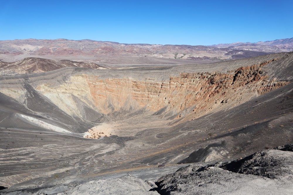
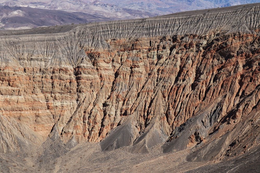
Ubehebe Crater
This large volcanic crater is a 20-minute drive from Scotty’s Castle and just next to the turnoff towards Racetrack Valley. The large crater, measuring half a mile across and 500 feet deep, is a result of steam and gas explosions released when hot magma met groundwater. The resulting heat created pressure that was eventually released with great force. This explosion took place about 2,000 years ago so, by geological standards, Ubehebe Crater is very young.
You can view Ubehebe Crater from the parking lot (it can get very windy up here) and even hike down to the bottom of the large crater, though coming up will be mighty hard as this entire area is covered with loose volcanic gravel. The best way of exploring the crater is by picking up the trail to its rim. This hike is about 1.5 miles in total and affords a bird’s eye view of smaller nearby craters.
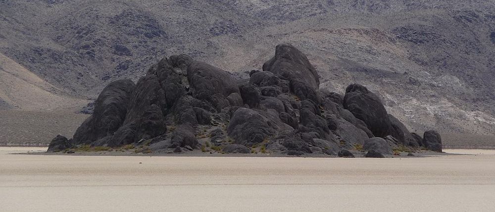
Racetrack Valley & Playa
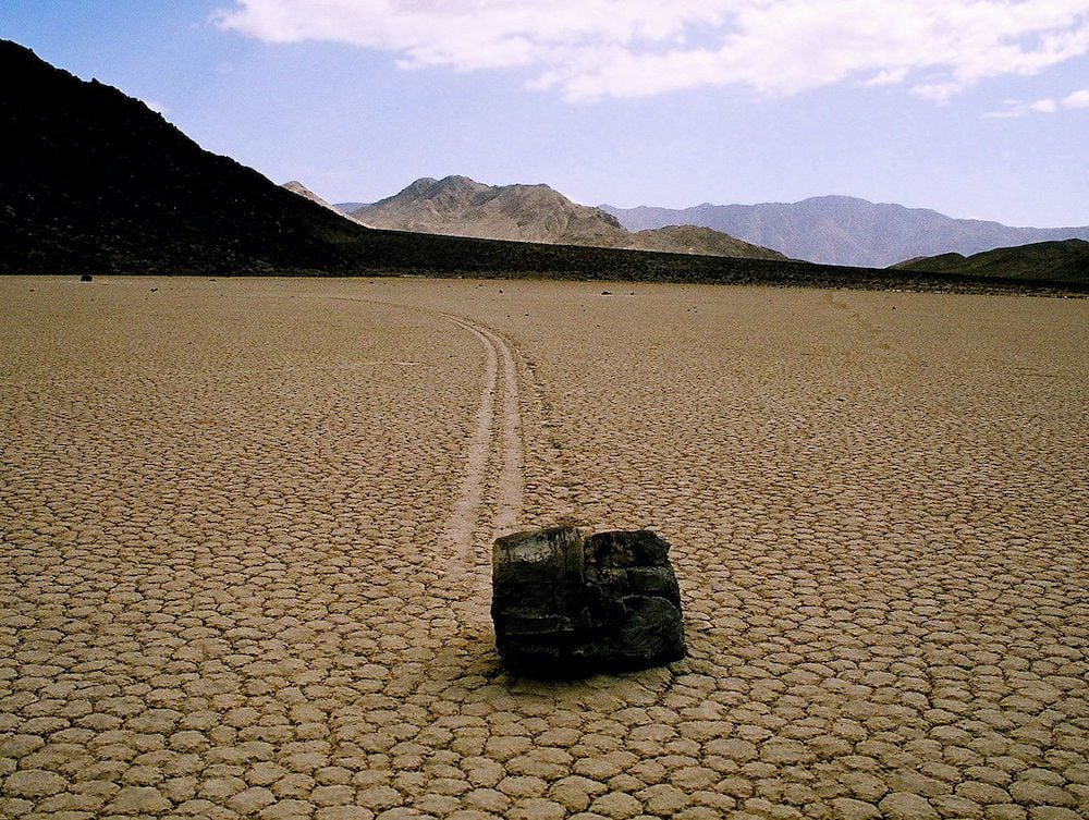
Large rocks mysteriously moving on their own power? Racetrack Playa is home to one of the world’s great desert mysteries. Scattered across the flat, arid surface of this dry lakebed, also called playa, are hundreds of rocks that seem to have been dragged across the ground, often leaving trails on the dry lakebed that can stretch for hundreds of meters. Some of these boulders weigh about 700 pounds (over 300 kg)! So what causes these rocks to move freely? Scientists believe this phenomenon is due to a rare combination of wind, rain, and the composition of the playa. But who really knows?
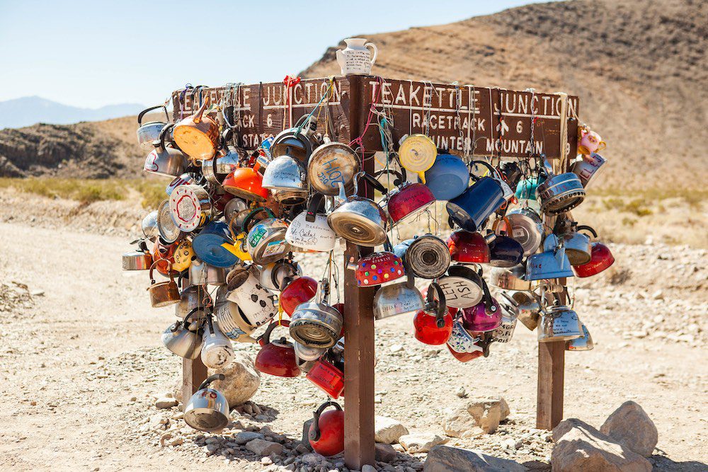
Seeing this mystery with your own eyes is the prime reason for making the arduous journey to Racetrack Valley. From Ubehebe Crater, it’s a 20-mile drive to quirky Teakettle Junction on a gravel road that requires a 4WD vehicle. From the junction, continue straight for another six miles to the Grandstand. To see the “moving rocks”, drive two miles south of the Grandstand parking area. Walk at least a half-mile toward the southeast corner of the playa (dry lakebed) for the best views of the rocks and their tracks.
It is strongly advised to drive to Racetrack Valley and the Grandstand with a proper 4WD. This area is extremely remote and there is no cell phone coverage. It is very common to get a flat tire on the drive. If you do not have a 4WD but wish to visit the Racetrack, inquire at the visitor’s center about renting a 4WD or joining a tour departing from Furnace Creek.
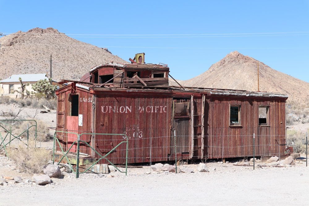
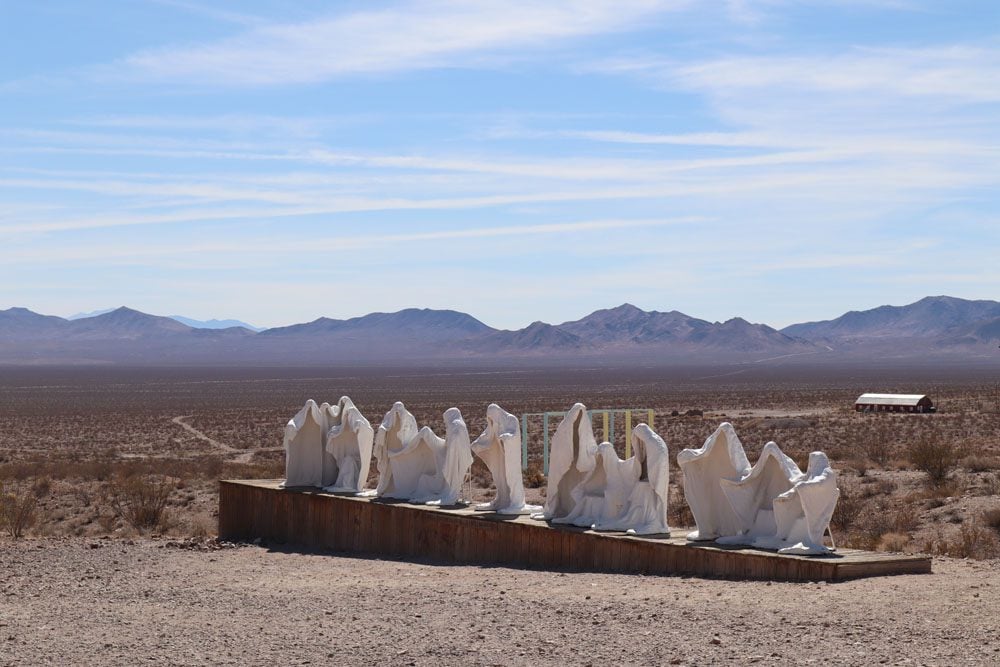
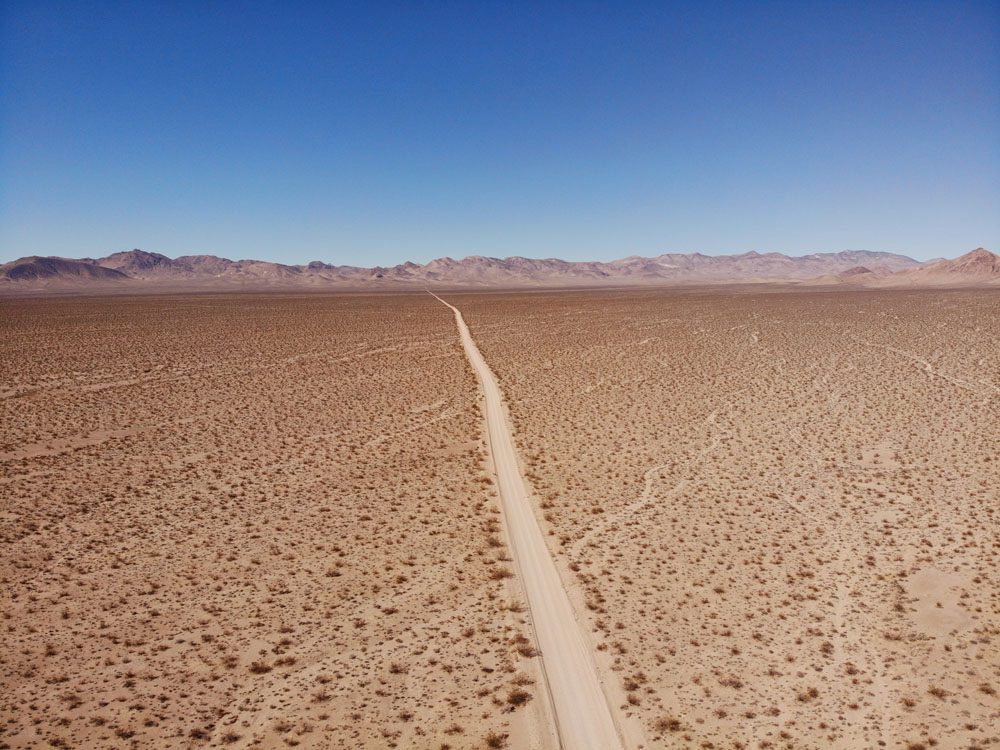
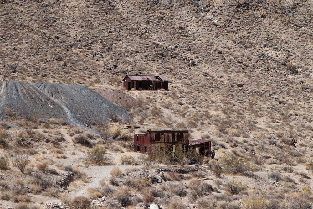
Rhyolite
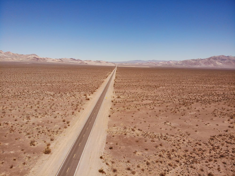
This ghost town sits outside the national park boundary on the Nevada side. The drive to Rhyolite is beautiful, first through a mountain pass and then on a long stretch of flat road that is as straight as an arrow. The former mining town, which at its peak was home to nearly 5,000 residents, was quite disappointing, with just a few remaining structures that can only be viewed from beyond a protective fence.
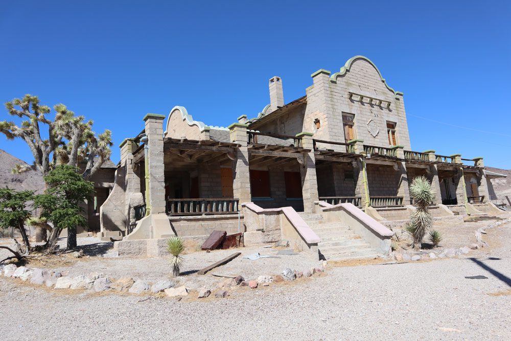
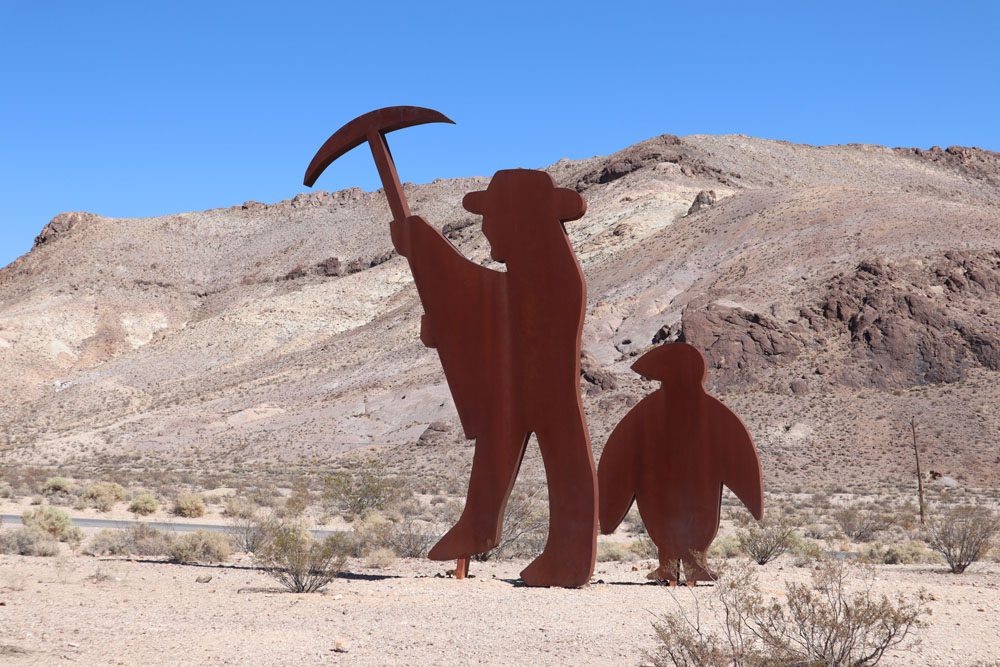
If you’ve made it to Rhyolite, you might as well pay a visit to the Goldwell Open Air Museum. This sculpture garden is just a five-minute drive from the ghost town.
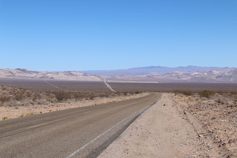
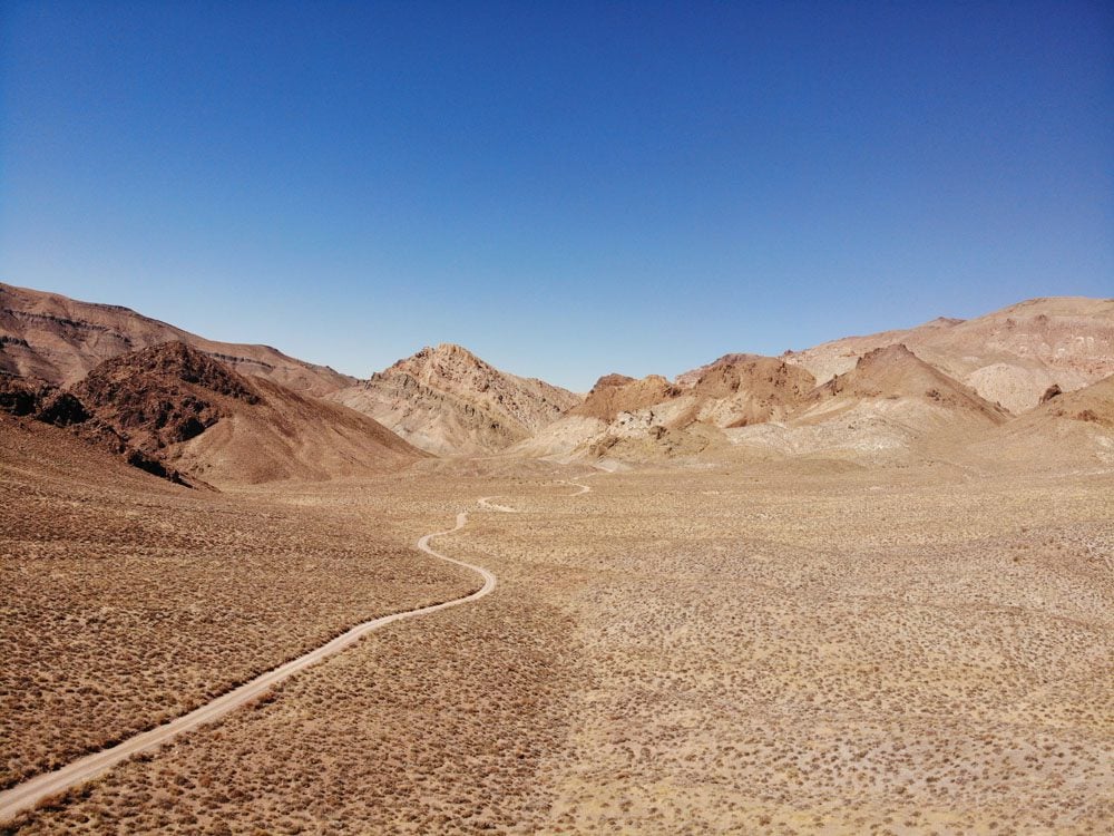
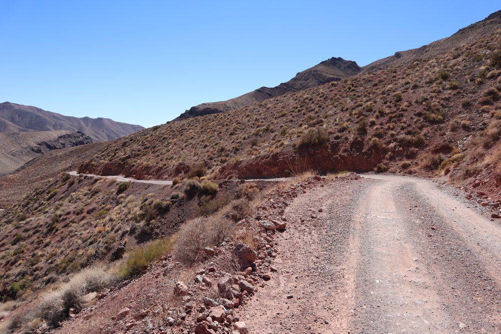
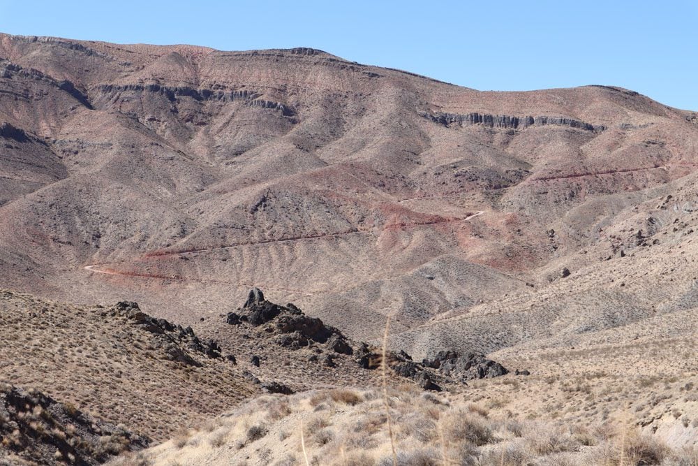
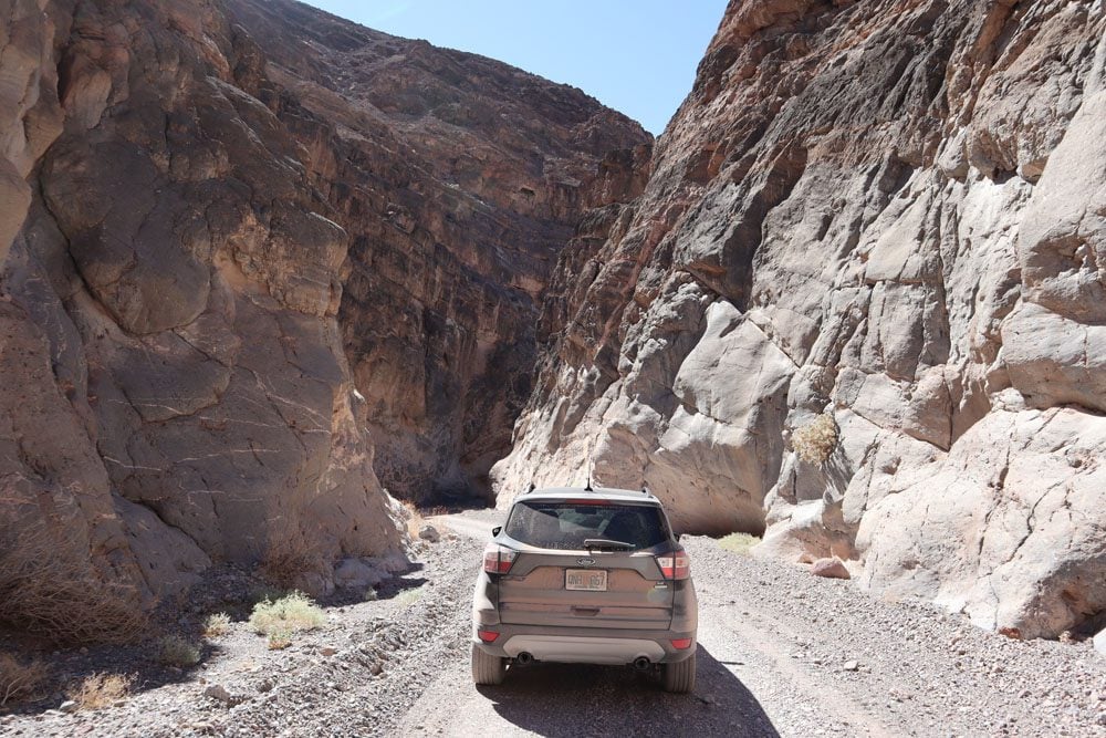
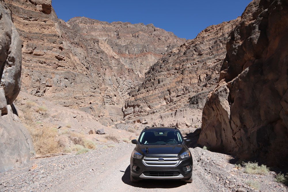
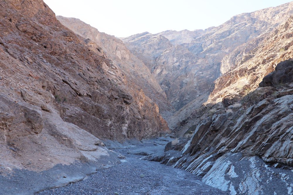
Titus Canyon Road
This scenic 27-mile (43 km) drive is a legacy of the boom and bust of Leadfield, an abandoned mining town about halfway through the drive. The canyon’s name honors Edgar Morris Titus, a mining engineer who disappeared in the deadly summer of 1905. Titus Canyon Road slices through a remote section of the park before joining the narrow and dry Titus Canyon riverbed.
Titus Canyon Road is a one-way scenic drive that begins just outside the park boundary on the way to Rhyolite. The dirt road is flat as a wall for about six miles before entering the canyon, at which point it begins to gain elevation via a long series of sharp turns. The view out here is breathtaking but you’ll likely have nobody else to share it with. Every bend in the road reveals another spectacular vista.
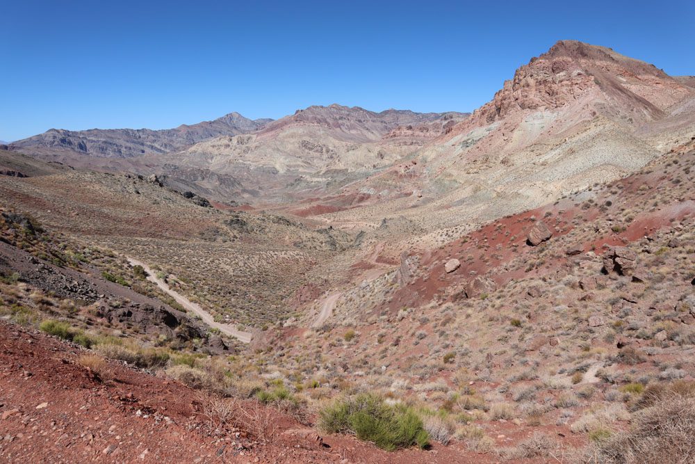
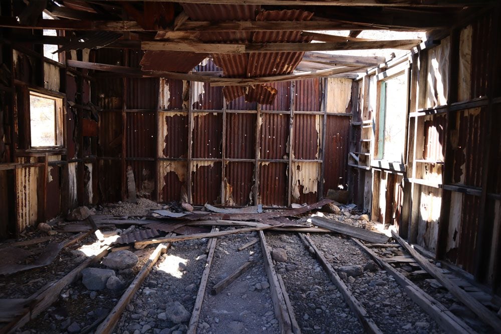
About halfway through the drive, you’ll reach Leadfield, an abandoned mining town that boomed in 1926 and busted just a year later. About 300 people lived in Leadfield and it even had its own post office. Park your car and take your time to explore the area. Imagine what life was like here during the town’s short heyday.
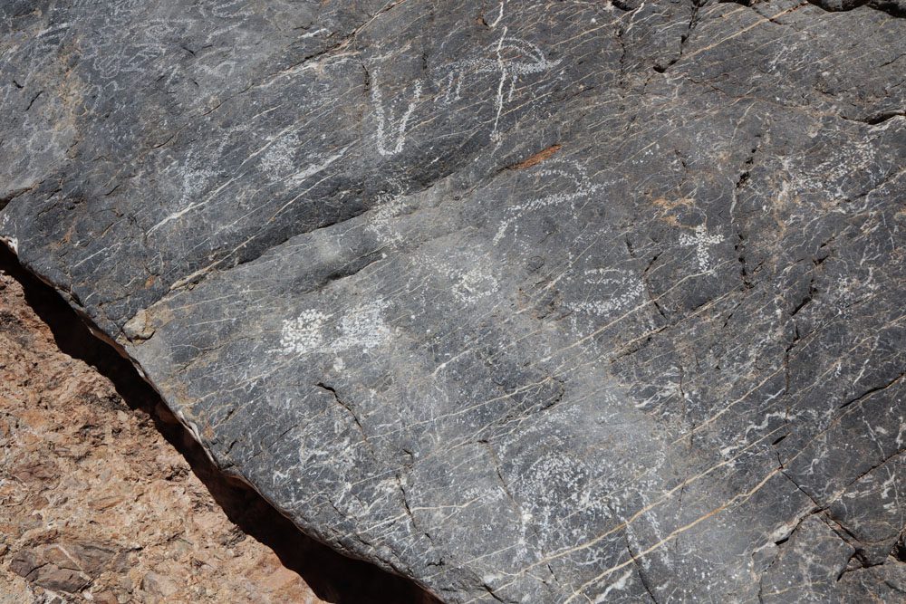
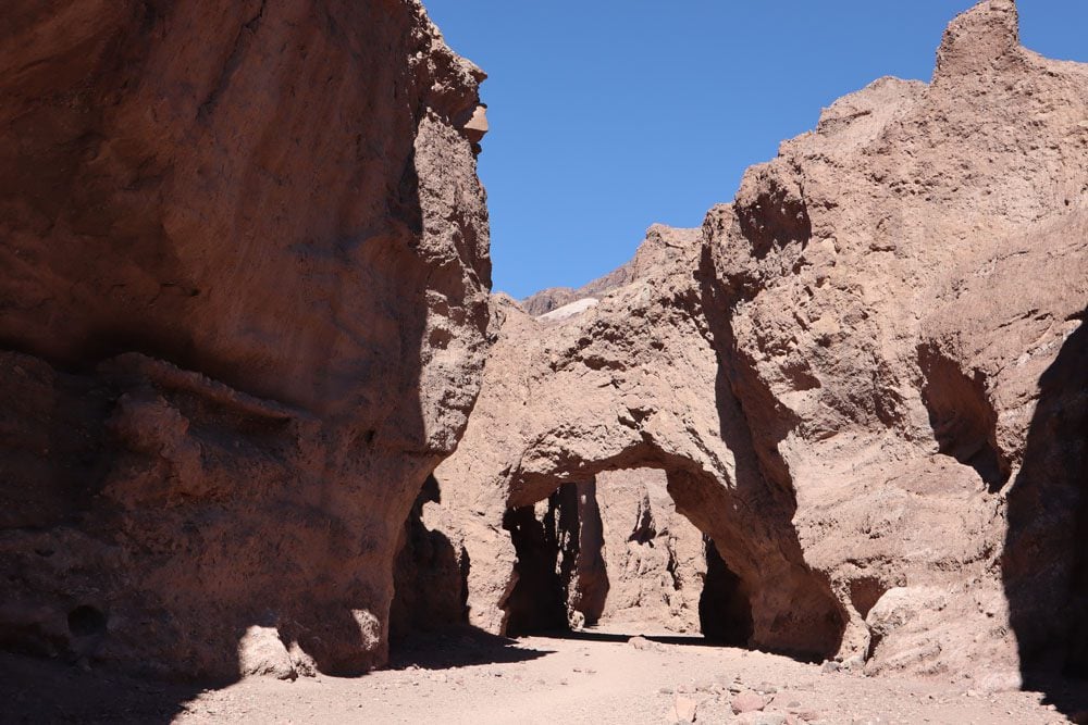
At Titus Canyon, the road narrows and follows the contours of this dry riverbed. At the mouth of the canyon, look for signs marking the Native American petroglyphs. While the exact meaning or purpose of these petroglyphs is unknown, several images are recognizable, including sheep, the sun, lizards, and human-like figures.
If you cannot or do not want to drive Titus Canyon Road, you can hike the narrow canyon on a marked trail beginning in the parking lot where cars exit the one-way canyon. For drivers who wish to ditch the car and extend the adventure, a hike to Fall Canyon is an option.
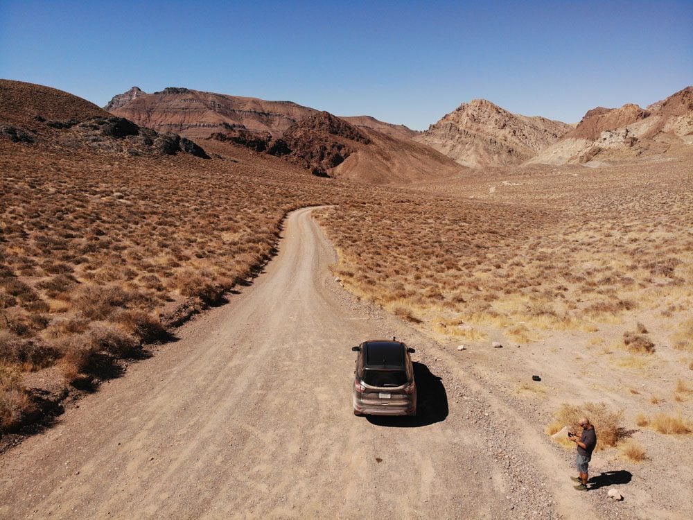
Logistics: you do not need a 4WD to drive in Titus Canyon but a high clearance 2WD is highly recommended as some sections are bumpy. Titus Canyon Road is just 27 miles, but for much of the way, you’ll average 5-15 mph. Bring more water and food than you need, download an offline map of the area, and do not rely on cell phone coverage. Fill up gas before starting the drive and ensure you have a proper spare tire and tools. Allow three hours to complete the drive, including stops, and slightly longer to include a picnic lunch. It’s best to enter Titus Canyon (the final section of the drive) when the sun is high in the sky.
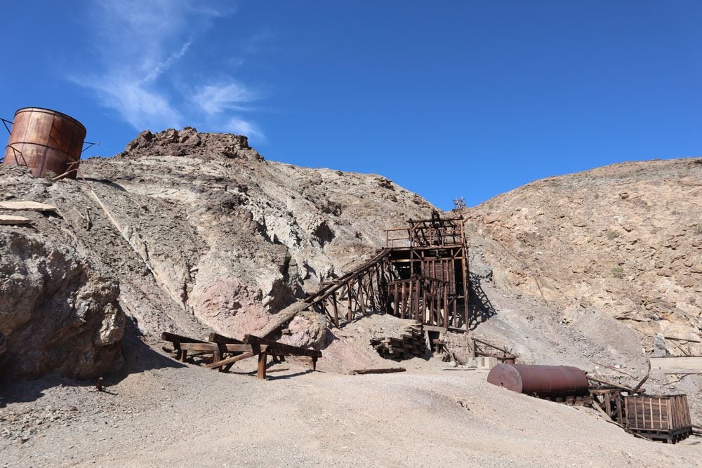
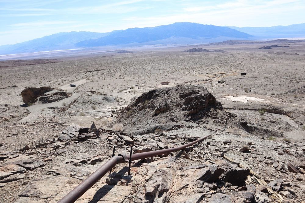
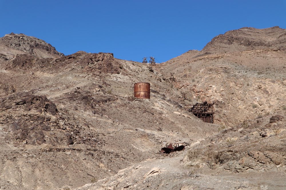
Keane Wonder Mine & Mill
History buffs will enjoy visiting this abandoned mine for the impressive logistics that were put in place to transfer gold ore from mine shafts in the high ground over one kilometer downhill to the valley floor for processing. A dirt road leads to the parking area, from where a steep trail climbs 1,500 feet in just 1.4 miles from the mill to the upper tramway terminal. You can continue slightly further to the mine.
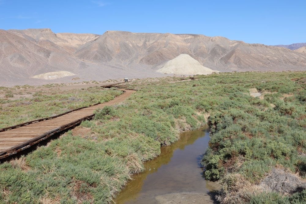
Salt Creek Interpretive Trail
This short and easy walk over a wooden boardwalk proves that Death Valley is actually full of life. Even in the summer months, water flows through this creek, and where there’s water, there’s life. The water in Salt Creek is actually saltier than seawater, eventually evaporating into the desert air further downstream.
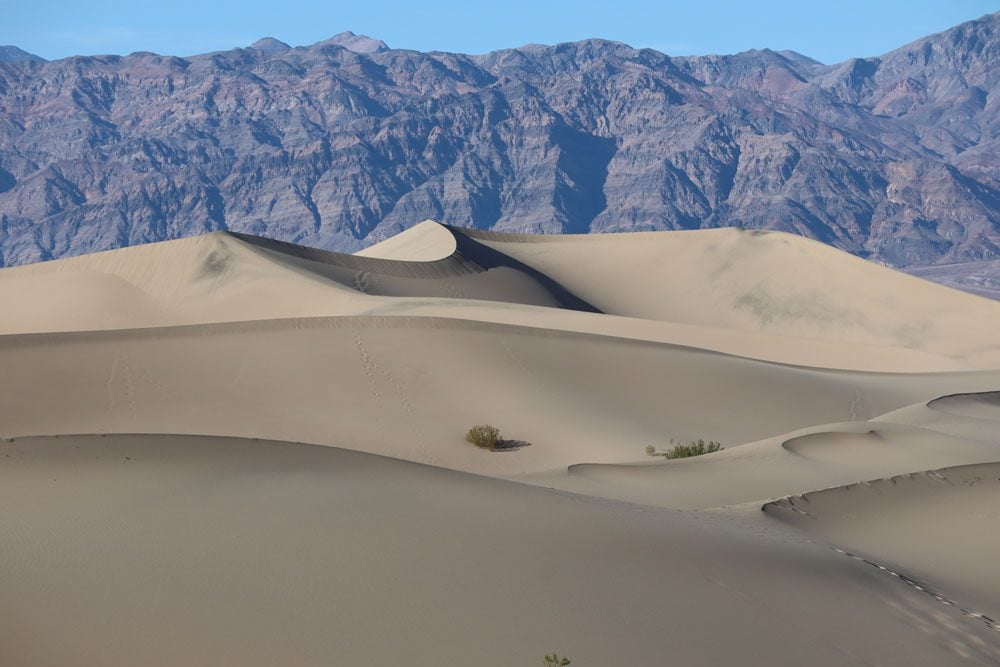
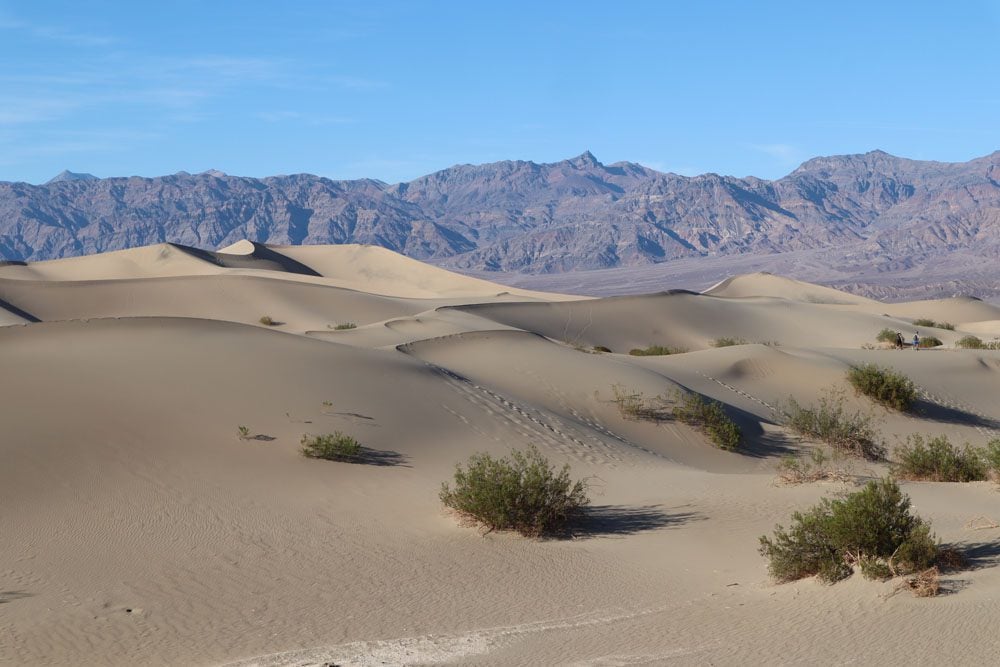
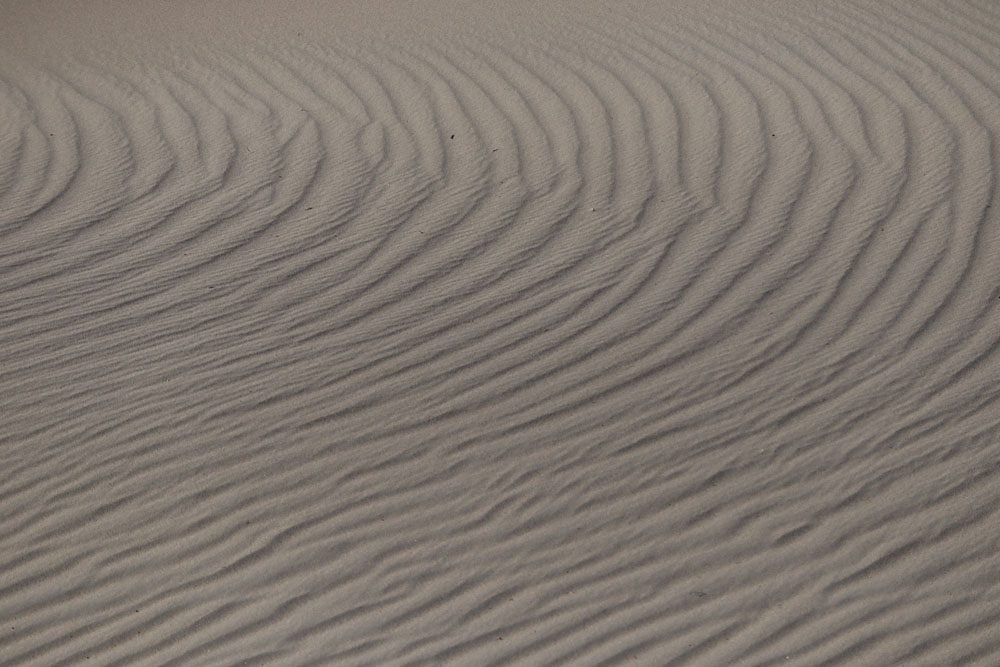
Mesquite Flat Sand Dunes
This isn’t the Sahara, this is still Death Valley. The Mesquite Flat Sand Dunes cover an extensive area near Stovepipe Wells with some dunes towering over 100 feet high. There isn’t an official trail so just go wherever your feet take you (here’s a suggested route). The sand is soft and the views are extraterrestrial.
(1) Visit the Mesquite Flat Sand Dunes during dusk or dawn when the dunes are painted gold. In the late afternoon, you might also catch a glimpse of creatures coming out of the sand when the weather cools (including snakes). (2) If you have a 4WD and are looking for an extra dose of adventure, head to the Eureka Sand Dunes in a remote section of the park.
Devil’s Cornfield
A very quick roadside stop to see a high concentration of arrow weed stacks that seem to form a neatly-planted field.
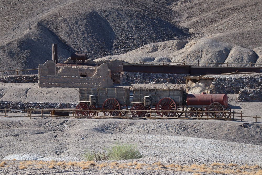
Harmony Borax Works
This outdoor museum tells the tale of borax mining in Death Valley. In the late 1880s, the mine and processing plant were erected in present-day Furnace Creek, giving rise to the importance of this area. Processed borax would then be transported out of the valley using the legendary Twenty Mule Teams. If you want to learn more about borax mining, head to the Borax Museum in Furnace Creek village.
Furnace Creek
This is the “commercial” and administrative center of Death Valley. It’s home to the historic Ranch at Death Valley, an expensive gas station, the visitor’s center, the borax museum, food, groceries, tour operators, and more.
Zabriskie Point
Named after a former executive in the Pacific Coast Borax Company, Zabriskie Point is one of Death Valley’s top sites. From the parking area, a very short path leads to a panoramic viewpoint above the uniquely-formed badland canyons. The colors and shapes of the canyons make for a beautiful scene, further accentuated by the changing angle of the sun.
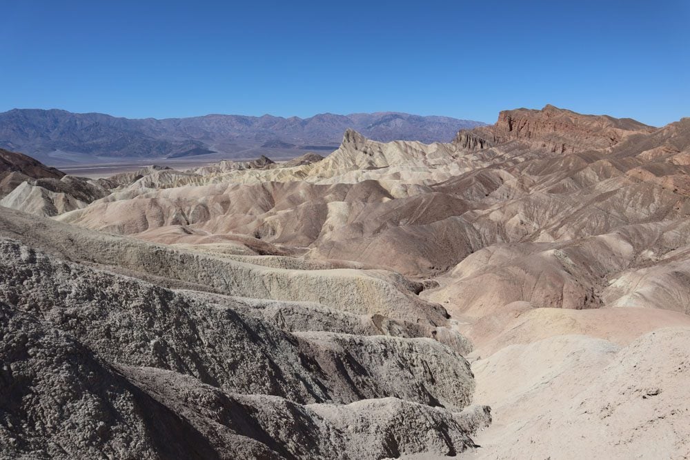
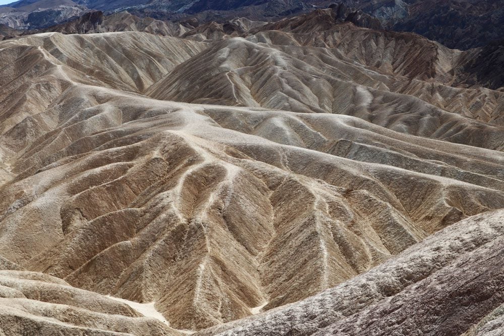
From Zabriskie Point, several trails head down into the network of canyons. The shortest is the Badlands Loop (2.5 miles roundtrip) which can be extended further through Gower Gulch to Golden Canyon (6.4 miles roundtrip) with an option to detour to the Red Cathedral (extra one mile).
Zabriskie Point is one of the best spots for watching the sunrise in Death Valley.
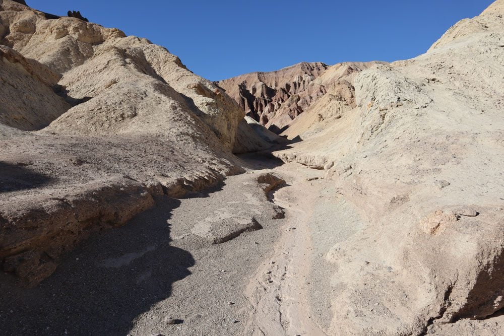
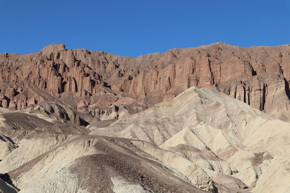
Golden Canyon Trail
This is one of the best hikes in Death Valley, a splendid walk through one of the most impressive badland canyons. The aim of the hike is to reach the Red Cathedral, a seemingly impenetrable fortress of red rock amidst the golden shades that dominated up to this point. There are several options for this hike, the shortest and easiest of which is the hike to Red Cathedral and back. The best time for this hike is in the afternoon when the sun’s rays illuminate the canyon.
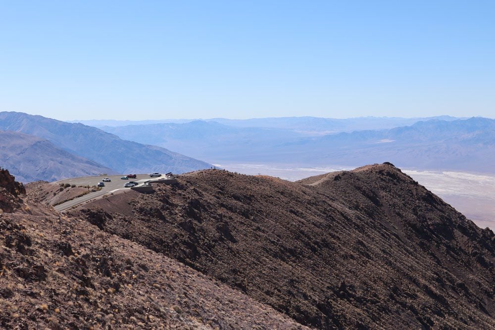
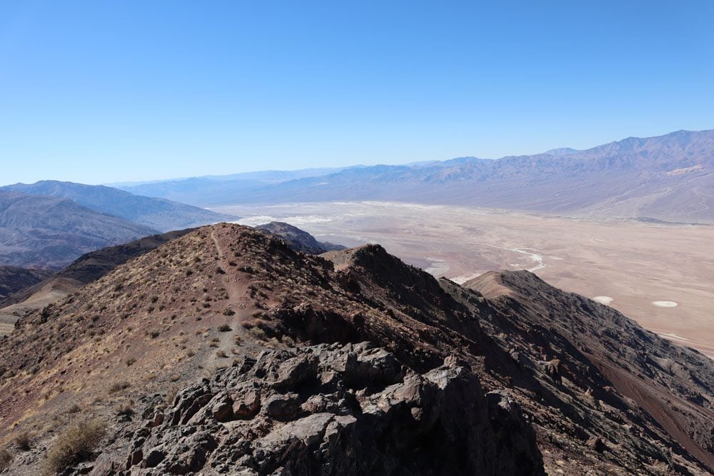
Dante’s View
Whether for watching the sunrise, sunset, or the night sky, the drive to Dante’s View is simply a must. This scenic viewpoint sits atop the Black Mountain range high above death valley at a height of 5,575 ft (1,699 m). Plaques at the viewpoint explain what exactly you are seeing and what forces combined to create this stunning scenery. Dead ahead is Telescope Peak, the highest point in Death Valley (11,043 feet | 3,366 m).
From the parking area and viewpoint, a short trail heads slightly down to a more secluded spot. You can also pick up the trail to Mount Perry on the opposite end of the parking lot and walk for as long as you want on the ridge overlooking Badwater Basin.
Even in warmer months, it can get very windy and consequently cold at Dante’s View. Be sure to pack something warm in the car.
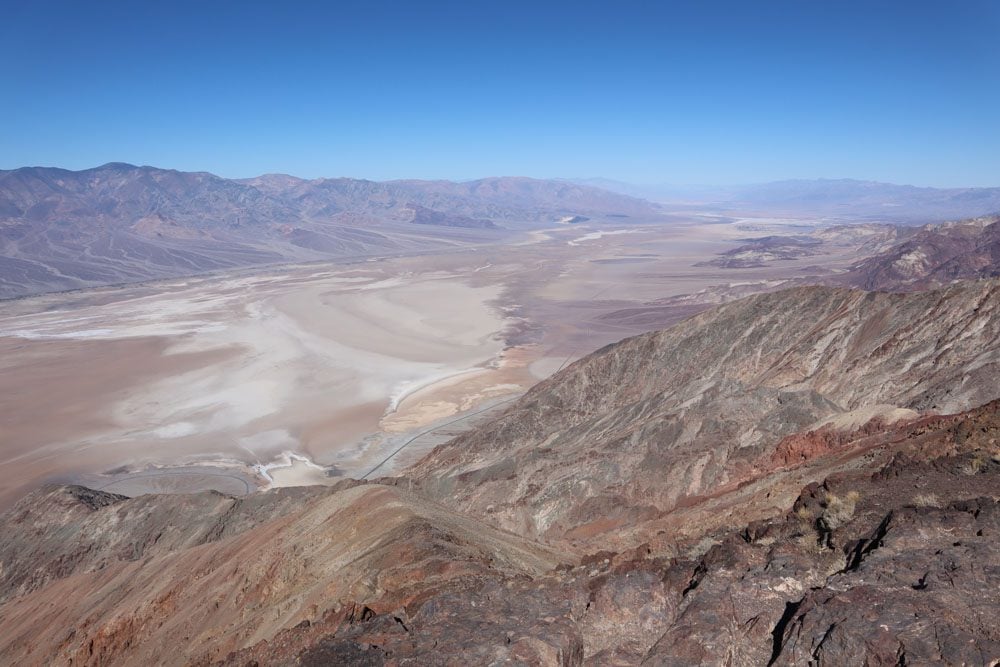
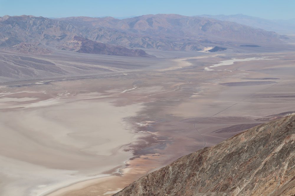
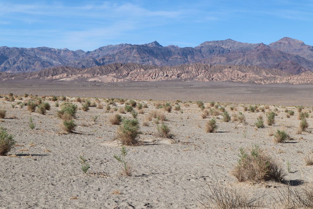
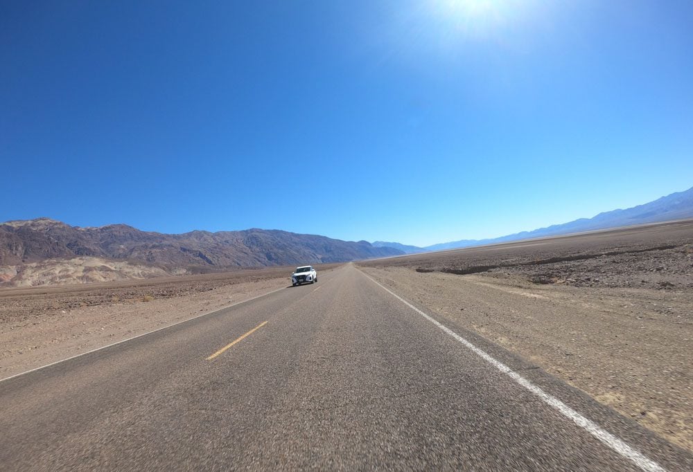
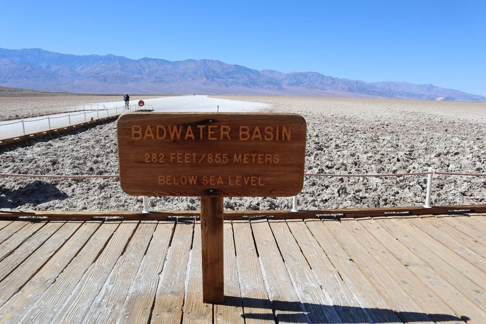
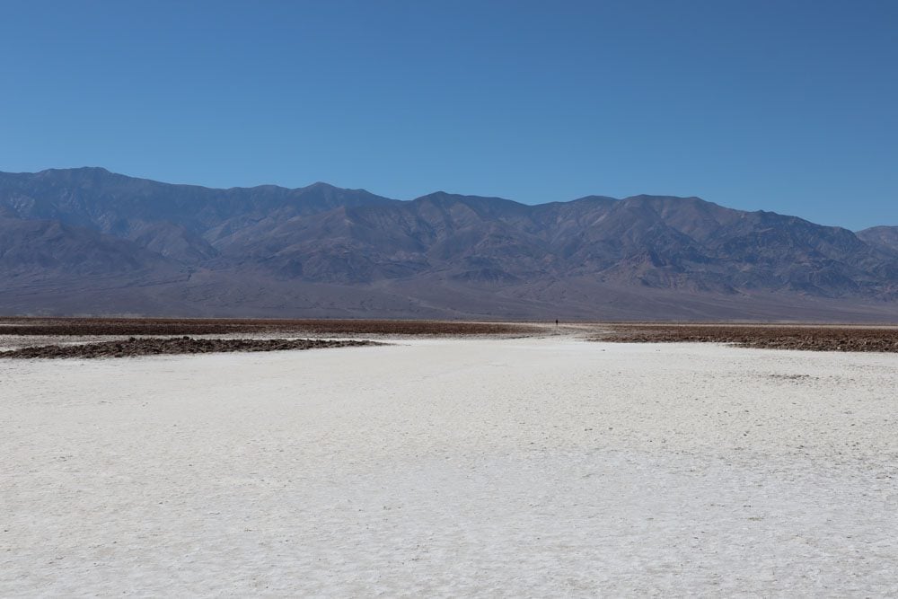
Badwater Basin
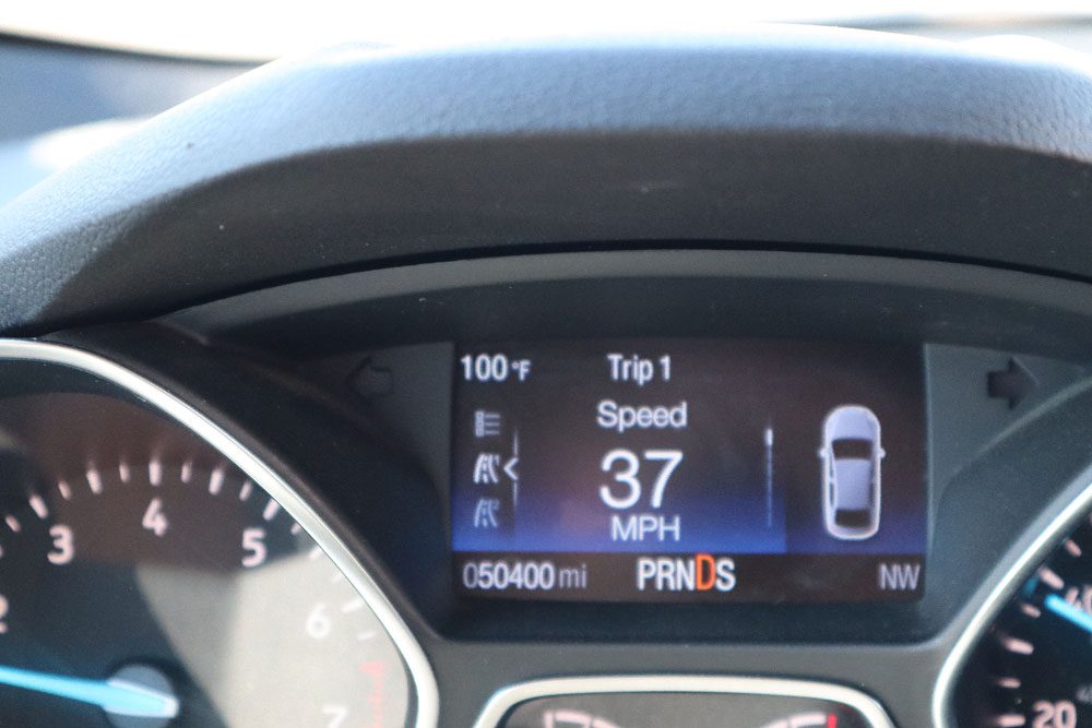
If there is one site to visit in Death Valley National Park, it is without a doubt Badwater Basin. Getting here on Badwater Road is an experience on its own. To your left are the badland canyons with their intense scars and colors and on your right are the vast salt flats that culminate at Badwater Basin. If you’re visiting Death Valley from late spring to early fall, there’s a very good chance that your car’s thermometer will top 100 degrees Fahrenheit (37.8 celsius).
At 282 feet (86 m) below sea level, the vast and surreal salt flats at Badwater Basin lie at the lowest point in North America. The secret to the basin’s salt deposits is its position at the heart of Death Valley’s drainage system. Rain falling on distant peaks picks up minerals as it heads to lower ground. Without much water left on this long voyage, all that remain are mostly the minerals that you see here at Badwater Basin.
From the parking area, head to the boardwalk and walk around Badwater Pool. The water might be extremely salty, but life still exists even in this hostile environment.
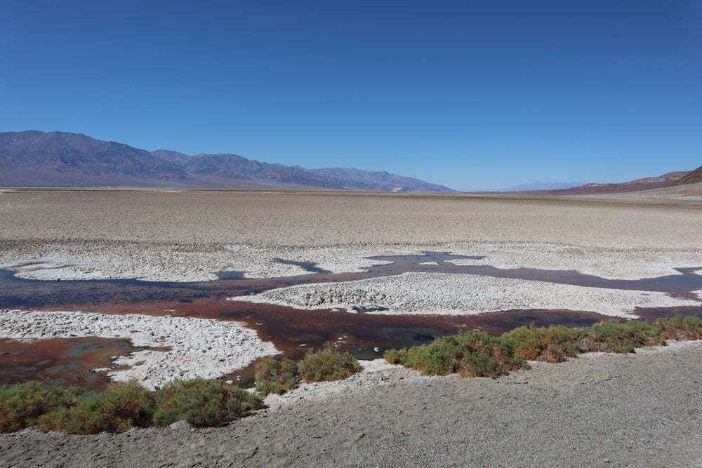
From Badwater Pool, continue straight into the heart of Death Valley along the salt flats. Get a closer look at the incredible crystal-like shapes of the dry salt, constantly altered by wind and rain. Follow the salty snow until you’ve had enough or try to make it to the second marker.
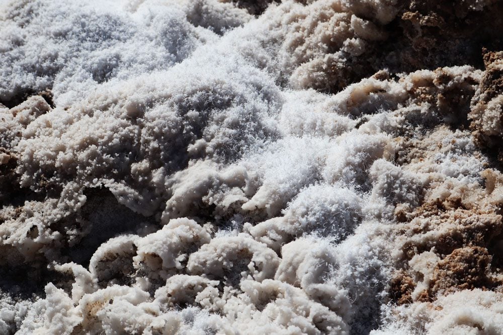
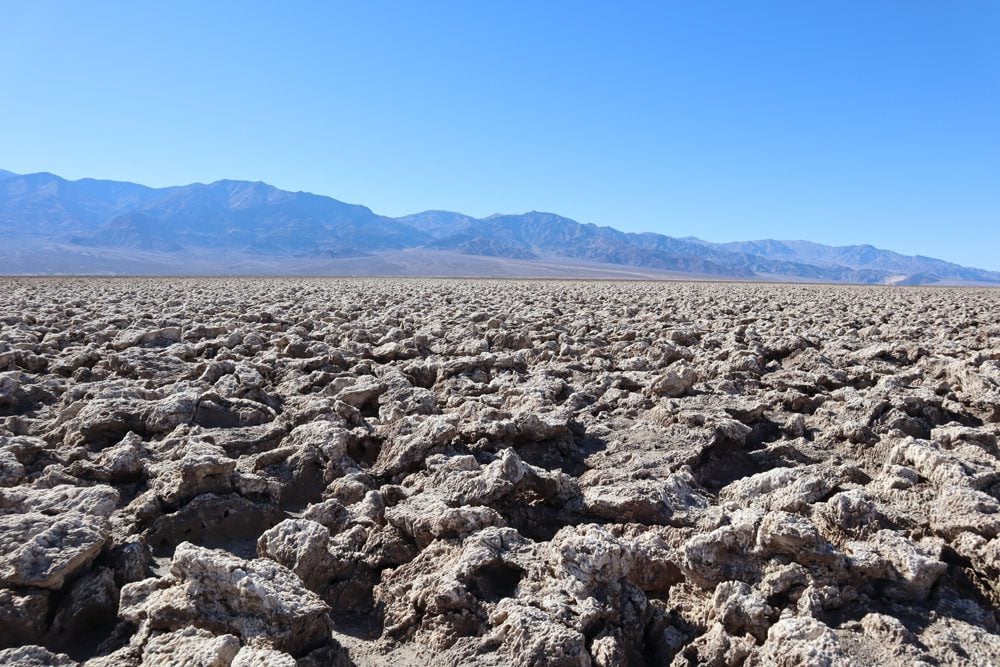
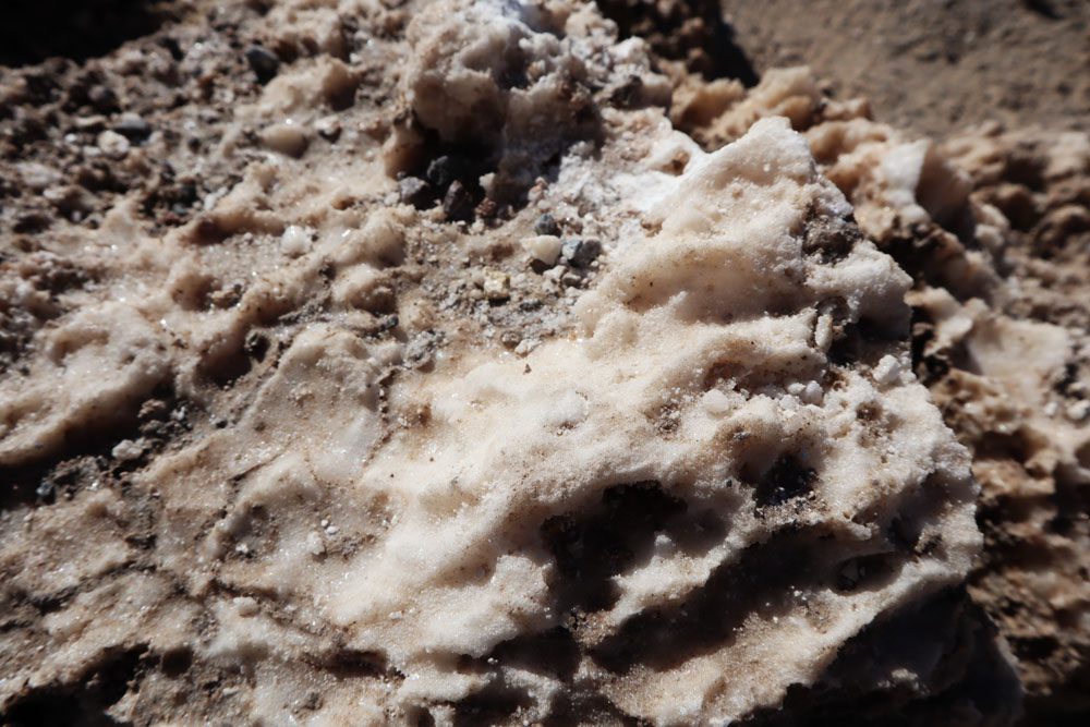
Devil’s Golf Course
Take the dirt road from Badwater Road to this interesting spot. Crystallized salts compose jagged formations in this harsh environment. Deposited by ancient salt lakes and shaped by winds and rain, the crystals are in a constant state of change. If you’re visiting Devil’s Golf Course on a hot day, you might hear a metallic cracking sound as the salt pinnacles expand and contract.
It’s best to stay in the parking area and not venture into the salt flat both for the protection of the environment and also because losing your balance and falling on sharp blocks of salt can result in injury.
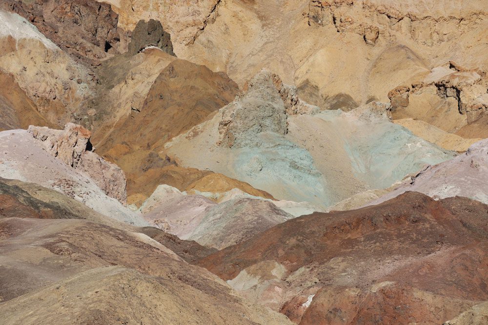
Artists Drive
This beautiful one-way, nine-mile (14.5 km) scenic drive is best experienced in the late afternoon when the sun directly shines on this unique landscape. Artists drive is paved throughout and perfectly blends with the surrounding topography. There are, however, a few narrow sections and sharp bends so drive with care.
Without a doubt, the top highlight on the drive is Artists Palette, an exposed hillside on which various minerals mixed and morphed over the years. Every color of the rainbow can be seen, even blue. You can ditch your car at Artists Palette and explore the colorful area from up close.
Natural Bridge Trail
About 500 meters from the parking area (0.3 miles), an impressive natural bridge connects the walls of this canyon. It’s an easy hike that can be extended slightly further to a dry waterfall and even deeper into the canyon until an impassable cliff is reached. The natural bridge is about 35 feet high (10.5 m) and has the same thickness.
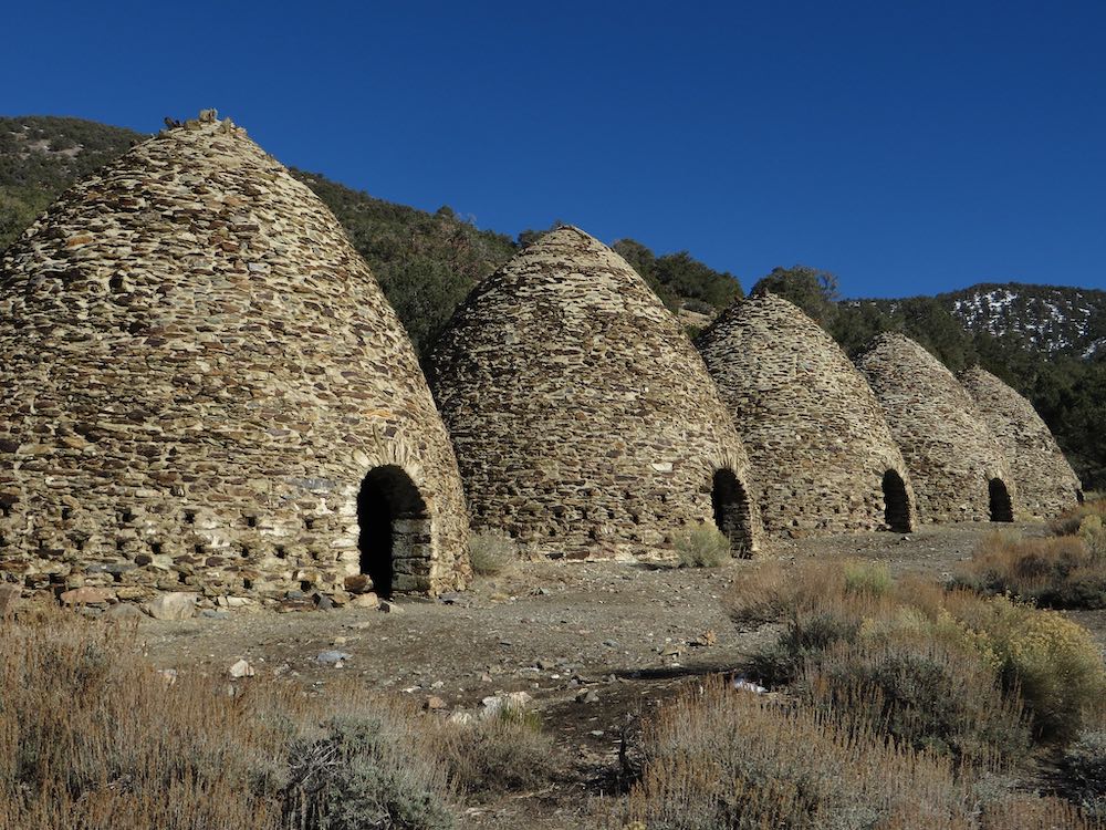
Wildrose Charcoal Kilns
A row of ten beehive-shaped stone structures that were built in 1867 to provide fuel to process silver and lead ore. The charcoal kilns are located in a distant section of the park, relatively close to Aguereberry Point and the trailhead to Wildrose Peak. It makes sense driving out here if you’re into architecture and history as these are believed to be the finest surviving examples of such kilns to be found in the western states.
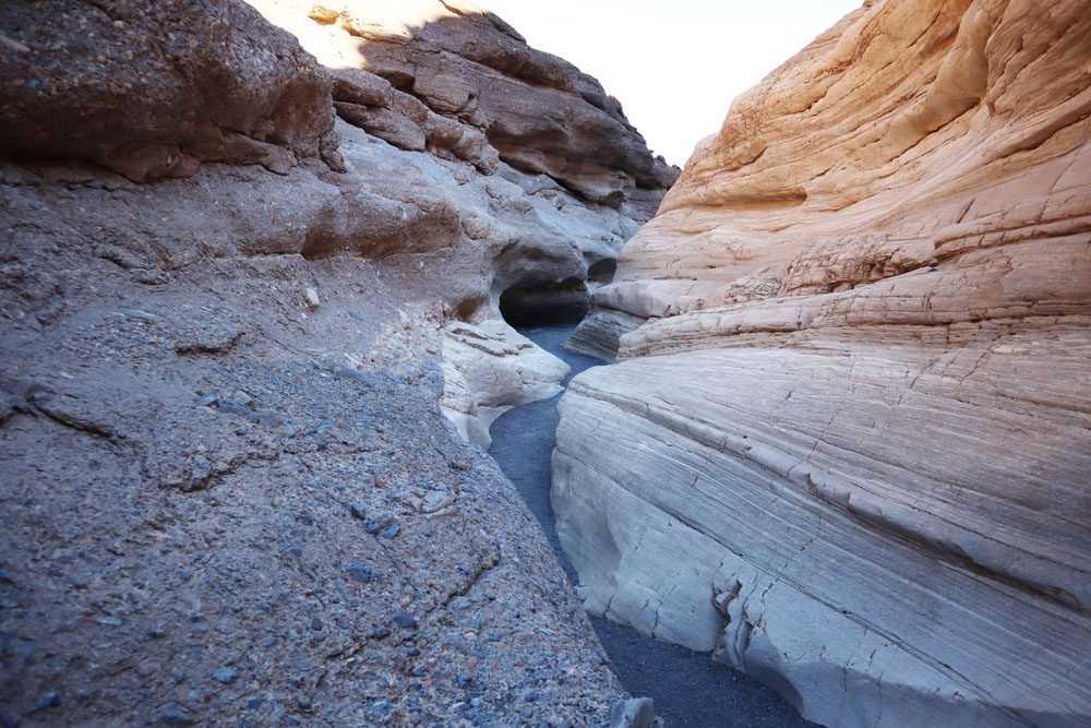
Mosaic Canyon
The trailhead for this moderate hike is reached via a dirt road just outside Stovepipe Wells. For the best natural lighting, hike Mosaic Canyon in the late morning or early afternoon, obviously taking into consideration the heat.
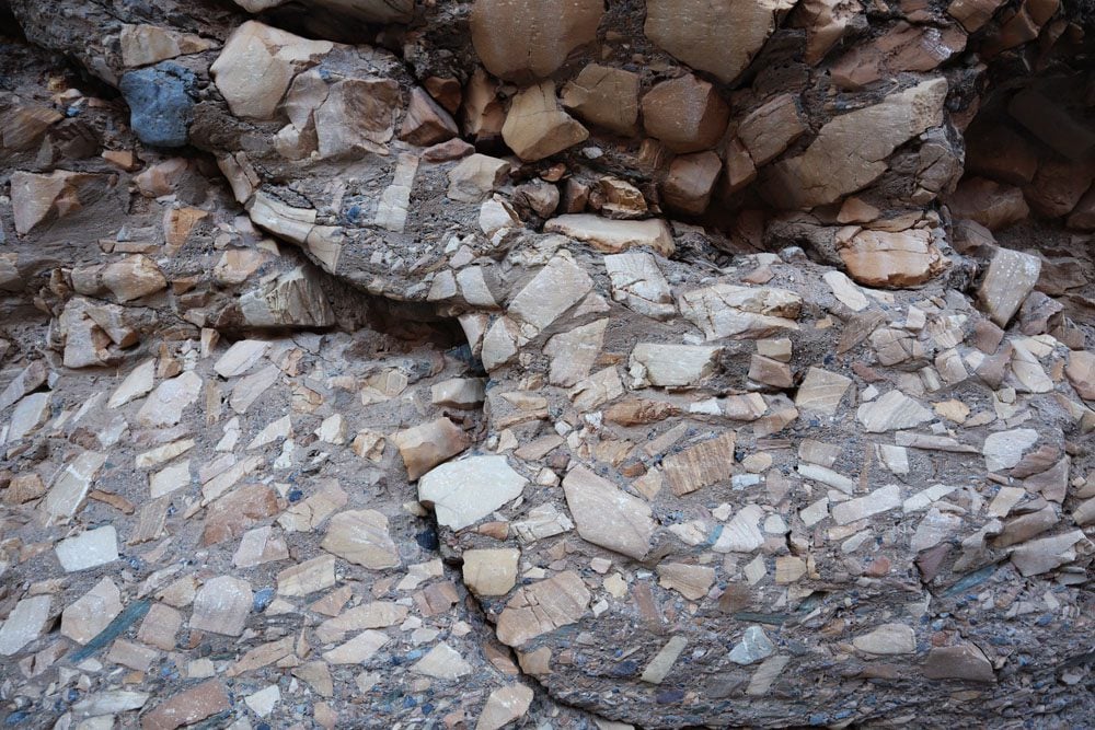
The trail ends in a dramatic rocky amphitheater culminated by a 25ft (7.6m) vertical dry waterfall. Along the gradual ascent, you’ll pass through a few narrow sections of the canyon where the rock has been smoothened by floods, and bypass a few large boulders and a small dry waterfall. Keep your eyes peeled for the canyon’s signature feature, Mosaic Canyon Breccia. It’s composed of small fragments of various types of rock locked within a natural cement that appears to create a mosaic.
Telescope Peak
The most challenging hike in Death Valley leads to its highest peak. From the summit of Telescope Peak (11,043 feet | 3,366 m), hikers are rewarded with panoramic views of Death Valley, Mount Whitney, the Sierra Nevada range, and everything in between. This is a very challenging hike that requires preparation.
Stargazing in Death Valley
Death Valley is an International Dark Sky Park with a Gold Tier rating. The skies here are virtually free of light pollution, so stars can be seen by the thousands. After catching the sunset at Dante’s View or Mesquite Flat Sand Dune, head back to your accommodation, grab dinner, and head back out again for some stargazing.
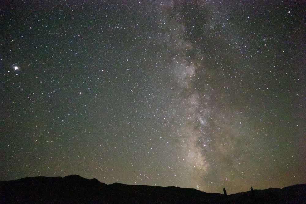
Where to watch the night sky at Death Valley? You can join a guided night sky ranger program or pretty much use any spot to explore the night sky at Death Valley. There are several popular locations, including the Mesquite Flat Sand Dunes, Harmony Borax Works, Dante’s View, Badwater Basin, and the information area at the junction of Daylight Pass Road and Beatty Road. I went to Mesquite Flat Sand Dunes but since it’s close to the main road, I found it quite annoying with the odd passing car.
(1) Even if it’s not cold at night during your visit, wear long sleeves, long pants, and closed shoes. Many night flies smother you the moment you turn on any type of light. Spray yourself with mosquito repellent before beheading out. (2) Download one of the many night sky mobile apps so you’ll know exactly what you’re looking at.
What’s Next?
With the information in this Death Valley travel guide, you’re now ready to begin planning your adventure. For more information about Death Valley, including sample itineraries, check out the Death Valley travel guide collection.
Pin These Images To Your Favorite Boards