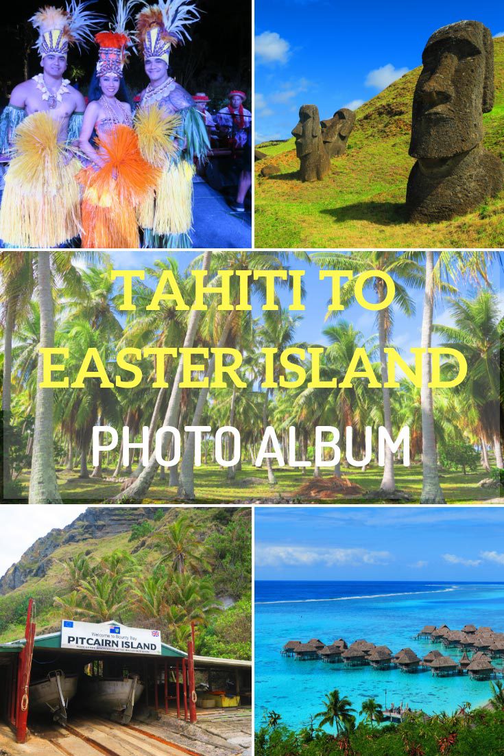
A Voyage from Tahiti to Easter Island
Pitcairn Island
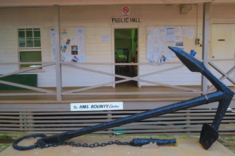
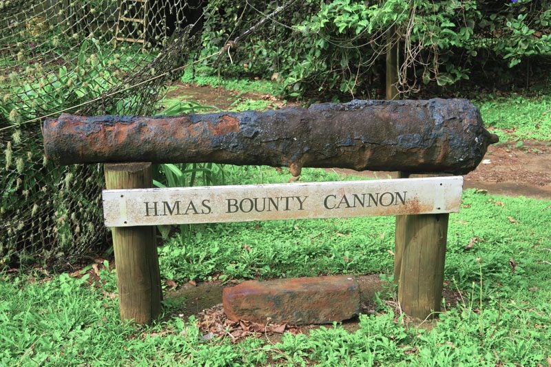
One of the toughest islands to reach in the South Pacific, Pitcairn Island is home to one of the most isolated communities in the world. Though measuring just 4.5 square km, Pitcairn’s fame far outweighs its physical size. This is owed to the fact that Pitcairn Island is home to the descendants of the Bounty mutineers and their Polynesian wives. In 1767, the mutineers, led by Fletcher Christian, arrived in uninhabited Pitcairn and began a settlement that has managed to survive to this very day despite a very turbulent past.
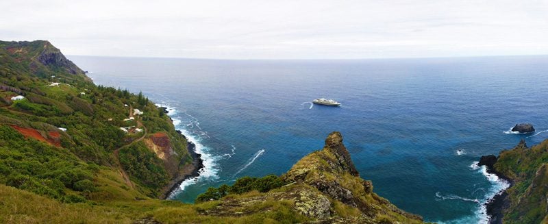
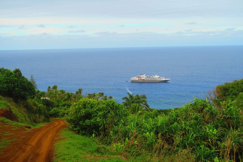
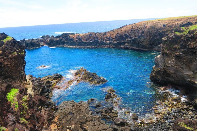
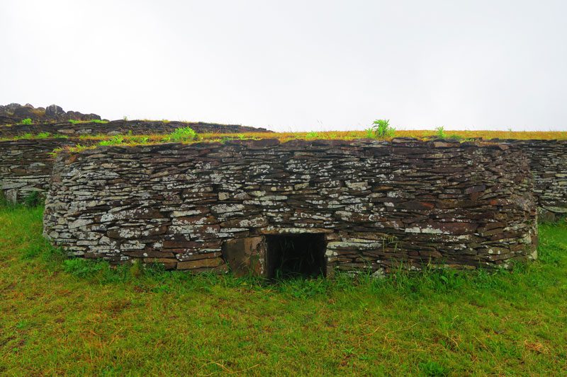
Pitcairn is an extremely rugged island with no natural harbor or airport, so even if you do manage to get here, there is no guarantee you’ll actually be able to set foot on the island as conditions must be right for a transfer onshore via zodiacs.
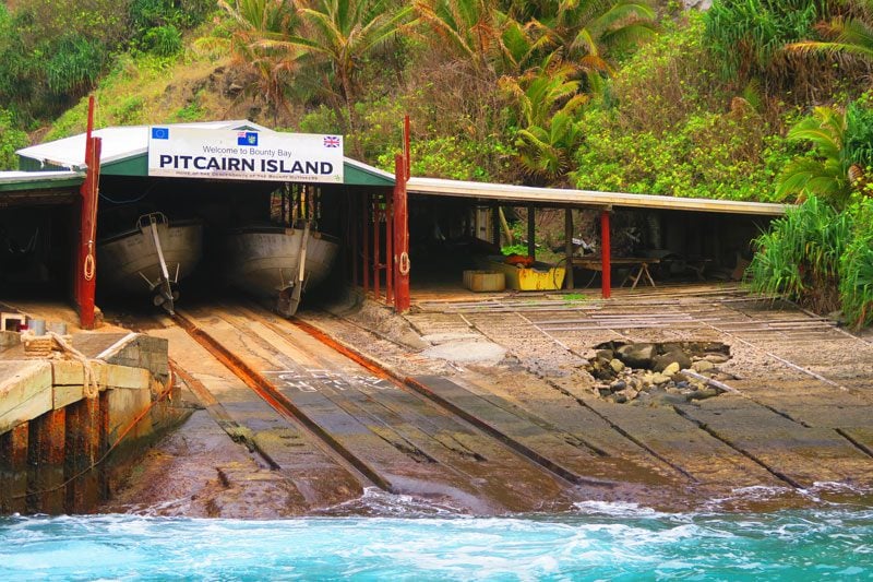
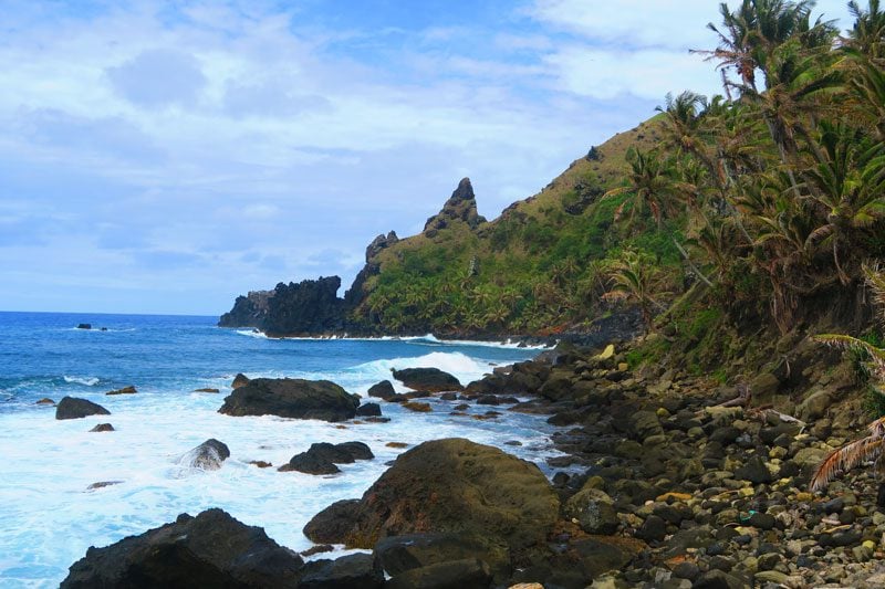
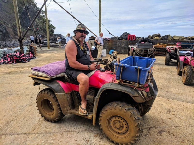
We were extremely lucky on this day and managed to make it to Pitcairn and visit its only settlement – Adamstown – where Pitcairn’s entire population of fewer than 50 inhabitants reside. During the short amount of time we could stay on the island due to incoming bad weather, we managed to meet the friendly locals and explore this magnificent island which rarely gets visitors from the outside world.
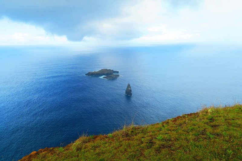
Ducie Island
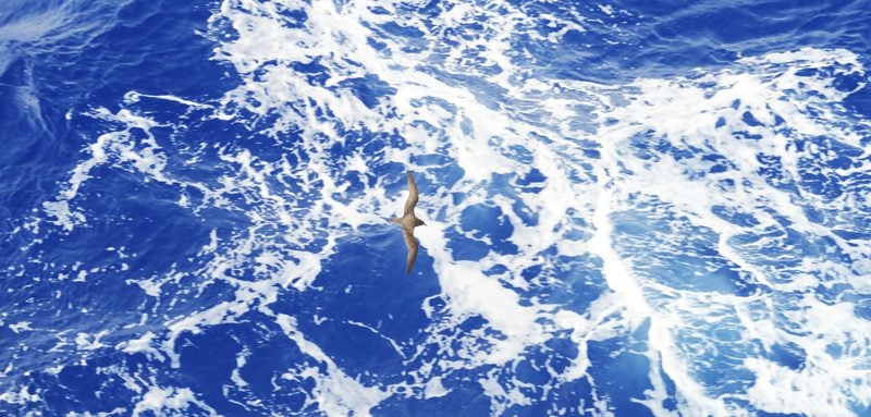
From Pitcairn Island, we pushed further east another 540 km and sailed past Ducie Island. It is considered by some geologists to be the southernmost atoll in the world and nobody lives here apart from massive bird colonies. Experts estimate that 90% of the world population of Murphy’s Petrel bird species resides just on Ducie Island.
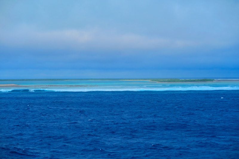
What was exceptional to me was the fact that one “could feel” we were nearing land hours before we even spotted Ducie Island, thanks to birds flying just above the waterline in search of fish swimming close to the surface. Ancient Polynesian explorers caught on to this early on and tracked flight paths to zoom in on tiny specs of land in the middle of the vast Pacific Ocean.
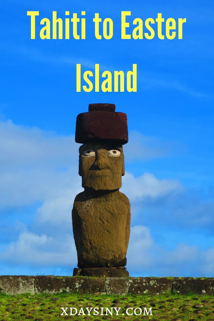
Easter Island
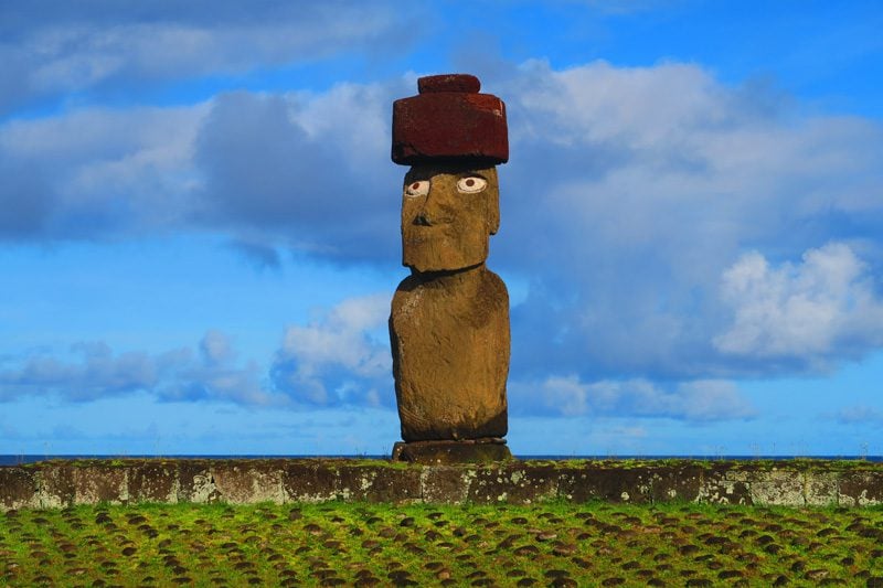
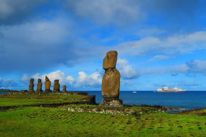
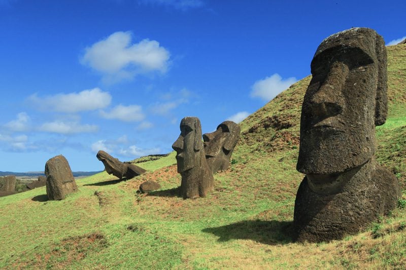
The easternmost tip of the Polynesian Triangle was the last stop on our long voyage and a fitting climax. Easter Island poses one of the world’s greatest mysteries, home to an ancient civilization whose ancestors left behind nearly 1,000 giant monolithic statues known as moai.
Living in complete isolation for centuries, the depletion of natural sources is the likely reason why the ancient society collapsed and spiraled into a civil war. The disease later brought by European visitors and slave raiding by American and Peruvian ships further decimated the local population and left no elders who knew anything about the past.
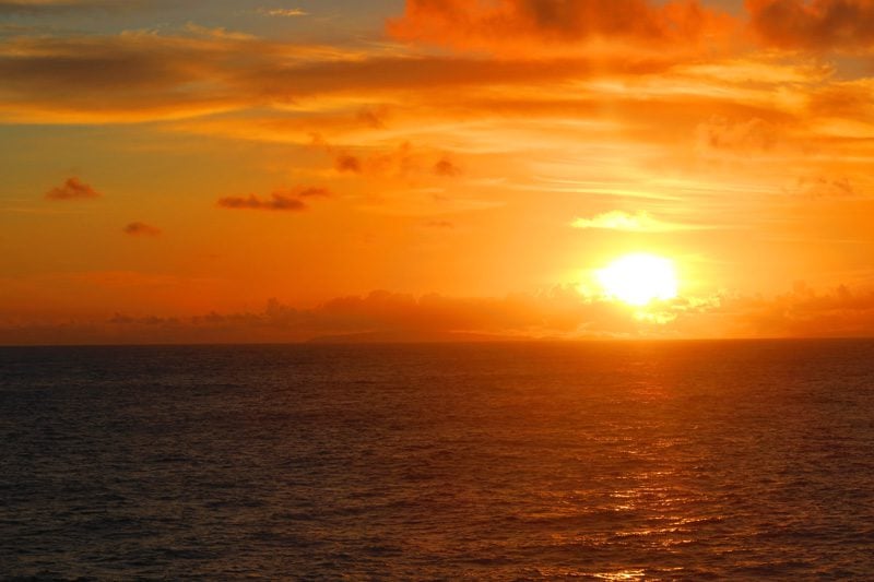
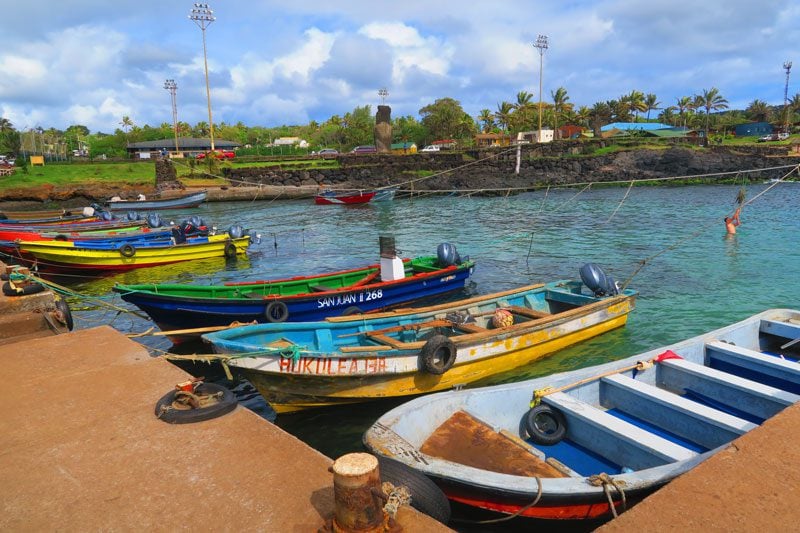
After a two-day 1,500 km journey from Ducie Island, we finally spotted land as the sun was rising over Easter Island. Anchoring just off the capital – Hanga Roa – it’s quite clear that Easter Island is not the “classic” Polynesian island. Its topography mostly consists of barren low-lying hills and there isn’t a protective reef. The scenery seems more Irish than Polynesian to me.
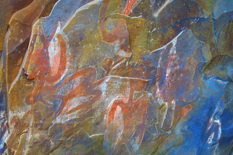
Our first stop was to explore the “Cannibal Cave” and its remarkable petroglyphs, followed by a visit to the dull settlement of Hanga Roa whose vibe is more Latin than Polynesian.
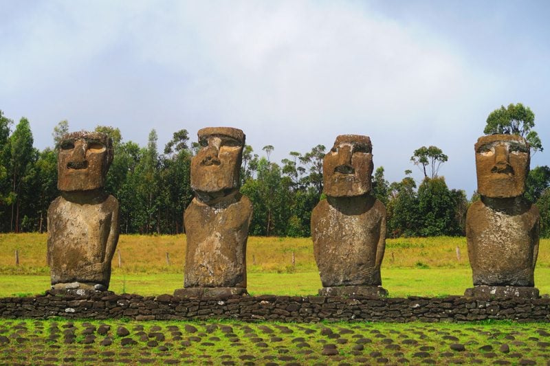
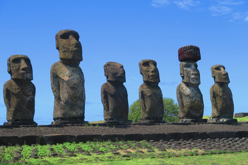
We then set out to explore the Rapa Nui National Park, beginning with the interesting temple complexes of Ahu Tahai and Ahu Akivi. Some of the moai statues erected on these altars were remarkably positioned to be in sync with seasonal events such as the spring and autumn equinox which helped locals mark seasonal changes and make agricultural decisions.
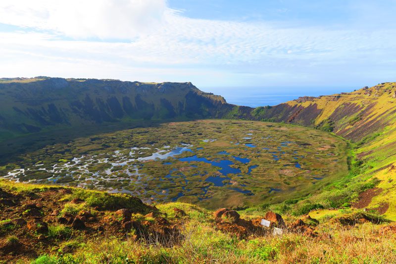
Just outside Hanga Roa, we paused to admire the crater of Rano Kao – one of Easter Island’s three major volcanoes and a former source of fresh water. Due to the shelter provided by the crater rim from the constant winds, the lake at the crater’s base has its own microclimate where a special kind of reed flourishes.
This reed was used in our next stop – the uninhabited village of Orongo. When the original society collapsed, a new religion sprung. It was centered around a new god who chose his ruler on earth via a bizarre sports competition known as the “Birdman competition”. Every year until 1868, local tribes led by their chiefs would gather at Orongo and choose a representative who was to swim through shark-infested waters with the help of a floating device made of reed to a small rocky islet where he was to wait for the laying of a special egg. The first to return with the egg intact would grant his master with the status of “Birdman” for the year and absolute power of the island’s affairs.
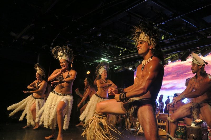
At night, we were entertained on board by the Kari Kari dance group from Hanga Roa. After seeing quite a few Tahitian dance shows, it was interesting to see how different the Rapa Nui dance movements are, much less sensual and more “war-like”, quite fitting with the island’s past. Check out some video footage from the show.
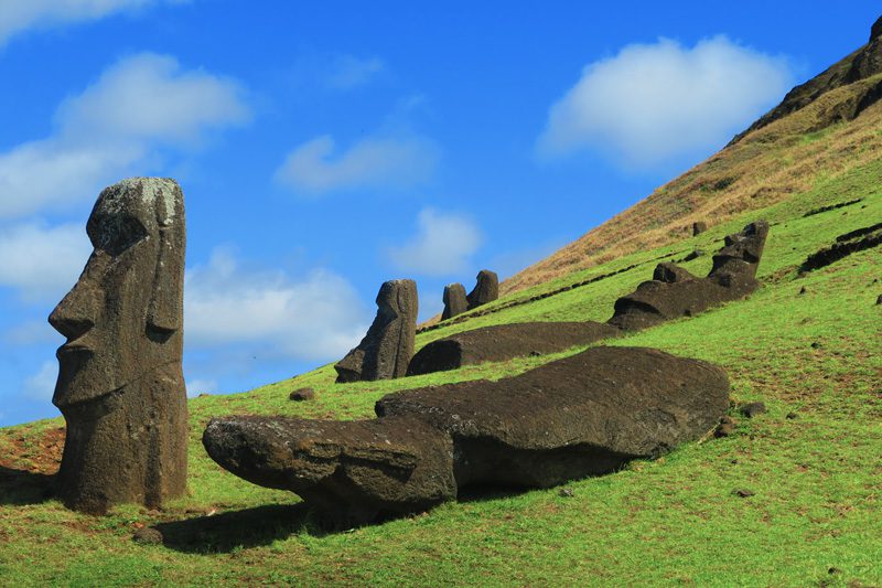
Our last day on Easter Island took us to the island’s iconic sites. We started the day in Rano Raraku which is the stone quarry from which 95% of statues were carved. Known as the “moai factory”, it was both incredible and chilling to see the 397 remaining statues in their various stages of completion and just imagine what it was like when the “last shift” dropped their tools and stopped a centuries-old obsessive practice.
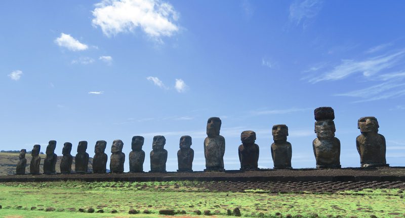
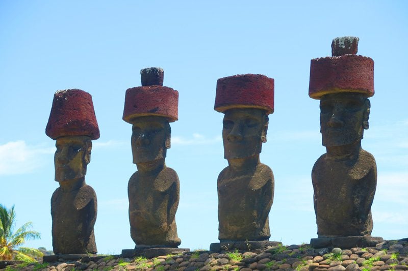
From Rano Raraku, we could see our next stop down on the coast – Ahu Tongariki, the most iconic temple in Easter Island.
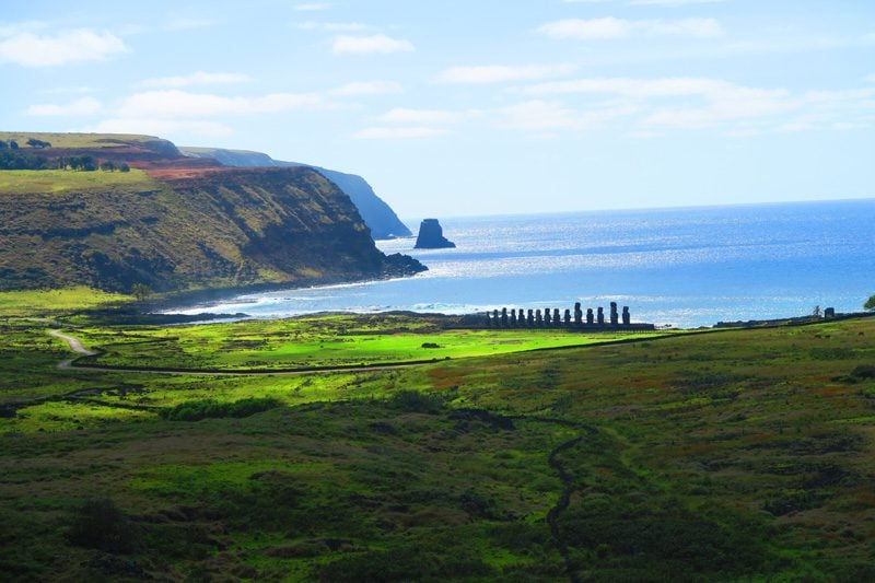
Ahu Tongariki is the largest temple on the island and its altar is adorned by 15 giant moai ranging from 40-88 tons in weight and averaging 7 meters in height. Walking around the statues it’s simply mind-boggling to think how a so-called primitive culture could not only carve such monothetic statues but also transport and erect them on platforms.
We wrapped up our visit to Easter Island at Anakena Beach, the only white sand beach on the island. It’s only fitting we end our trip here as Anakena is where everything is thought to have started on Easter Island, the spot where the first king – Hotu Matua – and his followed landed after a very long voyage from Mangareva, some 2,600 to the west.
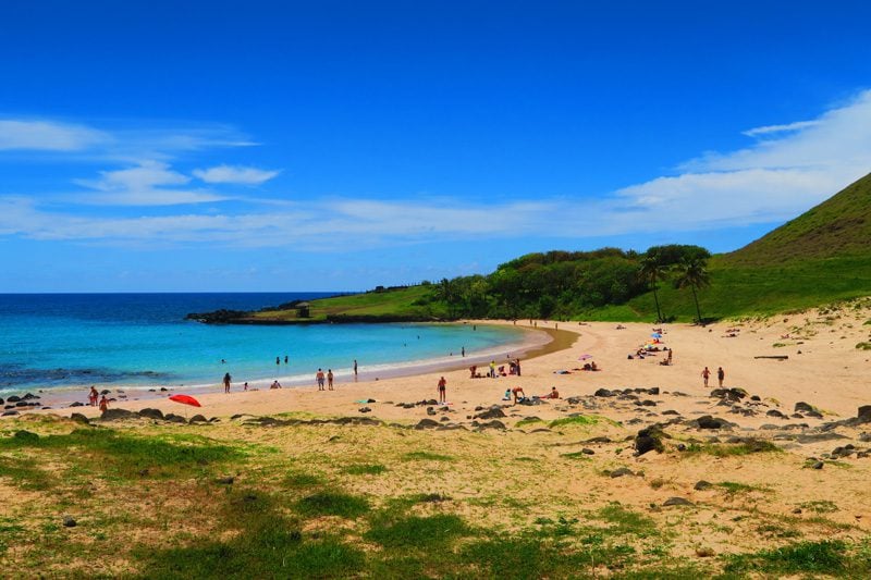
Anakena is also home to a fine-looking moai temple that was well-preserved thanks to the fine sand. Where else in the Pacific can your eyes see in the same frame a beautiful palm-fringed white sand beach and a temple created by an ancient culture whose mysteries we will likely never uncover.
Want to visit the South Pacific?
Here are a few resources to get you inspired.
Tahiti, Tailor Made!
The Islands of Tahiti are among the last places to be colonized by mankind, 118 islands, each with its unique personality.
Get expert advice and assistance with planning your trip to the destination where tropical dreams come true!
Pin These Images to Your Favorite Boards!