The Best Hikes In Hawaii
When you think about Hawaii, I bet that the first image that comes to mind is that of a pristine tropical beach. The good news is that Hawaii indeed has plenty of those, but to fully appreciate the unique beauty of the islands, you must put on hiking shoes and hit the trails. I spent four months exploring the major Hawaiian Islands, hopping from one island to another and covering hundreds of miles on a quest to find the top hiking trails. Though it was a very sweaty task, here are some of the best hikes in Hawaii!
Visiting Hawaii? Sample itineraries, guides to the best spots, and the must-see highlights in five islands are all waiting for you in the Hawaii Travel Guide collection. Aloha!
The Best Islands In Hawaii
Watch this video countdown of the top 5 islands in Hawaii (you might need to disable your ad blocker).
Best Big Island Hikes
The Island of Hawaii, better known as the Big Island, is bigger than the rest of its neighbors put together. It‘s one of the world’s most diverse islands, where you can ski in the morning, hike in a tropical rainforest in the afternoon, and dip in the ocean before sunset.
Mauna Kea Summit Hike
Distance: 16 miles (26 km) | Level: very challenging | Time: 8-10 hours | Trail Map
Mauna Kea is the highest peak in Hawaii at a height of 13,800 feet (4,207m). In fact, if the height of mountains were measured from their base on the ocean floor, Mauna Kea would be the tallest mountain in the world! A sacred place to native Hawaiians above the clouds, the air at the summit is free from light pollution. It’s the perfect location for the largest array of high-powered telescopes in the world.
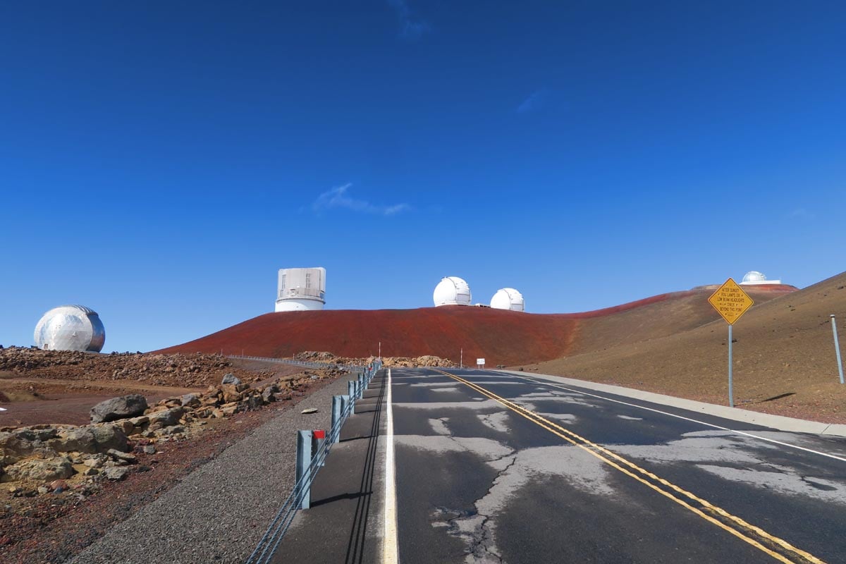
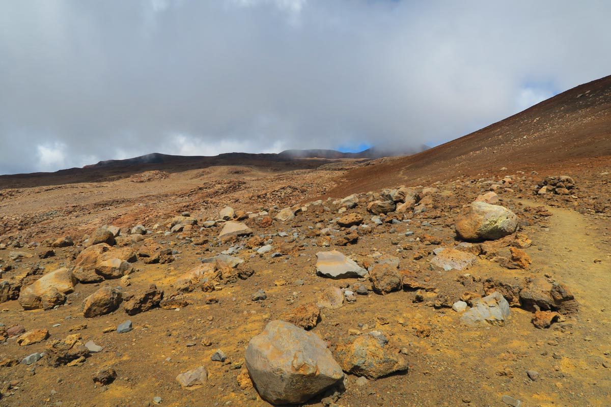
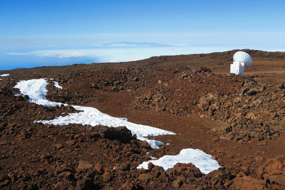
The summit trail is an uphill battle from the start, but the pain in your legs, shortness of breath, and often cold conditions (perhaps even snow) are constantly rewarded with superb Mars-like views. Along the way, you’ll reach Lake Wai’au – the third-highest lake in the US and a peculiar site amid the desert landscape. You’ll feel extra tiny at the summit amid the giant telescopes and enjoy endless unobstructed views. The hike can be combined with sunset viewing and stargazing at the visitor’s center.
Hi’ilawe Falls – Waipio Valley
Distance: ~4.5 miles (7 km) | Level: challenging | Time: ~5 hours
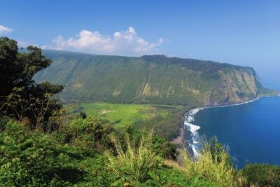
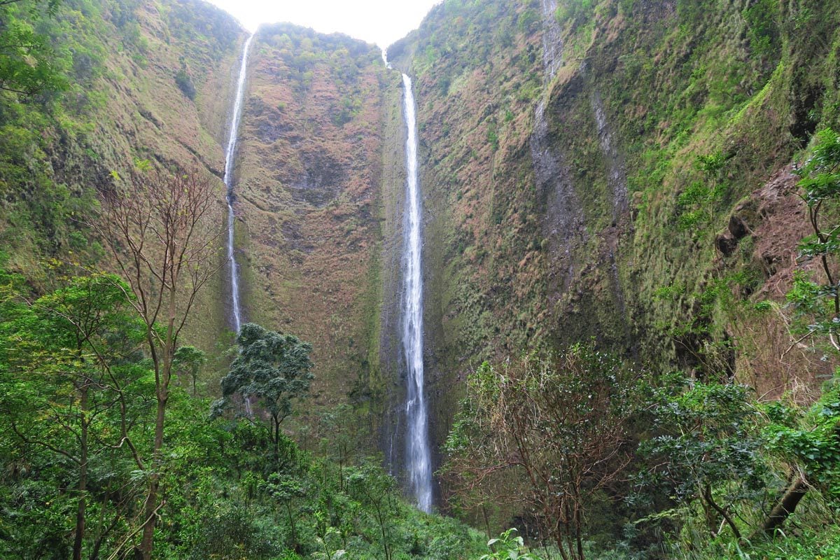
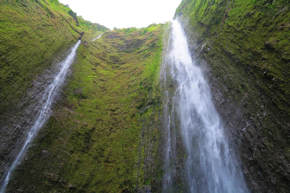
Majestic Waipio Valley is the most impressive in a series of deep valleys on the Big Island’s remote northeastern coast. Slicing inland for over 10 km of thick jungle, freshwater streams, and giant waterfalls, Waipio Valley is also known as “The Valley of the Kings” and holds significant importance in native Hawaiian culture.
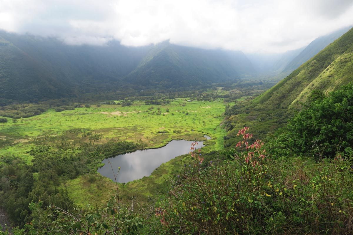
The valley is the setting for a number of great hikes, such as the multi-day Muliwai Trail. But for the ultimate adventure, hike to the spectacular Hi’ilawe Falls (1450 ft, 442m). Unfortunately, the trail to the falls runs on private land. You must ask permission from local residents to hike, but there’s only a slim chance they’ll allow it. Alternatively, walk to Hi’ilawe Falls Lookout to admire from a distance.
Green Sand Beach
Distance: ~5.6 miles (9 km) | Level: moderate | Time: ~3-4 hours including beach time | Trail Map
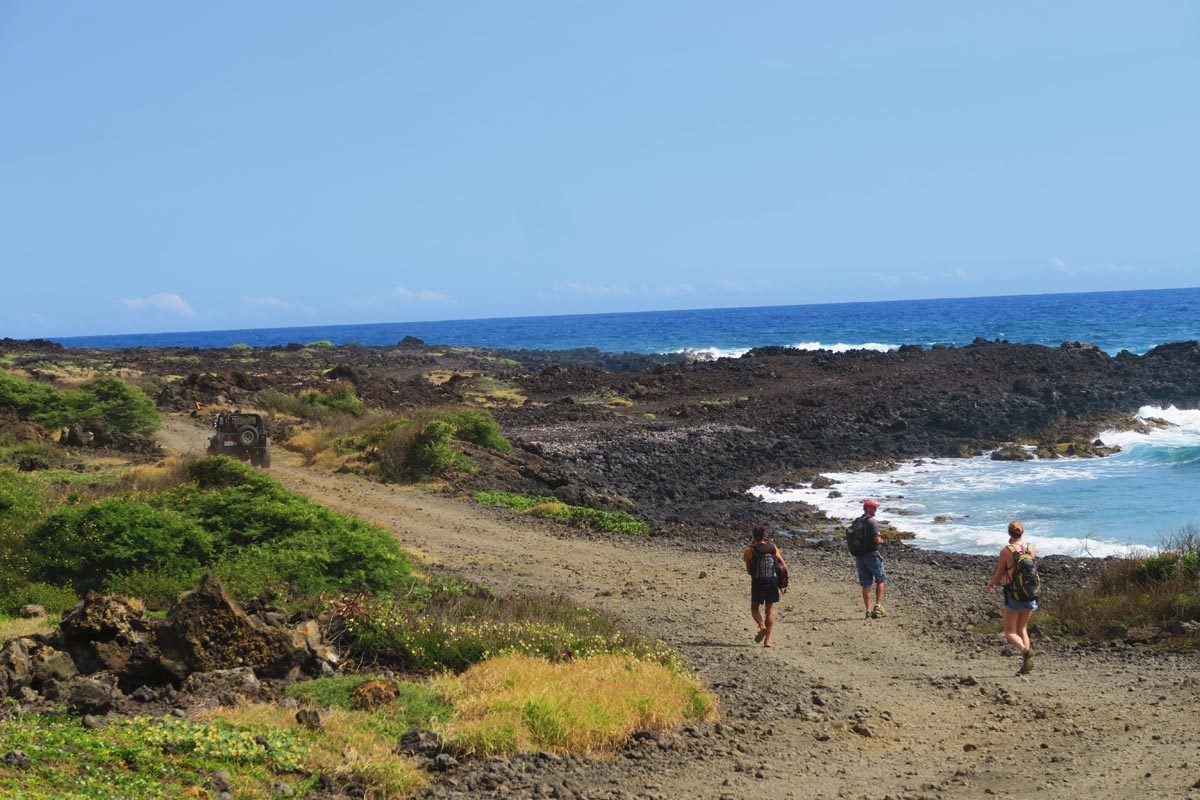
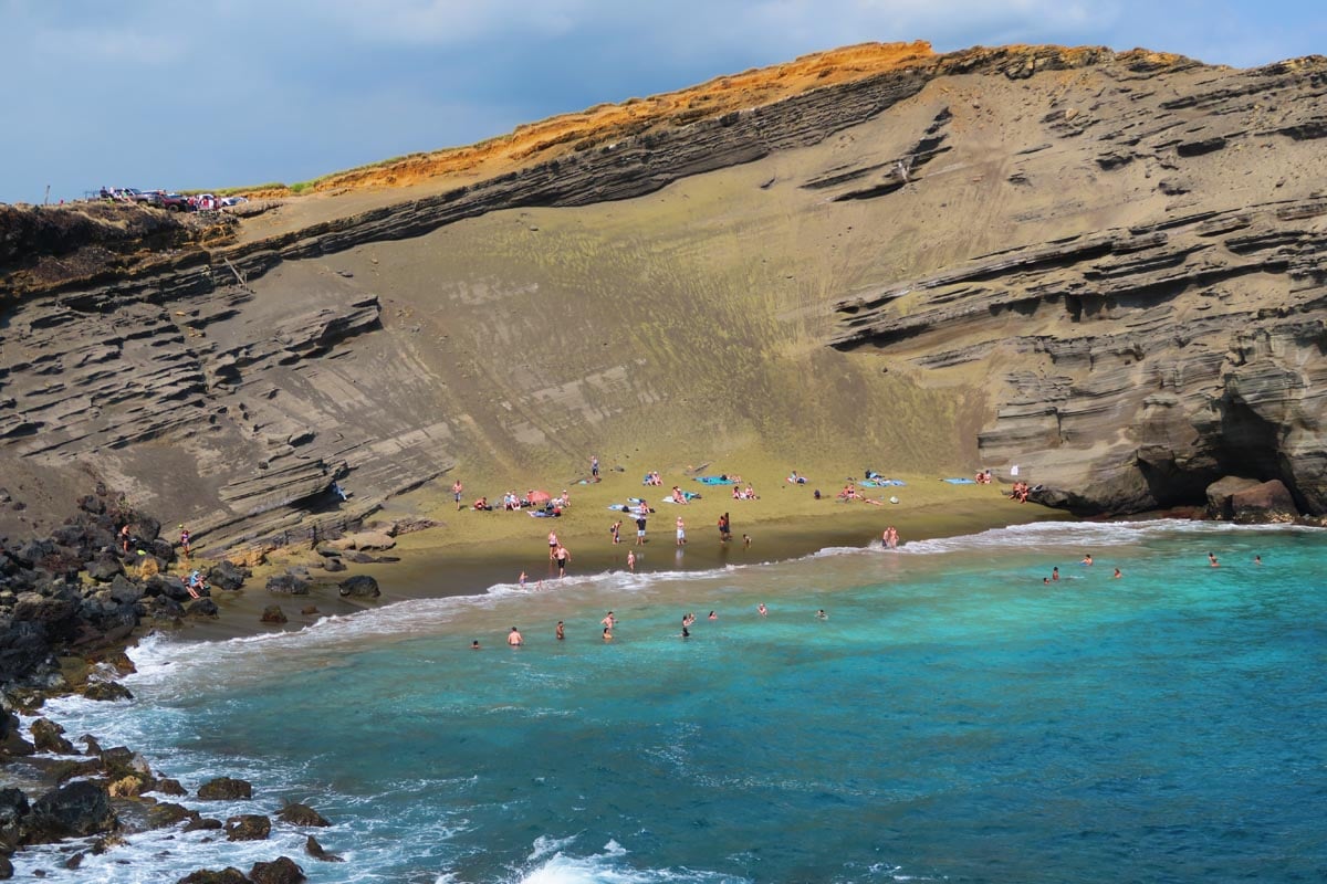
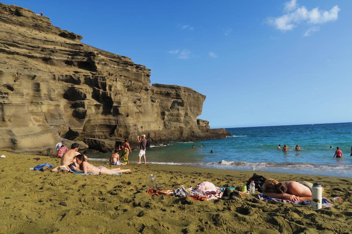
Officially known as Papakolea Beach, Green Sand Beach owes its fame to the unique composition of its eroded soil. The Green Sand Beach is located “way out there” in the South Point Peninsula – the southernmost point in the 50 states. Due to the fragile natural environment, hiking is the only way to reach Green Sand Beach. The trail runs along the coastline and is relatively easy, albeit long.
Kilauea Iki Trail
Distance: 4 miles (6.5 km) | Level: moderate | Time: ~2.5 hours | Trail Map
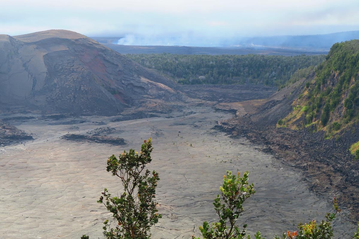
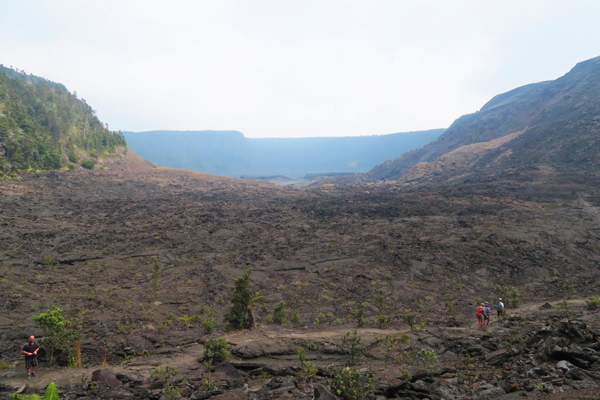
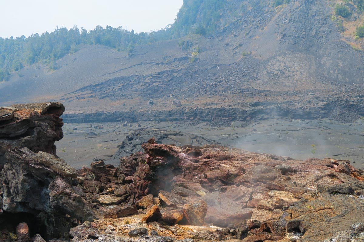
If there’s only enough time for one activity during your visit to Hawaii Volcanoes National Park, invest it at Kilauea Iki. This memorable trail takes you to “the moon and back.” The Kilauea Iki hike traverses a diverse landscape, starting from a misty rainforest and heading down to a steamy crater floor before climbing back to the top via a different section of the same forest. On the crater floor, you’ll feel tiny and awestruck at the sight of steam vents popping out of the ash-covered ground from every corner. This is a stark reminder that the Kilauea Volcano is alive and kicking.
Kalapana Lava Viewing
Distance: ~5 miles (8km) | Level: moderate | Time: ~3 hours | Trail Map
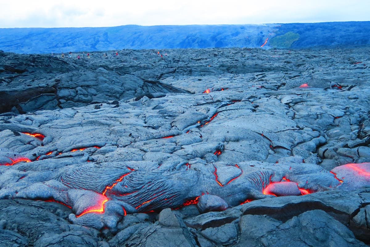
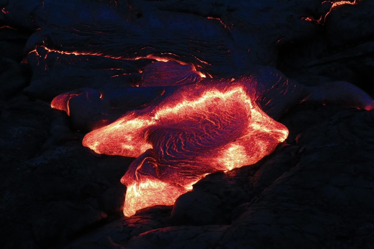
This trail might still be closed by the time you visit, but it’s worth researching to see if things have changed. The Kalapana Lava Viewing area brings you as close as possible to fresh lava flows from Kilauea. Because the eruption and lava flow are never static, this spot might not be relevant in the future for lava viewing, regardless of whether it has officially reopened.
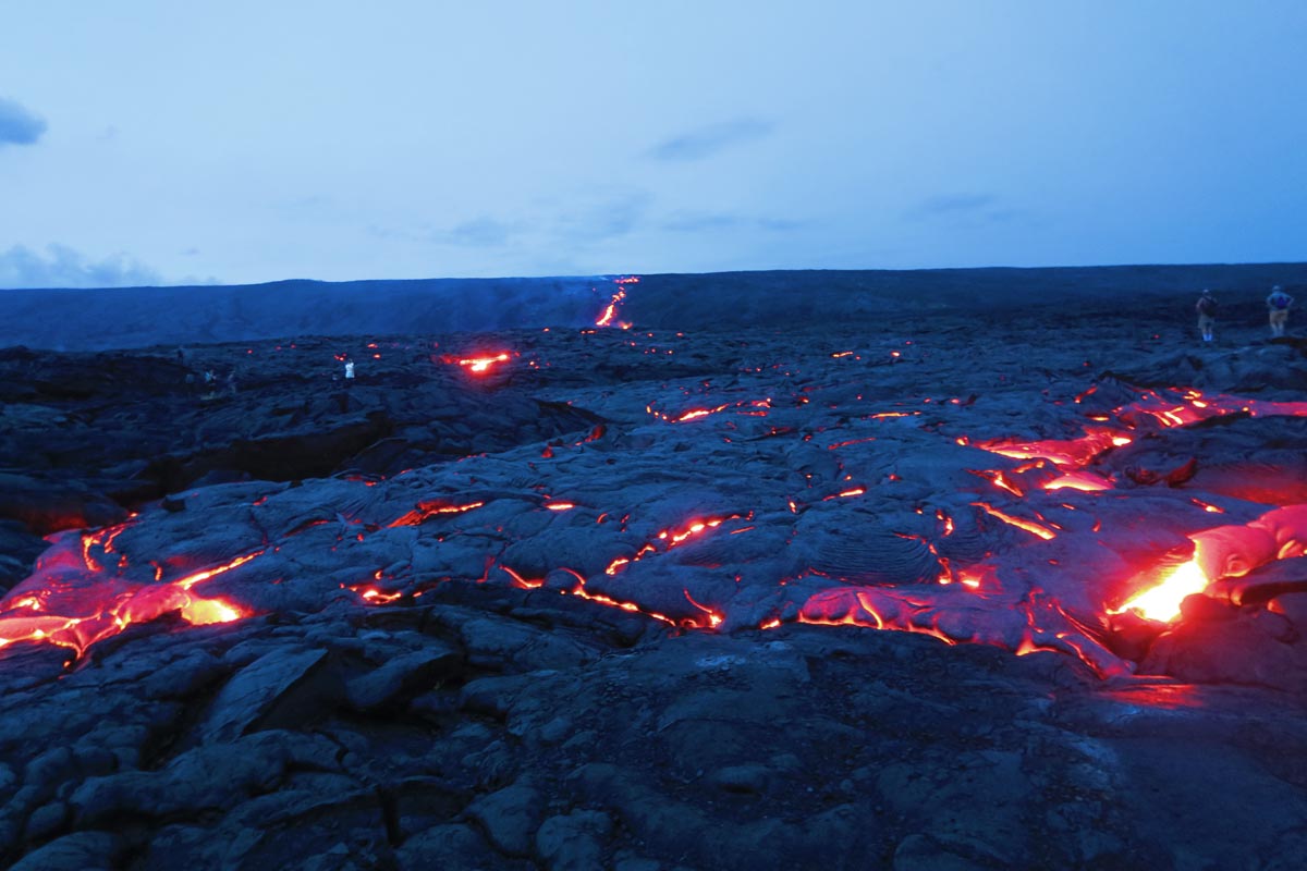
During my visit, you could either hike or rent bicycles to reach the lava flow. It was a long walk or ride, but the experience was thrilling. As you can see, there was nothing between you and a river of fresh lava. The trail ended just before the famous lava waterfall, where the lava river had nowhere left to go but tumble into the Pacific Ocean.
Best Kauai Hikes
Kauai is perhaps the most stunning island in Hawaii, an island famous for its eroded emerald peaks and fertile valleys. A visit to “The Garden Isle” is all about the outdoors, so finding some of the best hikes in Hawaii right here in Kauai isn’t surprising.
Kalalau Trail
Distance: 22 miles (35km) or 4-8 miles (6-13km) | Level: challenging | Time: 5+ hours | Trail Map
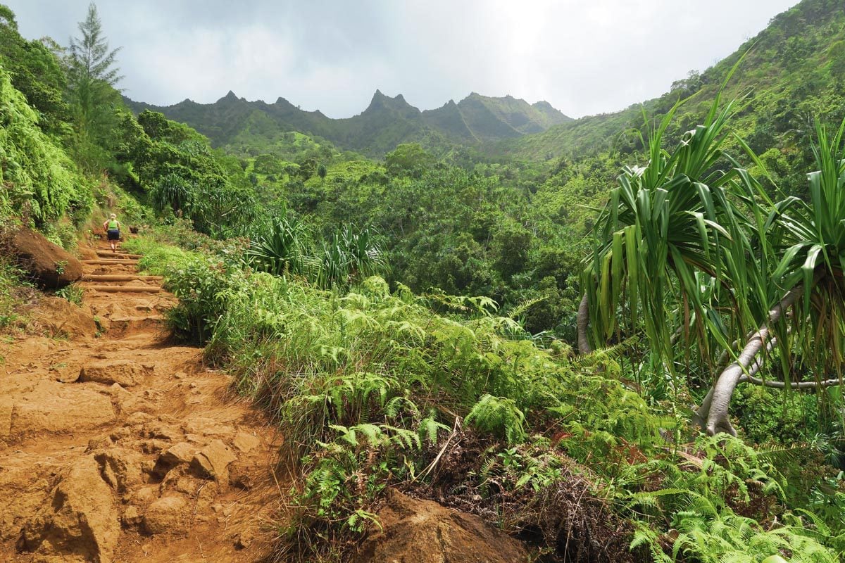
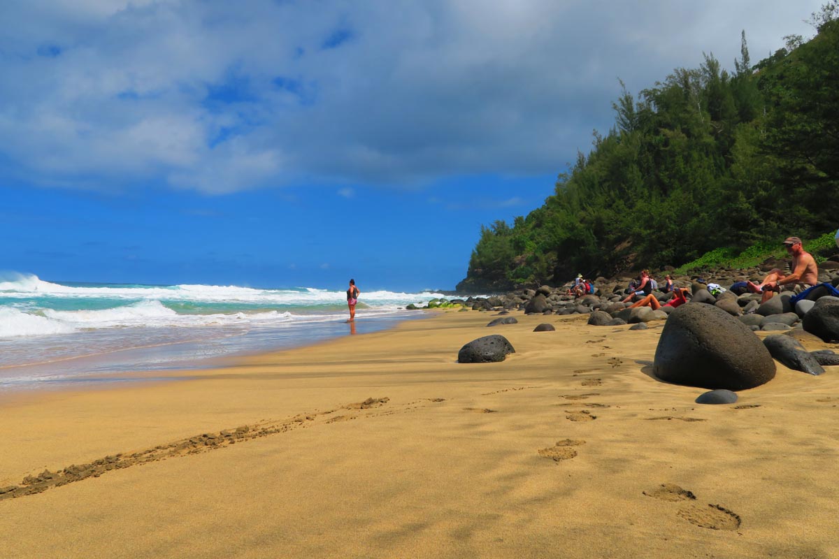
Hailed as the “most incredible hike in America”, the Kalalau Trail leads hikers atop the famous Na Pali Coast. This is Kauai’s signature feature, in which eroded cliffs rise out of the Pacific like jagged teeth of a deadly shark. Hikers must obtain a permit to complete the trail, but if you’re only doing a section of the Kalalau Trail, just make advanced reservations to enter Ha’ena State Park.
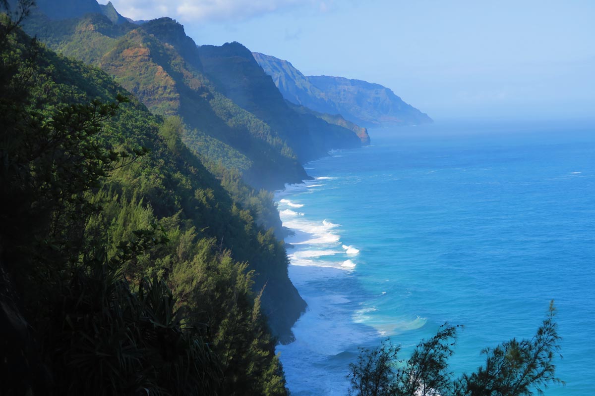
The Kalalau Trail‘s first section, from Ke’e Beach to Hanakapi`ai Beach, is also its busiest. It reaches the rugged beach via a series of wet gulches and sweeping coastal views. After a picnic lunch, permit holders continue “all the way” to Kalalau Beach via the trail’s most challenging section. Day hikers can return to the trailhead or continue the adventure with an inland detour to Hanakapiai Falls.
Awa’awapuhi Trail
Distance: ~6 miles (9.5 km) | Level: moderate | Time: 3-4 hours | Trail Map
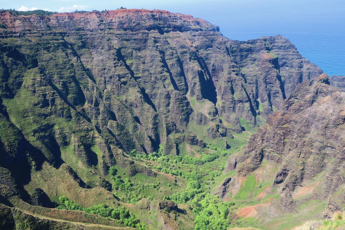
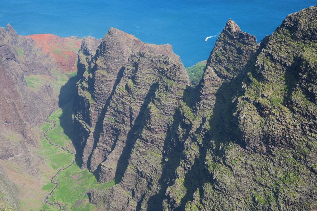
For the “best seat in the house,” head to Koke’e State Park high above the Na Pali coast. The Awa’awapuhi Trail has a modest beginning, with nothing too fancy until you reach the scenic overlook. If it’s possible and you feel safe, take a few more steps and grab a seat on a perfectly positioned rocky ledge. This is the best seat in Kauai.
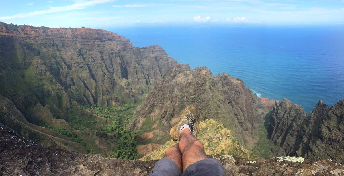
Sitting up here makes you feel like the master of the universe with the entire valley beneath your feet. The views keep improving as the sun fully rises over the valley, revealing its beautiful colors and the unique contours of the eroded cliffs. Take note of the incredible acoustics of this spot. You can clearly hear people chatting on the boats nearing the cliffs and even animals in the valley below.
Mahaulepu Heritage Coastal Trail
Distance: ~4 miles (6.5 km) | Level: moderate | Time: 3-4 hours | Trail Map
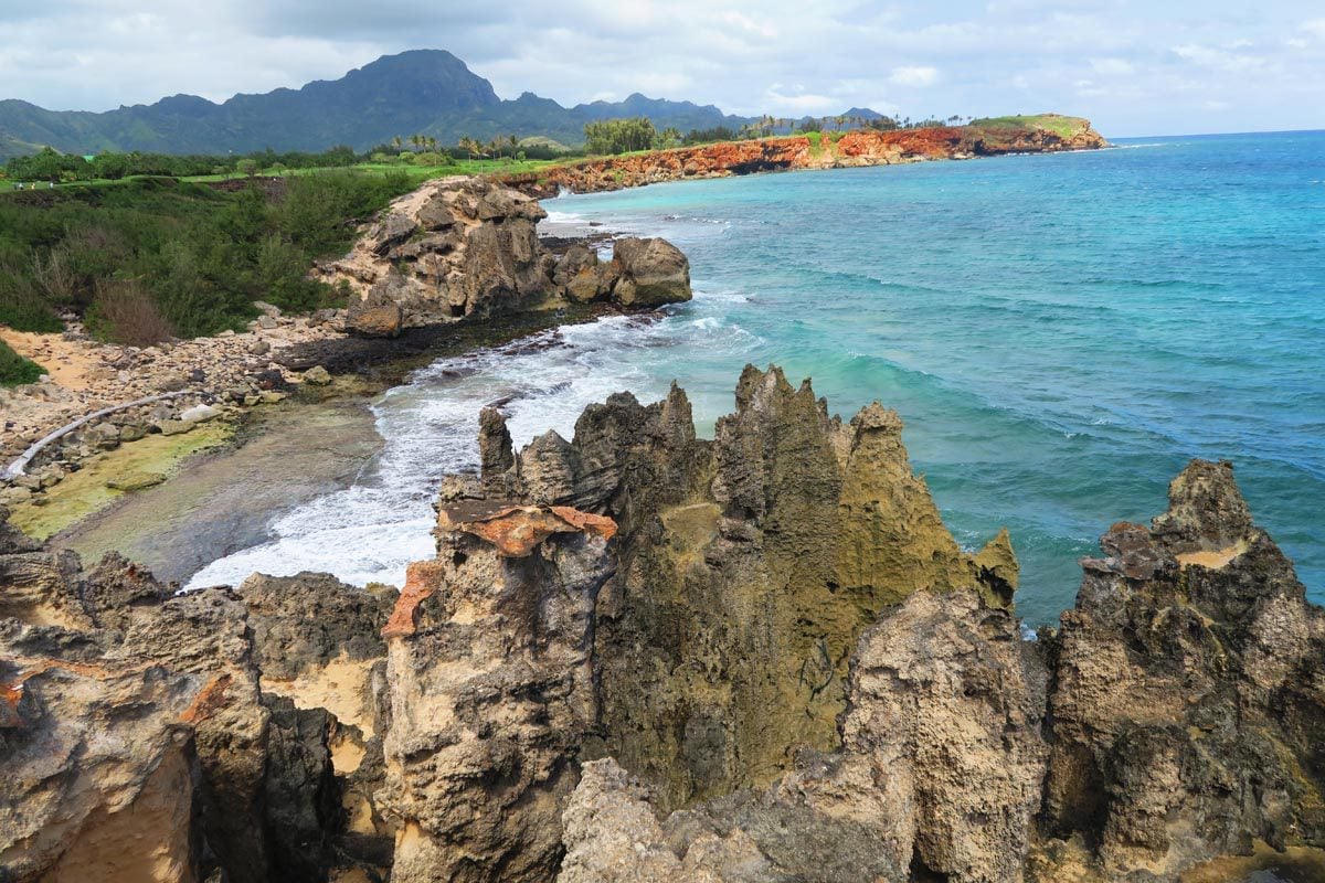
On an island so frequented by visitors, it’s nice to know there’s one trail where you might have nature all to yourself. Running along the rugged coastline between Shipwreck and Ha’ula Beaches, the Mahaulepu Coastal Trail rewards hikers with stunning south shore views. Along the way, you’ll pass hidden coves protected by sharp limestone pinnacles, ancient Hawaiian relics, and maybe even schools of sea turtles coming up for air. Hikers who make it to Mahaulepu Beach enjoy the beautiful off-the-beaten-track beach. You can and also check out Makauwahi Cave – one of the richest fossil sites in Hawaii.

In late 2024, the Makauwahi Cave closed until further notice. Check the official website for updated before planning your visit.
Cliff & Canyon Trails – Waimea Canyon
Distance: 3 miles (4.8 km) | Level: moderate | Time: ~2 hours | Trail Map
It’s hard to believe a natural wonder like Waimea Canyon can exist on such a small island like Kauai. Waimea Canyon is certainly worthy of its nickname, “The Grand Canyon of the Pacific”. Formed in ancient times by the collapse of Kauai’s shield volcano and subsequent millennia of rainfall and erosion, the red canyon follows the bending contours of the Waimea River for over 10 miles and, in certain sections, at a depth of over 3,500 feet (over 1,000m).
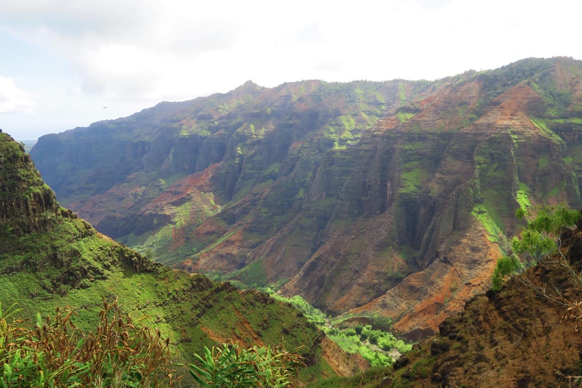
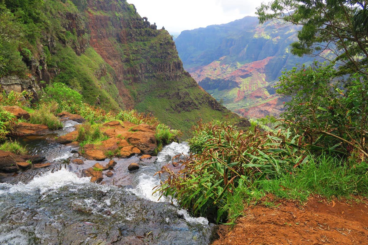
The Cliff and Canyon Trails form a relatively short hike that’s easily combined with the scenic Waimea Canyon Drive. The trail leads hikers 400 feet down into the canyon to an exposed red-soil hill that offers a unique vantage point. Continue a few steps further and reach the top of Waipo’o Falls, usually only seen from distant overlooks on the scenic drive.
Best Molokai Hikes
After Lanai, Molokai is the Hawaii’s least visited main island. It’s a sparsely populated gem where over 50% of residents possess native Hawaiian heritage. Molokai is a top choice for nature lovers, home to the tallest sea cliffs in the world and nature that is often yours.
Kalaupapa Peninsula Hike
Distance: 4.2 miles (7 km) | Level: challenging | Time: 2 hours | Trail Map
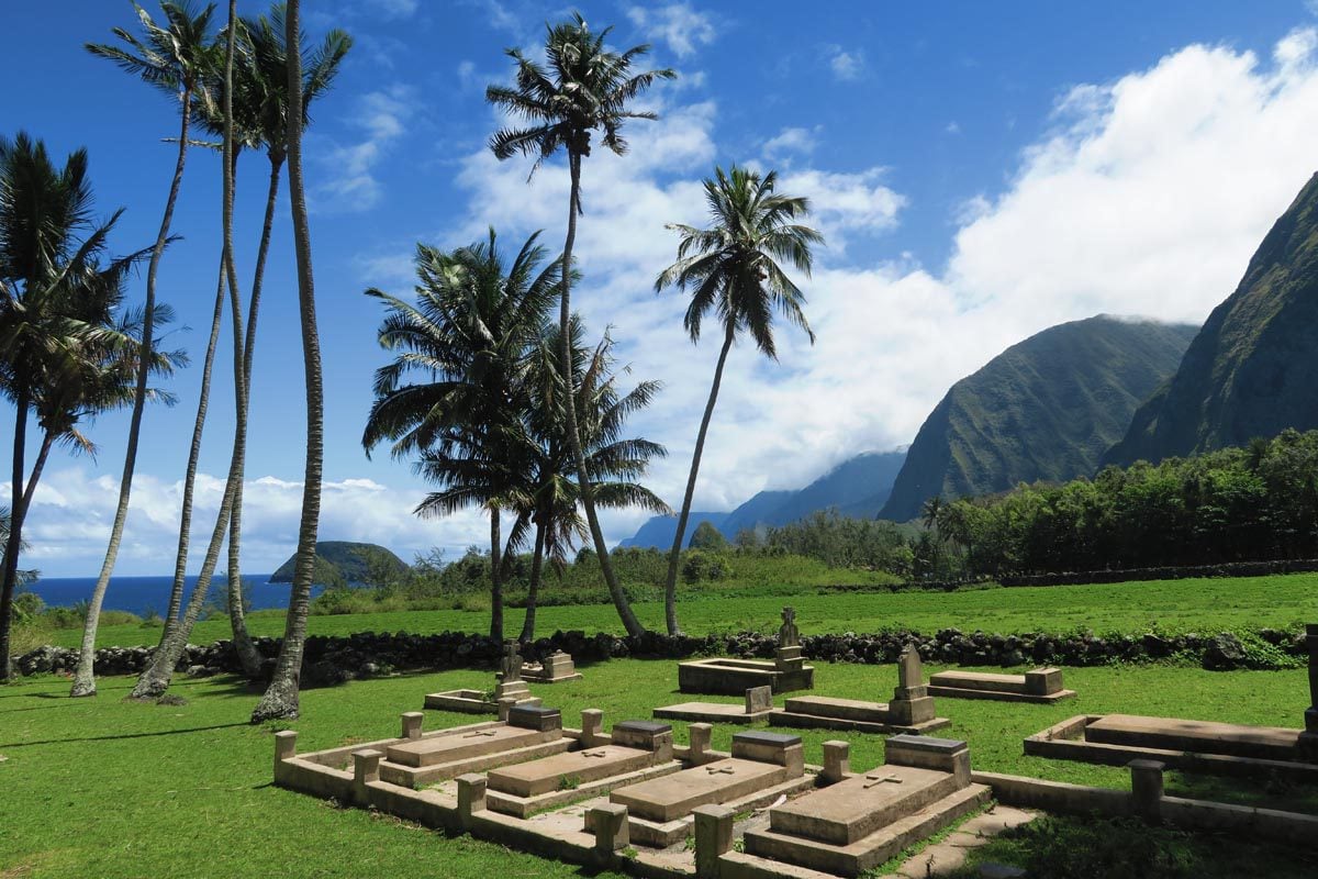
The Kalaupapa Peninsula is the most isolated section of Hawaii’s isolated island. It is a place of dramatic natural beauty and the site of a tragic episode in modern Hawaiian history. In an effort to curb the spread of the leprosy virus, Kalaupapa was designated as a (forced) quarantine zone between 1866 and 1969. Patients were free to leave when a cure was discovered, but some stayed in the only home they’d ever known.
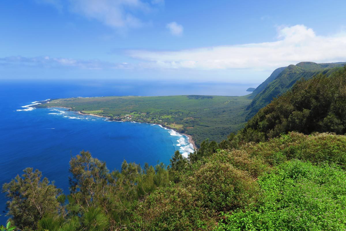
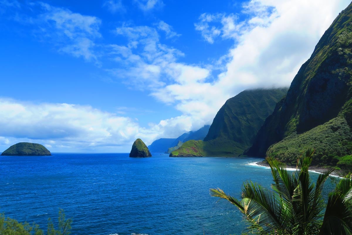
These days, only a dozen or so residents live in Kalaupapa National Historical Park but this is no ordinary park, as visitors must obtain a special permit to enter the former leper colony. The hike or mule ride (check opening status) down from “the topside” involves a descent of 1,664 feet (~500m) via 1,400 steps and 26 switchbacks. What’s on the menu? Uncover the remarkable story of Kalaupapa as you visit key sites, maybe meet a resident, and visit Kalawao – on the rugged windward side of the peninsula – where spectacular views of Molokai’s Pali Coast are simply the best!
Halawa Valley Hike
Distance: 4.2 miles (6.8 km) | Level: easy | Time: ~2-3 hours | Trail Map
Fertile Halawa Valley was once home to over 1,000 residents who lived off the lush land and mainly grew taro. Following a 1946 tsunami, very few off-the-grid dwellers stuck around in the most isolated of Molokai’s “neighborhoods”. The guided hike in Halawa Valley brings you as close as possible to sampling life in “old Hawaii”.
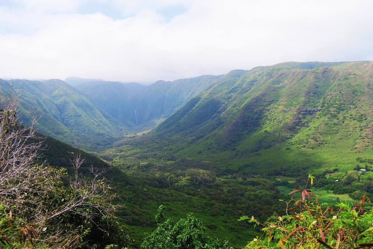
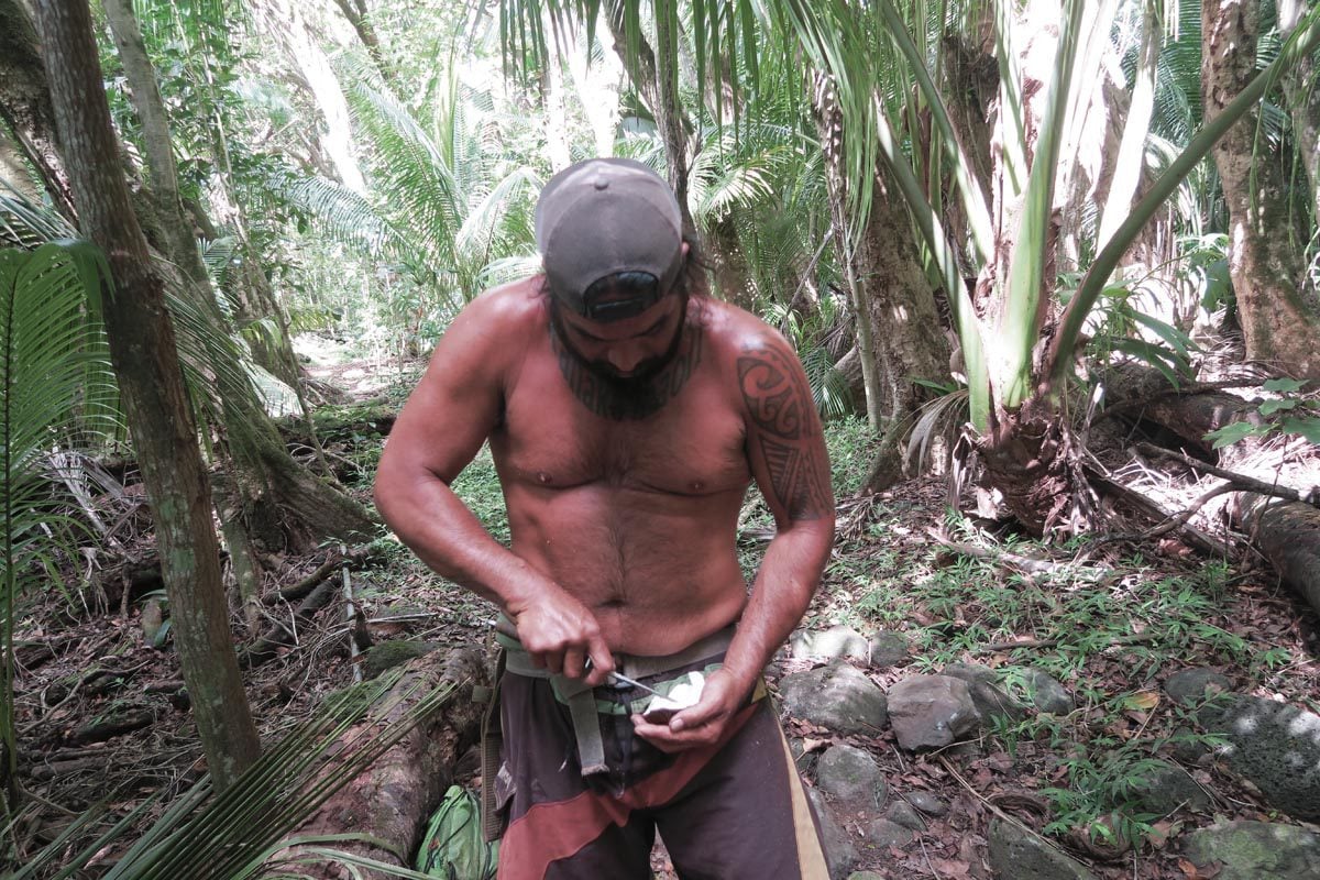
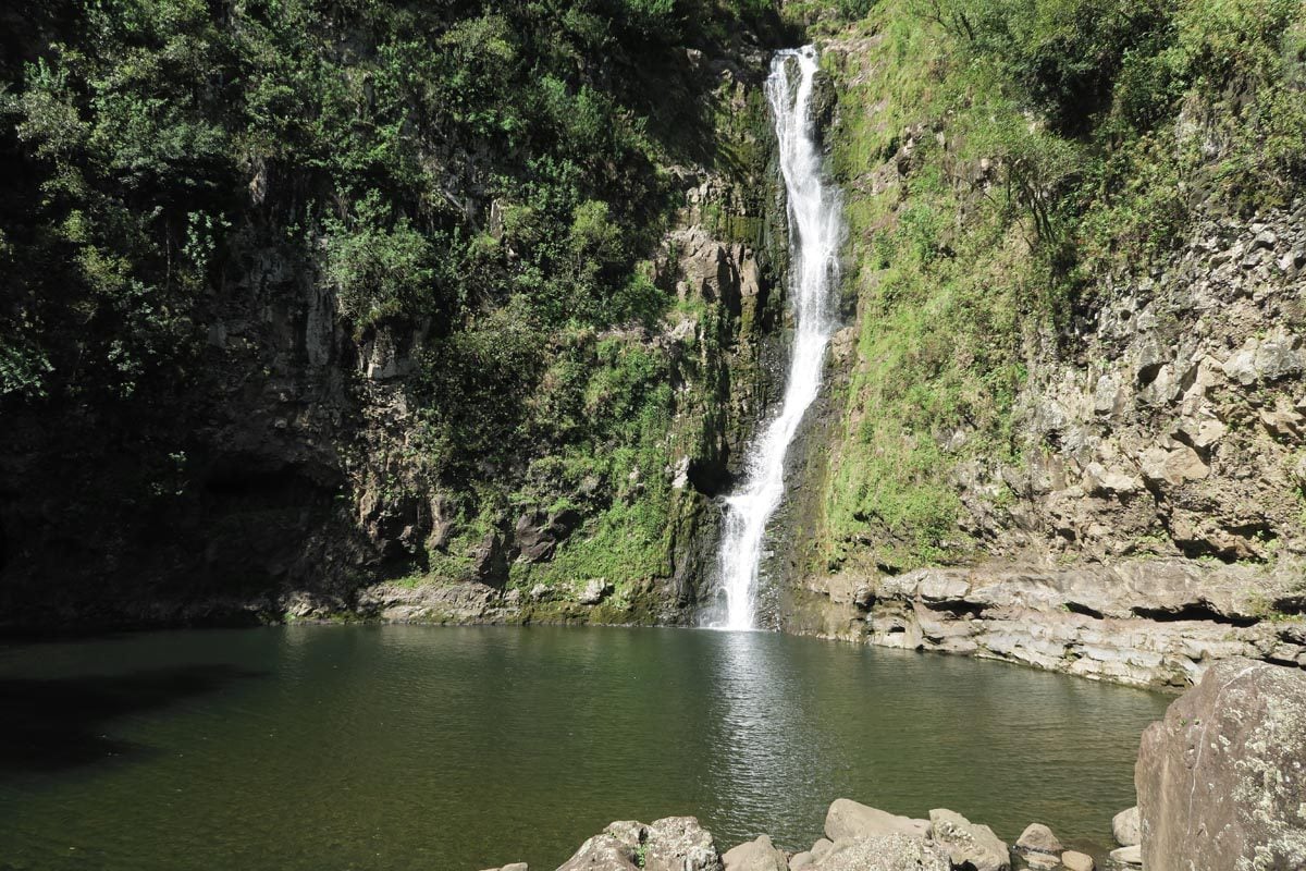
As you hike atop the banks of the Halawa Stream, your guide points out to the valley’s endless supply of food, from river shrimp to papaya, jackfruit, medicinal plants, and even coffee. With every step you take, the sacred mana is also felt, as ancient sacrifice temples lurk from just about everywhere. The hike ends with a refreshing dip at the source of Moa’ula and Hipuapua Falls, which you reach in a mad dash after spotting them from a distance as if you’ve just discovered the final piece of a treasure map. Once out of the valley, grab a picnic lunch and spend the rest of the day at Halawa Beach Park.
PepeOpae Bog Trail
Distance: 3 miles (~5 km) | Level: easy | Time: ~4-5 hours (including scenic drive) | Trail Map
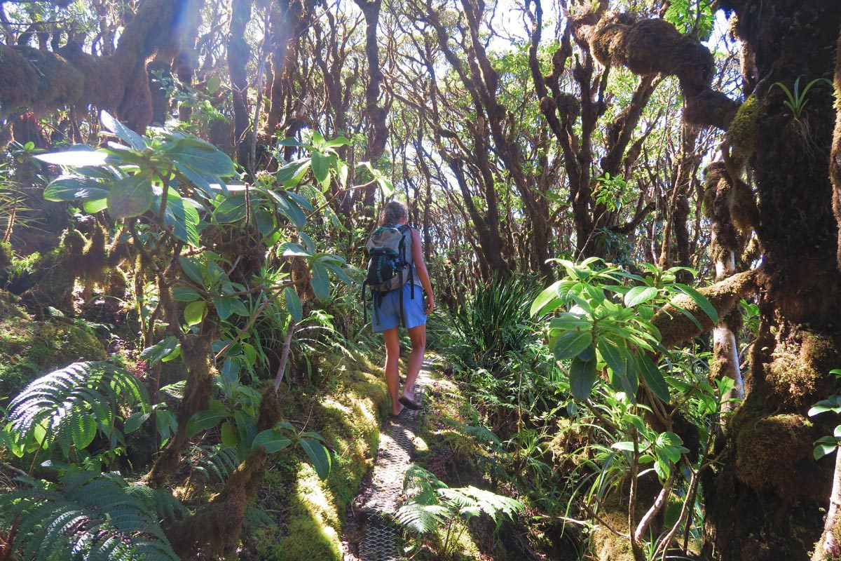
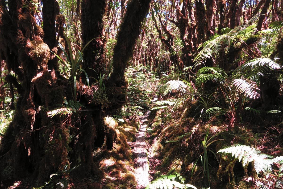
Like stepping into the set of a Lord of the Rings sequel, hiking in the cloud forest of Molokai’s Kamakou Preserve is a fairytale experience. Requiring a proper 4WD to reach the trailhead, the PepeOpae Bog Trail begins on a metal-covered wooden boardwalk over who-knows-how-many centuries of rotting vegetation and rainfall. Along the way, spongy moss-covered ohia lehua trees arch over your head, their sweet red flowers a magnet for apapane songbirds who cheer you on.
A few more surprises later, you reach the jaw-dropping Pelekunu Valley Overlook. Across the valley are Molokai’s highest peaks, often covered in clouds. To your left, the deep chasms of the valley meet the blue of the Pacific Ocean. If it has been raining lately, you’ll be treated to a symphony of cascading waterfalls, but, in any case, this is a pretty good spot to park it for a couple of hours, have a picnic lunch, and count your blessings.
Best Maui Hikes
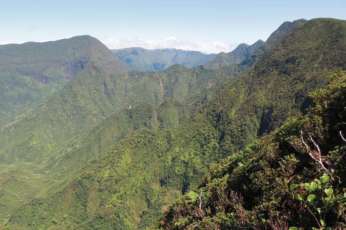
One of the most visited islands in Hawaii, Maui enjoys exceptional global fame as one of the top tropical destinations. Though its beaches are surprisingly nothing to write home about, “The Valley Isle” does reward those who work up a bit of a sweat.
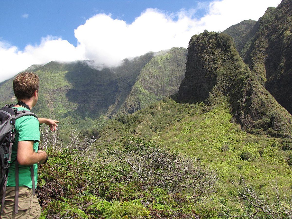
“The Needle” in Iao Valley
Distance: 0.5 miles (~1 km) | Level: easy | Time: ~30 mins | Trail Map
Carved over the course of millennia by the eroding forces of water, “The Needle” is the crown jewel of Iao Valley State Park (advanced reservations required). Like several spots in Hawaii, the Iao Valley is one the world’s wettest places. Rising to a height of 2250 ft (696m), the Needle is Maui’s unofficial icon and the subject of millions of photos. More of a walk rather than a hike, viewing areas of the “The Needle” are reached via a short walk from the parking lot.
Sliding Sands Trail
Distance: ~11 miles (18 km) | Level: challenging | Time: ~5+ hours | Trail Map
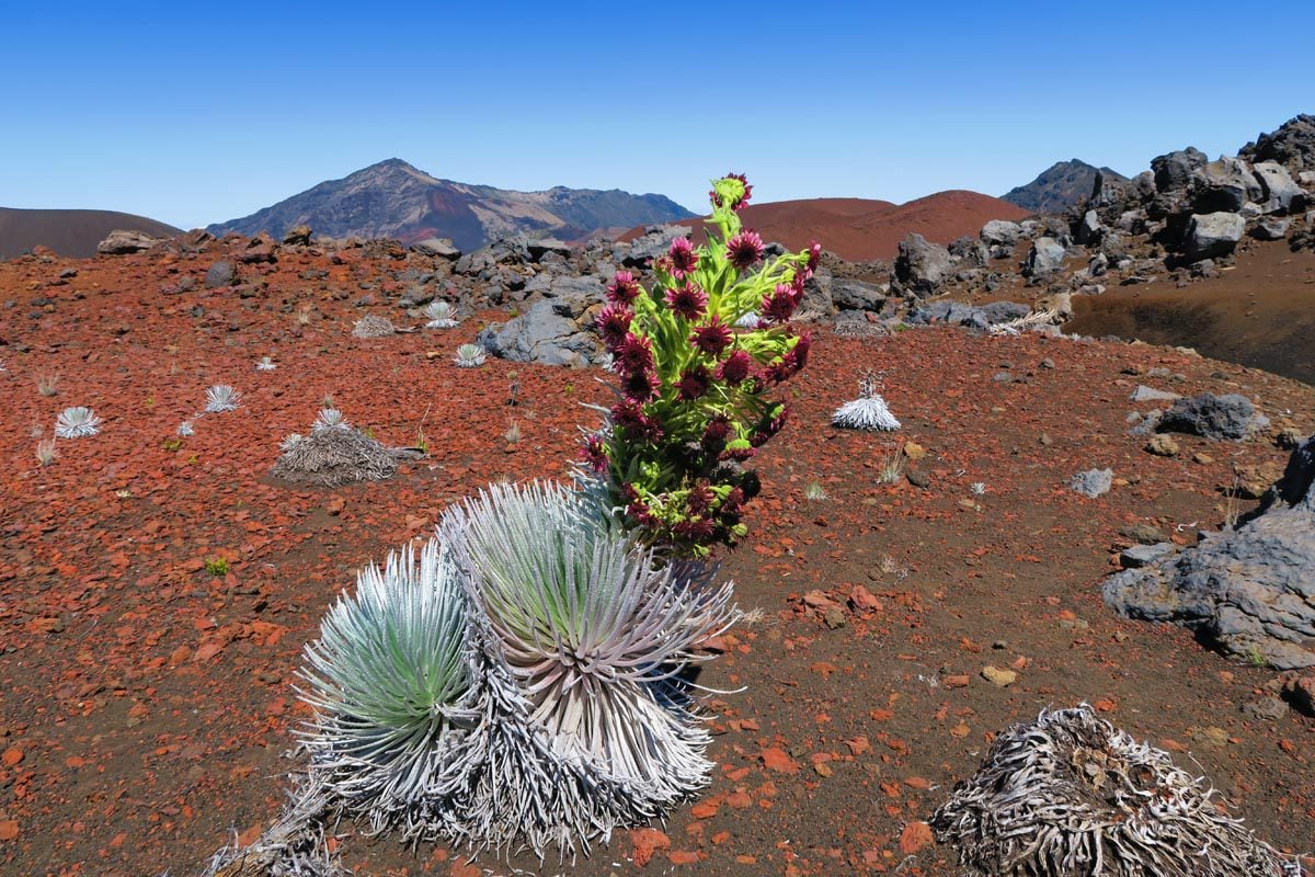
Maui’s crown jewel, this section of Haleakala National Park, makes it hard to imagine that you flew to a tropical island. Haleakala is the volcano that created East Maui. It is so immense that it’s roughly the size of Manhattan! Known as “the world’s largest dormant volcano”, Haleakala reaches a height of 10,023 ft (3,055m) and is responsible for much of the bizarre weather on the island. Its accessible summit is a magnet for early risers, space scientists, and ferocious winds, while its crater is a heaven for hikers.
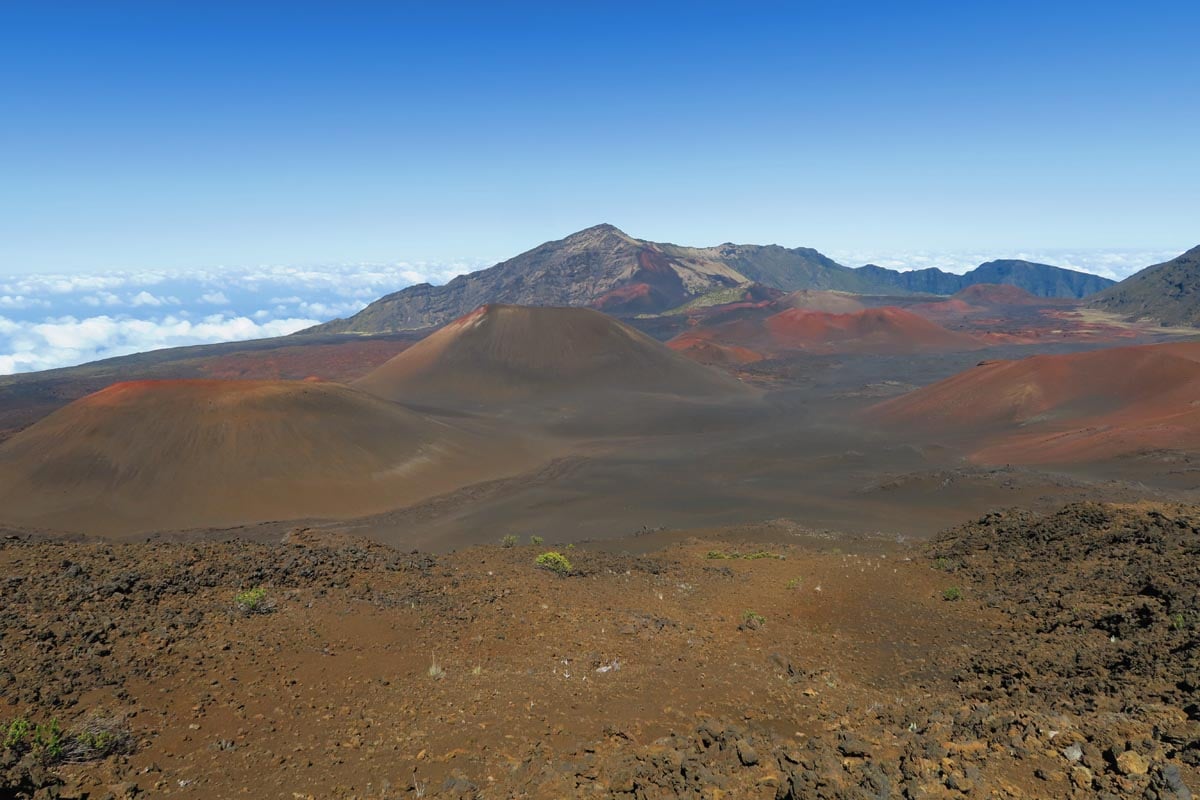
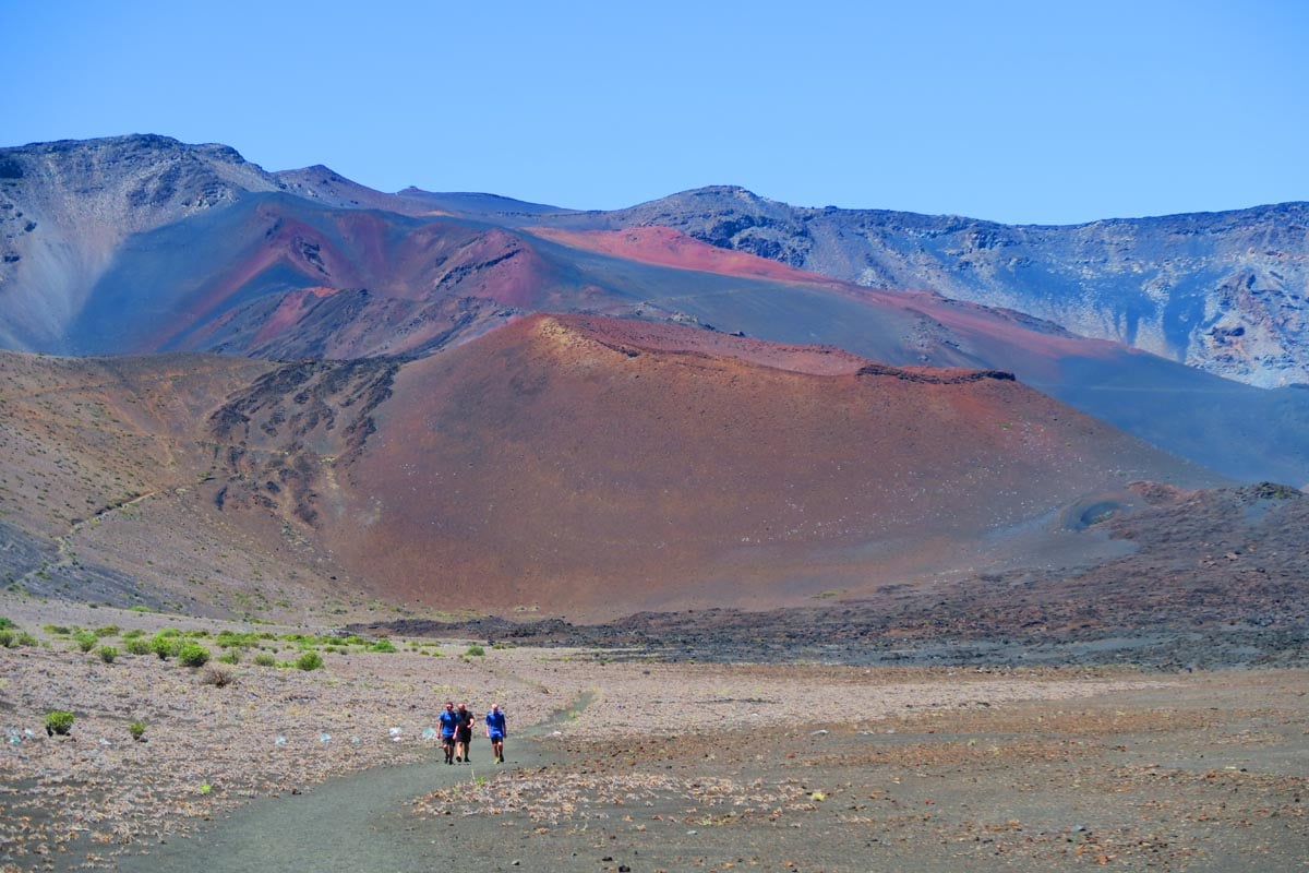
The best way to experience Haleakala is by hiking all or part of the Sliding Sands Trail. The challenging hike leads you down to the crater floor and offers a unique look at Haleakala’s magnificent red shades, unique flora, and bizarre cinder cones. Day hikers can hike to the crater floor and explore some of its sections before returning to the trailhead.
Pipiwai Trail
Distance: 3.4 miles (5.5 km) | Level: moderate | Time: ~1.5-2 hours | Trail Map
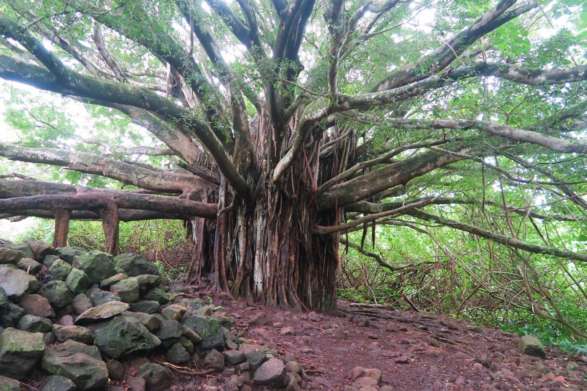
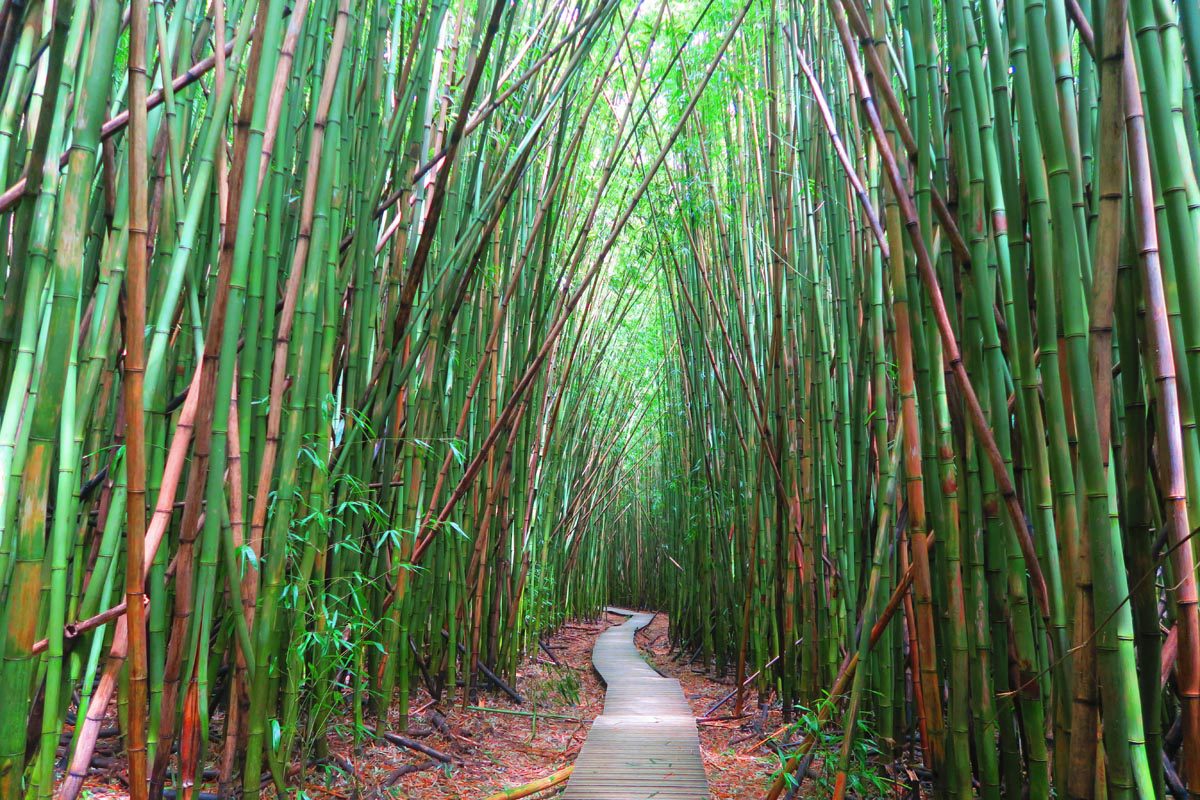
Part of the tropical Kipahulu section of Haleakala National Park, the Pipiwai Trail has many tricks up its sleeve. After a brief climb amidst guava and banyan trees, enter the magic of the bamboo forest as you walk along a raised wooden boardwalk to the tune of thousands of giant bamboo trees cracking in the gentle wind. Visibility into the forest’s interior is impossible; it is not the kind of place you want to get lost in. The density of the giant bamboo is extreme, and its uniform structure and color play tricks on the eyes. It’s a bizarre scene, further amplified when you have the trail all to yourself.
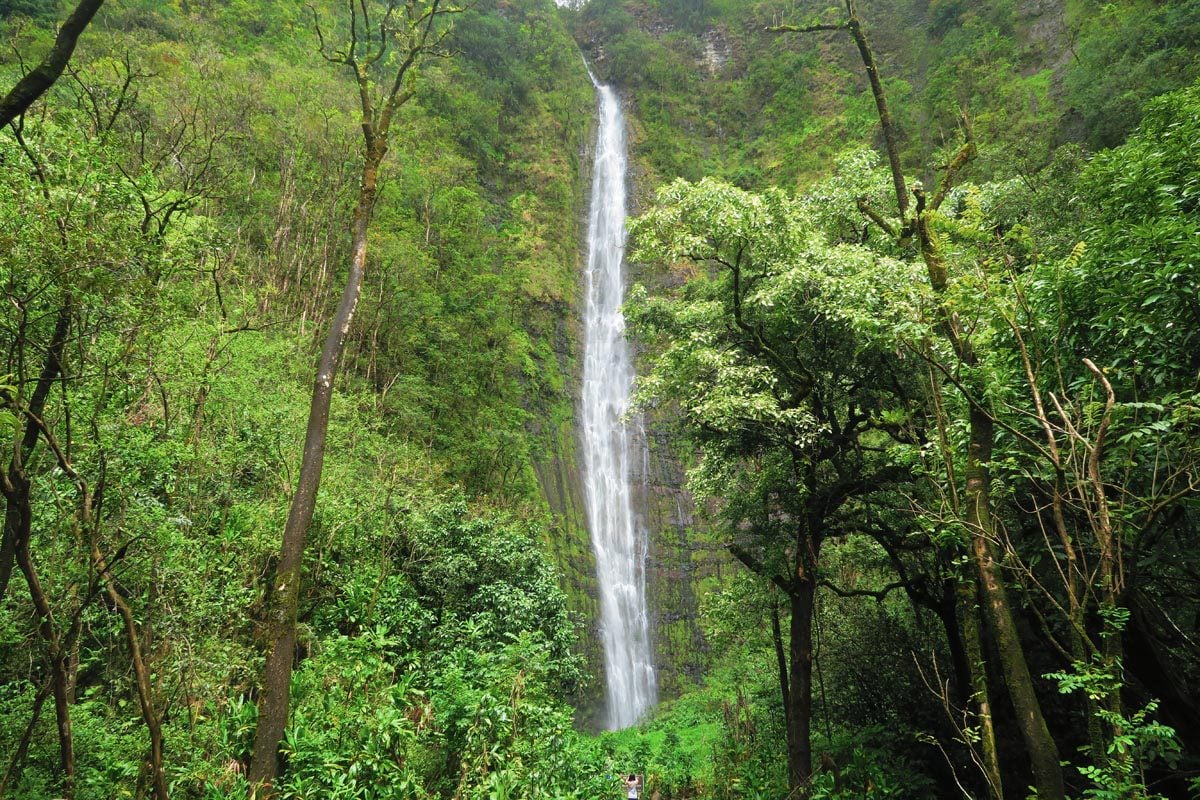
But that’s just the beginning… The Pipiwai Trail reaches a climax when you exit the bamboo forest and reach the 400-foot Waimoku Falls. Once more, you feel tiny when staring up at the column of water that violently splashes into a pool. It’s a waterfall that has claimed the lives of a number of hikers who did not adhere to the warning signs asking to “look but stay dry”.
Waihe’e Ridge Trail
Distance: 4 miles (6.4 km) | Level: challenging | Time: ~3 hours | Trail Map
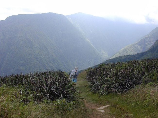
Reminiscent of the exceptional Mount Aorai hike on the island of Tahiti in French Polynesia, the Waihe’e Ridge Trail rewards hikers with diverse landscapes throughout the journey. Traversing through pristine rainforest and narrow ridgelines, enjoy sweeping views of Maui’s Central Valley and the windswept north coast. Be on the lookout for waterfalls in the distance, and watch out for falling fruit!
Best Oahu Hikes
Oahu is indeed the most populated island in Hawaii, but it is also one of the prettiest in the archipelago. A good way to block out the traffic and all the people is by heading into nature to explore Oahu’s rain forests and jagged peaks.
Manoa Falls Trail
Distance: 2.7 miles (4.3 km) | Level: Easy | Time: 1 hour | Trail Map
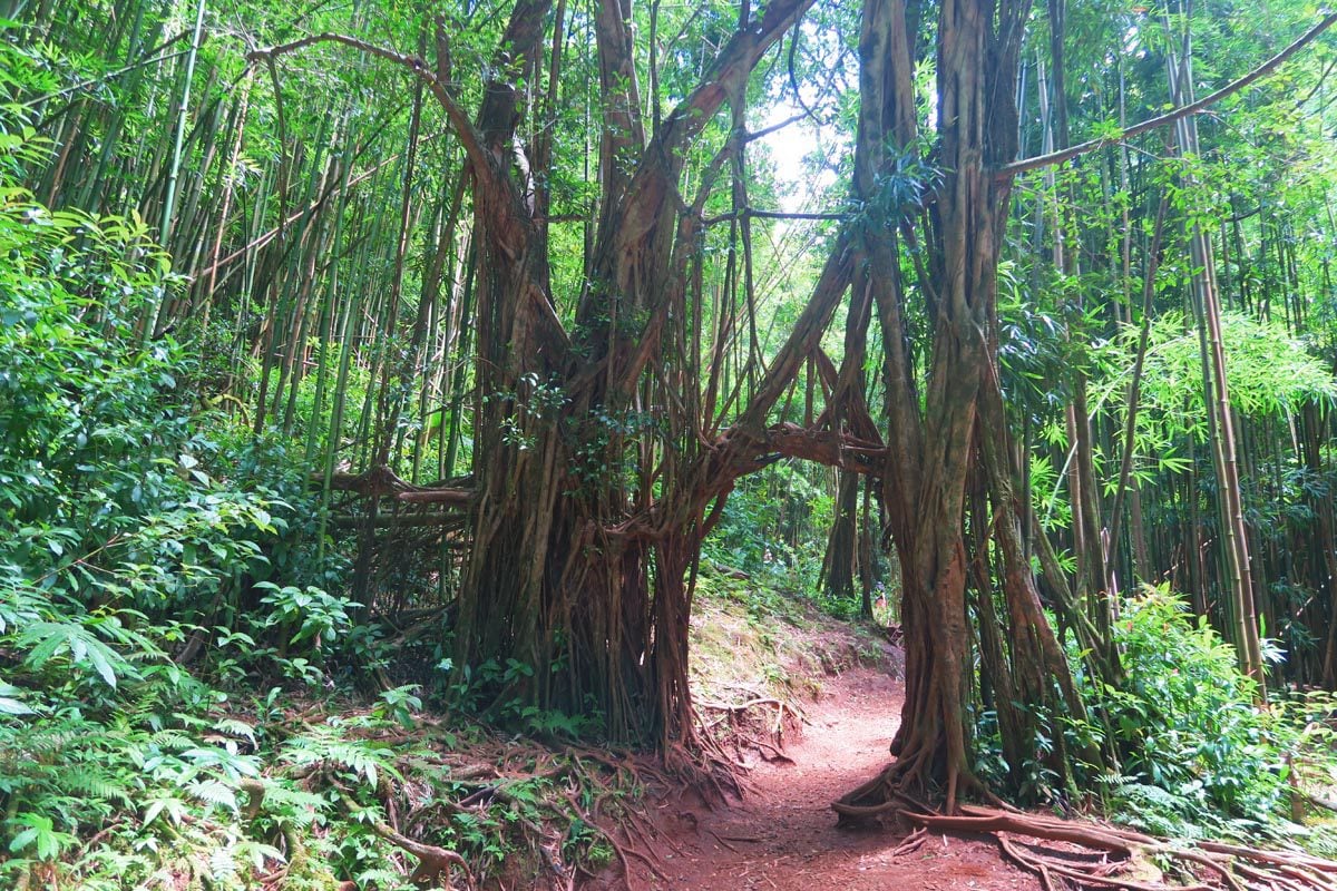
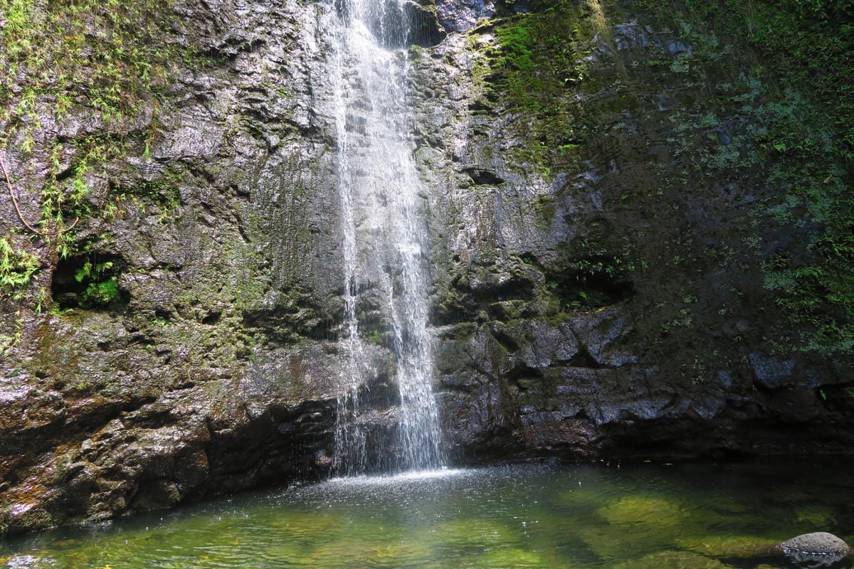
Manoa Falls may not be the most impressive in an island chain home to so many dreamy waterfalls (100ft, 30m), but since they’re just a few minutes from downtown Honolulu, you have to check them out with your own eyes. This is especially true if Oahu is your only stop in Hawaii. Reach the Manoa Falls trailhead via Tantalus Drive. This scenic road offers stunning panoramic views of Honolulu and Diamond Head.
Diamond Head Crater Hike
Total distance: ~1.9 miles (3.1 km) | Level: moderate | Time: ~2 hours | Trail Map
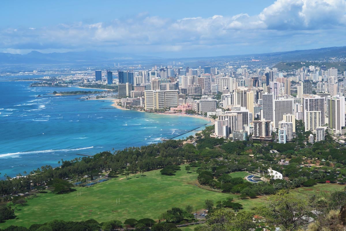
Overlooking Waikiki Beach, Diamond Head is Oahu’s symbol and Hawaii’s most recognized landmark (advanced reservations required). Blasted ash, coral, and other debris from an underwater volcanic eruption formed the crater. It was given its name by early Western explorers who mistook its calcite crystals for diamonds. Later on, U.S. forces erected artillery firing stations on the crater’s slopes and summit as part of Oahu’s coastal defense system.
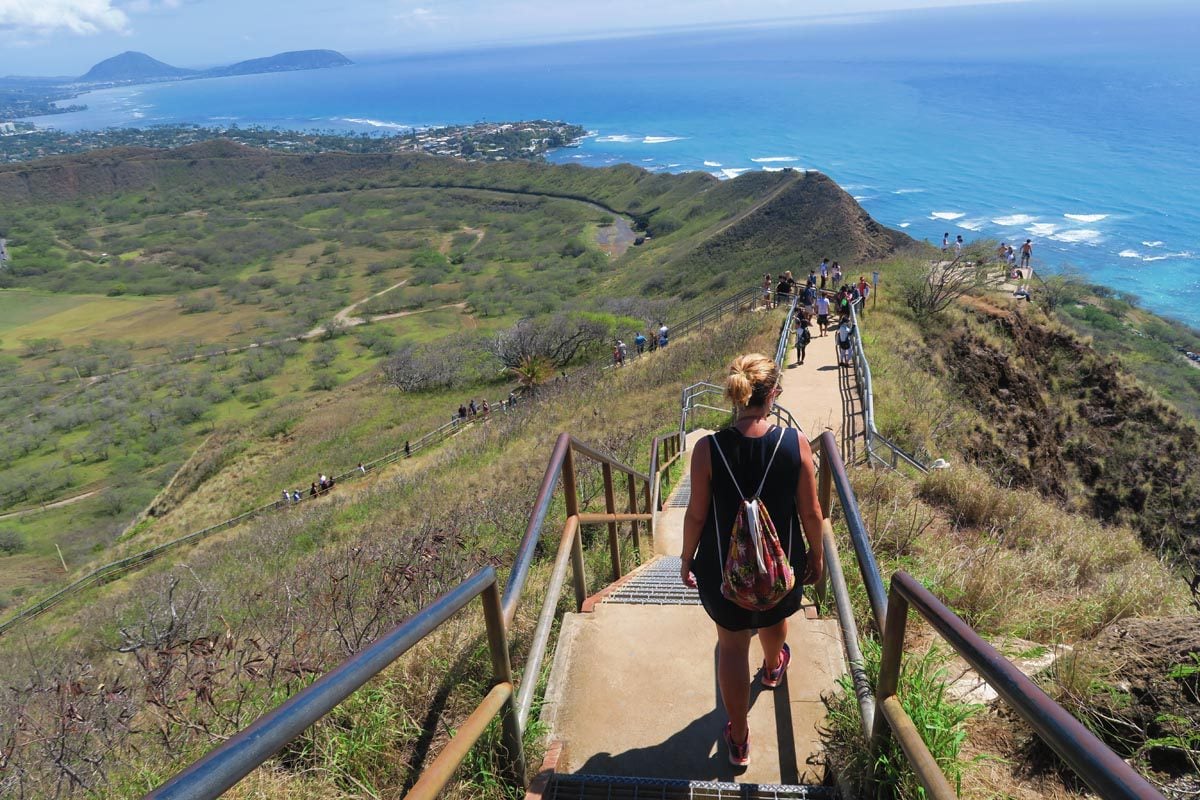
Hiking to the summit of Diamond Head is an absolute must. The unobstructed views of Waikiki Beach from its summit are the hallmark of any visit to the island, and from up here, you can’t help but wonder what this area may have looked like before all those high rises “sprung to life.”
Koko Crater Trail
Distance: ~1.6 miles (2.6km) | Level: challenging | Time: ~2 hours | Trail Map
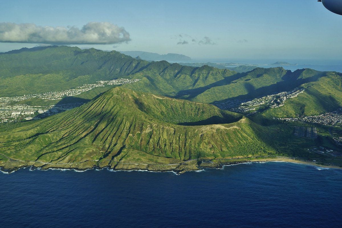
The Koko Crater Trail is definitely one of the more challenging and rewarding hikes in Oahu. I’m talking about a steep mile-long climb over 1,000 “overgrown steps” that are actually the remains of an old railway built during WWII to construct and supply a lookout tower atop the summit of this tuff cone – Diamond Head’s little sibling. The more you climb, the finer the views get, even if you don’t make it to the summit. On a good day, you’ll enjoy exclusive views of Hanauma Bay and the coastline.
Maunawili Trail
Distance: 8.7 miles (14 km) | Level: challenging | Time: 6 hours | Trail Map
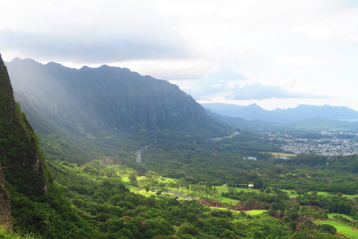
This trail is one of the most popular hikes in Oahu, though you must be prepared to get your shoes super muddy. Extending from Waimanalo to the Pali Lookout, the Maunawili Trail also branches off to the shorter Maunawili Falls Trail, eventually reaching the modest-looking falls and its swimming pool. Along the way, enjoy views of Kailua and the signature eroded cliffs of the Koolau Mountain Range – better known as the Pali Coast.
Makapu’u Point Lighthouse Trail
Distance: 2.5 miles (4 km) | Level: moderate | Time: ~1.5-2 hours | Trail Map
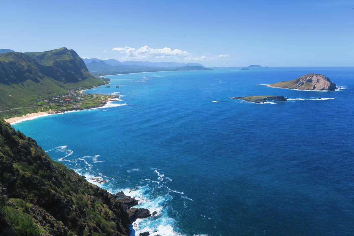
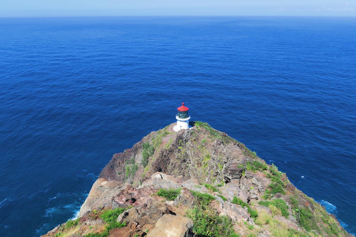
Exposed to the elements (mostly wind) and commanding a breathtakingly beautiful spot overlooking the Pali Coast, hiking to the old lighthouse on Makapu‘u Point is a worthy stop on your road trip up the windward coast. The short and paved trail starts with awesome views back to Koko Head before rising to the lighthouse overlooking Makapuu Beach and the island’s Pali Coast. Along the way, pause for a look down at the deep blue from atop the sea cliffs, and you might even spot a family of sea turtles cruising up the coast. Makapu‘u Point has to be one of the prettiest spots in Oahu.
Stairway to Heaven
Distance: 9.1 miles (14.8 km) | Level: challenging | Time: ~4-5 hours | Trail Map
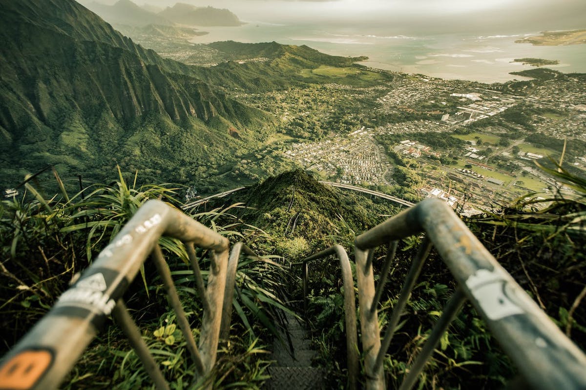
Officially known as the Haiku Stairs, I’ll start by stressing that hiking here is illegal and can result in a $1,000 fine. That said, just from its name – the Stairway to Heaven – you can understand why so many Instagrammers risk it and sneak up here. The trail is basically comprised of roughly 3,900 steps which lead up a ridgeline. Needless to say, the views along the way and from the top are surreal. The steps were built in the 1940s by the U.S. Navy for easy access to a secret radio transmission station. Due to land disputes, access to the steps is strictly prohibited. There are also constant discussions about entirely dismantling the step.
More from Hawaii
With this list of the best hikes in Hawaii, fill your days with a mix of fun in the sun and get closely acquainted with Mother Nature. Want to see more of paradise or plan a visit to the islands? Sample itineraries, guides to the best spots, and the must-see highlights in five islands await you in the Hawaii Travel Guide collection. Aloha!

Pin These Images To Your Favorite Boards!
