Driving From Bryce Canyon To Arches NP In One Day
Take it slow on the drive from Bryce Canyon to Arches National and explore the scenic backcountry on a memorable road trip on two of Utah’s exceptional scenic byways. In this one-day itinerary, we’ll hit the road and see how to squeeze the most out of this long desert drive.
In the fall of 2022, I completed an intense five-week road trip in the American Southwest, which included driving over 6,000 miles across four states with a focus on visiting national parks. I spent over two weeks in Southern Utah and a full day driving from Bryce Canyon to Arches National Park. This travel guide is based on my experience and extensive research. You can also use this itinerary for planning a road trip from Moab to Bryce Canyon.
Why Visit?
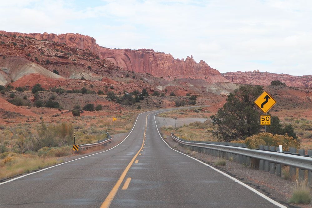
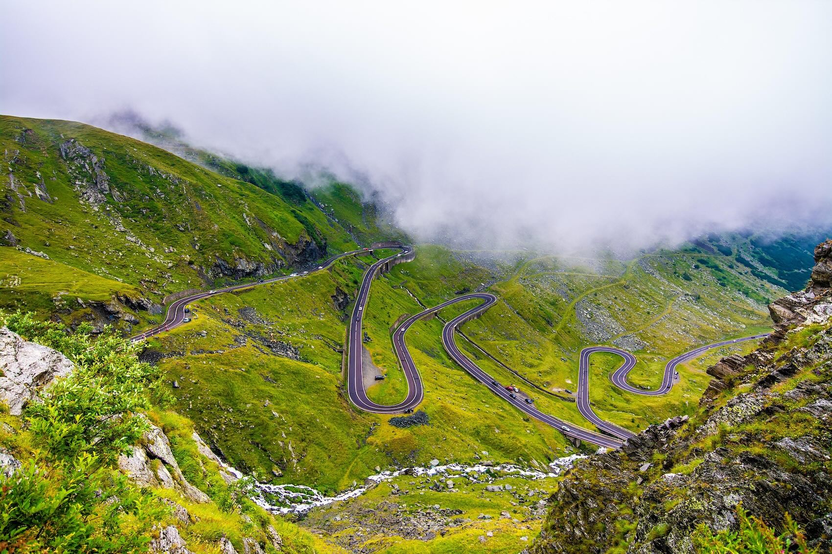
Highways 12 and 24 are two of Utah’s scenic byways, turning the drive from Bryce Canyon to Arches NP into an experience on its own. These scenic roads travel through some of the Southwest’s remotest and finest desert landscapes.
Enjoy a quick sample of this mammoth national monument, with its strange rock formations, detours on miles of dirt roads, and a hike to a fantastic desert oasis for drivers making good time.
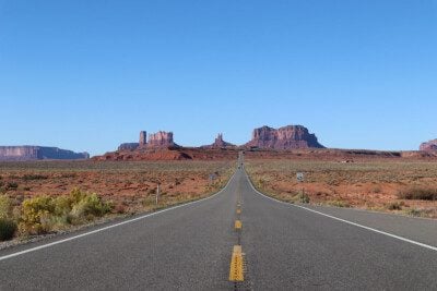
Drive through the northern tip of Utah’s second-largest national park. Stop at roadside viewpoints with “classic” Wild West vistas, see historic sites, and embark on short hikes to properly experience the desert landscape.
Brief Overview
The drive from Bryce Canyon to Arches National Park is one of America’s finest road trips, offering the chance to experience two of Utah’s 28 scenic byways. Scenic byways are roads that not only connect point A with point B but are an experience on their own. They’re a great way to get off the beaten track and combine driving with exploring exciting sites off the highway or further inland. In our case, the drive from Bryce Canyon to Arches takes us through Grand Staircase-Escalante National Monument and Capitol Reef National Park.
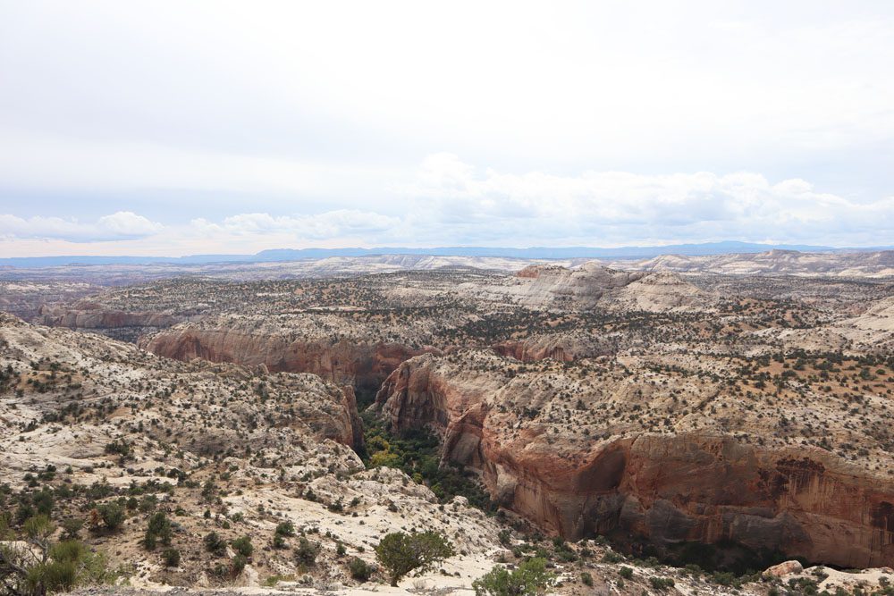
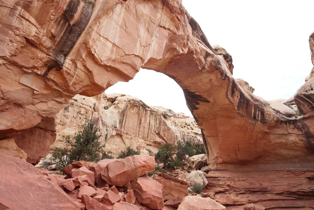
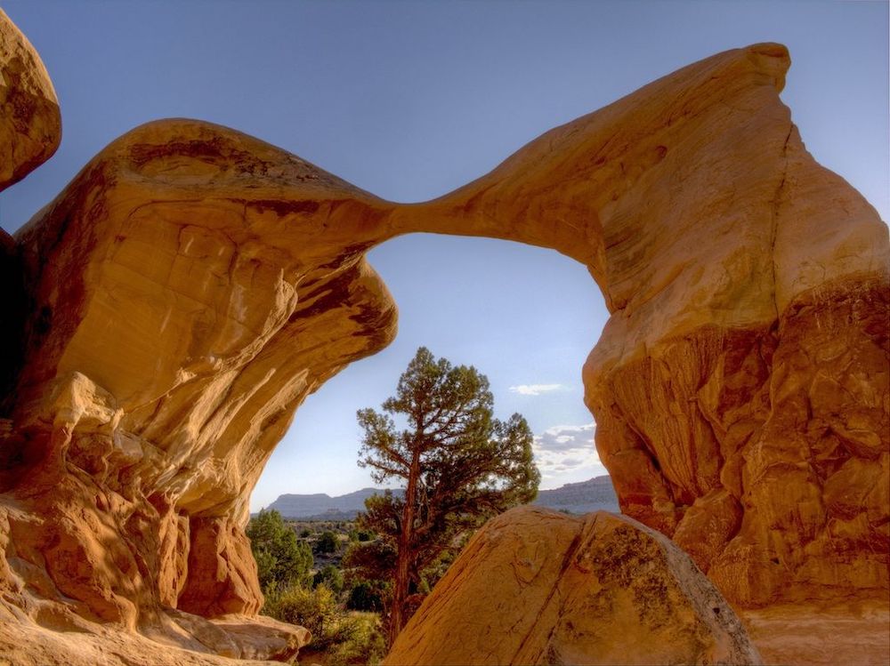
Grand Staircase-Escalante National Monument extends over 1.9 million acres of sandstone canyons, plateaus, cliffs, and unique rock formations. The immense national monument derives its name from the Escalante River Canyons and a series of stunning colorful cliffs known as Grand Staircase. There are very few services or paved roads inside the park, but Highway 12 provides a quick taste and an excuse for an extended return visit to Southern Utah.
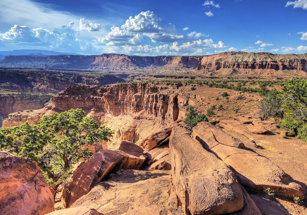
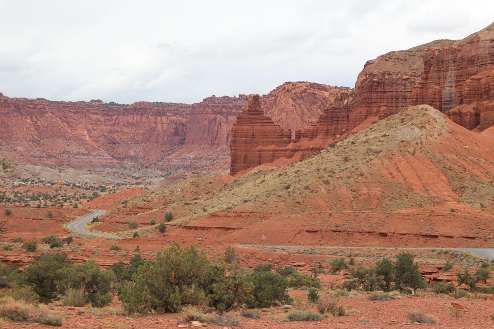
Capitol Reef National Park is the second largest of Utah’s national parks but is the least visited member of the “Mighty Five”. Nevertheless, several experienced travelers I met during my five-week road trip raved about Capitol Reef’s beauty and off-the-tourist-radar vibe. The national park boasts stunning “classic” desert scenery, but to adequately cover its grounds, you need a few days and a bit of camping. Scenic Highway 24 slices through the northern tip of Capitol Reef, complemented by a few interesting sites that do not require many detours.
Three sections make up this road trip guide from Bryce Canyon to Arches NP
- Essential planning tips
- Grand Staircase-Escalante via Highway 12
- Capitol Reef NP via Highway 24
Additional Southern Utah Resources
Check out additional travel guides to Southern Utah, including travel guides and itineraries to Utah’s “Mighty Five”.
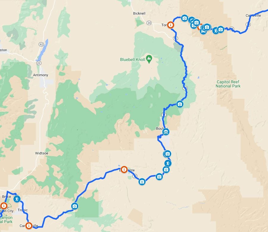
Bryce Canyon to Arches NP Road Trip Map
Click on the image below to see all places mentioned in this itinerary on Google Maps.
Planning Tips
This section highlights key travel tips for planning the drive from Bryce Canyon to Arches National Park.


How Long is the Drive?
The drive from Bryce Canyon to Arches NP on scenic byways 12 and 24 takes about five hours, not including stops. The total distance is 265 miles (236 km).

There is a shorter option if you’re pressed for time. Head to Highway 89 and merge with Interstate 70 for most of the journey. Then turn to Highway 191 towards Arches NP and Moab. This journey takes about 2.5 hours to drive the 245-mile distance (395 km).
How Many Days Do You Need?
One day: this itinerary focuses on completing the drive from Bryce Canyon to Arches National Park in a single day. If you leave Bryce Canyon in the morning, you’ll make it to Moab (the gateway town to Arches NP) early in the evening and have time for brief stops along the scenic drive.
Two days: if you have an extra day, spend it at Capitol Reef NP. Tick another member of Utah’s “Mighty Five” off the list, and explore the more impressive and manageable of the two parks.
Three days: spend the extra night at Grand Staircase-Escalante and see a slightly more significant chunk of this colossal park using dirt roads to reach a few top highlights. Alternatively, devote another night to Capitol Reef.
The secret sauce to this road trip is to leave Bryce Canyon at just the right time. The one-day plan is more feasible in the summer when the days are longer and it’s likely more possible to combine the long drive with sightseeing.
Where to Stay?
Spend the night in Moab if you drive from Bryce Canyon to Arches NP in a single day. Moab is the gateway town to Arches NP and Canyonlands NP. You’ll find here a healthy selection of motels in all price ranges and camping options. Prices are a bit high in Moab, but it’s a very convenient base for exploring the area’s national parks.
Here are all Moab accommodations that can be booked online via booking.com. For a more secluded stay outside Moab, check out the Red Cliffs Lodge.
If you’re spending a night in Capitol Reef, the best option is in the popular Fruita Campground. However, if camping is not what you’re after, the towns of Caineville and Torrey are the best options.
In Grand Staircase-Escalante, the small town of Escalante is the best option, with Boulder a close second. Additional options in nearby towns might also be available. For camping, Calf Creek is a sweet spot.
Mobile Reception & WiFi
Do not count on catching a signal beyond the major towns on this drive. Instead, I strongly advise downloading an offline Google Map of the area and plotting the points of interest you wish to visit before leaving Bryce Canyon. That way, you’ll still be able to navigate from point to point even without reception. I also highly recommend purchasing All Trails Pro and downloading trail maps of the hikes on your wishlist so you can navigate offline.
Getting Local Information
If you have any questions, need some advice, or just want to be on the safe side, stop at one of the visitor centers along the drive. You might also be able to get information and maps of Grand Staircase and Capitol Reef at the Bryce Canyon Visitor Center.
In Grand Staircase-Escalante, information is available at the Escalante Interagency Visitor Center in Escalante, the Cannonville Visitor Center, and Wayne County Tourism in Torrey. In Capitol Reef, information is available at the Capitol Reef NP Visitor Center near Fruita.
(1) Get a copy of the Rough Guide to Southwest USA, which has just the right amount of information on the area’s national parks and everything in between. (2) Check out these maps of Capitol Reef NP and download relevant ones to your phone.
Here are some basic tips for driving safely from Bryce Canyon to Arches.
- Inspect your spare tire and parts (even on a rental car), and check your oil and other essential fluids.
- Fill your gas tank when leaving Bryce Canyon.
- Download offline navigation maps but also carry a physical map of the area.
- Carry a USB car charger.
- Stay on paved roads and only drive on dirt roads that suit your vehicle.
- Familiarize yourself with what to do when your car overheats.
- Carry a first aid kit and a flashlight.
- Do your best to avoid driving at night in remote sections of the scenic byways.
- If planning to spend extended time in Grand Staircase or Capitol Reef, pack emergency water and food just in case you’ll get stranded for a few hours, and notify your hosts or park rangers if heading to very remote spots for the day.