A Tale Of The Greatest American Road Trip
Antelope Canyon and Horseshoe Bend
I had hopes of returning to the Grand Canyon and visiting Antelope Canyon en route, so an overnight in Page, Arizona, made perfect sense. The drive from Monument Valley on backcountry roads took me deeper into Navajo Nation on a seemingly never-ending high plain with little signs of action apart from ranches with typical “old west” wind-powered water pumps. The GPS showed that a gain of one hour was called for soon, as I was about to exit Navajo time, and flashes of Glen Canyon in the distance promised forgotten warmer temperatures.
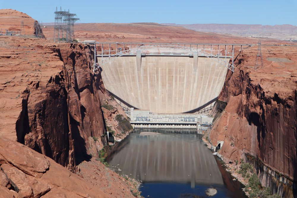
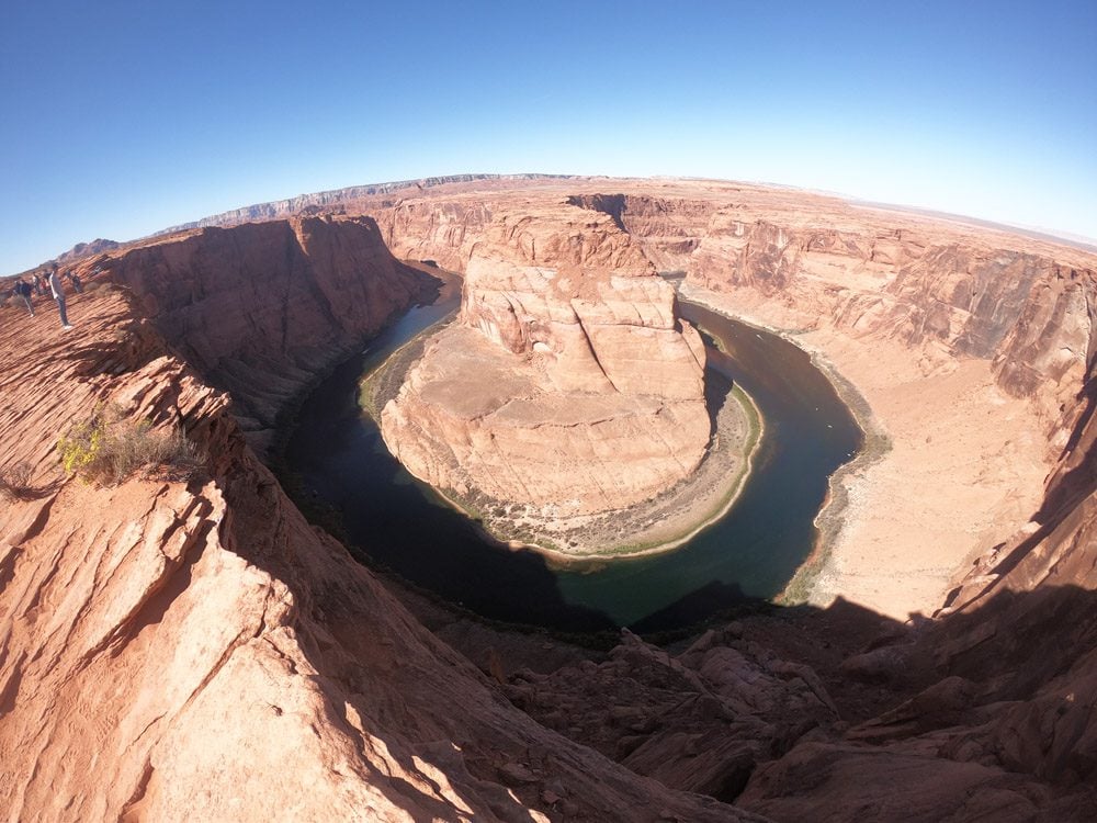
Seeing the cold weather forecasted for the Grand Canyon and realizing the sacrifices this return visit would entail, I made the call to skip this detour and head south deeper into the Arizona desert. I was lucky to score last-minute (overpriced) tickets to Antelope Canyon and had some time to kill before the tour, so I checked out the Glen Canyon Dam and Horseshoe Bend. Surely you recognize the latter from countless Instagram photos.
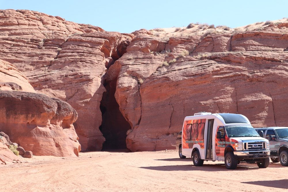
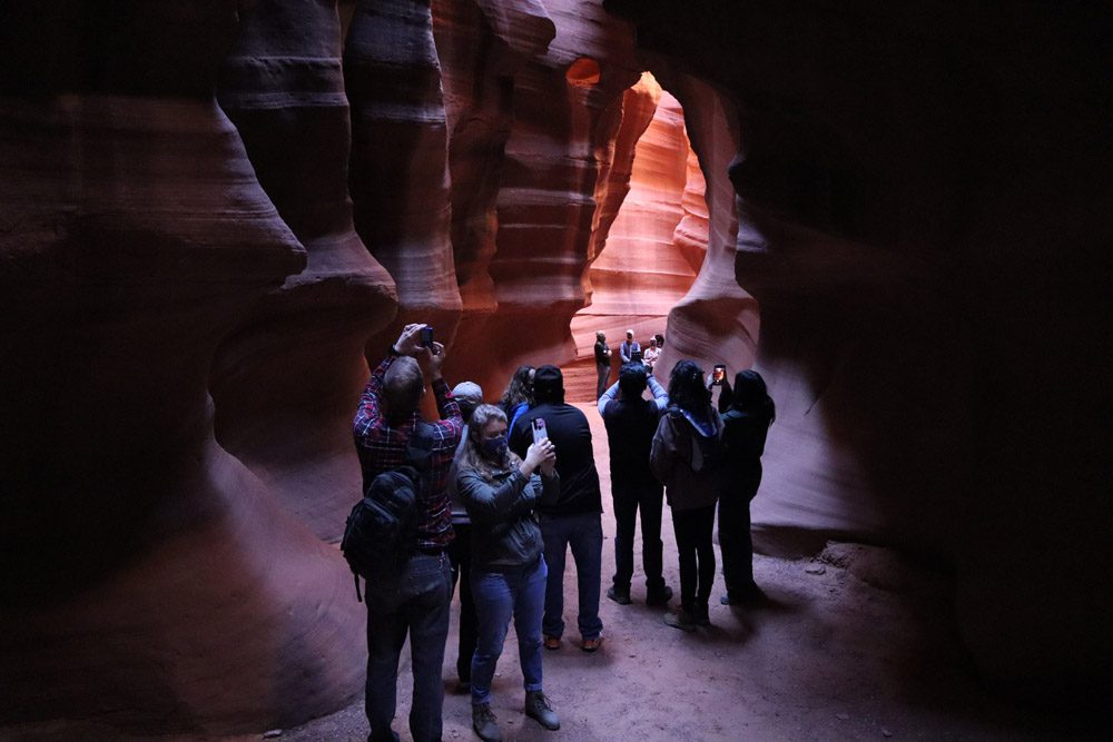
Along with parts of Utah, the area around Page is blessed with slot canyons. Without a doubt, Antelope Canyon is the most famous of them all. I’m sure you recognize it from somewhere, if only from a computer screensaver. Back in Navajo land, groups are ferried on 4WD vans from Page to the mouth of Upper Antelope Canyon for a rapid tour in the slot. From high ground, you could never suspect that this natural wonder hides right beneath your feet inside a small crack. Created by the force of water meeting compact sand, the canyon reaches 85 feet (26m) at its deepest point.
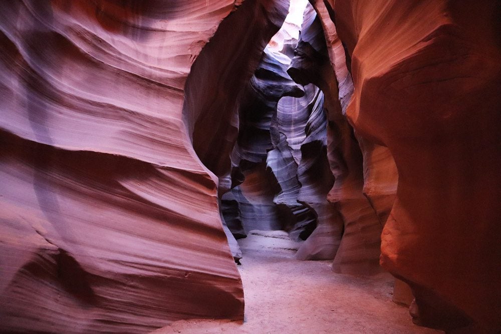
The tour itself is pretty much a claustrophobic hunt for the perfect shot to beam to one’s social media accounts. This is what’s become of us these days… While the guide focuses most of his energy on pointing out the best angles, he does also share a few interesting tales, and the geology of Antelope Canyon is out of this world.
Standing On a Corner In Winslow Arizona
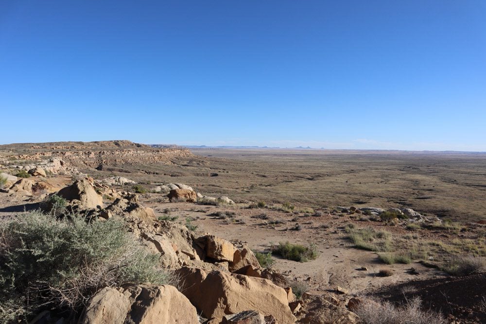
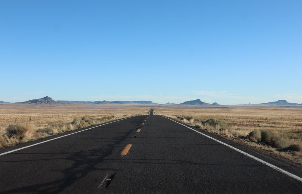
I could have taken the quick route to Phoenix but, longing for a taste of old Route 66, I went out of the way back into the backcountry to visit a couple of forgotten towns. From Page, I re-ascended the high plateau where the temperatures plummeted and there was nothing to block the wind for miles, apart from a few farmhouses. This was the Hopi country, tribal members of the Navajo
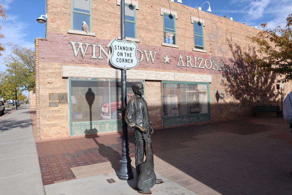
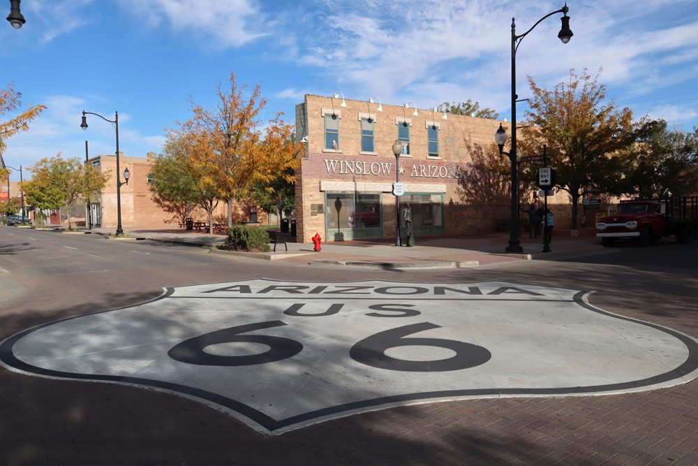
It was getting dark by the time I rolled into Winslow together with a New Mexico-bound freight train. I had hoped to score last-minute accommodations at the upscale and out-of-place La Posada but instead had to settle for the truckers-favorite Motel 6. Winslow used to be a happening place in the old Route 66 days but interstate travel and other external factors left it a historical sh%$hole. What draws the crowds these days apart from La Posada is a single line in the Eagles classic song Take it Easy (“Well, I’m standing on a corner in Winslow, Arizona…”). Since the Eagles didn’t exactly specify which corner in Winslow they were referring to, the local council decided on a spot and erected a mini shrine to celebrate its claim to fame. This whole intersection is quite lovely, with restored buildings, a huge Route 66 road painting, diners, and souvenir shops.
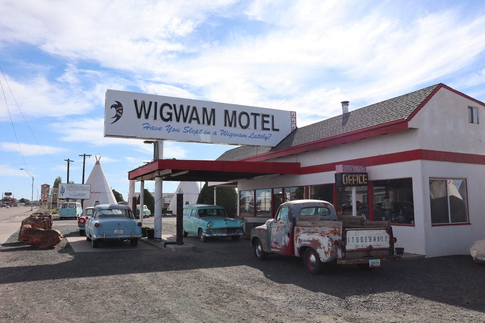
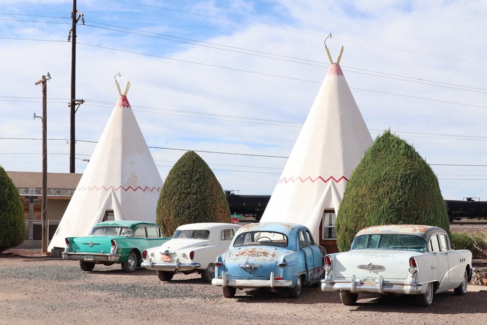
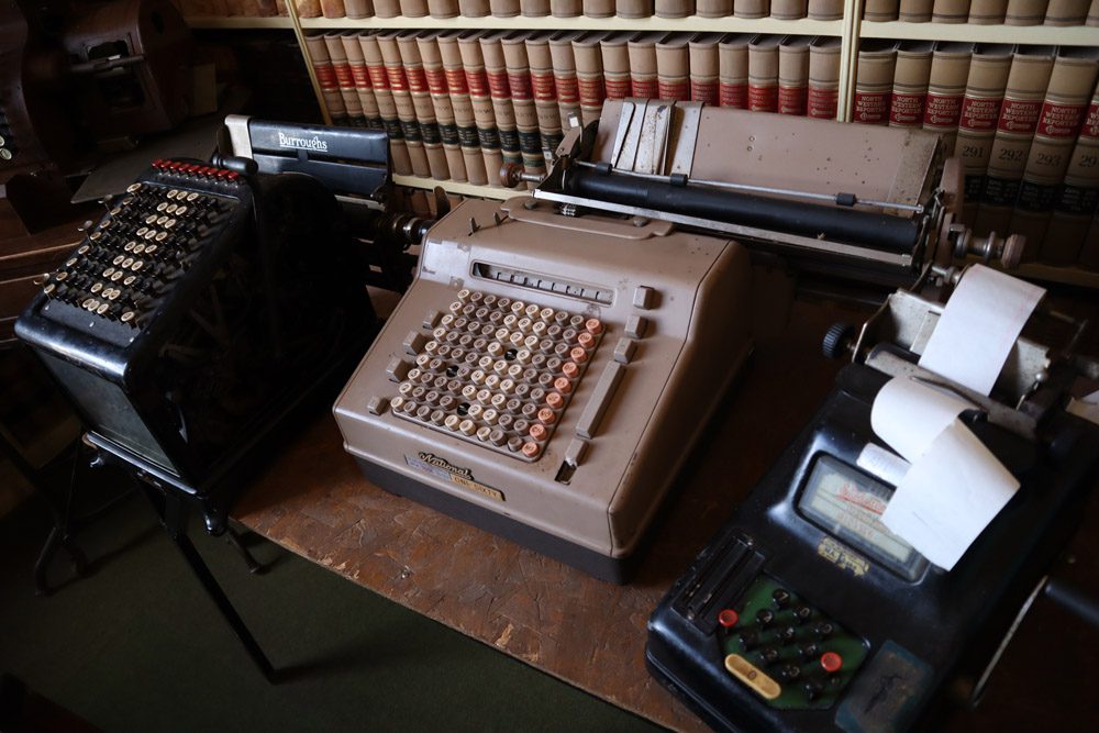
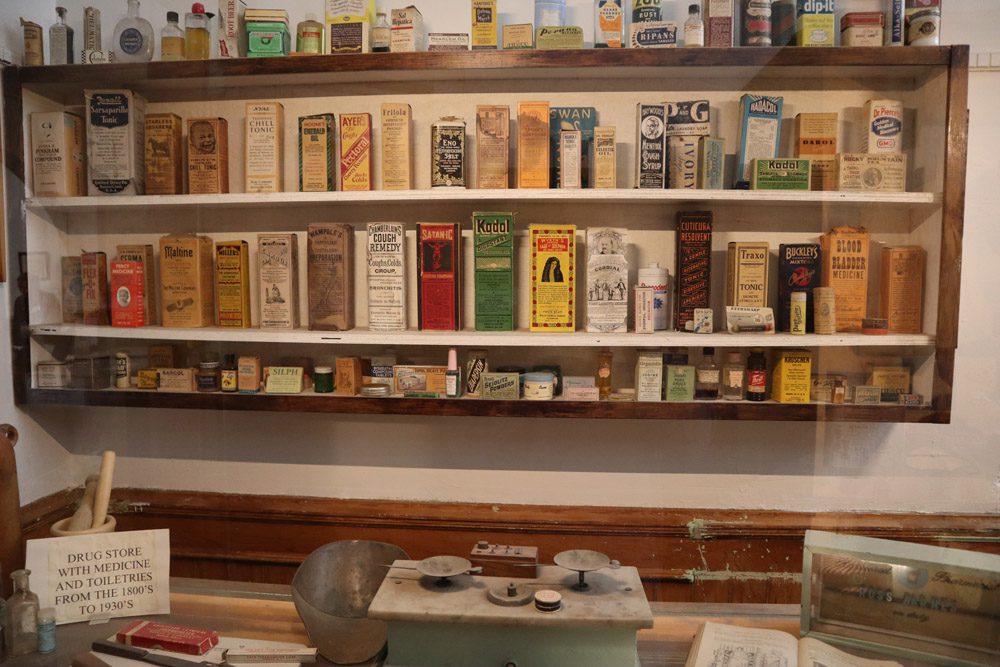
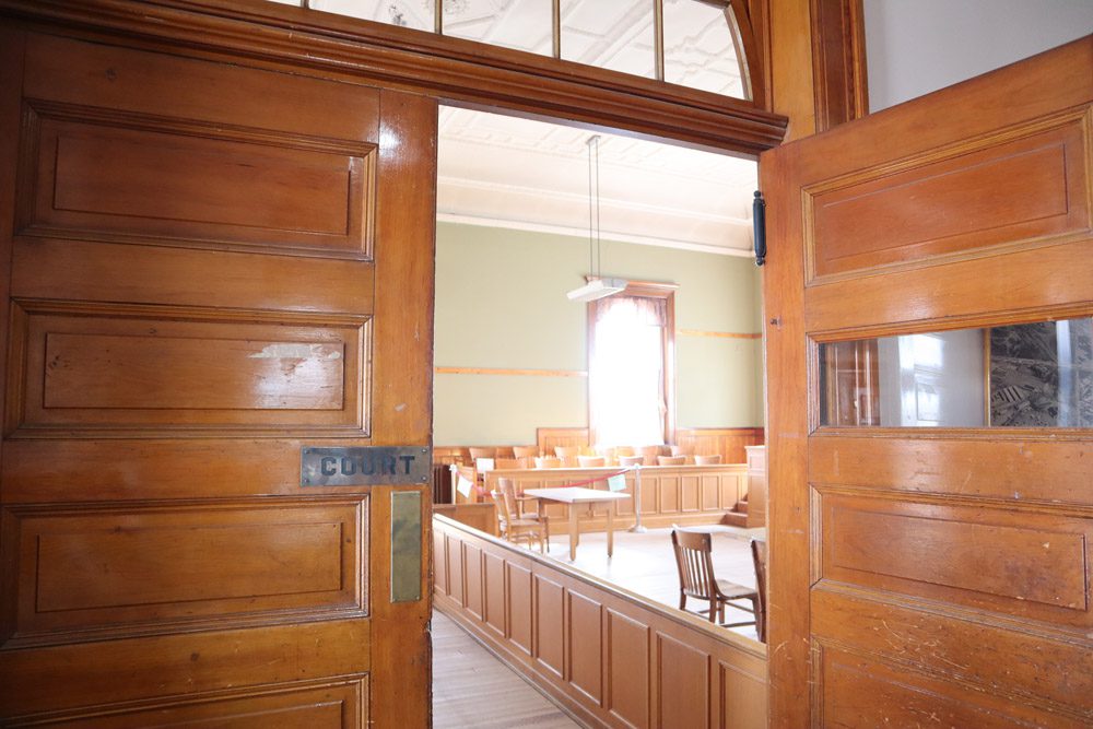
In an effort to capture more of that Route 66 charm, I continued down the interstate to Holbrook, and that’s exactly what I found. At the Wigwam Motel, I regretted not pushing further on yesterday’s drive to have a chance to spend the night inside a wigwam. At the old courthouse, I found one of the most interesting museums I’ve ever visited. The county gathered local antiques from decades past and put them on a display that takes visitors down memory lane.
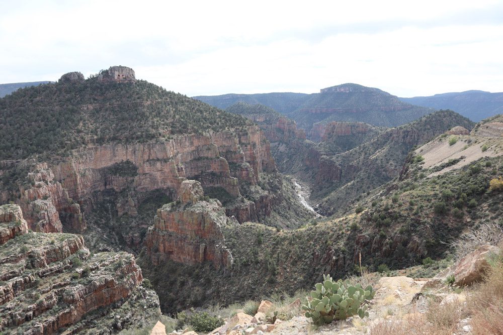
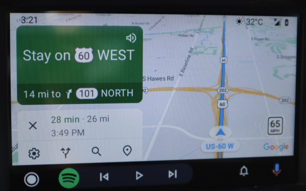
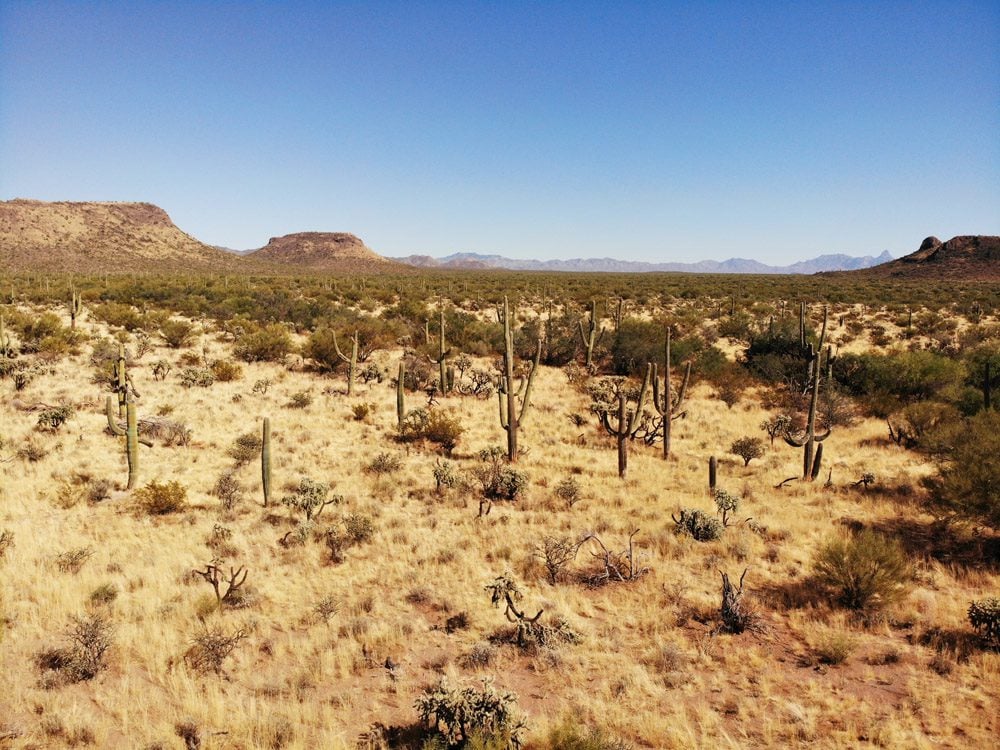
Pushing on towards Phoenix, the backcountry highway took me through the vast Apache territory, where the flat desert and ruler-straight road entered the woods around the “old west” town of Snowflake, Arizona. Getting through Salt Creek Canyon with its hair-razing turns and sharp grades proved to be a challenge. But at the creek’s exit in Tonto, the road straightened again, the temperature topped 30 degrees Celsius, and cactuses made their first appearance before giving way to an eight-lane freeway.
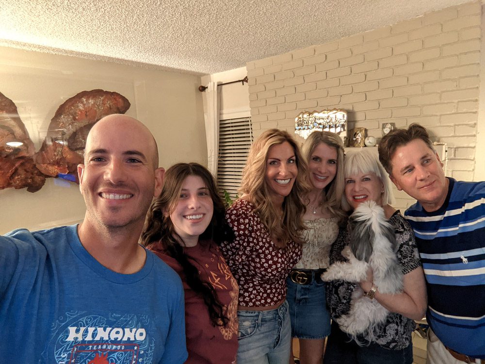
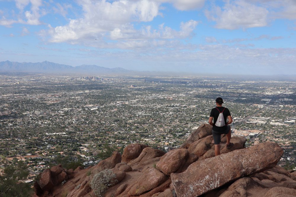
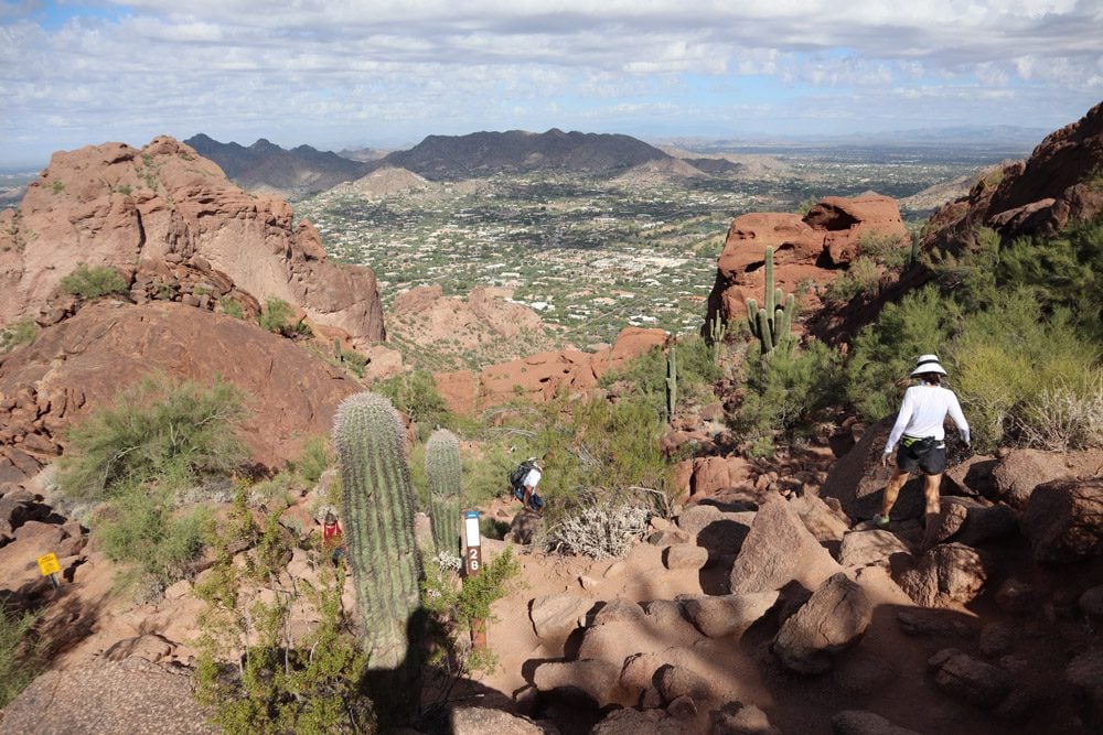
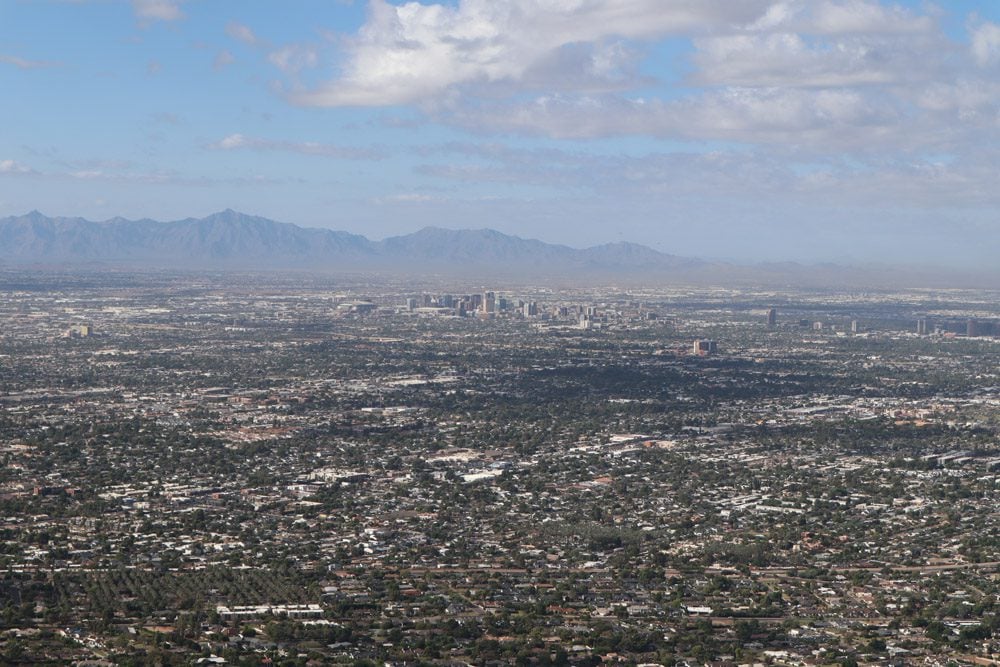
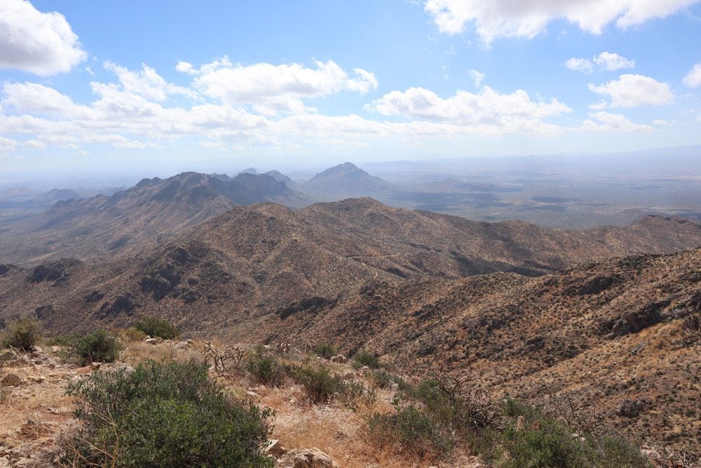
In Phoenix, I finally reunited with my aunt and cousins from my father’s side. I hadn’t seen them since 1997! Before leaving for Tucson the next day, I took the short but challenging Echo Trail to the top of Camelback Mountain to catch the finest views of the “valley of the sun”. My overall impression from this rapid stop in Phoenix is that there’s a great quality of life here.
Tucson and Down to Mexico
Tucson is a cool desert town although its downtown was disappointingly boring and devoid of much action, perhaps due to COVID-19 measures. The weather was great though, warm and dry, and even cactuses spring up inside gas stations! I checked into my luxury suite for the next three nights at El Amador and did what many Americans do when there are a few hours to kill… hit the outlet mall for some shopping.
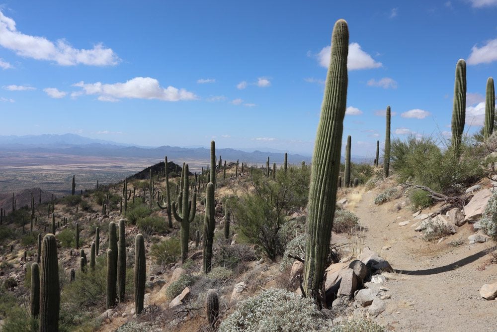
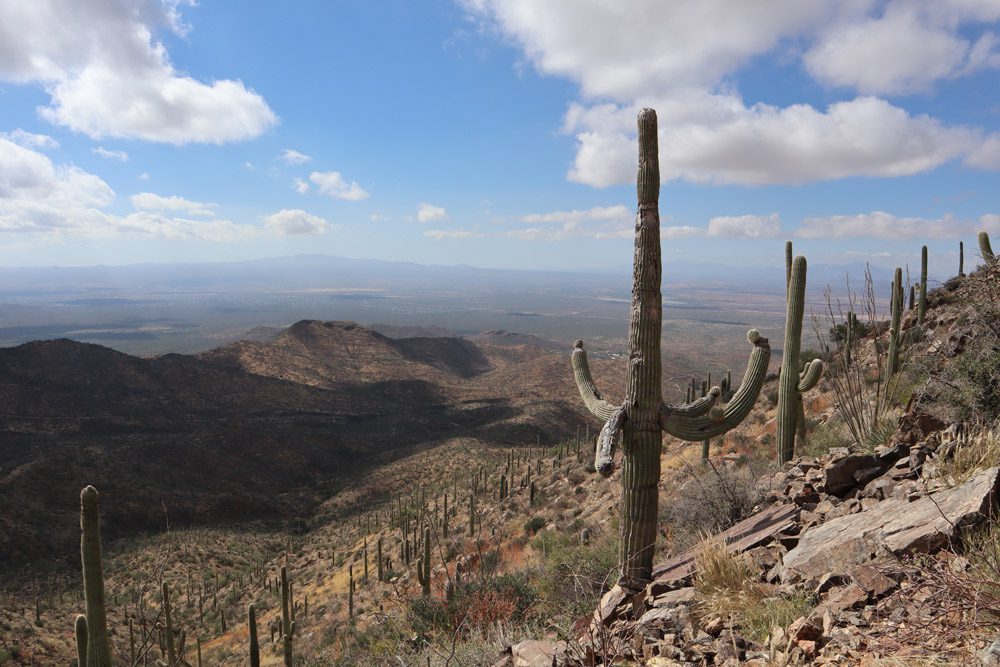
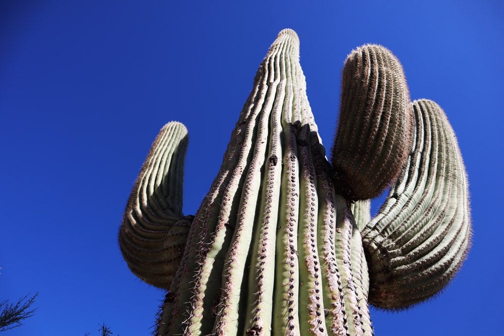
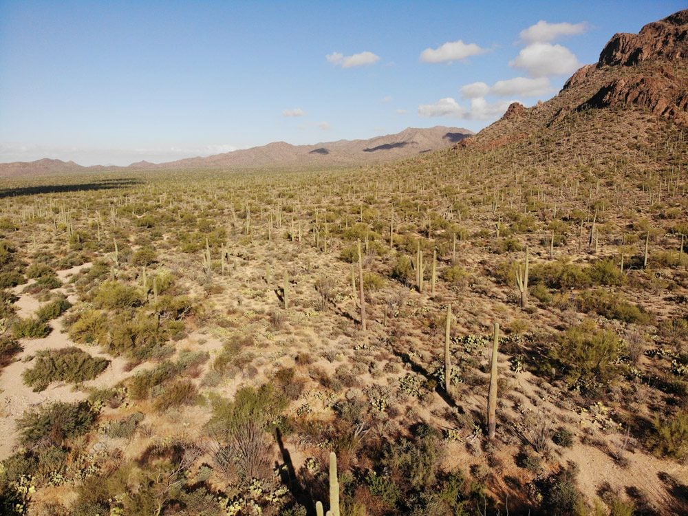
The following day was dedicated to Saguaro National Park, where the highlight is, of course, seeing the famous cactus. Although the saguaro is very ubiquitous around here, it’s hardly a bore since no two are ever the same. There are also a few exceptional hiking trails within the park, some of which offer quite an escape into the deep wilderness.
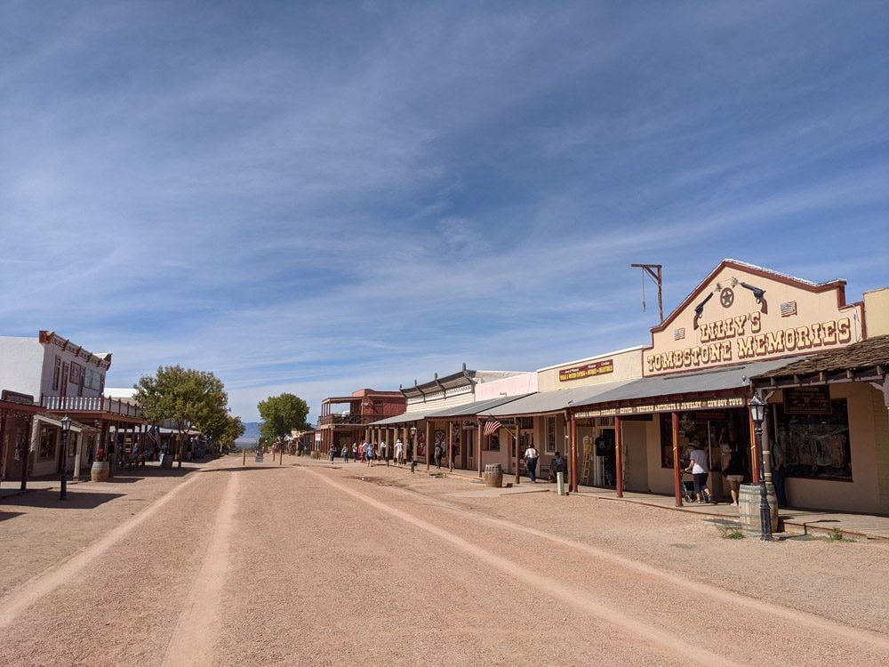
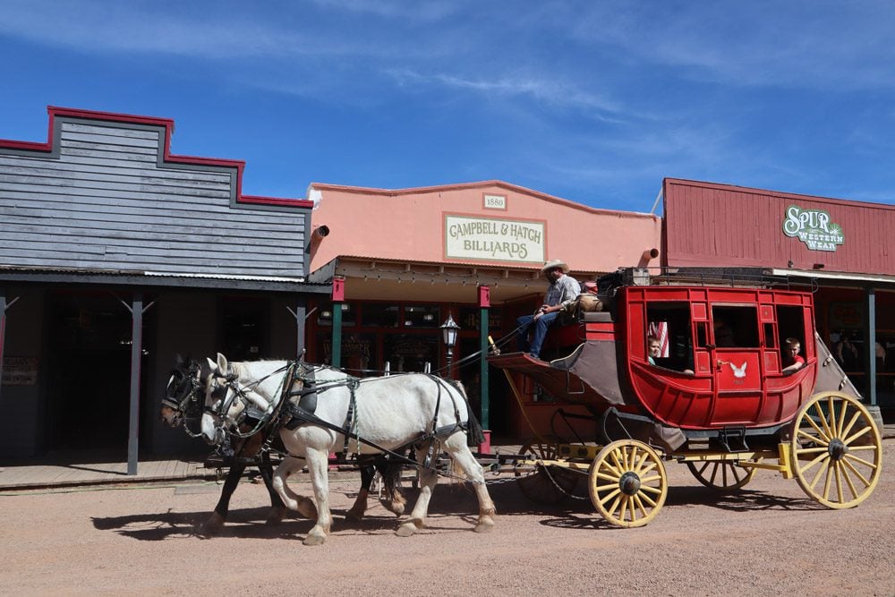
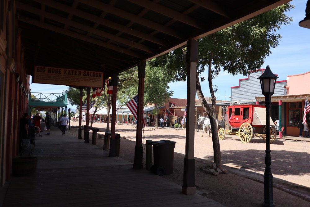
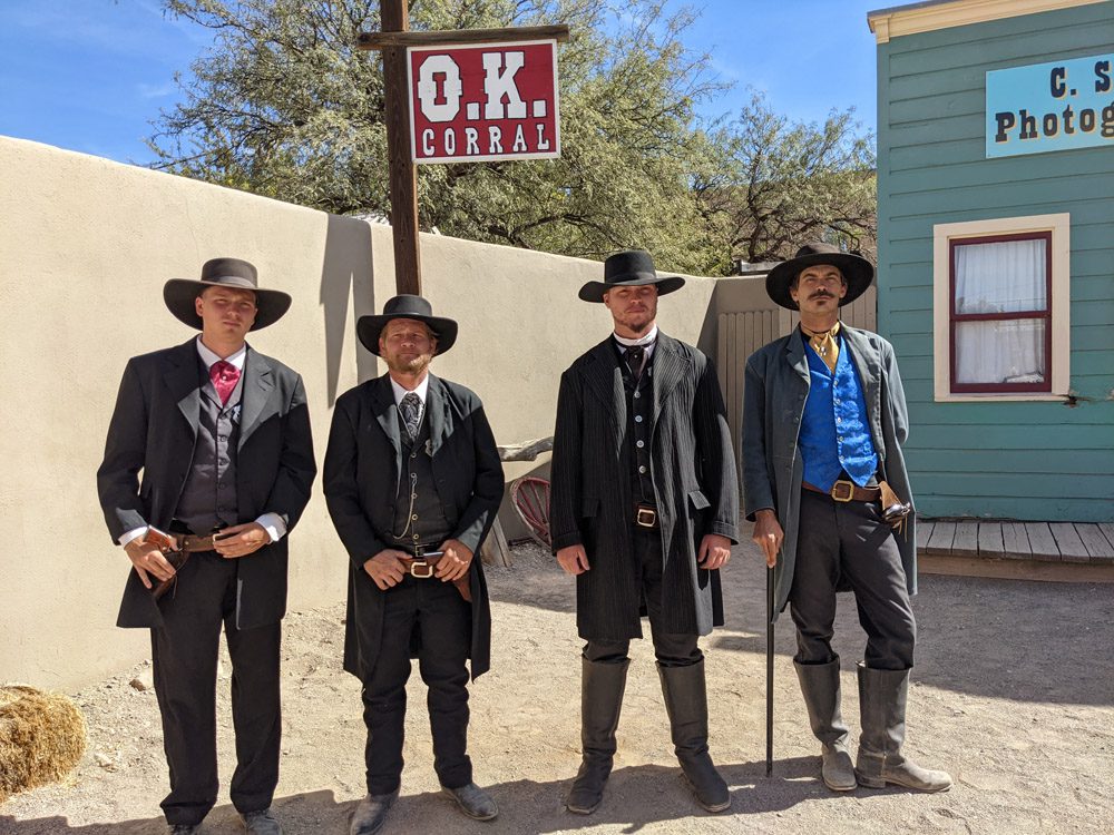
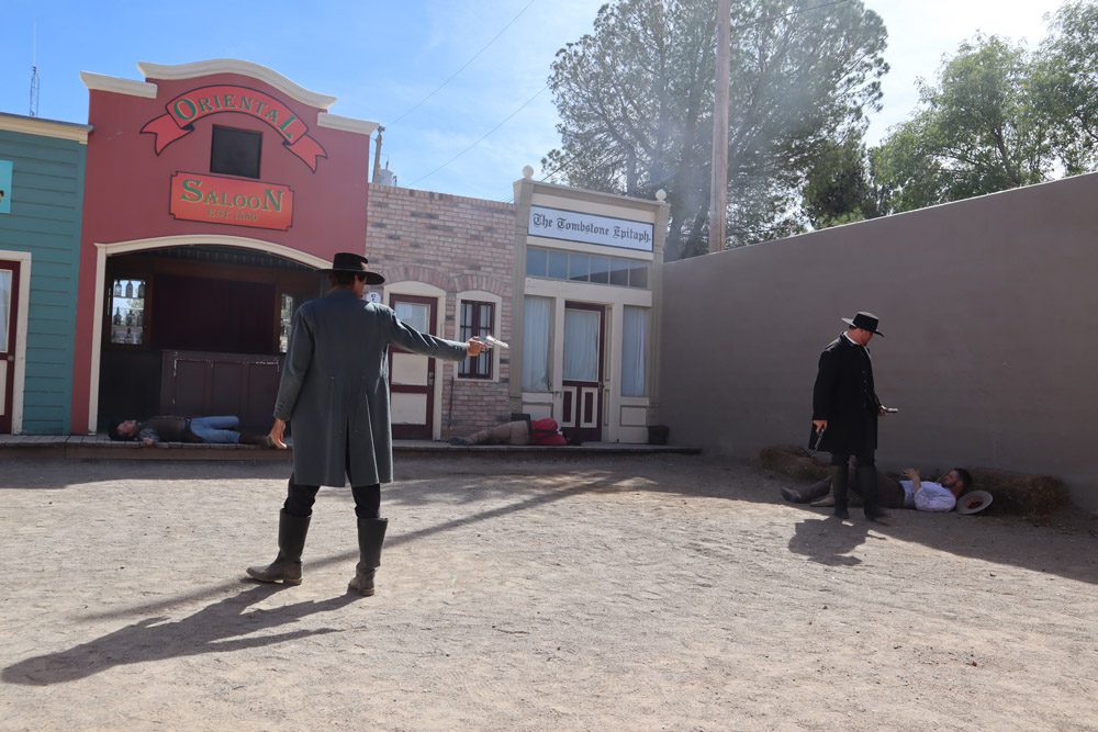
On day two in Tucson, I headed on a small road trip that would take me very close to the Arizona-Mexico border. First up was Tombstone, a Wild West throwback town where mustaches and smoking are totally in fashion. I came here as a child in the late 80s, so the stroll through the town, the reenactment of the gunfight at the O.K. Corral, and the saloons, all resurfaced some sweet childhood memories.
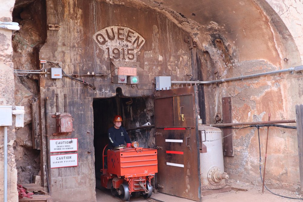
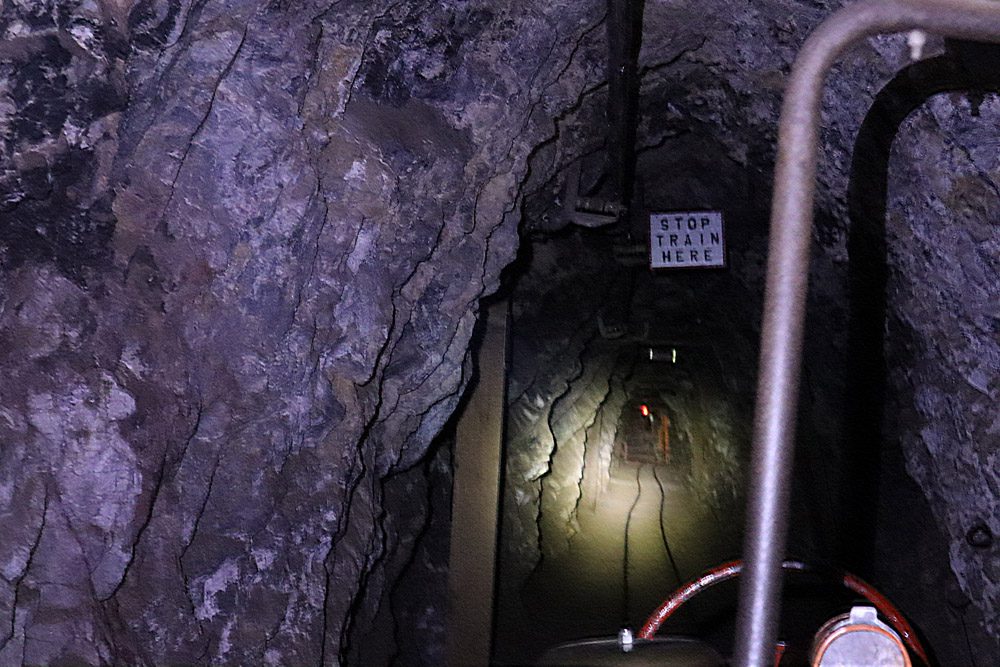
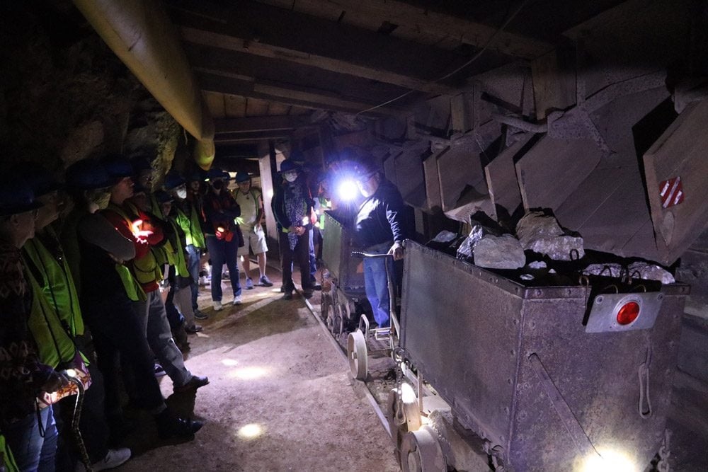
From Tombstone, I continued to the former mining town now turned local art capital, Bisbee. At the Queen Mine, I hopped on a mine train and railed down to 1,500 feet. There are over 2,500 miles of tunnels around Bisbee and it was very cool to learn about the area’s mining history, in particular, what life was like for everyday miners as technology advancements were made.
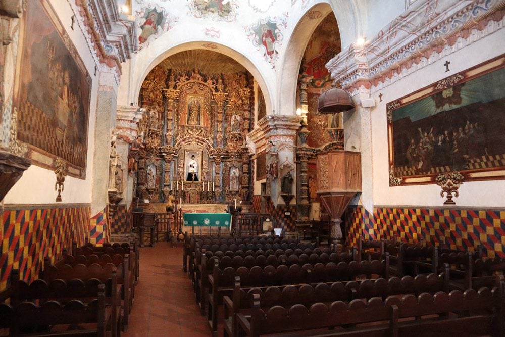
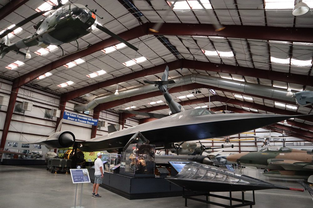
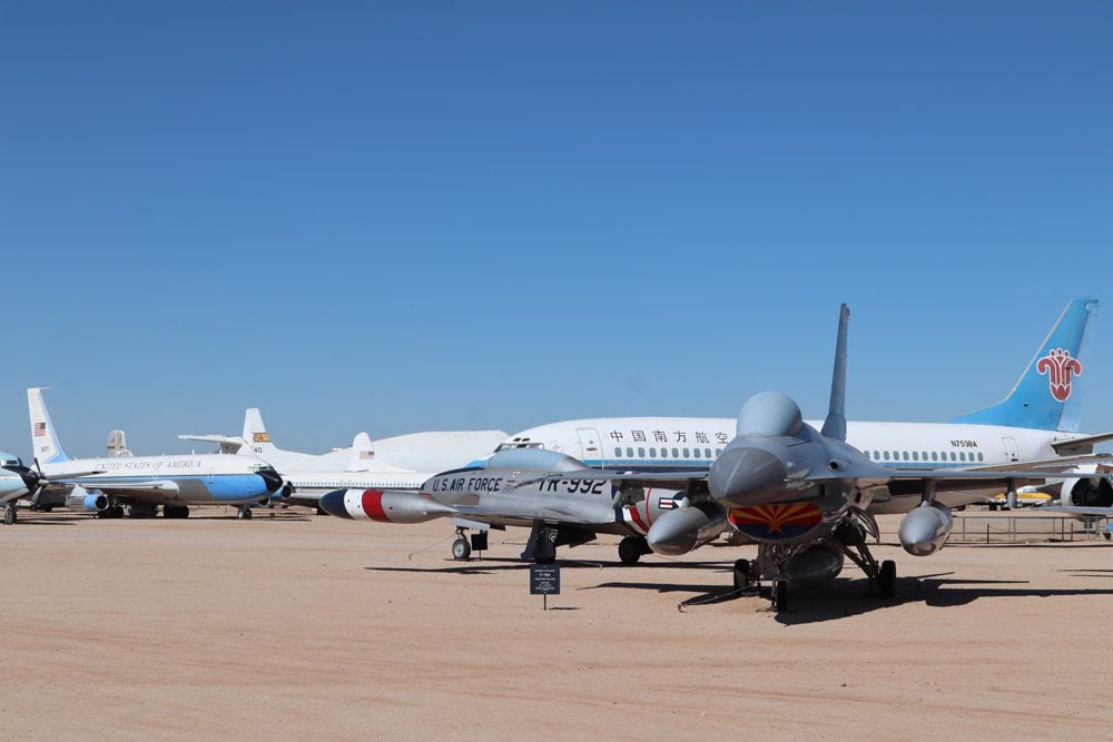
Leaving Tucson, the plan for the day was to do a bit of sightseeing and to get as close as possible to Joshua Tree National Park, some 450 miles to the west. I started the morning at the Pima Air and Space Museum, an absolute fantasyland for children and aviation fans. The highlight for me was the F-14 Tomcat, the featured fighter in the greatest film of all time – Top Gun. Next up was the San Xavier del Bac Mission, a surreal sight in the middle of the desert.
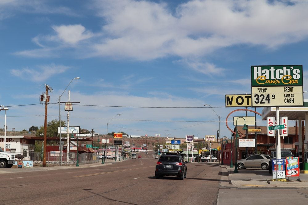
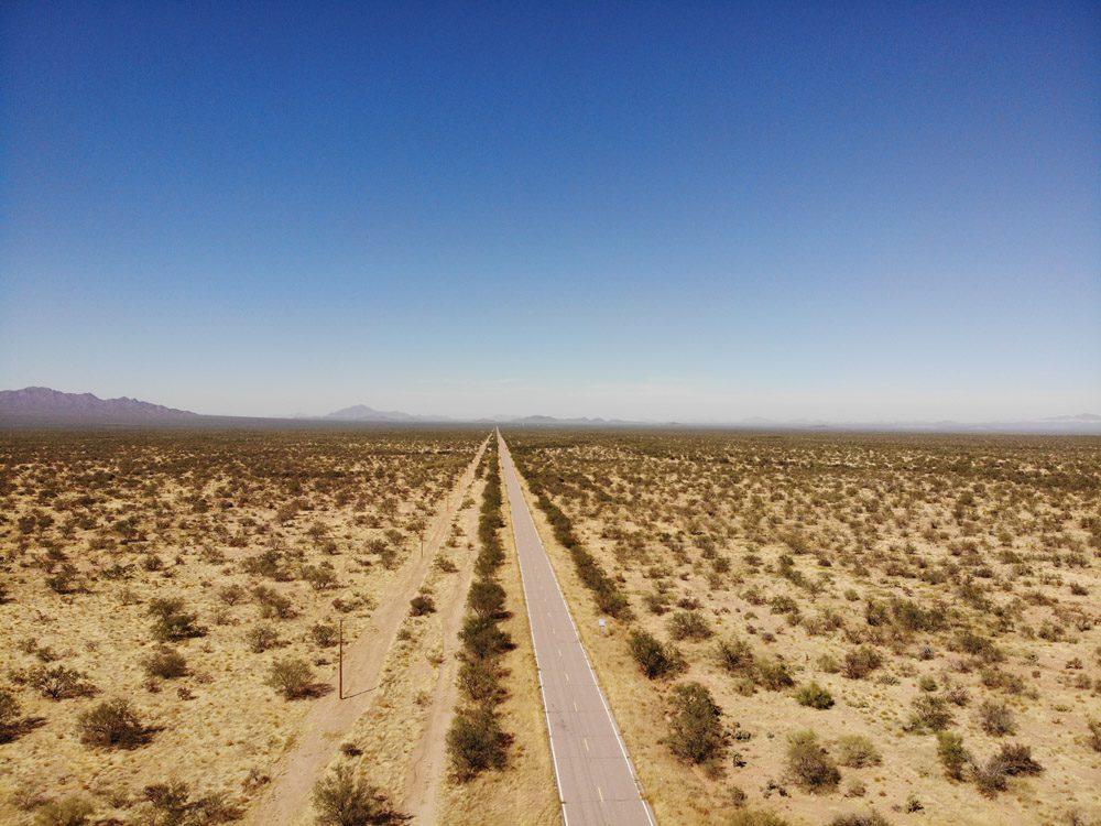
As a standard procedure, I took the long route to Joshua Tree. On highway 86, I drove the length of the Tohono O’odham Nation Reservation, one of the most desolate spots in Arizona. There was nothing but roadside cactuses, occasional border patrol cruisers, and a couple of checkpoints. Reaching the oddly-named town of Why, I filled up the tank with expensive gas and headed north on highway 85. This part of Arizona is favored among both RV-owner snowbirds and Mexico-bound road trippers. Many local businesses cater for the two, offering places to camp or purchase car insurance valid south of the border.
On Interstate 10 heading west, I was chasing the sun at 80 mph but to no avail. Miscalculating the great distance, I was forced to drive for over an hour on a dark backcountry road through the Mojave Desert just as my car began to demand an oil change. As soon as light pollution from Twentynine Palms became visible, my spirits were lifted and thoughts of a nice shower and some ESPN before calling it a night took over.
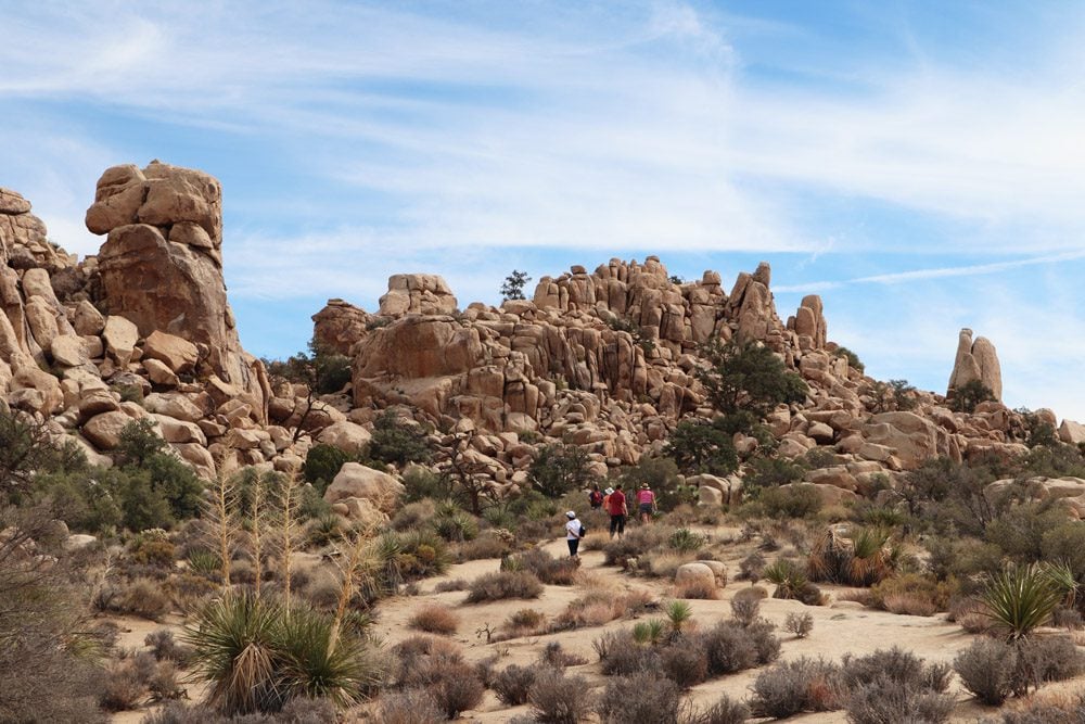
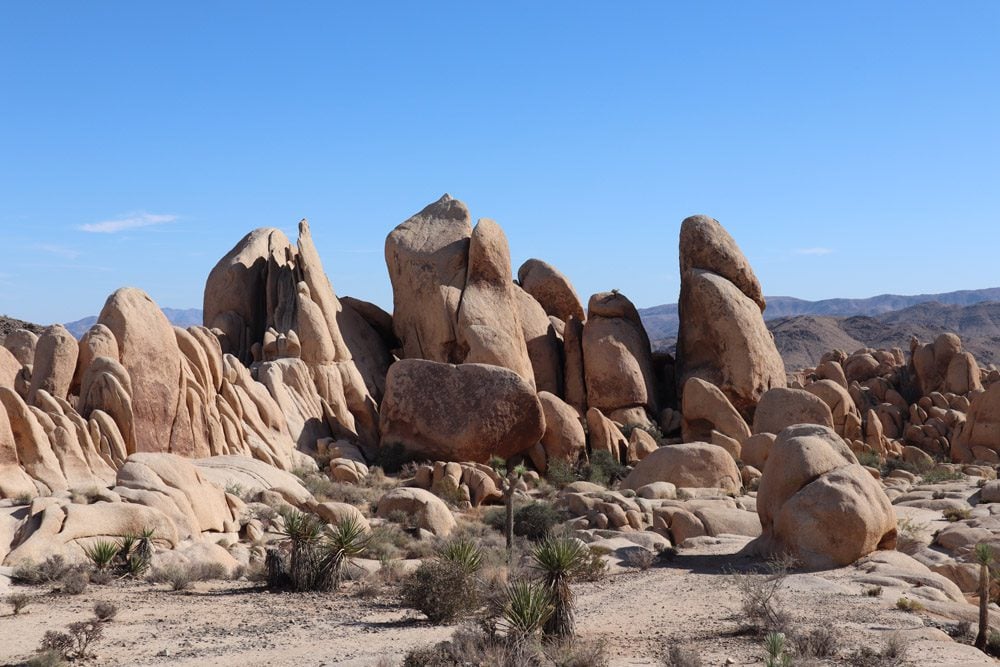
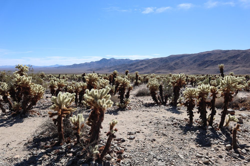
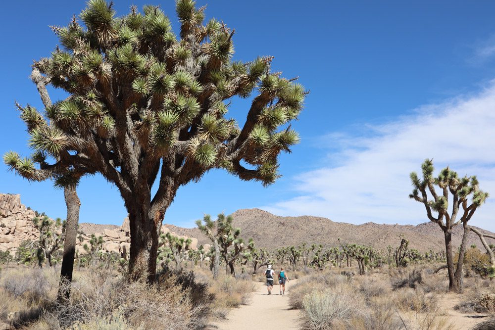
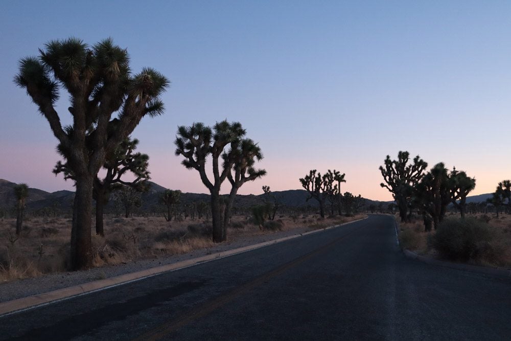
Joshua Tree National Park
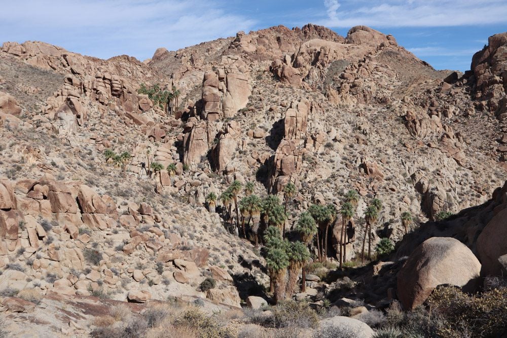
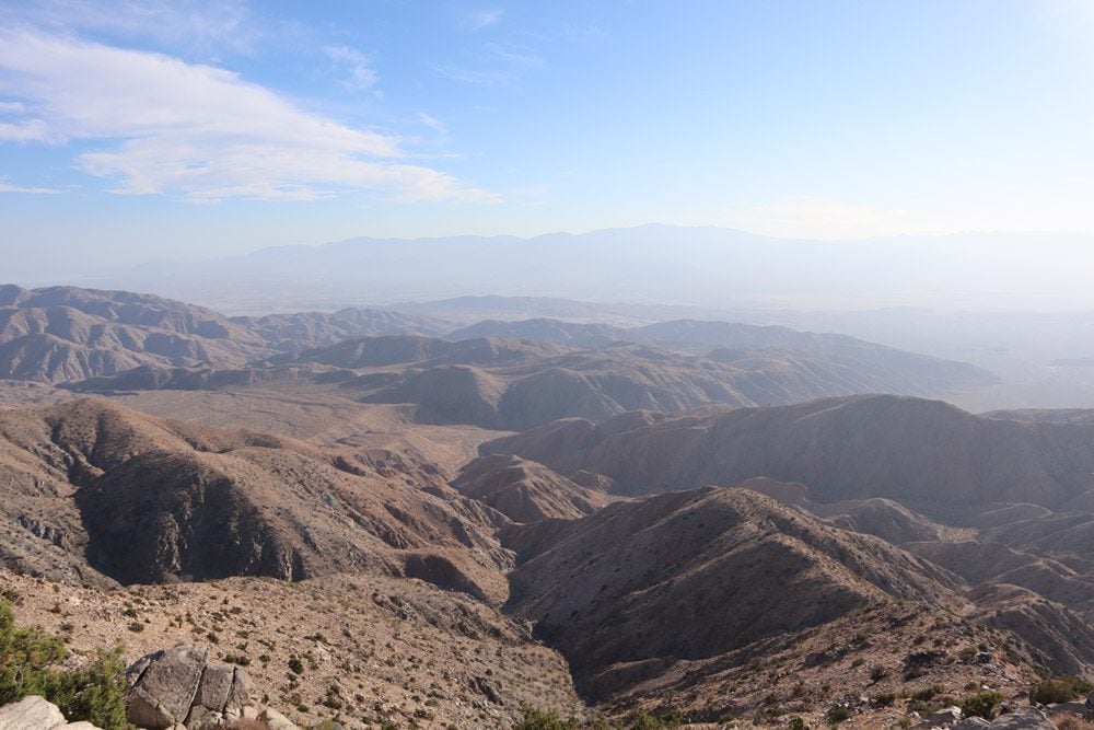
Where the Mojave and the Colorado deserts meet lies Joshua Tree National Park. This park is not just about the unique desert tree for which the U2 album is named after but also interesting for its beautiful desert landscape, highlighted by clusters of strange rock formations. I spent two days exploring the park and its two distinct sections, mainly hiking to vista points such as Ryan Mountain, short loops like the Hidden Valley, and remote spots like the Lost Palms Oasis.
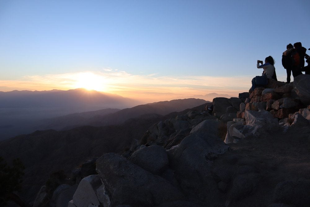
Joshua Tree is also a prime stargazing and sunrise viewing spot but I settled for a sunset viewing at Keys View. From up here, you need to withstand the chilly breeze but the reward is a sweeping view of Coachella Valley and even of Palm Springs if it’s not too hazy.
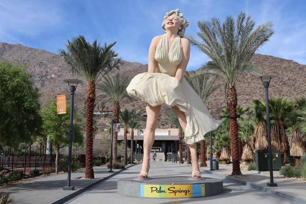
Palm Springs
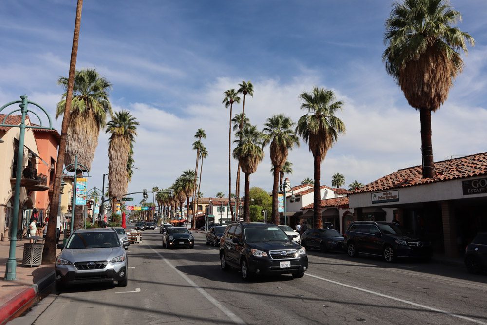
I planned a quick overnight stay in Palm Springs but poor weather on the Pacific Coast Highway called for slowing things down so an extra night in this luxury desert town was added. I actually really liked this place, not for its pretentious downtown but for its fine late October weather and the variety of surrounding highlights.
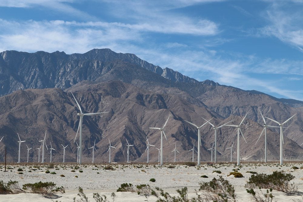
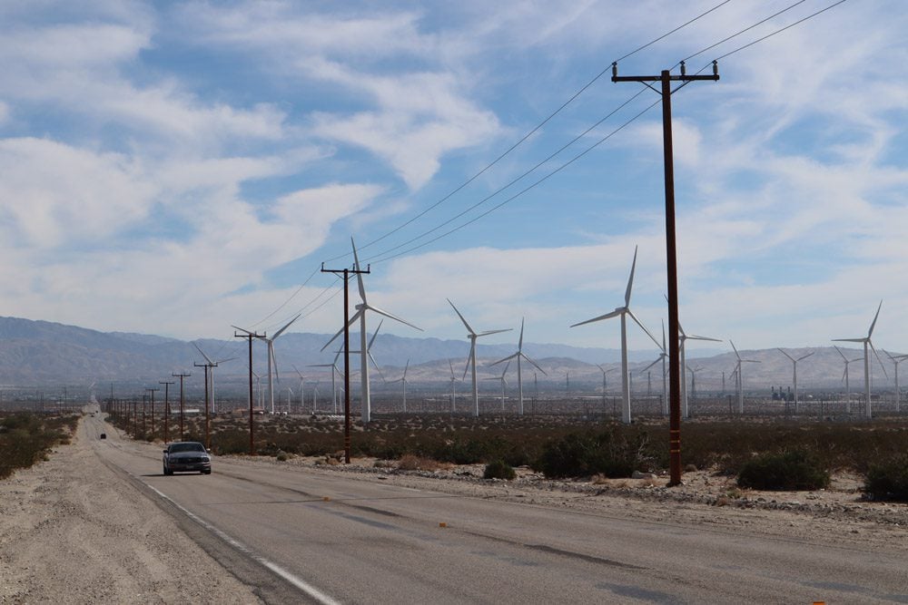
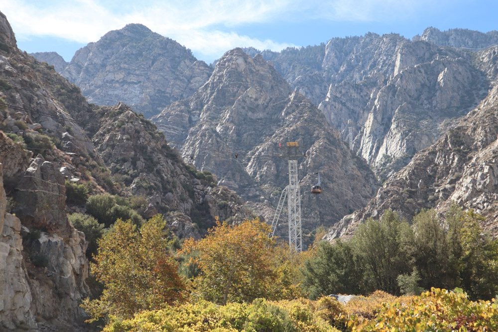
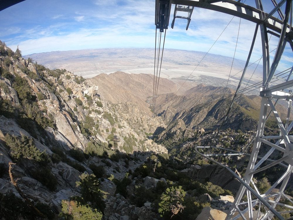
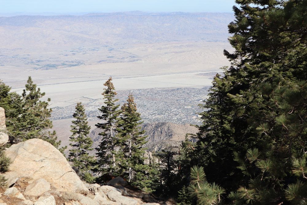
First up were the wind farms just outside Palm Springs, where many Hollywood scenes were shot. The next order of business was to catch the Palm Springs Aerial Tramway and explore Mount San Jacinto State Park. The aerial ride is quite thrilling, not only for the splendid views and the altitude gained but also for the rotating floor! What a great method to fairly share the vista. Just a few minutes ago, I was on the desert floor but inside the park, it’s back into the forest with flashbacks of Yosemite. The state park offers miles of short and long hiking trails. I opted for the short Desert View Trail that loops around a series of scenic overviews.
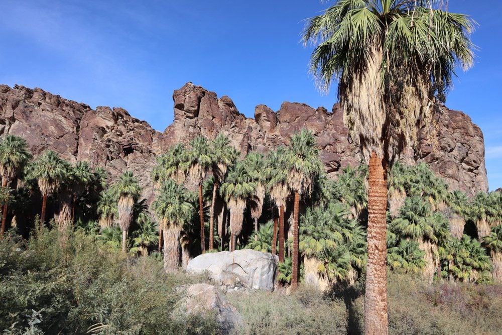
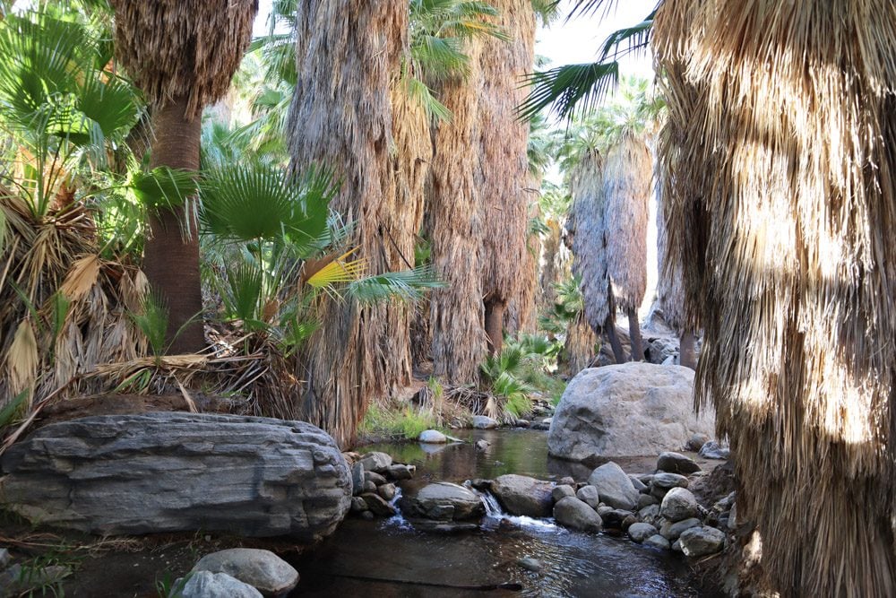
Back on the desert floor, I entered Indian Canyons just a couple of hours before its gates closed. This area is well known for its high concentration of desert palms. On the Andreas Canyon Trail, I got acquainted with the stars and was surprised to find a live stream of water flowing through the desert.
Pacific Coast Highway
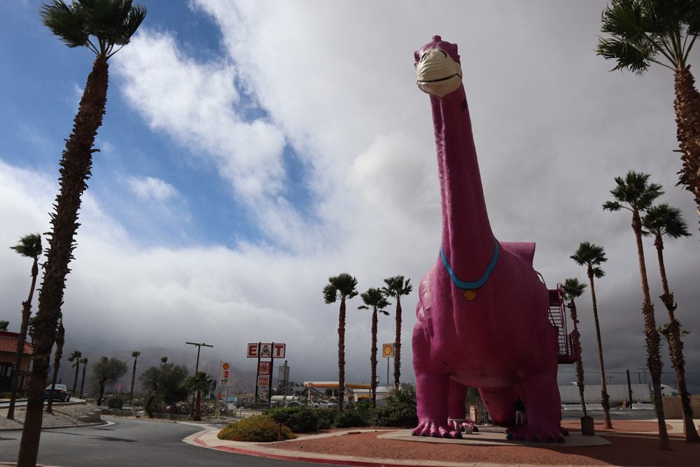
With the end of this five-week road trip well in sight, it was time to return to the coast and head north towards San Francisco. A miserable weather day was a perfect excuse to spend hours in the car for the 230-mile leg to Solvang. Outside Palm Springs, I made a quick stop at the Cabazon Dinosaurs. This legendary rest stop was featured in the Tears for Fears clip Everybody Wants to Rule the World, a major catalyst for this road trip. The famous Wheel Inn Diner is no longer here but its sign still looms on the side of the interstate.
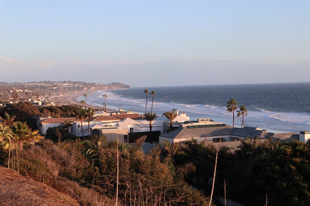
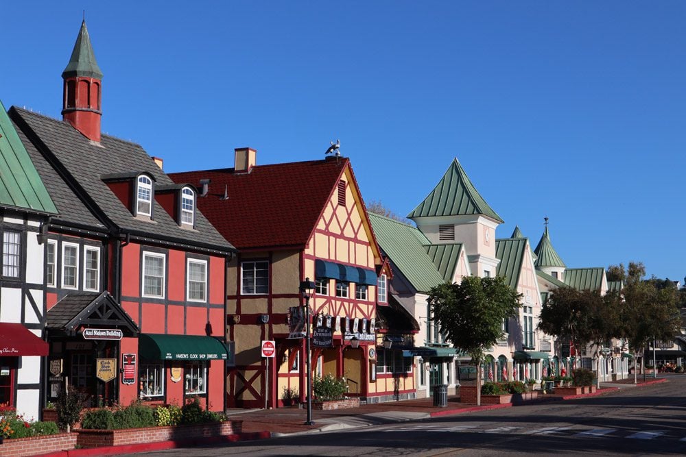
I made it to Malibu just as the clouds that poured rain the entire day cleared. A perfect sunset marked my return to the Pacific coast after more than a month and a dark drive to Solvang ended a long day. After a sweet danish pastry for breakfast, I set out to explore this cute tourist town that hails everything Danish.
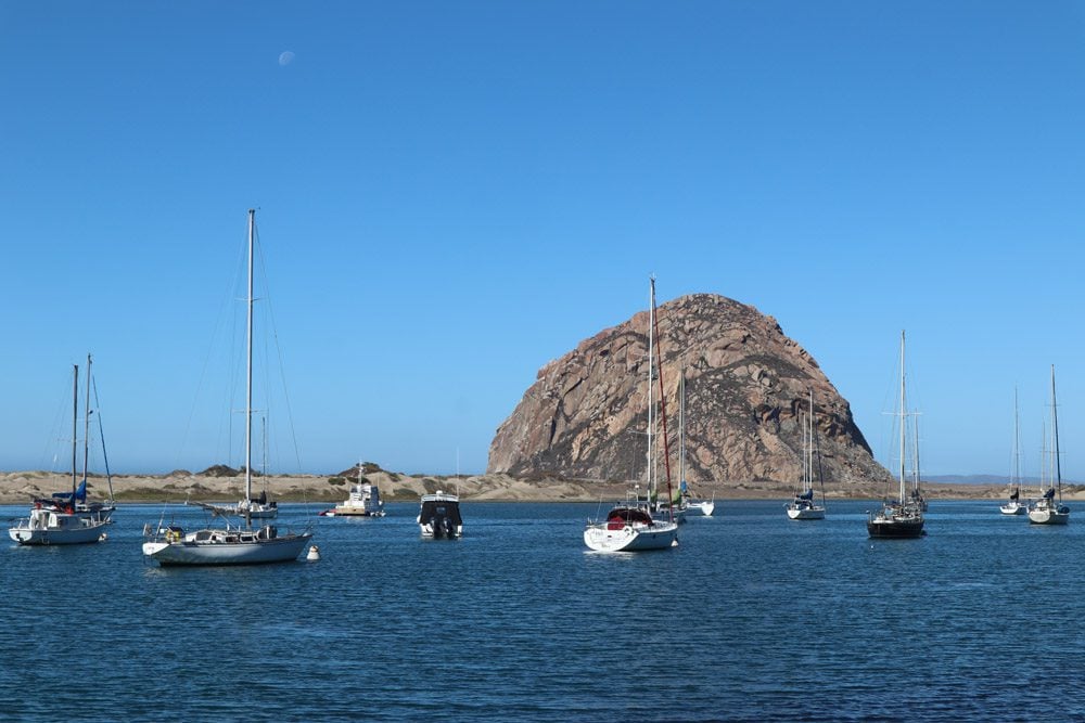
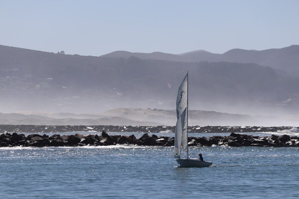
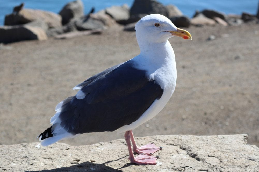
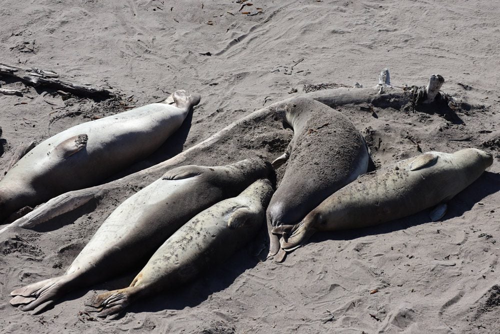
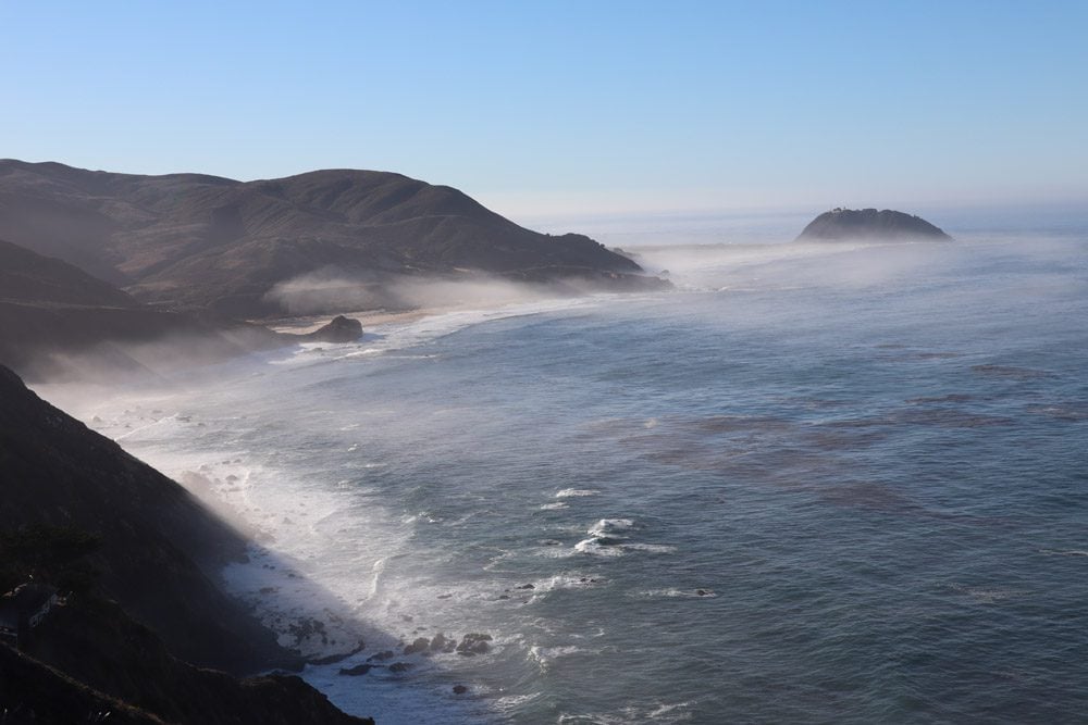
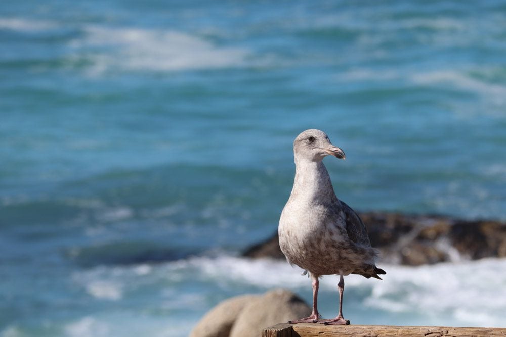
At Morro Bay, the seagulls, sea lions, and ocean-scented breeze meant I was back on the Pacific Coast Highway (PCH). A few years back, I made the opposite journey south from San Francisco but had to swing back north at Big Sur. This time around, I would drive a much longer stretch of the legendary coastal highway.
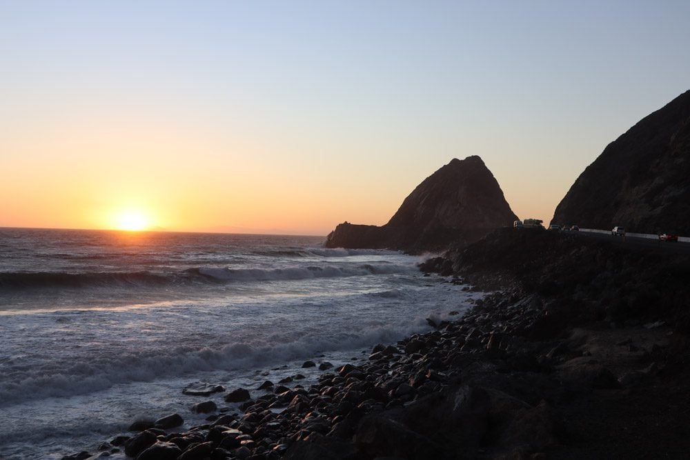
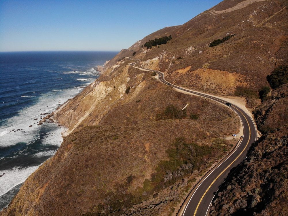
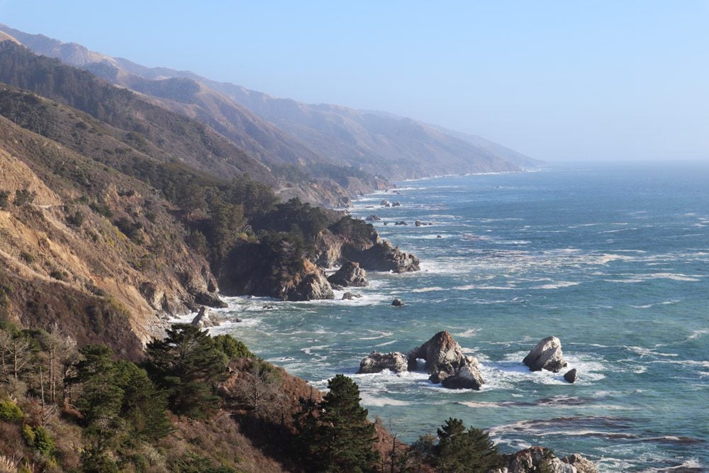
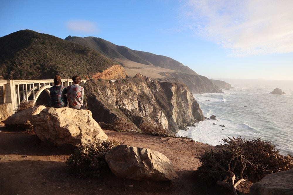
At Ragged Point, the “classic” PCH thrills begin as you inch closer to Big Sur. The road was narrow, the curves were sharp and never-ending, and the temptation to stop at every roadside scenic overlook really slowed progress down.
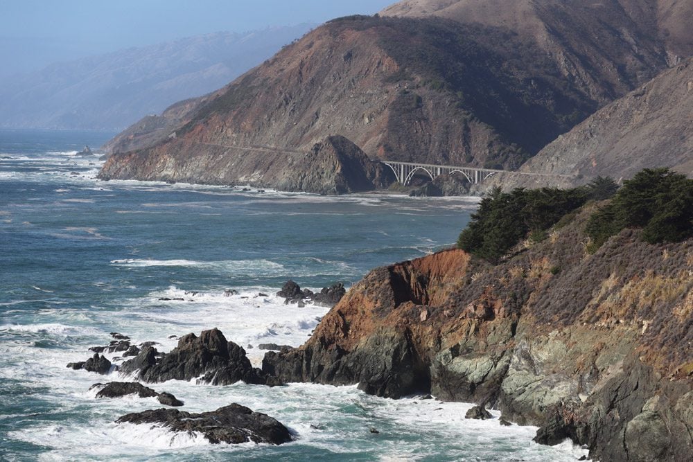
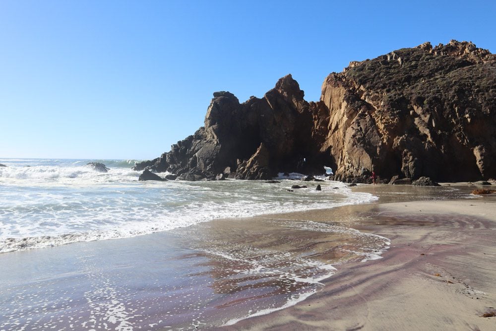
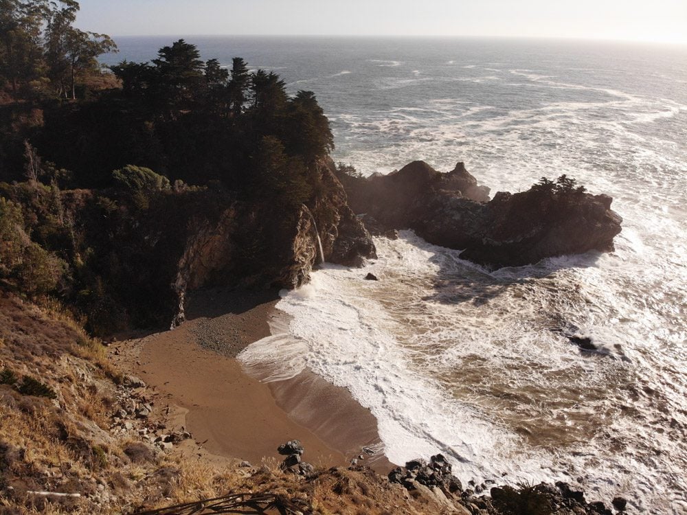
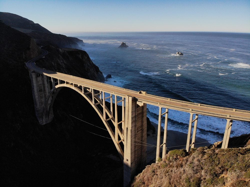
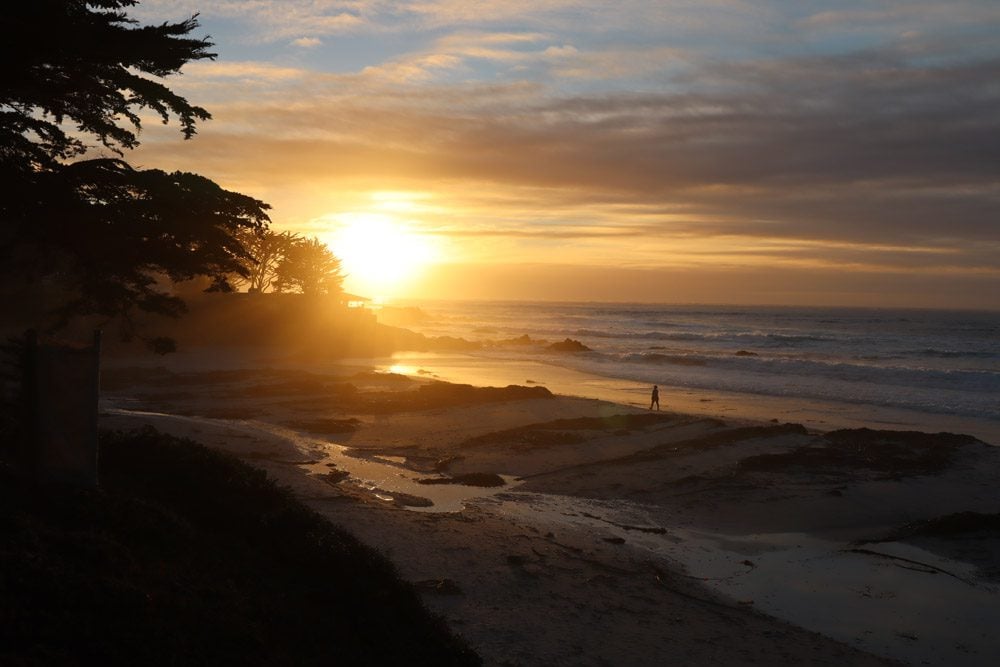
A trickle of water was all that was needed to keep McWay Falls, at Julia Pfeiffer Burns State Park, at the top of my list of PCH sights. I also hiked to Pfeiffer Falls and headed down Pfeiffer Beach, one of the most impressive sandy spots on the PCH. To end the day, I crossed Bixby Bridge, a well-known spot from social media and car commercials, reaching artsy and ritzy Carmel-by-the-Sea just in time for sunset.
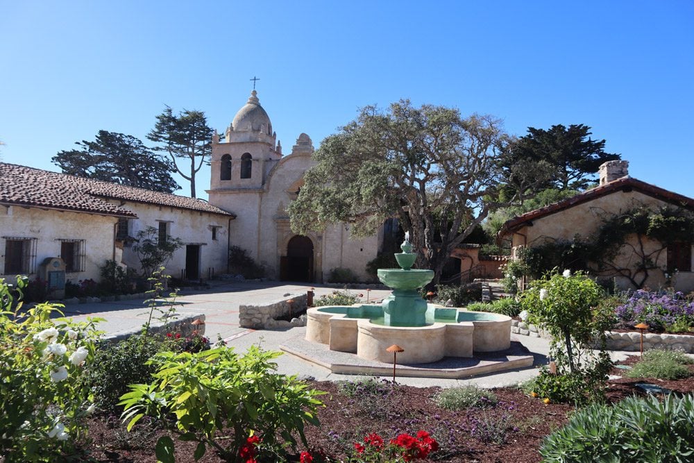
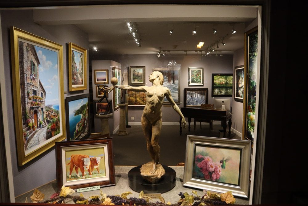
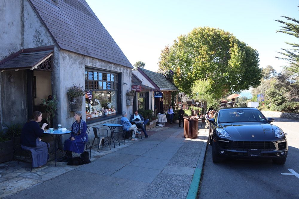
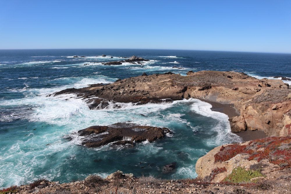
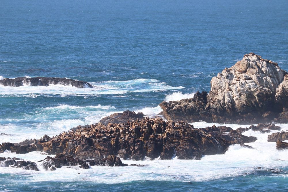
Carmel is the kind of town many people can picture themselves living in. It’s got a pretty beach, clean streets that bend around trees that were there before, art galleries galore, and fine dining only restaurants. The Carmel Mission is a great stop to learn about the area’s history and marvel at the bygone architecture. Nearby, Point Lobos State Natural Reserve is a prime spot for nature viewing.
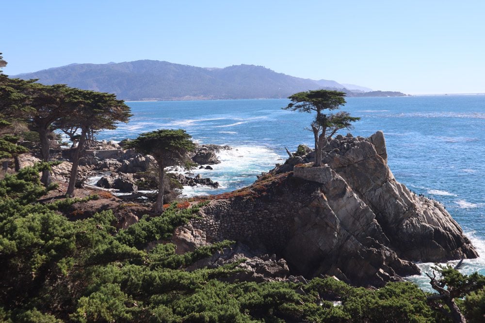
With just a few hours left before my flight back to Israel, I cruised 17-Mile Drive where I definitely could not picture myself living despite the pretty beach and clean air. This area is a gated community, home to the Pebble Beach Golf Links and lots of folks sporting Lacoste fashion.
Slightly further north, I was running out of time. I broke a few speed limits to revisit Santa Cruz, though it was kind of dead because of COVID-19 restrictions. Disappointed at not being able to continue on the PCH as planned, it was time to ask Google Maps for the opposite thing I’ve been asking since picking up the car: find me the quickest way to get to my next (and final) destination – San Francisco International Airport.
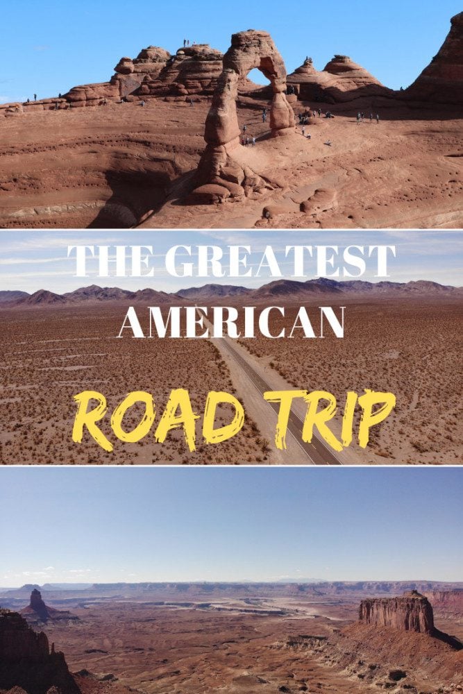
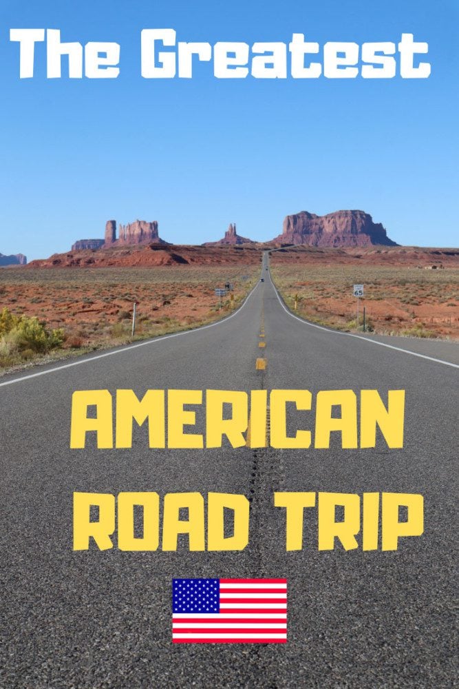
Pin These Images To Your Favorite Boards!