A Tale Of The Greatest American Road Trip
Bryce Canyon to Moab
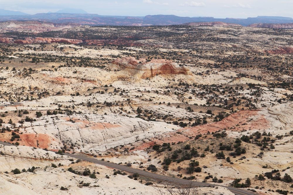
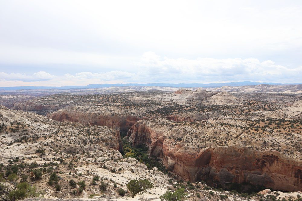
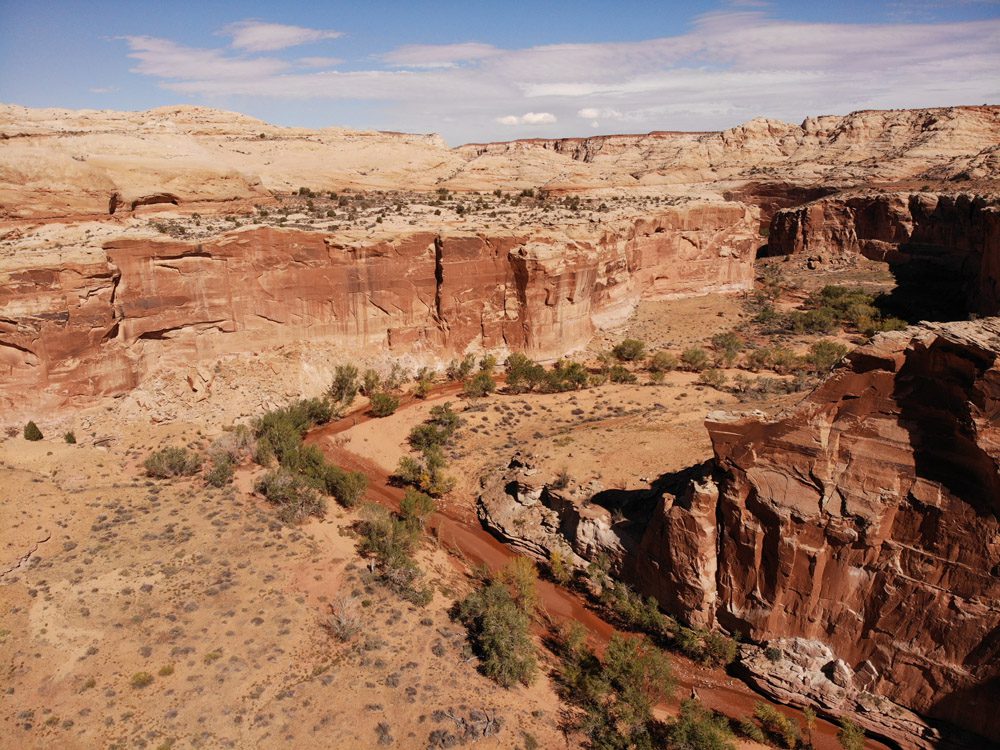
It was almost noon when I exited Bryce Canyon with 250 miles to Moab on the plan and lots to see on the way. This leg is worthy of at least an overnight as it encompasses Grand Staircase Escalante National Monument and Capitol Reef National Park, one of Southern Utah’s “mighty five” national parks. But even on a five-week road trip, tough calls need to be made so I did my best to maximize the time and see the top sites along the scenic highways.
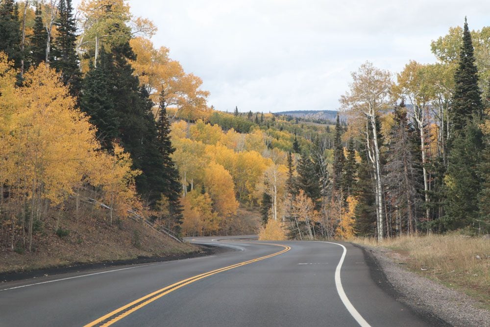
Utah’s Scenic Byway 12 cuts through Grand Staircase National Monument and offers numerous vista stops and trails for day-trippers. I stopped at Head of the Rocks Overlook for the views and hiked the narrow creek to Calf Creek Falls before gaining elevation and experiencing the fall colors of aspen trees covering Boulder Mountain.
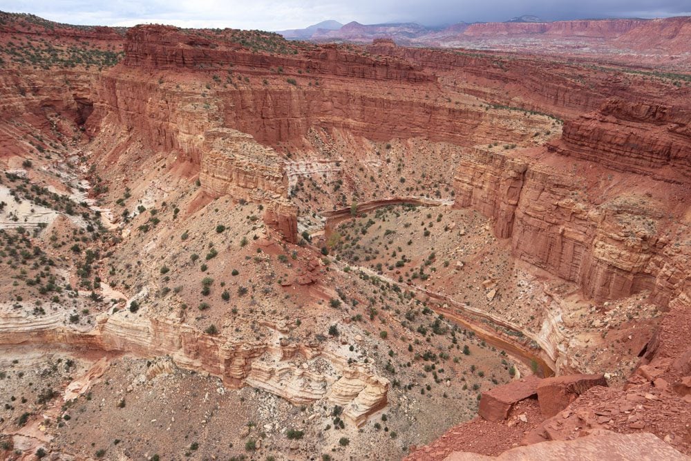
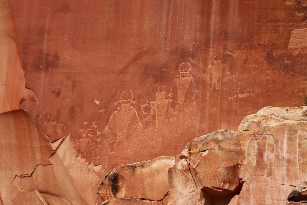
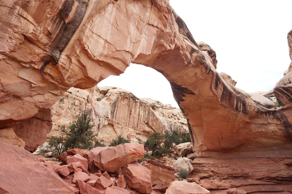
In Capitol Reef, the scenery turned to “classic” Southern Utah with the towering reddish pinnacles and rocky mesas at Goosenecks Overlook, Chimney Rock, and the Fluted Wall. Near Fruita, I stopped to check out some Native American petroglyphs, hiked to Hickman Bridge, and drove the famous dead-end scenic drive.
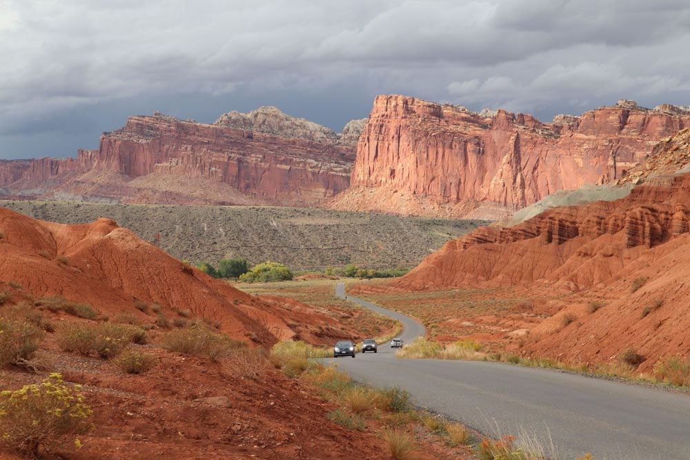
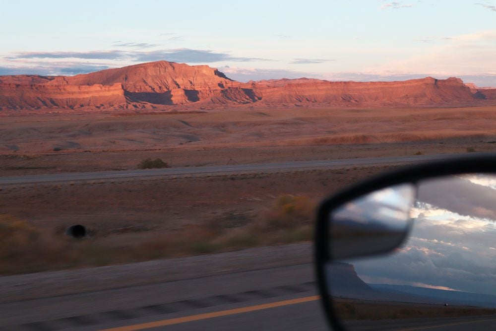
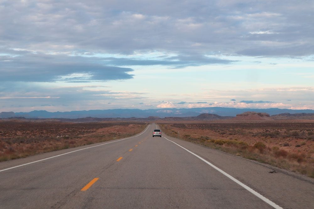
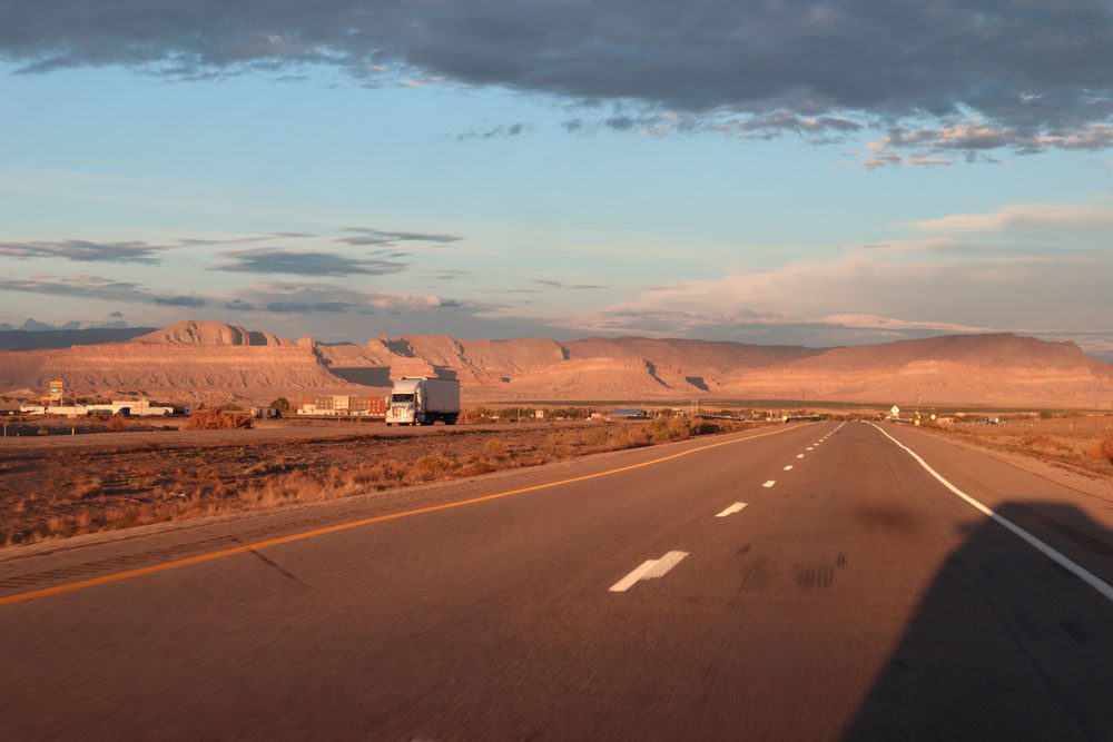
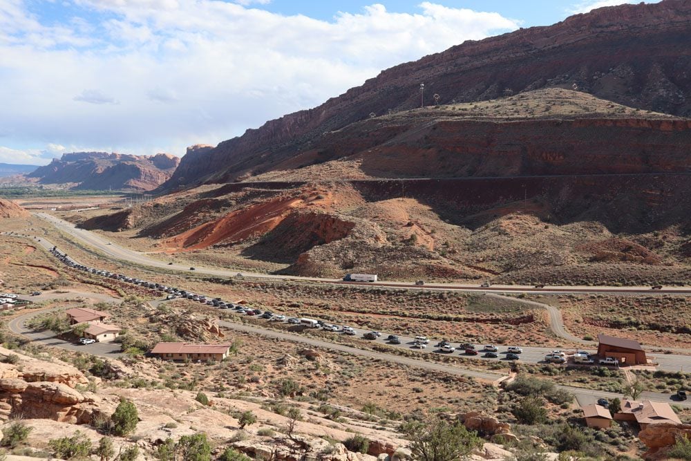
Beyond the farming town of Hanksville, scenic highway 24 ran nearly straight for 45 miles through open country with almost absolutely nothing around until joining Interstate 70. I made it to Moab with its busy main street and flashy neon signs at 19:30 on a Friday, just as a convoy of cars headed down after catching the sunset at Arches National Park, my next stop.
Arches National Park
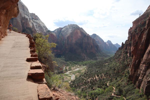
Together with Death Valley, Arches National Park ranks at the top of my experiences on this road trip. I’ve seen nothing like this before, perhaps only in NASA footage of Mars. Like Zion, this national park is heavily congested but a shuttle system is yet to have been put in place. You must enter the park very early in the morning to avoid having to wait at the gate for cars to exit. And even with this load balancing act, the park’s interior is quite busy. Scoring a parking spot at one of its top attractions is certainly worthy of a pat on the back.
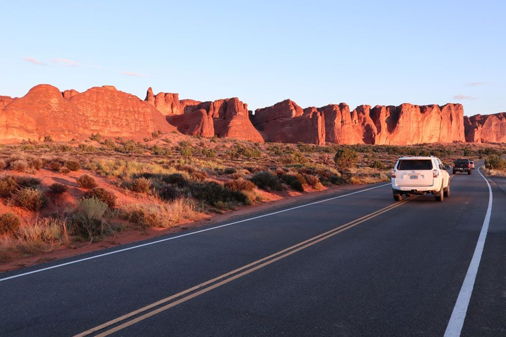
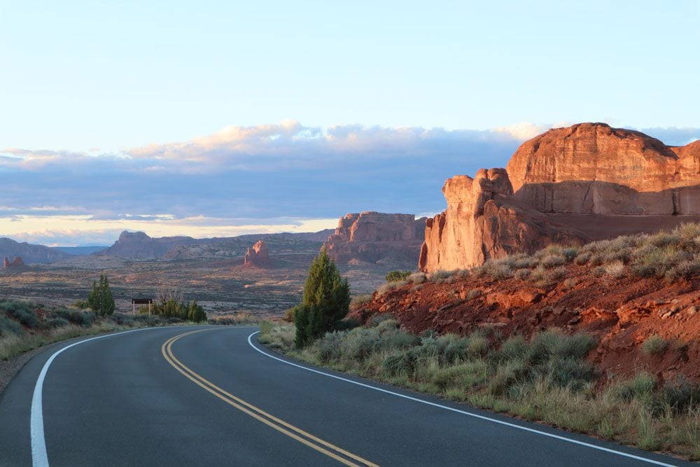
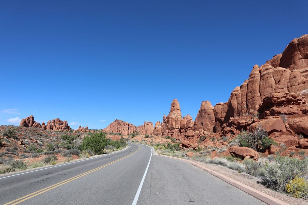
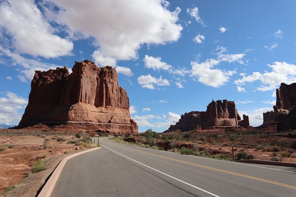
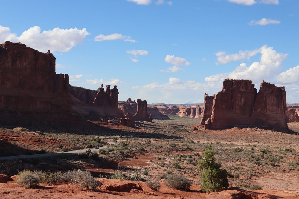
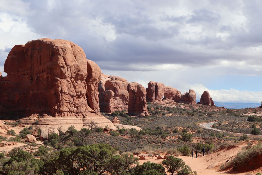
The park’s scenic drive is its main artery and offers tempting opportunities to stop at vista points or embark on short hiking trails. What surprised me the most is that Arches is not only about “the arches”, though they are spectacular and found nowhere else around in such high numbers. The diverse geology ranges from the smooth rock faces of Devil’s Garden to the eroded pinnacles of the Courthouse Towers and Park Avenue. If these sites seem familiar from somewhere, it might be from Thelma Louise, the classic road trip film that was partly filmed within the park.
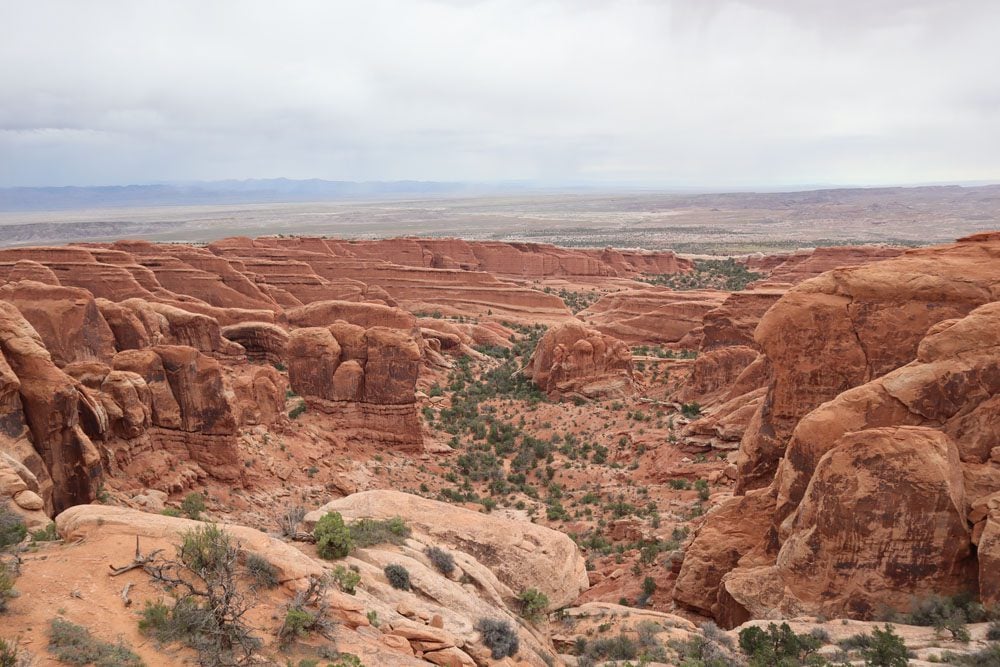
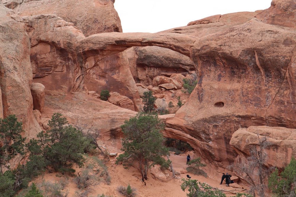
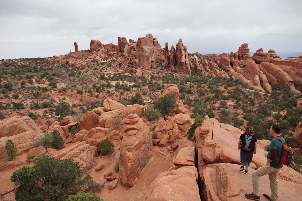
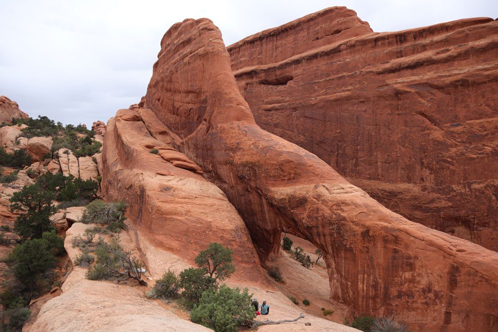
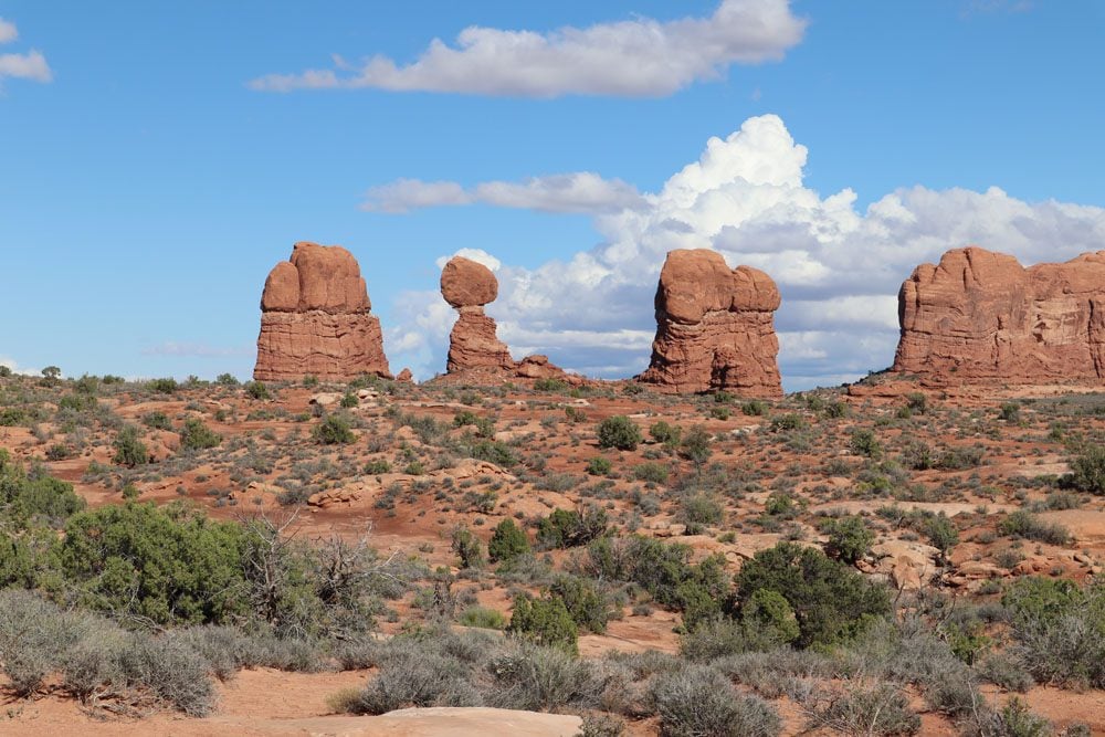
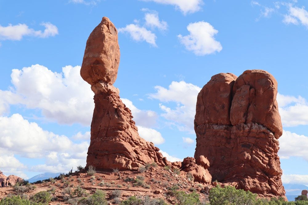
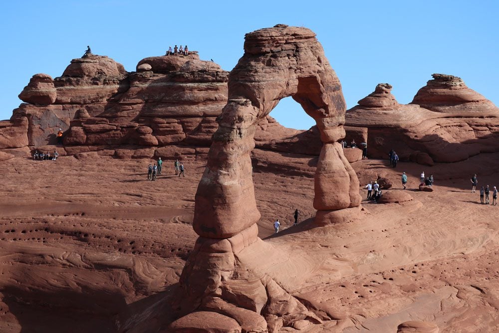
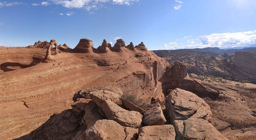
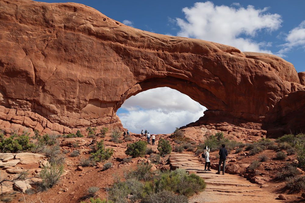
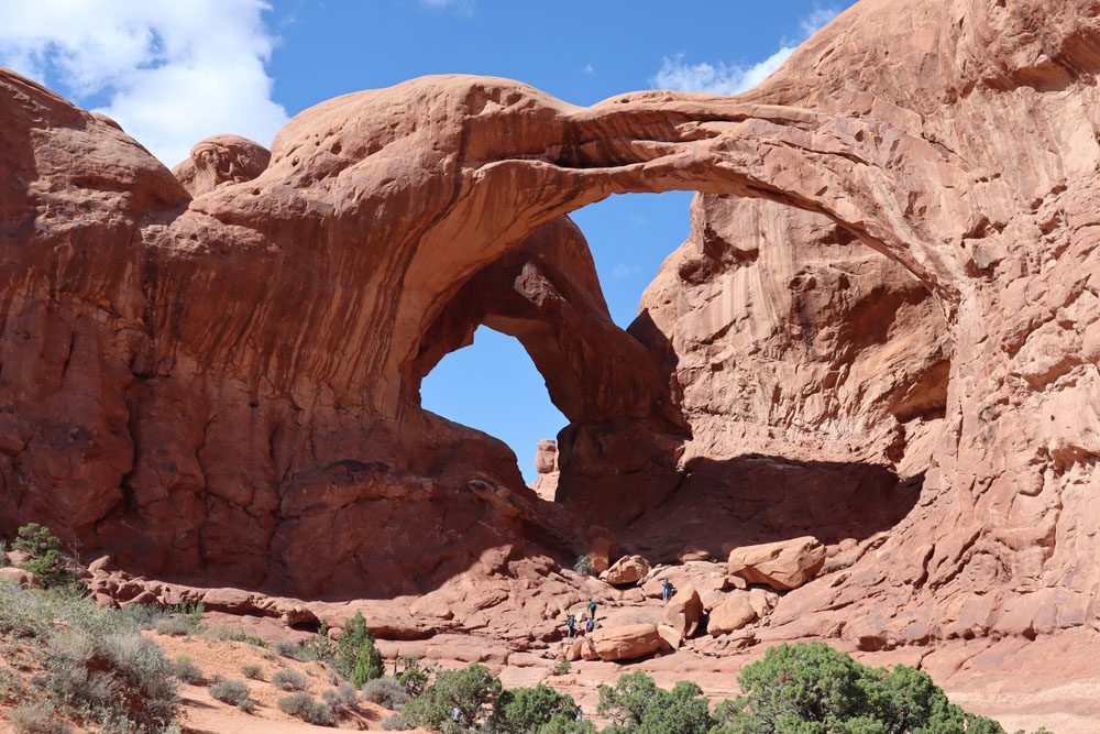
Without a doubt, the park’s main attraction is Delicate Arch, the celebrity arch is even featured on Utah’s license plates. But apart from this star, the drive to the Windows section of the park with its myriad of arches via the Garden of Eden lookout and the Parade of Elephants truly teleports the visitor to a seemingly different planet.
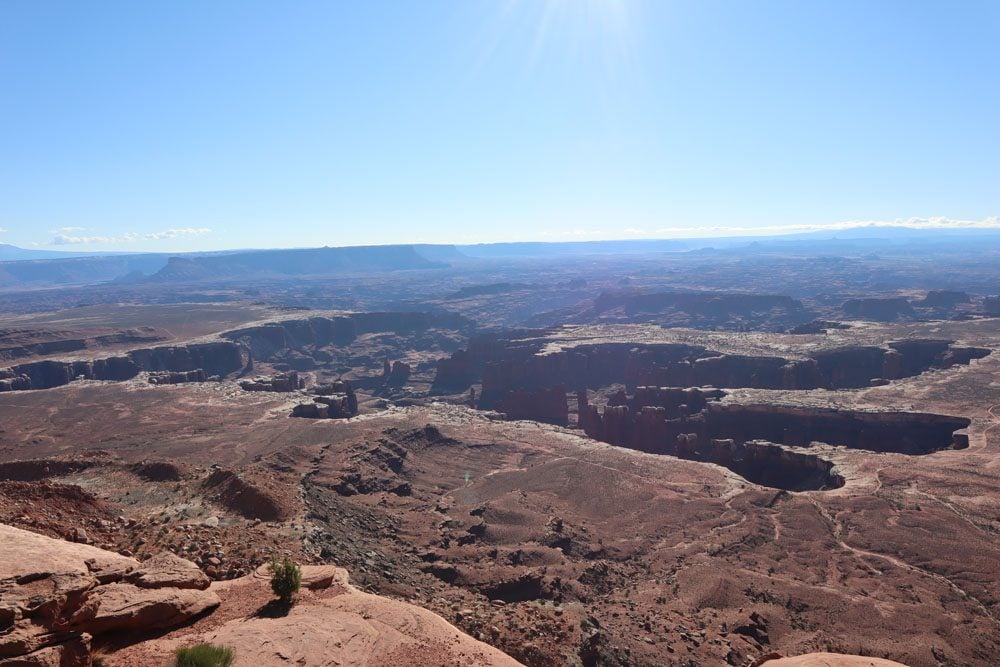
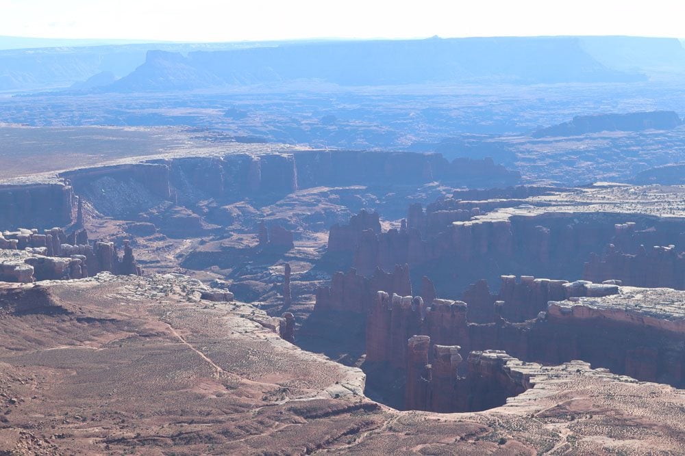
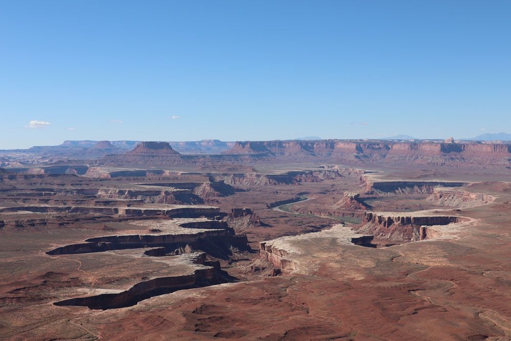
Island in the Sky
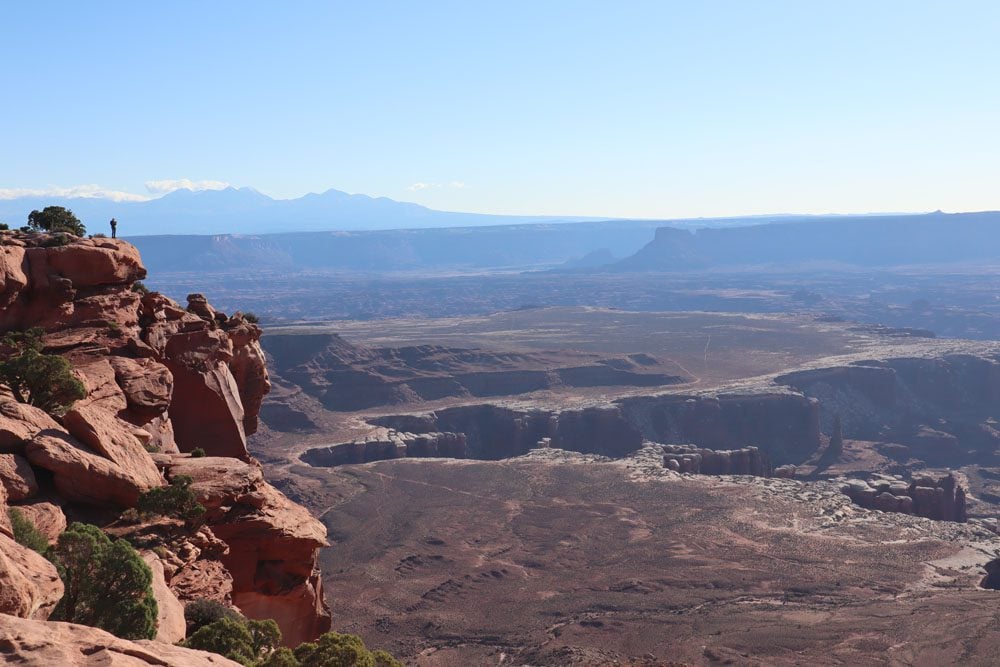
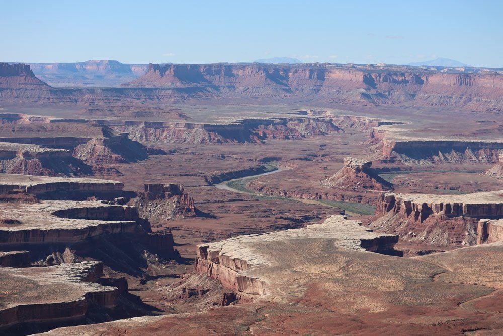
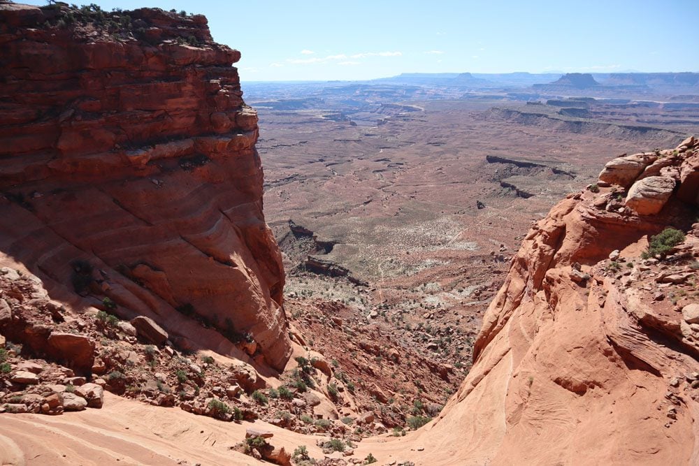
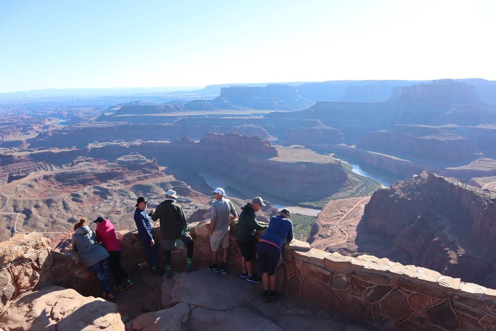
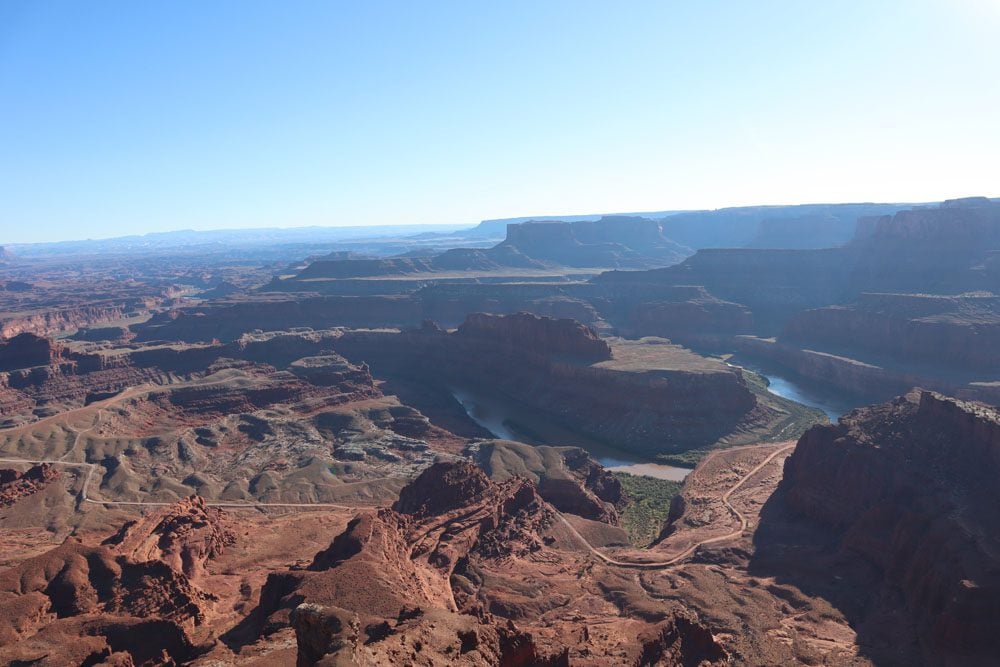
The next three days were spent at Canyonlands National Park, a park so massive in size that it’s divided into four distinct sections. I devoted the first day to the park’s star attraction, the Island in the Sky, a huge mesa almost completely detached from the outside world by a high drop in elevation and the natural boundary that is the mighty Colorado River. From the images below, you can understand how this place got its name.
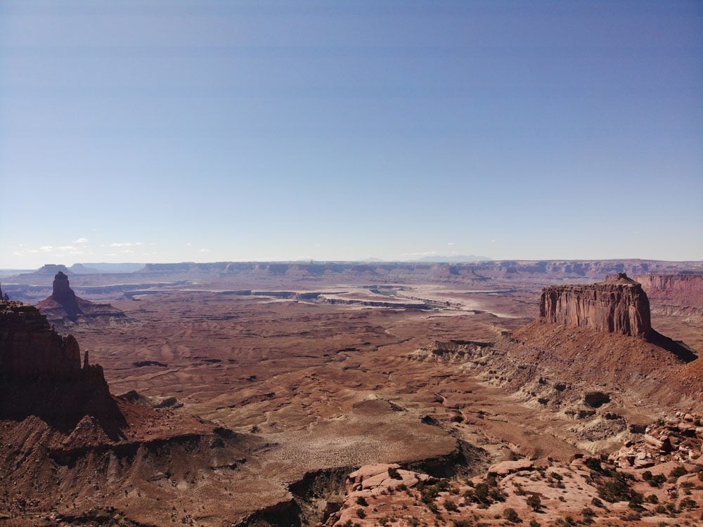
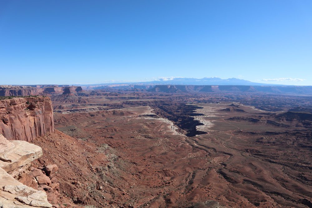
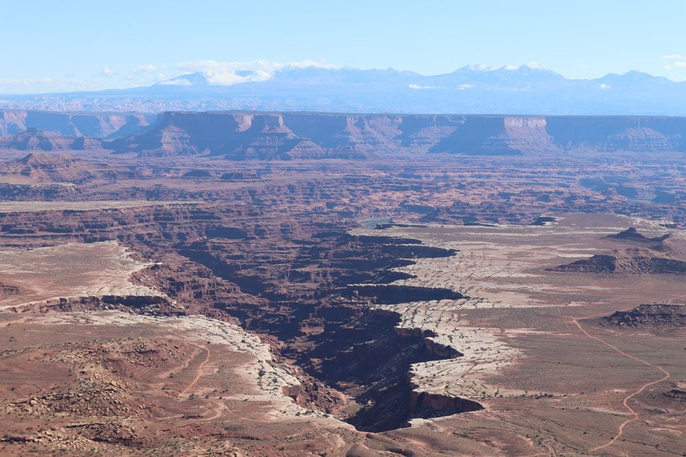
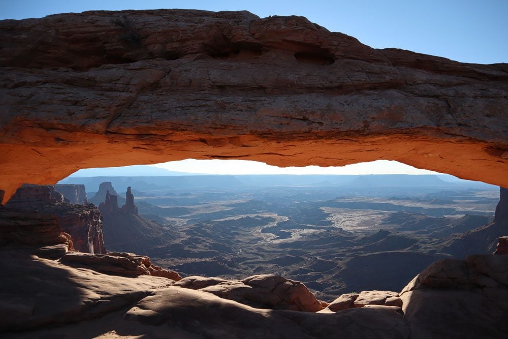
It was very cold up here in the morning but that’s also the best time to enjoy the view at Mesa Arch, one of the iconic frames of Southern Utah. From there, I ventured along the top of the canyon rim from its various lookouts, the best of which were Grand View Point and Green River Overlook.
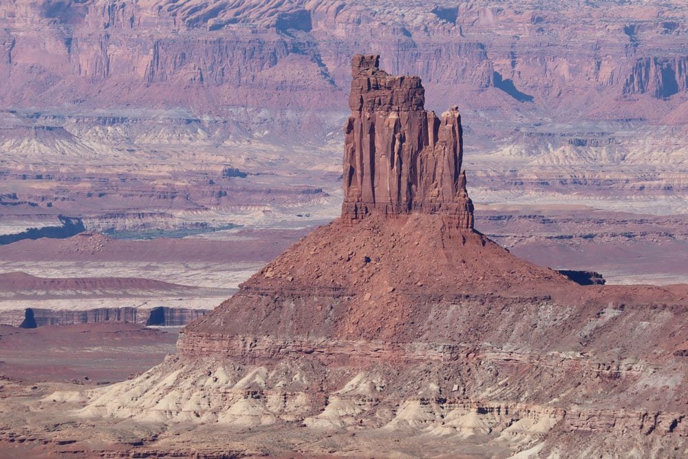
I was really curious to see what it’s like at the bottom rim, metaphorically speaking where the island’s shores meet the ocean, so I took the Murphy Trail for a challenging hike down to White Rim Road. It turns out that the view is better from high above but this hike was exceptional and there was hardly anyone around.
Before sunset, I headed to nearby Dead Horse State Park to see what all the fuss was about. From Dead Horse Point, it’s easy to understand how this place got its name. Back in its ranching days, a band of horses was so scared of the terrain, that they died of thirst instead of traveling a short distance where water was found. It’s also the area where the epic final scene from Thelma and Louise was filmed.
Horseshoe Canyon
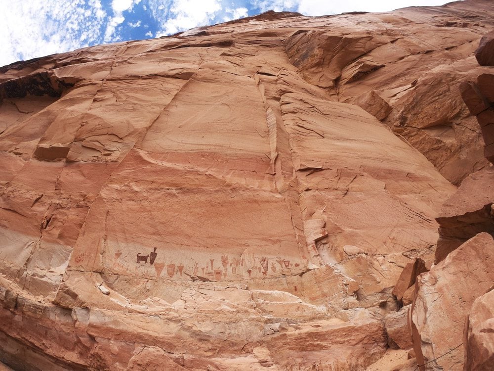
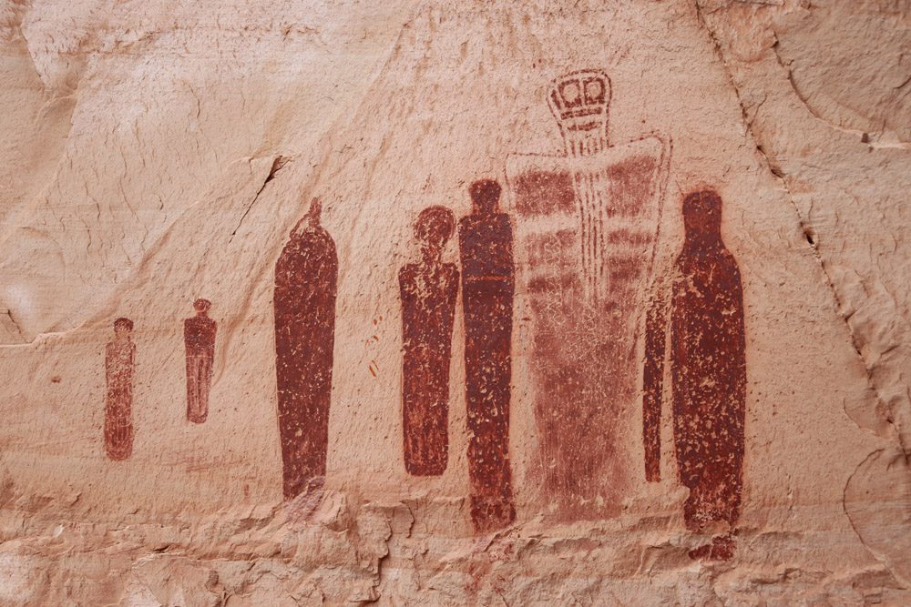
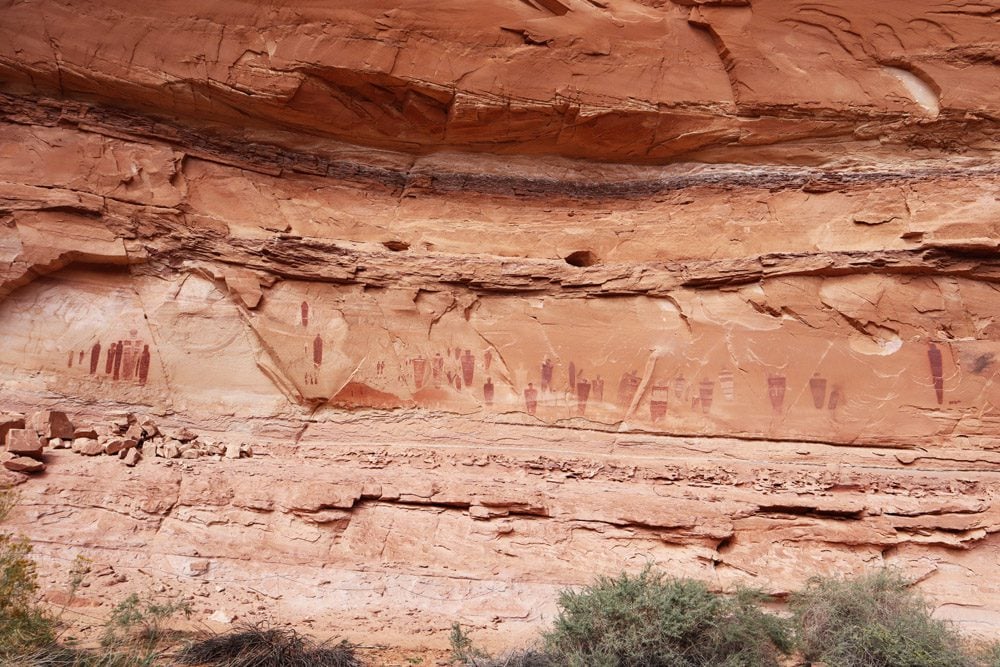
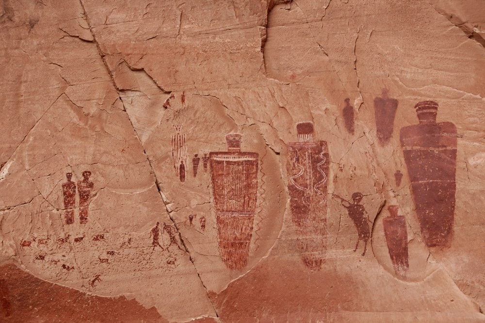
Detached from the rest of the national park, reaching Horseshoe Canyon requires a very long drive on a dirt road. So what’s the reason to venture to this remote canyon? How about the most impressive Native American rock paintings currently known in North America. I remembered seeing an episode of Ancient Aliens featuring Horseshoe Canyon, so I just had to see it with my own eyes.
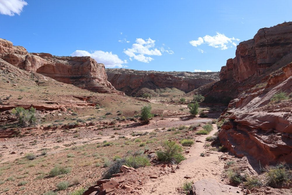
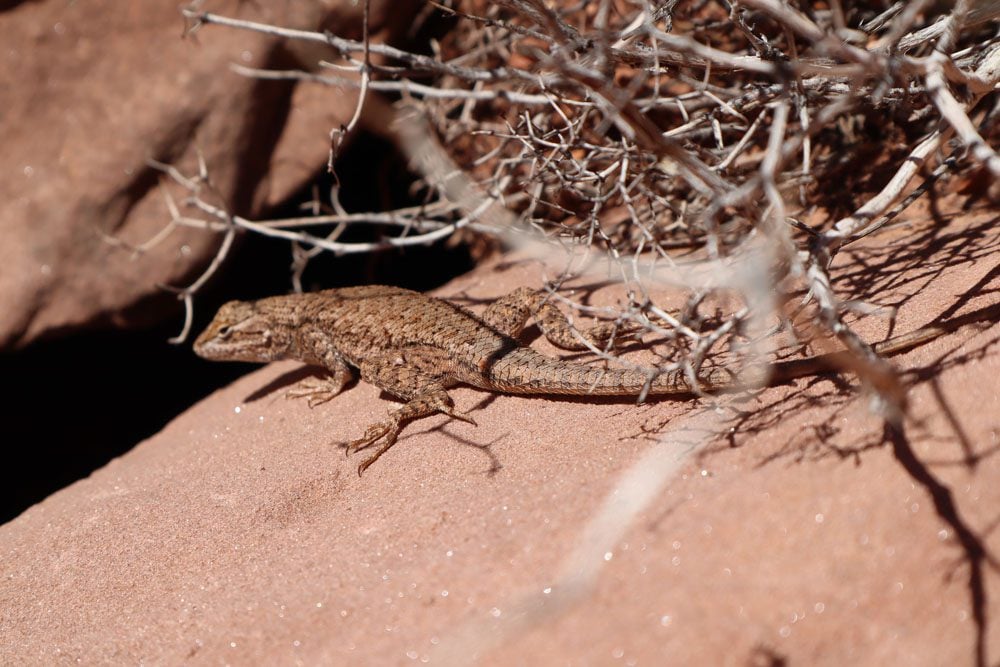
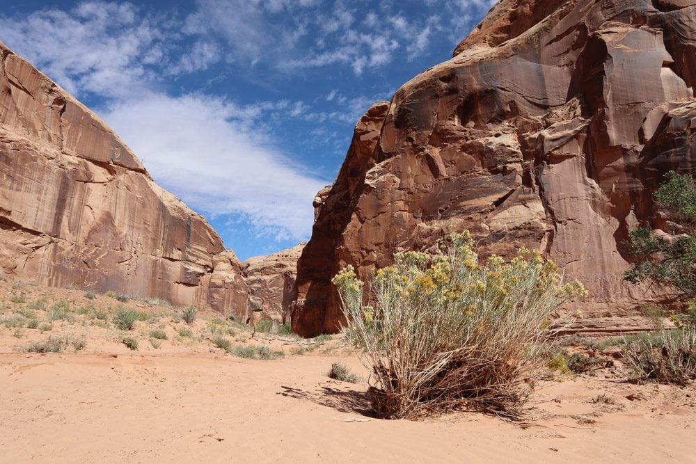
To see the rock paintings, you need to walk the length of the sandy canyon floor. The experience is quite surreal because it can be very windy at the rim but as soon as you descend to the floor, complete silence. It’s a different world down here, with smooth sand cliffs, lots of green, and lots of lizards.
The hike reaches its climax at the Great Gallery, where a series of lifesize paintings of humans and perhaps non-humans decorate the canyon wall. Not much is known about these works of art, among the oldest found to this date.
Moab to Chinle
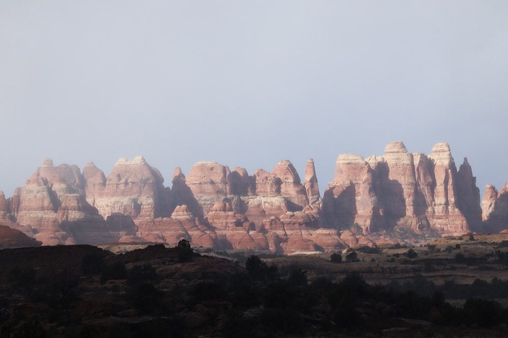
I planned to spend another day in Canyonlands National Park to explore the more remote Needles section, but the bad weather caught up with me once again. It was a very chilly morning and I managed to catch a good glimpse of the pointy rocks from a distance before conditions worsened.
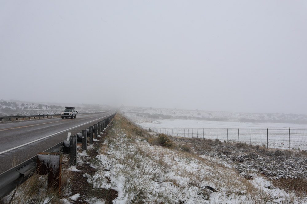
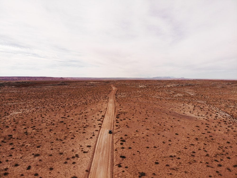
To head further south, I had to pass by the Blue Mountain area which on this early October day was covered in white. This was a proper snowstorm with low temperatures and low visibility. There was no point in taking the scenic backcountry so I just headed straight into Navajo country. The self-governing Navajo Nation is the largest Native American reservation. It covers an enormous area across three U.S. states and even sets its own time zone.
Though mostly flat at times, the drive was interesting if only for the clear signs of the culture change; trading posts instead of 7/11s, Navajo police instead of the highway patrol, washes instead of rivers, fry bread instead of pizza, and absolutely no alcohol. After being heavily hit by early waves of COVID-19, residents take extreme caution now. Dirt roads leading to family compounds explicitly warn visitors to keep out. It’s family only from this point. I rolled into Chinle and settled into the Thunderbird Lodge to warm up and wait for the promise of sunshine tomorrow.
Canyon de Chelly
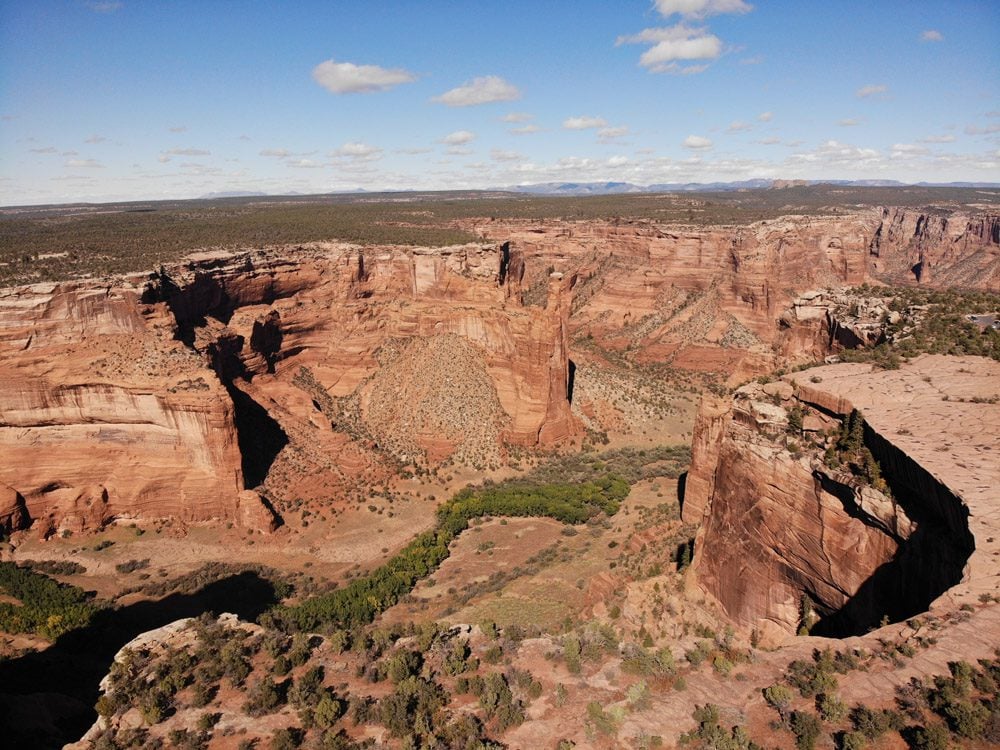
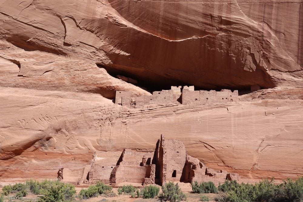
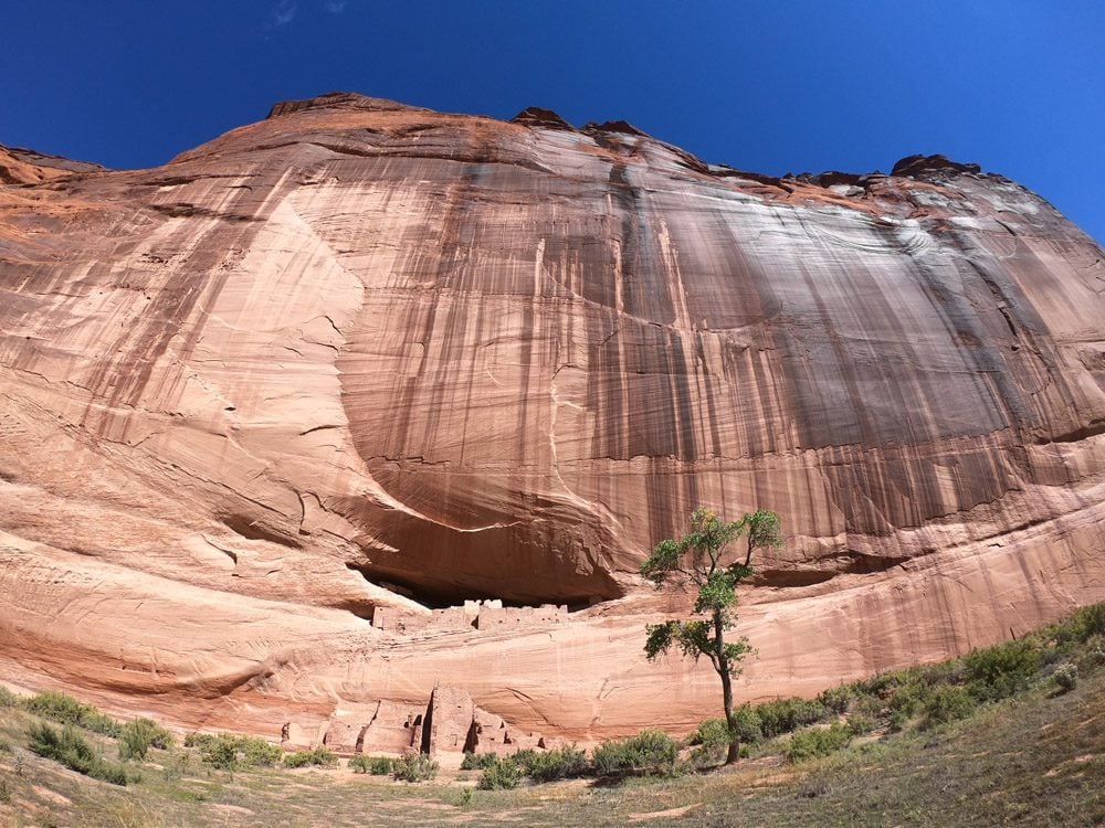
Pronounced canyon de-shay, Canyon de Chelly National Monument is regarded by some as the most beautiful canyon in the southwest. For almost 2,000 years, Canyon de Chelly has served as a place of refuge, first from the elements and later from Spanish colonizers. The first to arrive were the Ancestral Puebloans. They erected cliff dwellings in seemingly inaccessible spots, some of which still stand today. When they mysteriously vanished, the Hopis moved in and when they left, the canyon was left to the Navajo.
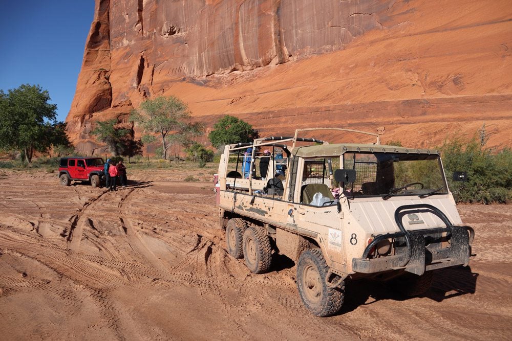
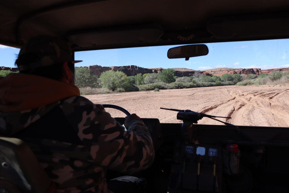
Together with three other curious guests, I hopped on the behemoth military surplus Pinzgauer all-terrain 4WD on a sunny but freezing cold morning to explore the canyon floor. Elton, our superstar Navajo guide, easily maneuvered the beast through the soft sand and took us to scenic spots while sharing the canyon’s history and the ins and outs of contemporary Navajo life. A few families raise cattle and grow crops inside the canyon. Elton tells us that once every few years, the canyon floods and becomes inaccessible, so ranchers must toss hay from the rim to feed the stranded cattle below.
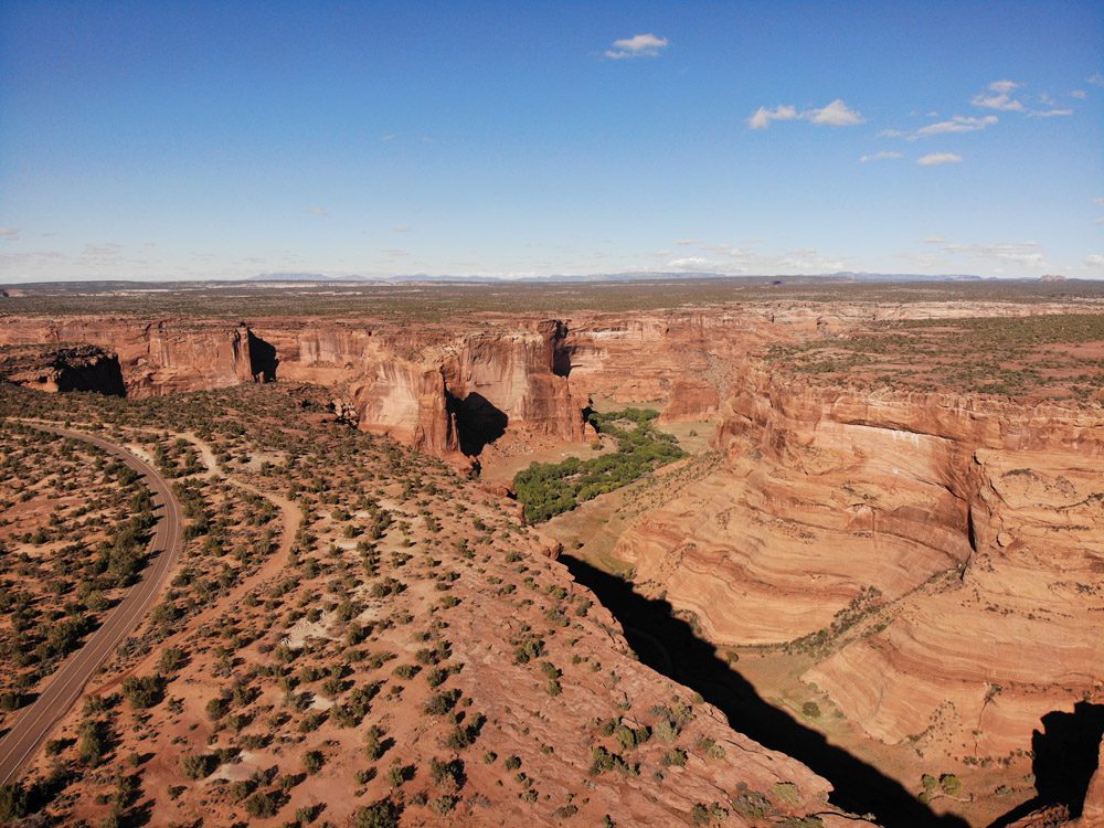
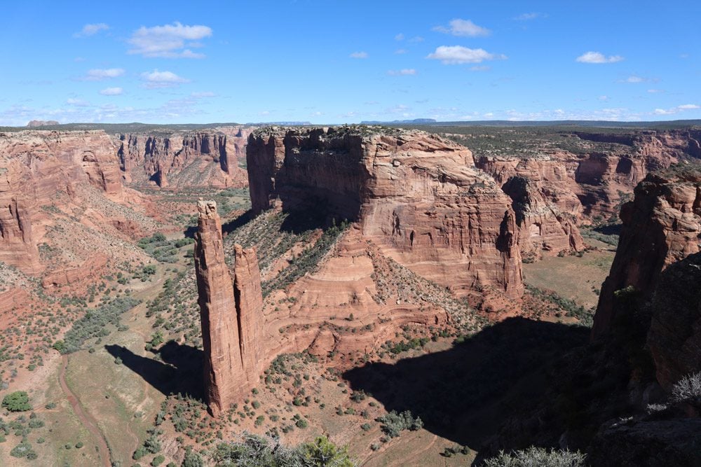
After exploring the low ground, I turned to the north and south scenic rim drives to enjoy the views of the canyon and the pueblo remains from high above. The “money shot” without a doubt comes at Spider Rock, where a giant double monolith vertically rises from the canyon’s floor.
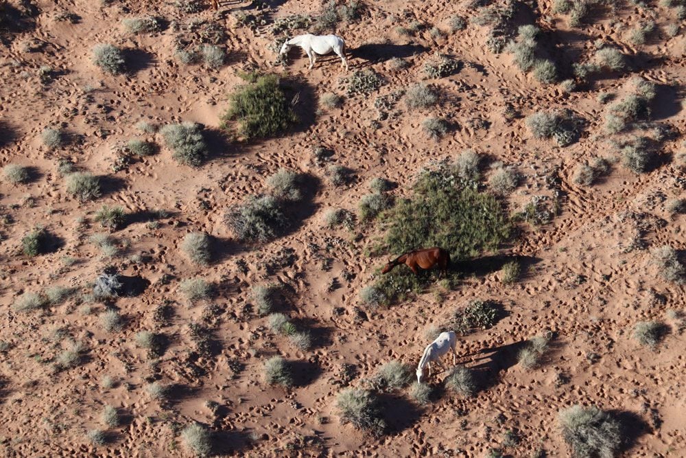
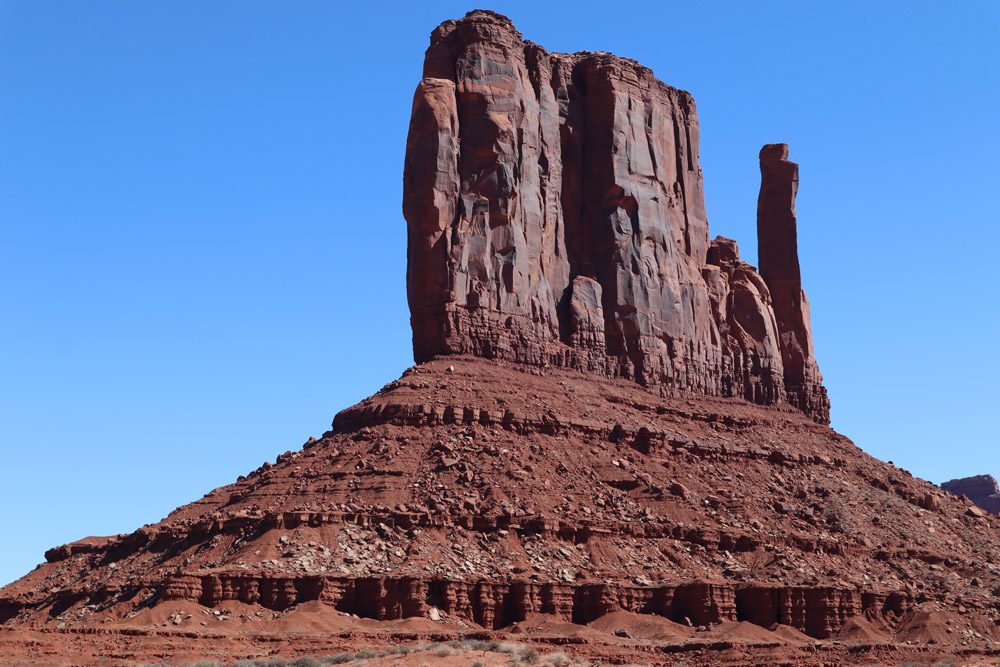
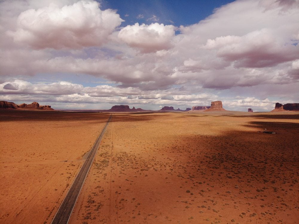
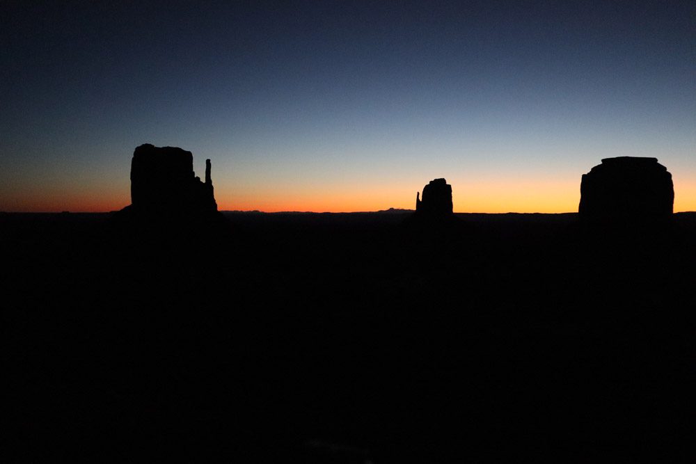
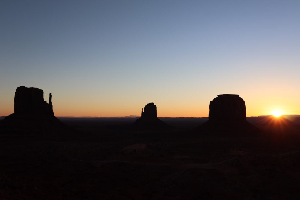
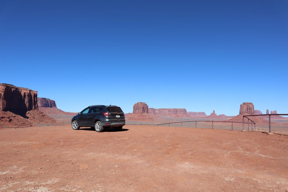
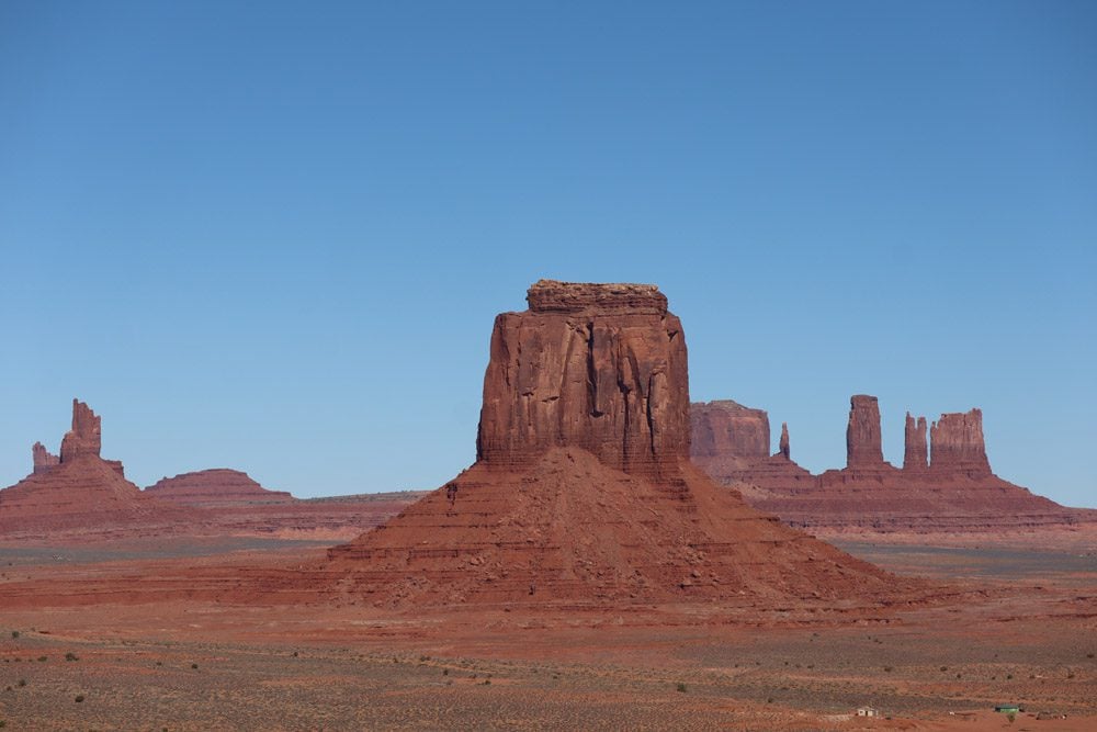
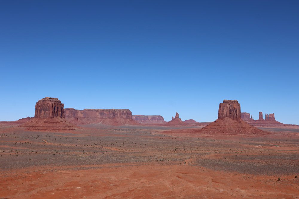
Monument Valley
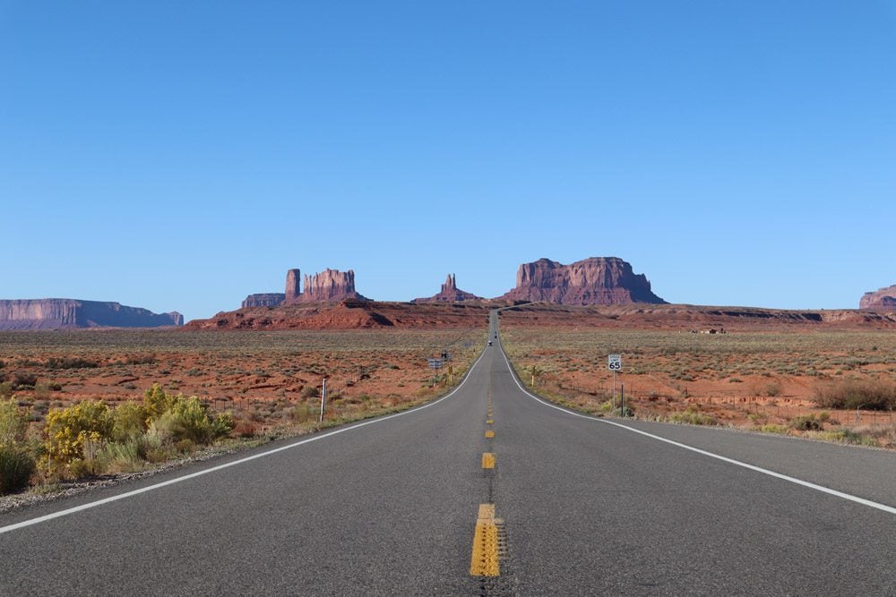
Featured in legendary westerns and one famous scene in Forrest Gump, Monument Valley is a quintessential stop on any road trip in America’s southwest. I came here for the first time in 2014 as part of a short road trip from Las Vegas and even sent my folks here a couple of years later. What I especially love about Monument Valley is that you can see it from a distance and the excitement builds up as you inch close to its official entrance.
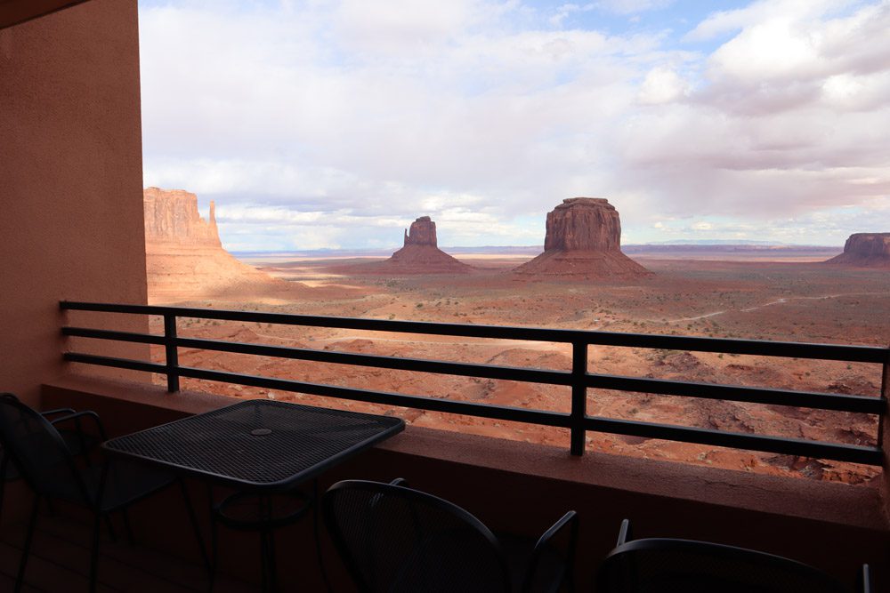
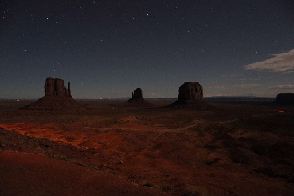
As in the original visit, I chose to stay at The View Hotel and made it just in time to catch the sunset and prepare for an evening of stargazing despite the freezing nighttime temperatures. I woke up before the sun did and brewed a few cups of coffee, waiting for it to paint the valley in beautiful morning colors as it rose above the horizon.
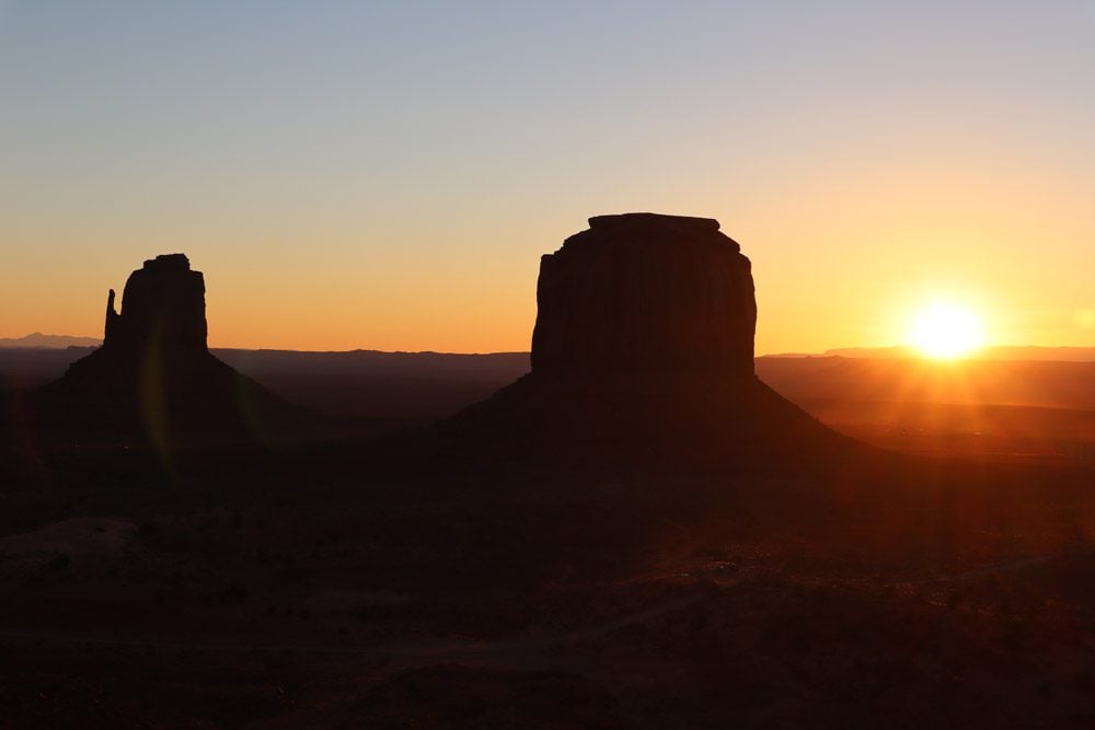
The first order of call was to revisit one of the most photographed spots in America. If not from Forrest Gump, surely you recognize this from popular culture.
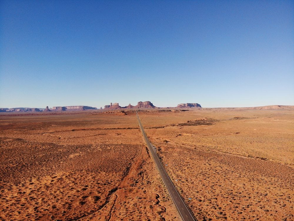
With that out of the way, I descended to the canyon floor and drove the length of the scenic drive, stopping at all the possible lookouts to digest the unique desert landscape of Monument Valley. Due to COVID-19, the Navajo restricted the number of cars allowed on the scenic drive notwithstanding the outdoor nature of the experience. So despite having to queue for my turn, there were spots where I had the valley floor all to myself.
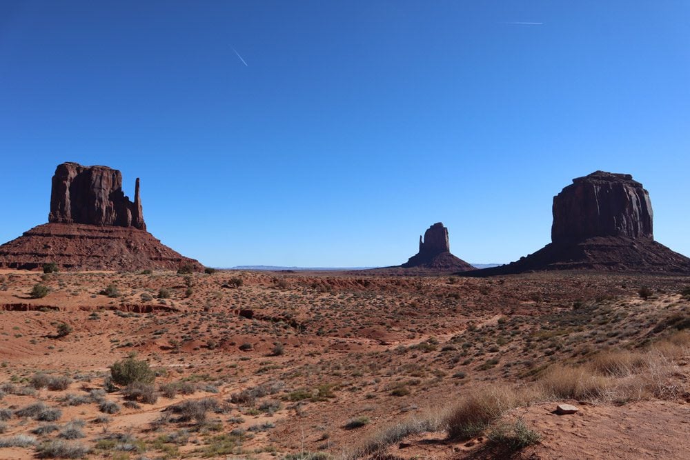
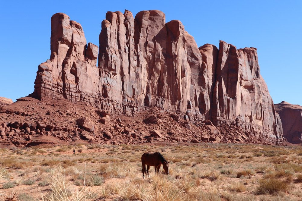
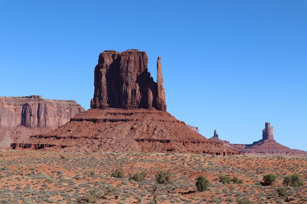
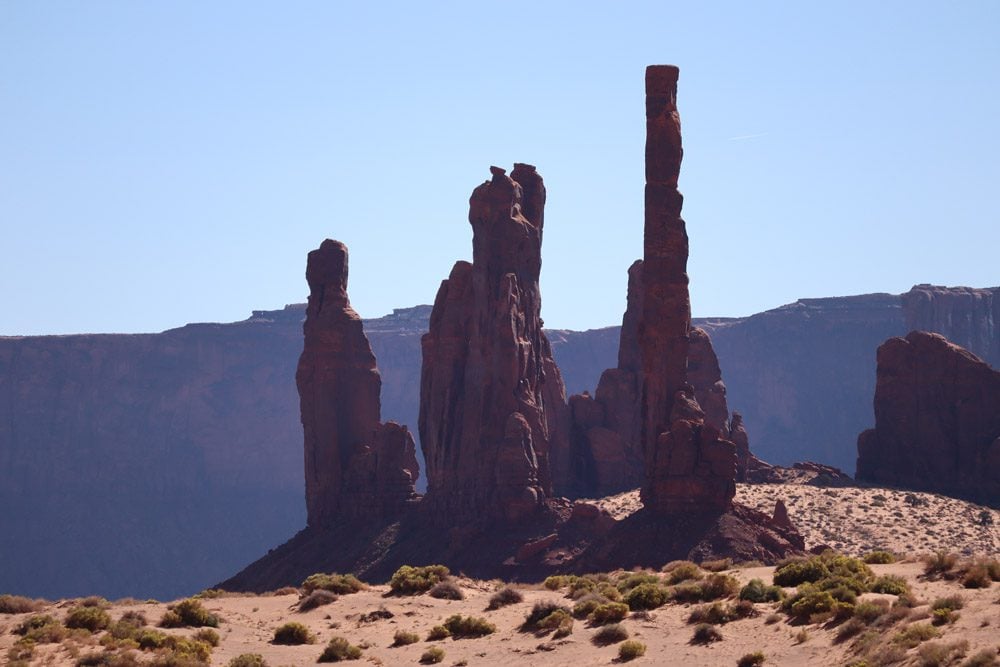
Having scaled my consumption of burgers, fries, Twizzlers, beef jerky, and other junk food on this road trip so far, I thought it’s a wise idea to try and squeeze in a short hike before departing. I circled the famous mittens on the Wildcat Trail, getting even a quieter experience of the valley before getting back into the car and heading 127 miles west to Page.