2 Weeks in Reunion Island Itinerary
Part 3: Three Days in Langevin, Volcano & Foret de Bebour-Belouve
The third section of this Reunion Island itinerary is a mix of both the tropical and the volcanic. We’ll spend a couple of days chasing waterfalls and secluded pools and one day visiting the island’s active volcano.
Where to Stay Around the Piton de la Fournaise Volcano?
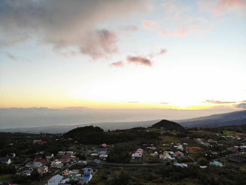
Our base for this section is near the village of Bourg-Murat in La Plaine des Cafres. It’s the western plain that separates the Piton de la Fournaise and the Piton des Neiges, a chilly and windswept area that resembles Ireland or Scotland. It is an optimal base for exploring the area’s grand attractions and the prime launchpad for the volcano visit.
We stayed at the Le Relais du Volcan, a very basic (and low-priced) bed and breakfast set in a large, aging wooden home. The owner, Philip, doesn’t speak much English, but we learned that he moved here from Toulouse 20 years ago. Rooms are basic, with a private bathroom/shower in a separate room across the hall.
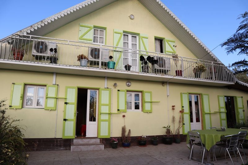
There was no WiFi then, but Philip said a fiber connection was already in the works. A fire is lit in the common area after dark, and breakfast is left for you late in the evening so you can get up early and start your day (this is very helpful). As for the dining option, Philip offered to recommend a few places, but we bought groceries and did our own home cooking. Bottom line: it wasn’t fancy, but the location was spot on, and the sunsets were incredible.
Click here for other accommodation options in La Plaine des Cafres that you can book online.
Day 9: Grand Coude and Riviere Langevin
This is one of the most enjoyable days of the trip. It starts with a lovely coastal drive that eventually finds its way to one of the most picturesque hamlets on the island. From there, we drive through a lush valley rich in waterfalls and natural pools. To wrap things up, we ascend the Plaine des Cafres to position ourselves for the coming days, not before paying a visit to yet another stunning panoramic lookout.
Drive to Grand Coude
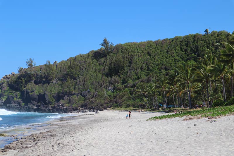
It’s best to get an early start to the day, but not too early. The drive from Saint-Pierre to the hamlet of Grand Coude begins along the coast. If you have the time, make a slight detour to Plage Grand Anse, one of the best beaches in Reunion Island. It’s a good spot for a picnic or a stroll and gets crowded with local families over the weekend who get here early to claim the prime real estate.
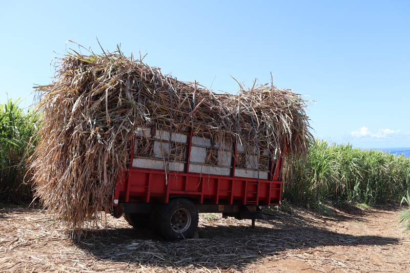
Once you head inland on the D33, it’s all sugarcane fields for a few miles until the scenery changes with the altitude gained.
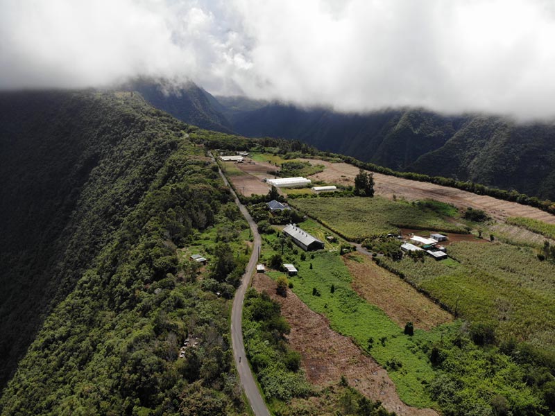
Grand Coude
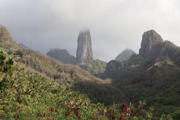
We saw Grand Coude from above during the scenic helicopter flight and knew we had to pay a visit. This hamlet sits atop a narrow plateau at a height of 1200m. On either side of the plateau are deep valleys whose origins are the slopes of the high ridge that form the beginning of the volcano and gradually widen until meeting the coastal plain. If you’re really into coffee, book an advanced visit at la Maison du Laurina to taste its fine blends and learn about coffee growing in the region.
To fully enjoy the view, get here before 10:30 am or it might be cloudy. If it’s cloudy in Grand Coude, head slightly downhill as you might find a clearing.
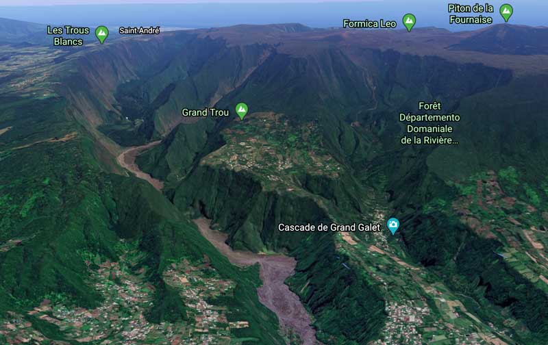
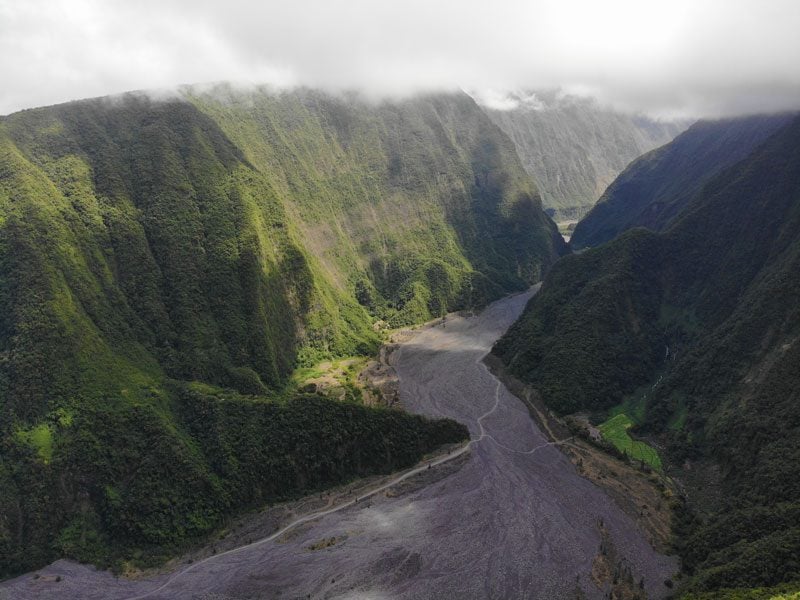
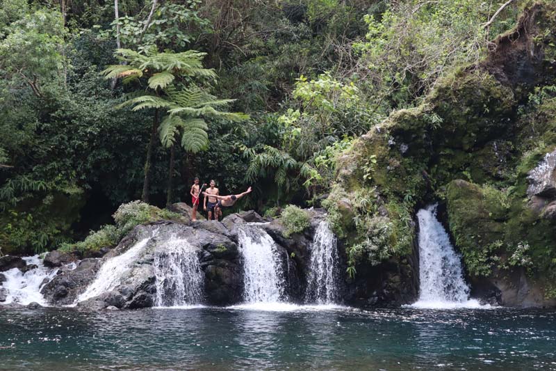
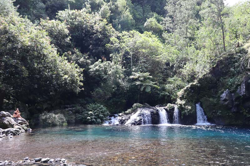
Riviere Langevin
One of the valleys that separate Grand Coude from the rest of the world is the Riviere Langevin, which is blessed with abundant water. A backcountry road heads inland for about 9km and follows the contours of the valley’s river. It’s a pretty drive, popular with local families over the weekend and thrill-seekers who embark on canyoning tours. Locals come prepared, park the car in a nice spot, and let the kids splash in the river for the day.
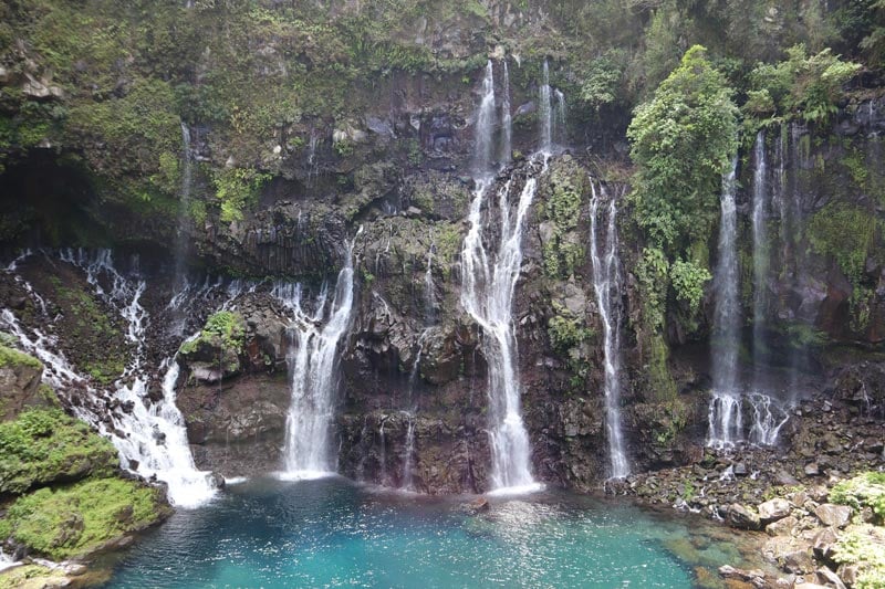
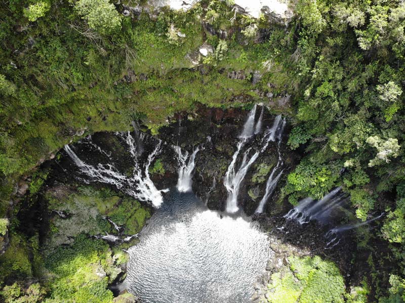
Grand Galet Waterfall
Take extra caution driving on Route de Grand Galet and stop as close to Cascade de la Grand Galet as possible. It’s one of the most beautiful sites on the island, a collection of small waterfalls cascading to a clearwater pool. Most enjoy the spectacle from the viewing area, but some locals hop over the fence and head further down.
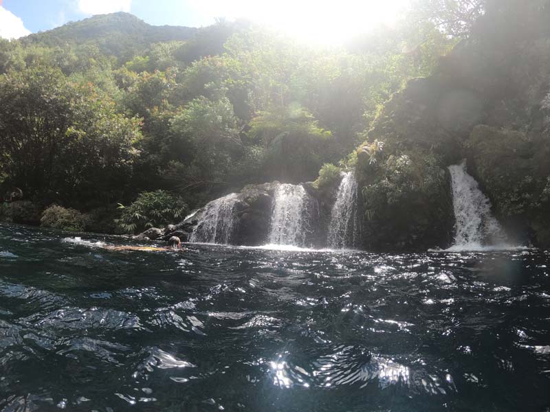
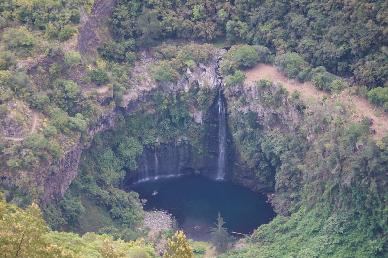
Trou Noir Waterfall
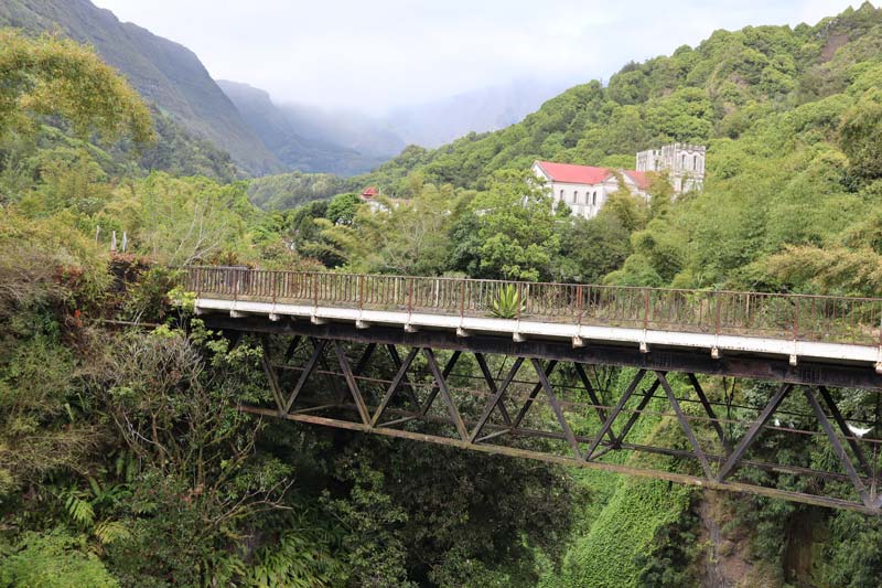
The next stop is at Cascade du Trou Noir. This secluded waterfall and swimming hole are what you envision when booking a vacation to a tropical island. From the previous stop, head back towards the coast, and immediately after the iron bridge, take a left to the narrow opening and park the car (or anywhere near that). Follow the path through the bush, and you’ll reach this fantastic spot after about ten minutes. Don’t forget your swimming gear; if you want to appreciate the clearness of the water, bring a mask. This is an excellent place for a picnic lunch.
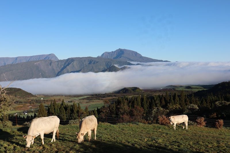
La Plaine des Cafres
The high plain rising from the warm coast detaches you again from the tropical island feel. Plaine des Cafres is a farm country, a high and fertile plain between the two volcanos. The scenery out here is reminiscent of somewhere in Ireland or Scotland, with lots of farms, cows, and damp weather.
The weather in this part of Reunion Island is particularly hard to forecast. Check the weather forecast but do take it with a grain of salt. It’s best to have more than one day for the volcano visit in case bad weather forces you to move to plan B.
Belvedere de Bois Court
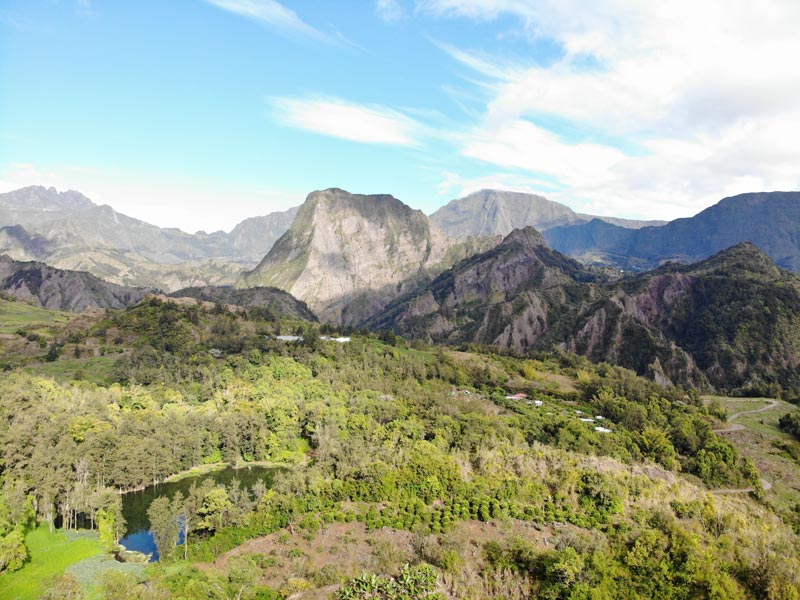
It is one of the most stunning sites on Reunion Island, definitely one that cannot be missed. Arrive in the early morning or late afternoon when the clouds are resting for a view of what’s known as Mini Mafate. From the lookout, enjoy the view above Grand Bassin, a tiny hamlet at the intersection of three rivers. Locals live entirely off the grid as this hamlet is only accessible on foot (hence the reference to Cirque de Mafate).
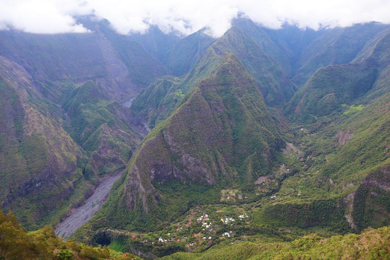
The jewel in the crown is the Cascade du Voile de la Mariée, a waterfall that splashes into a pool that seems completely detached from the outside world. You can hike down there and even spend a few nights with the locals if you have the time. The scenic lookout is a proper local attraction. There’s a small park next to the viewing area, toilet facilities, picnic tables, and a local market that runs throughout the weekend.
Day 10: Forêt de Bébour-Bélouve & Trou de Fer Waterfall
Moving into double digits in this two weeks in Reunion Island itinerary, we’ll spend the day in one of the most unique landscapes on the island and hike to a viewing area over the island’s grandest waterfall.
Morning: Volcano Summit Hike Attempt
Hiking the Piton de la Fournaise volcano is the main attraction in this part of the island, but you need a clear day. Despite a very early rise, the weather didn’t cooperate this morning, as it was foggy, windy, and wet. It also didn’t seem like clearer skies were in the works. We had another shot tomorrow, so we moved on to plan B, which is doable even in cloudy weather.
Drive to Forêt de Bébour-Bélouve
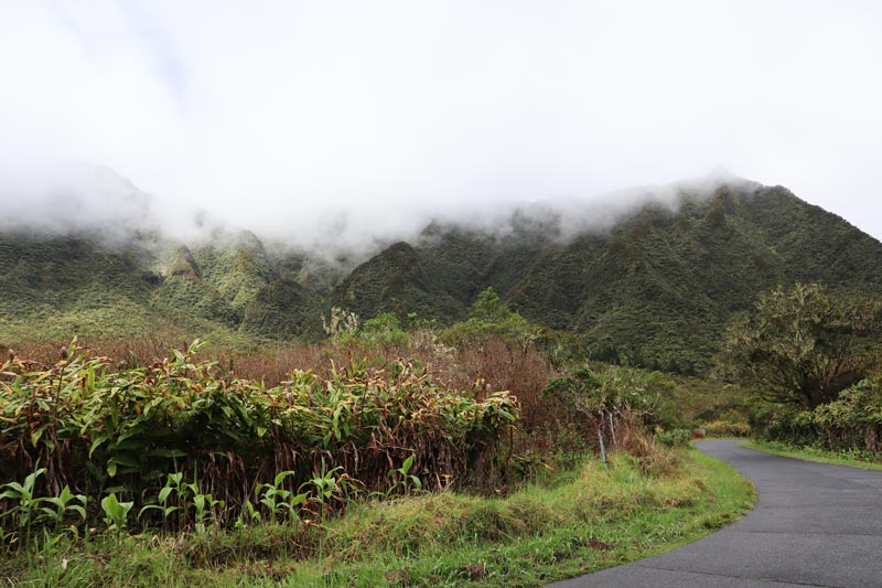
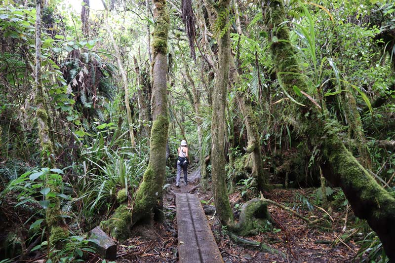
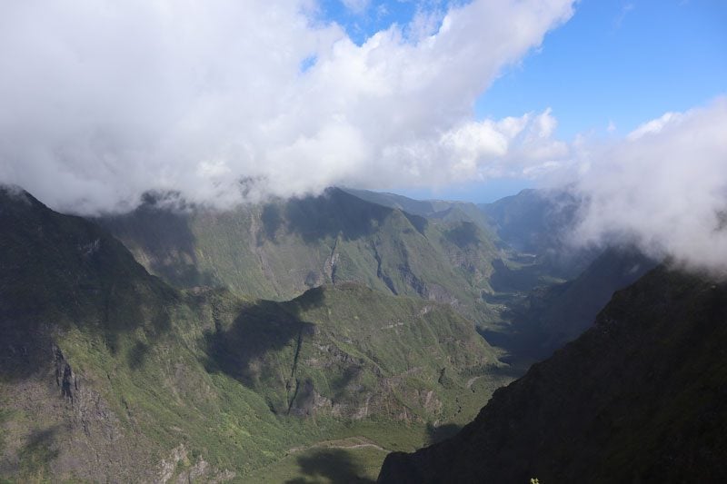
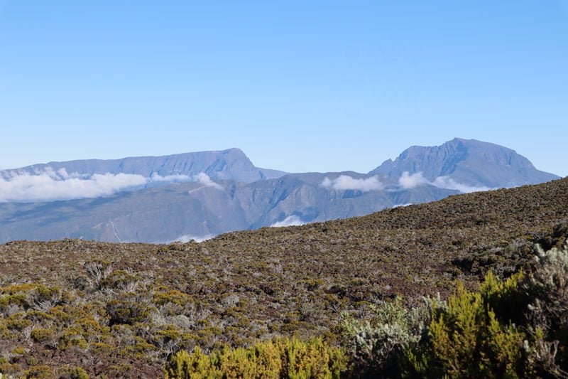
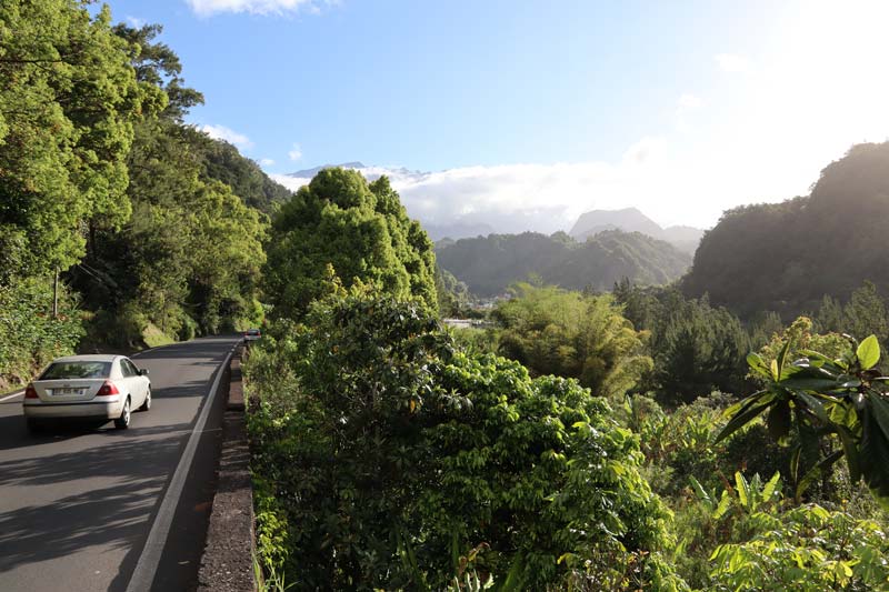
The Bébour-Bélouve forest is one of the most enchanting places in Reunion Island, certainly a must-visit. It’s an ancient primeval forest, having naturally grown over the years without mankind’s interference. Its spongy layers absorb enormous amounts of rainfall and prevent soil erosion (unlike in the cirques). In fact, the soil here can hold up to three times its weight in water, and considering that anywhere between 2-5 meters of rainfall here annually, that’s quite an achievement. It’s a constantly cool and humid place where ferns, Tamarind trees, and spongy moss rule the landscape.
The drive from Bourg-Murat to Gîte de Bélouve takes less than one hour. You transition from la Plaine de Cafre to la Plaine des Palmistes, from the “dry” side of the island on the west to the “wet” east coast. Pick up the F2 forestry road from Bras des Calumets and drive about 9 km of changing scenery from tall cedar trees to sharp bends with misty ridges on both sides. At the end of the road, there are a couple of parking lots and a metal gate, beyond which is the final stretch to the cabin.
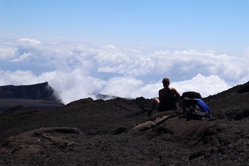
Trou de Fer Hike
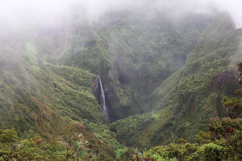
Trou de Fer translates to “Iron Hole” and it’s one of the most striking natural features in Reunion Island. Several rivers are funneled into this 300-meter deep chasm, culminating in a 695m waterfall that is the highest in France and her territories. Best appreciated from a scenic helicopter flight, we caught fine views of the Trou de Fer waterfall and its little sisters on day 2. For hikers, the best way to see the Trou de Fer is from a viewing area, on a trail from the Gîte de Bélouve.
You can also hike to the Trou de Fer from Hellbourg but it’s much easier to do it from here. The hike from Hell-Bourg involves a tough section of “climbing out” of the cirque, before reaching the Belouve cabin and heading to the waterfall on the same trail we’re about to take. So unless you want the exercise, choose the easier route.
At an altitude of 1,500m, the Belouve cabin sits at the crossroads of several hiking trails, so you can overnight here and, more importantly, take advantage of its kiosk (bring cash). Before starting the hike, you can quickly visit the modest museum across the lawn to learn about the forest’s history and enjoy the view down towards Hell-Bourg in Cirque de Salazie.
Rainforest Hike
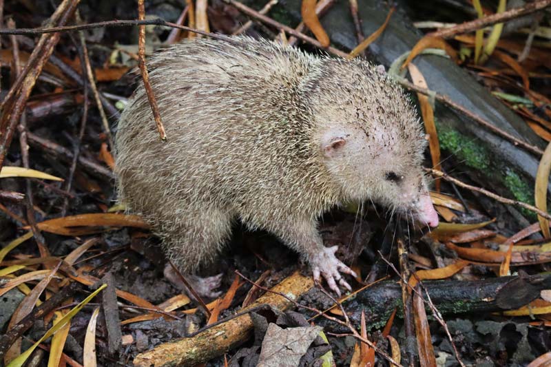
You must applaud the effort in constructing and maintaining the trail from the cabin to the Tour de Fer waterfall. A series of bridges and a raised wooden path cut through one of the wettest parts of the island. The scenery resembles something you’ve seen before in a fantasy movie; everything is so green, and the birds are having a blast in the canopy of the tamarind trees. Keep your eyes peeled, and you might even spot some animals foraging near the path.
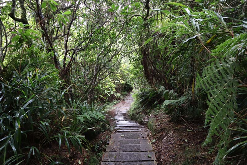
The walk was easy, but the constant drizzle soon made the trail very muddy and unpleasant (see pro tip below). We didn’t have any options as we had only one shot on this particular day to make it to the waterfall.
Trou de Fer Viewing Area
We had to wait about 30 minutes at the viewing area for the clouds to clear and finally reveal the star attraction briefly. It was pretty amazing because, for a while, you could hear the water gushing but see nothing. The Trou de Fer resembles a Jurassic Park scene and is well worth the effort, even if you are taking your chances on a rainy day.
On rainy days, the trail will be very muddy and unpleasant. However, you can take the “parallel trail” on the forestry road from the cabin. It’s definitely not as scenic but it does reconnect with the forest trail not too far from the waterfall.
Logistics
Distance – 9km (return) | time: 3.5-4hrs | difficulty – easy. Bring – prepare for wet weather, including good shoes, a rain jacket with hood, a cover for a camera bag, backpack cover, rain pants (adjust if sunny day), a complete change of clothes (you’ll be sweaty), extra socks, and underwear, cash, flip flops/sandals for after removing muddy shoes in the car, snacks, water.
Domaine des Tourelles & Volcano House
If you want to buy souvenirs, visit Domaine des Tourelles in Bras des Calumets (a good spot for a post-hike lunch). This early 20th-century Creole mansion is now a large souvenir shop, and its perimeter is lined with artisan shops. If you are interested in learning about the active volcano, head to La Cite du Volcan back in Bourg-Murat.
Day 11: Piton de la Fournaise & Scenic Drive to Cirque de Salazie
The first half of the day is dedicated to Reunion Island’s active volcano. After completing “the trip to Mars”, we drive to Reunion’s third cirque, our base for the last section of the trip.
Scenic Drive to The Volcano
It’s about an hour’s drive from Relais du Volcan to the Dolomieu Crater trailhead, but there are a few scenic stops to make on the way. Aim to start the hike by no later than 8:30 am to avoid cloud cover at the crater rim, so do the math accordingly.
The drive from Bourg Murat begins with the panoramic backdrop of the Piton des Neiges summit and the Indian Ocean behind grazing cattle. On a clear day, you can even spot the overnight cabin en route to the summit. The scenery will quickly change from now on, with less and less vegetation until it practically transforms into a desert moonscape.
Nez de Boeuf Scenic Lookout
The first stop is at the Nez de Boeuf scenic lookout. A Plaque at the lookout explains how 300,000 years of erosion created this magnificent valley that was used in the old days to raise cattle.
Pas des Sables
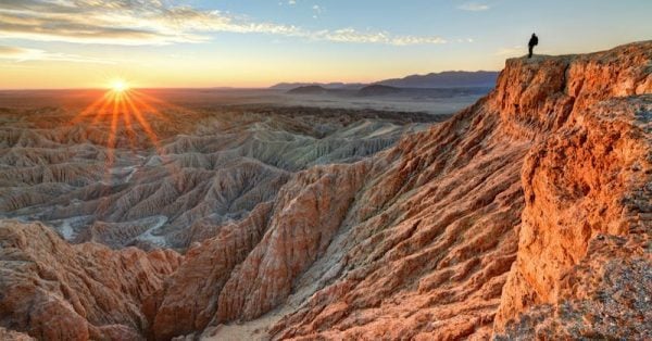
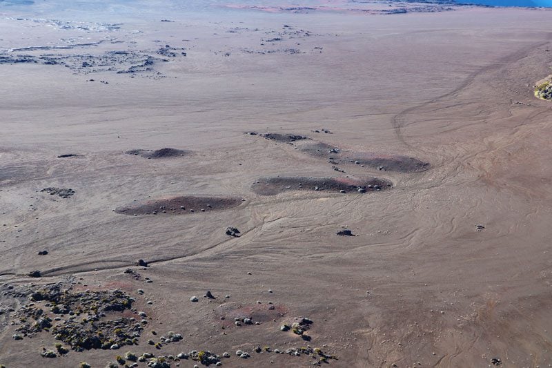
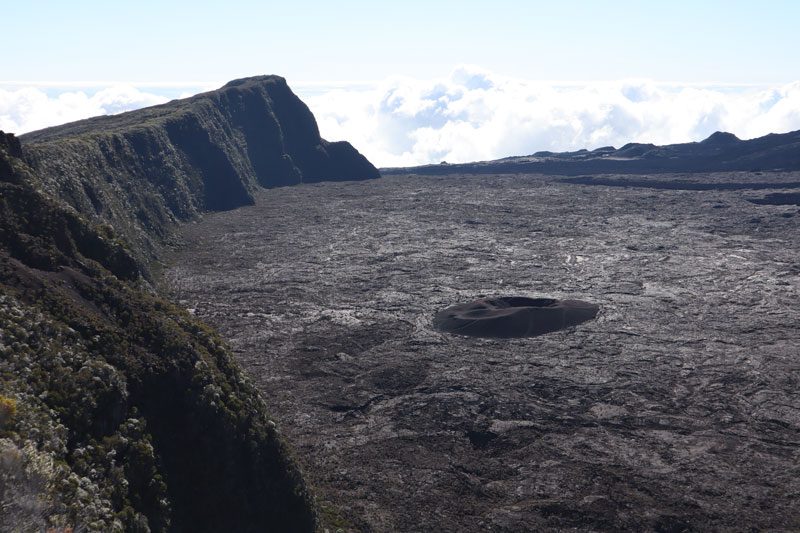
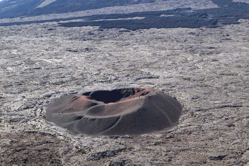
The next stop is at Pas de Sables, where the landscape becomes a desolate desert. Peer down to the vast volcanic ash plain, scarred by sporadic craters marking past major eruptions and cinder cones indicating minor activity.
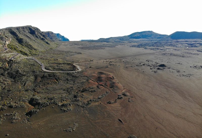
The Ash Plain
Naturally, the next thing to do is hop back in the car and swirl your way to the ash plain. The paved road turns to dirt to the end of the line, but the drive is doable even with a small car.
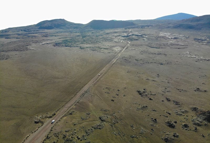
Pas de Belecombe
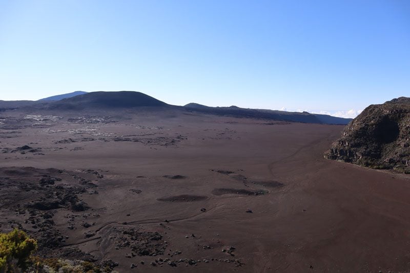
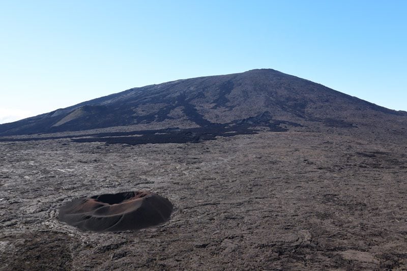
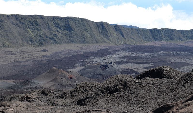
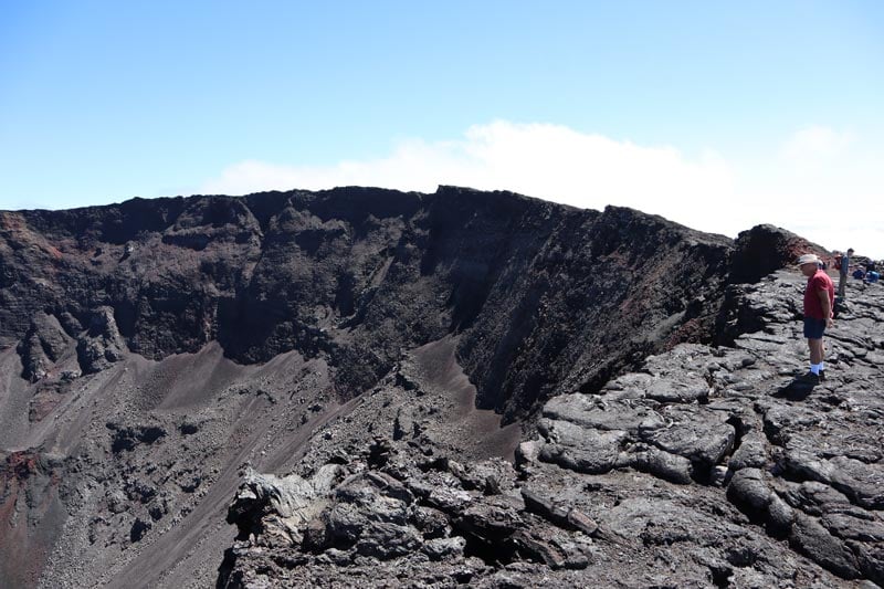
Pas de Bellecombe marks the end of the road and the starting point for numerous trailheads that venture to various craters. You’re now at an altitude of 2,311m, but it’s quite warm out here on a sunny day. The cabin adjacent to the viewing area sells snacks and drinks, but do come prepared for the hike to come. From the viewing area, you can see the Dolomieu Crater in the foreground and the Formica Leo on the caldera floor, a small cinder cone made of red scoria rock.
Piton de la Fournaise
Piton de la Fournaise (Peak of the Furnace) is one of the world’s most active volcanoes and continues to shape Reunion Island, even as you read these lines. This shield volcano is right up there with the likes of Kilauea on the Big Island of Hawaii in terms of activity, and it has left its mark on the southern coast of the island in an area known as Grand Brule.
(1) Check the Piton de la Fournaise Facebook page for updates and trail closures (albeit in French) before planning your day. In times of increased activity, the viewing area in Pas de Bellecombe will likely remain open but a metal gate will prevent hikers from descending to the caldera floor, where trails head to the active craters. (2) For additional thrills, consider joining a small-group tour of some of the volcano’s lava tubes.
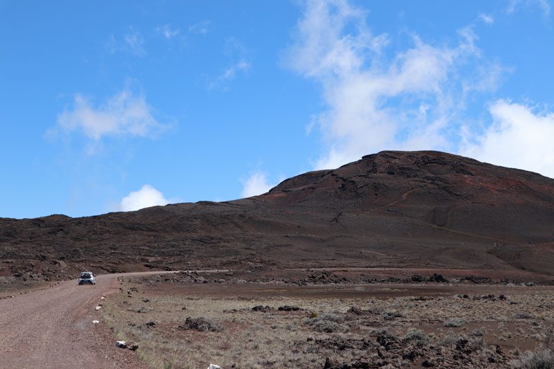
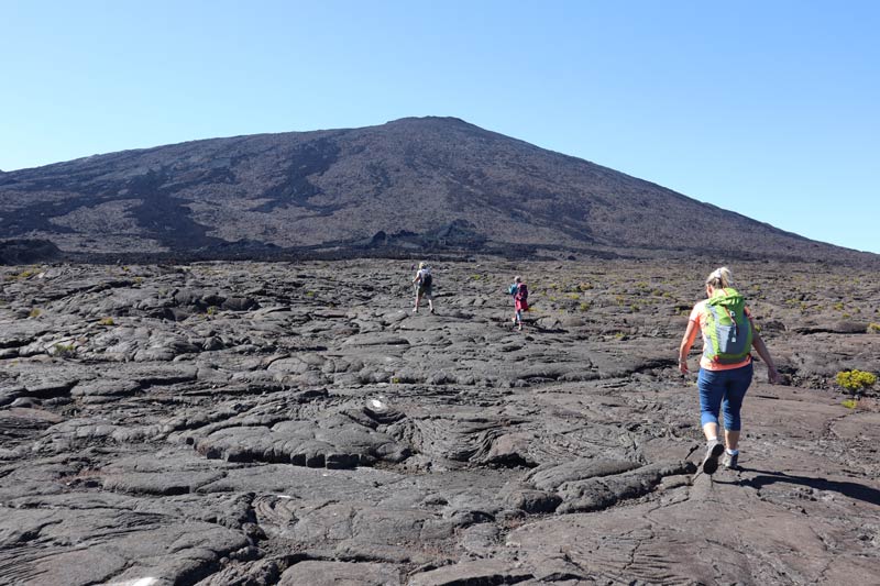
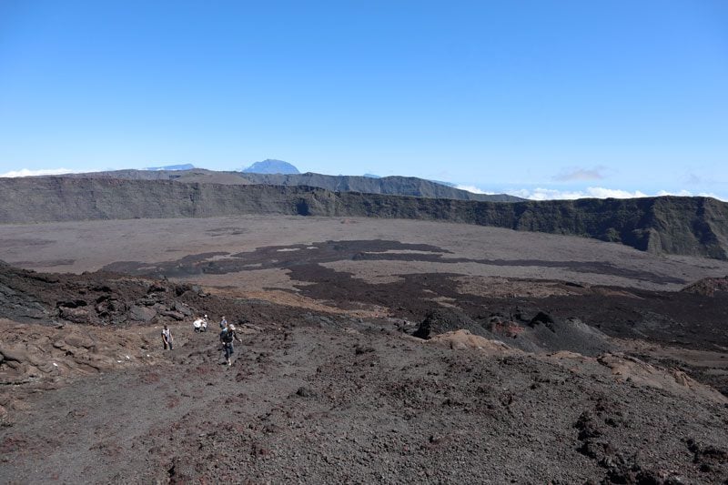
Hike to Dolomieu Crater
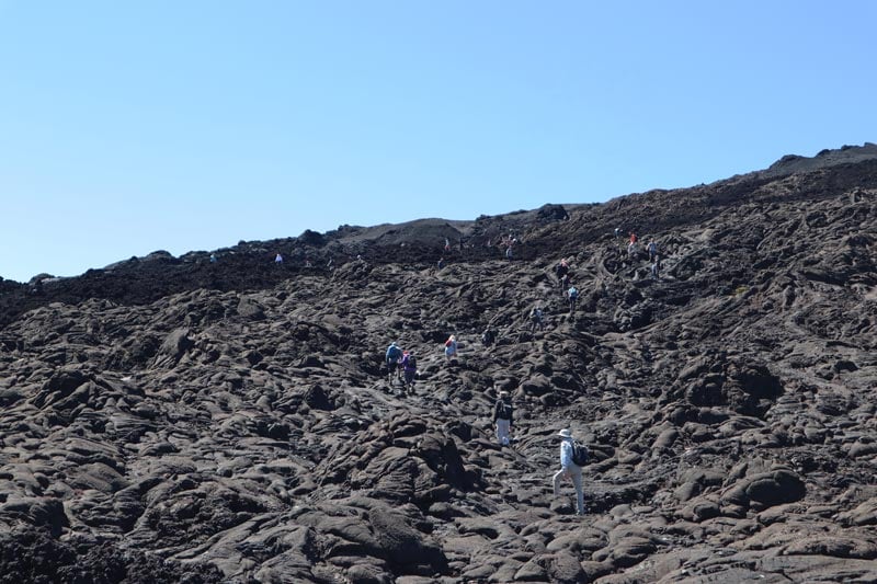
The hike from Pas de Bellecombe to the Dolomieu Crater is one of the most popular hikes in Reunion Island and the closest we humans will ever get to travel to Mars. The hike basically involves a descent from the rim of the outer crater down to the caldera floor, hiking across the dry lava field, and climbing to the rim of the Dolomieu Crater. You can hike from the same starting point to easier-to-reach craters, but the Dolomieu is the top attraction. This is a very busy trail, extra busy after day(s) of bad weather, so starting early (also for clearer skies) is recommended.
the Caldera’s Floor
The trail begins with switchbacks that plunge as quickly as possible to the caldera floor. From there, white markings on the crumbling dry lava point the way. The slow ascent to the rim of the Dolomieu Crater begins after about 45 minutes. Unlike what might be written in guidebooks, the Rosemont Chapel is no longer viewable following recent volcanic activity.
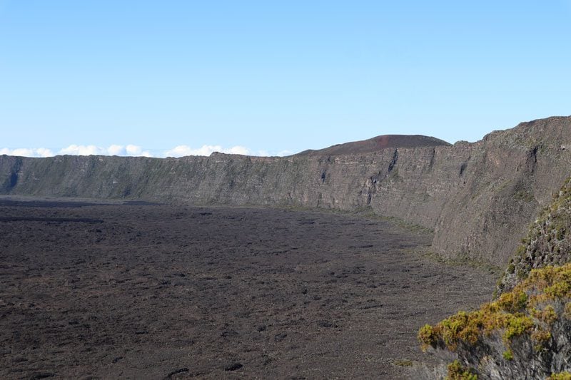
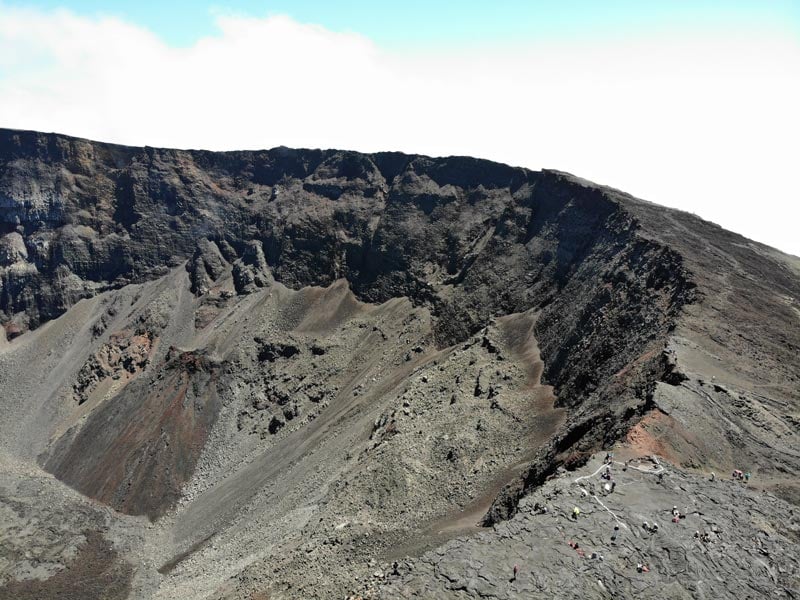
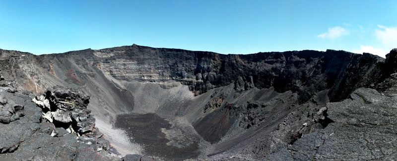
Dolomieu Crater Rim
It’s now a little over an hour’s climb to the rim. You’ll be walking on solid lava in various shapes and sizes, so sturdy shoes really make the difference. The view on the gradual climb is breathtaking. The rich black, brown, and red spectrum mix together and meet their abrupt end on the outer rim’s wall, where you start the hike.
As impressive as the trail has been so far, the real highlight comes when you take the final step that reveals the size and depth of the Dolomieu Crater (2,460m), spanning 400 meters across and 300 meters deep. If the weather is fair, this is an excellent spot for a picnic lunch before the return leg.
Logistics
Distance – 12km (return) | time: 4.5hrs | difficulty – challenging. Bring – prepare for slight rain with a thin jacket with a hood as there is no cover, snacks, extra water, sun protection, lip balm, tissues (for a runny nose), sunglasses, cash, sturdy shoes, (optional) walking poles, a complete change of clothes, a warm fleece for the rest in the crater rim.
Scenic Drive to Cirque de Salazie
From Pas de Bellecombe, it’s about a two-hour drive to Hell-Bourg, the tourist capital of Cirque de Salazie. We’re now in the heart of the island’s east coast, a wet and tropical landscape so different from what we just saw. It’s back to the familiar scenes of sugarcane fields and palm trees, but the roadside fruit stalls sell exotic produce I’ve never seen, and many local folks are of Tamil origin.
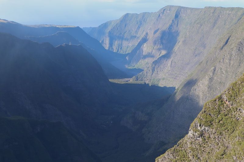
Riviere du Mat
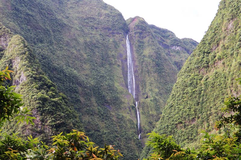
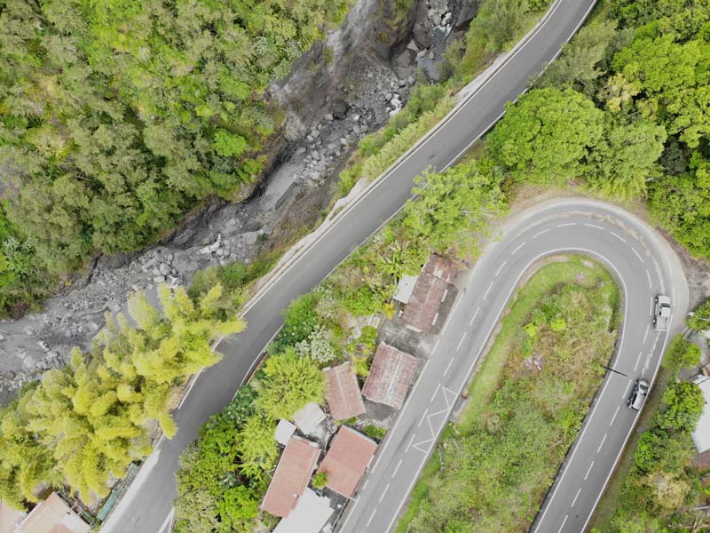
The D48 follows the contours of the 37 km-long Riviere du Mat into Cirque de Salazie. It’s another spectacular scenic drive into what is Reunion’s wettest cirque. Often leaving you breathless, there seem to be more waterfalls than people living here, some trickling straight onto the asphalt after minor periods of rain. Tightly squeezed between shark-fin-shaped emerald peaks, keep a sharp look for hidden waterfalls, like Cascade Blanche, but do drive with caution as there are a couple of challenging sections involving blind turns and one-lane roads.
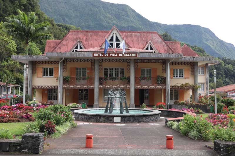
Salazie
The village of Salazie is the cirque’s capital, but there’s nothing here of particular interest for tourists apart from the architectural beauties of the town hall and the church. It’s also worth checking out the view from the old bridge.
Cascade du Voile de la Mariee
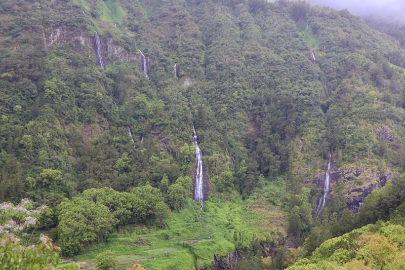
The closer you get to Hell-Bourg, the more altitude is gained, and the scenery becomes less tropical but nonetheless remains green. Stop to check out Cascade du Voile de la Mariee, a family of waterfalls raining from the cloud-covered peaks to the river in several stages (not to be confused with the waterfall bearing the same name in Grand Basin). In the following (and final) section of the trip, we’ll explore Hell-Bourg with the rest of the area’s highlights.